Travel maps & atlases
Results 841 - 864 of 1259
Travel maps & atlases
.
- Publisher
- Ordnance Survey
- Publication date
- 2015
- Edition
- September 2015 ed
- Condition
- New
- SKU
- V9780319471746
- ISBN
- 9780319471746
Condition: New
€ 23.99€ 17.67
€ 23.99
€ 17.67
.
- Publisher
- Ordnance Survey
- Publication date
- 2015
- Edition
- September 2015 ed
- Condition
- New
- SKU
- V9780319470954
- ISBN
- 9780319470954
Condition: New
€ 23.99€ 17.67
€ 23.99
€ 17.67
Sheet map, folded. .
- Publisher
- Ordnance Survey
- Publication date
- 2015
- Edition
- September 2015 ed
- Condition
- New
- SKU
- V9780319244166
- ISBN
- 9780319244166
Condition: New
€ 17.99€ 14.23
€ 17.99
€ 14.23
Sheet map, folded. .
- Publisher
- Ordnance Survey
- Publication date
- 2016
- Edition
- February 2016 ed
- Condition
- New
- SKU
- V9780319474754
- ISBN
- 9780319474754
Condition: New
€ 23.99€ 17.67
€ 23.99
€ 17.67
Sheet map, folded. Series: OS Landranger Map. BIC Classification: 1DBKEMM; 1DBKESU; WSZC; WTRM. Category: (G) General (US: Trade). Dimension: 135 x 228 x 29. Weight in Grams: 100.
- Publisher
- Ordnance Survey
- Publication date
- 2016
- Edition
- February 2016 ed
- Condition
- New
- SKU
- V9780319262504
- ISBN
- 9780319262504
Condition: New
€ 17.99€ 14.23
€ 17.99
€ 14.23
Sheet map, folded. Series: Michelin Regional Maps. Num Pages: colour mapping. BIC Classification: 1KBBE; 1KBC; WTRD. Category: (G) General (US: Trade). Dimension: 167 x 252 x 7. Weight in Grams: 108.
- Publisher
- Michelin Editions des Voyages France
- Publication date
- 2013
- Edition
- 14th edition
- Condition
- New
- SKU
- V9782067184626
- ISBN
- 9782067184626
Condition: New
€ 8.99€ 8.07
€ 8.99
€ 8.07
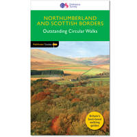
Paperback. 28 fabulous walks in the hill country of the Scottish Borders, the Cheviots, Northumberland National Park and along stretches of the coast and Hadrian's Wall. Graded by length and ranging from 3 to 13 miles, all routes come with a clear, large-scale OS map, GPS waypoints and highlight where to park, good pubs and places of interest en route. Series: Pathfinder Guide. BIC Classification: 1DBKEYN; 1DBKSB; WSZC; WTM; WTRM. Category: (G) General (US: Trade). Dimension: 135 x 230 x 7. Weight in Grams: 212.
- Publisher
- Ordnance Survey/Crimson
- Format
- Paperback
- Publication date
- 2016
- Edition
- Revised edition
- Condition
- New
- SKU
- V9780319090268
- ISBN
- 9780319090268
Paperback
Condition: New
€ 17.99€ 14.21
€ 17.99
€ 14.21
Sheet map, folded. .
- Publisher
- Ordnance Survey
- Publication date
- 2015
- Edition
- September 2015 ed
- Condition
- New
- SKU
- V9780319471395
- ISBN
- 9780319471395
Paperback
Condition: New
€ 23.99€ 17.67
€ 23.99
€ 17.67
Paperback. Num Pages: 8 pages, colour illus. BIC Classification: 2ACSN; WTK; WTRM. Category: (G) General (US: Trade). Dimension: 257 x 115 x 2. Weight in Grams: 48.
- Format
- Paperback
- Publisher
- Bilingual Books Inc.,U.S. United States
- Number of pages
- 8
- Publication date
- 2000
- Edition
- Phrasebook
- Condition
- New
- SKU
- V9780944502129
- ISBN
- 9780944502129
Paperback
Condition: New
€ 13.00€ 10.71
€ 13.00
€ 10.71
Sheet map, folded. .
- Publisher
- Ordnance Survey
- Publication date
- 2015
- Edition
- September 2015 ed
- Condition
- New
- SKU
- V9780319244302
- ISBN
- 9780319244302
Paperback
Condition: New
€ 17.99€ 14.23
€ 17.99
€ 14.23
Sheet map, folded. .
- Publisher
- Ordnance Survey
- Publication date
- 2016
- Edition
- February 2016 ed
- Condition
- New
- SKU
- V9780319474525
- ISBN
- 9780319474525
Paperback
Condition: New
€ 23.99€ 17.67
€ 23.99
€ 17.67
Sheet map, folded. Series: OS Landranger Map. BIC Classification: 1DBKEML; 1DBKEMN; WSZC; WTRM. Category: (G) General (US: Trade). Dimension: 135 x 229 x 58. Weight in Grams: 98.
- Publisher
- Ordnance Survey
- Publication date
- 2016
- Edition
- February 2016 ed
- Condition
- New
- SKU
- V9780319262276
- ISBN
- 9780319262276
Paperback
Condition: New
€ 17.99€ 14.24
€ 17.99
€ 14.24
Sheet map, folded. Series: Old Ordnance Survey Maps of Nottinghamshire. BIC Classification: 1DBKEMN; WQH; WTRM. Category: (G) General (US: Trade). Dimension: 210 x 120 x 2. Weight in Grams: 24. Nottinghamshire Sheet 38.14. Series: Old Ordnance Survey Maps of Nottinghamshire. Cateogry: (G) General (US: Trade). BIC Classification: 1DBKEMN; WQH; WTRM. Dimension: 210 x 120 x 2. Weight: 24.
- Publisher
- Alan Godfrey Maps
- Publication date
- 2003
- Condition
- New
- SKU
- V9781841515502
- ISBN
- 9781841515502
Paperback
Condition: New
€ 7.04
€ 7.04
Sheet map, folded. Series: Old O.S. Maps of England and Wales. BIC Classification: 1DBKEMN; 3JJC; WQH; WTRM. Category: (G) General (US: Trade). Dimension: 146 x 120 x 27. Weight in Grams: 24. One Inch Map 126. Series: Old O.S. Maps of England and Wales. Cateogry: (G) General (US: Trade). BIC Classification: 1DBKEMN; 3JJC; WQH; WTRM. Dimension: 146 x 120 x 27. Weight: 24.
- Publisher
- Alan Godfrey Maps
- Publication date
- 2001
- Edition
- Facsimile of 1906 ed
- Condition
- New
- SKU
- V9781841512785
- ISBN
- 9781841512785
Paperback
Condition: New
€ 7.04
€ 7.04
Sheet map, folded. .
- Publisher
- Alan Godfrey Maps
- Publication date
- 2006
- Condition
- New
- SKU
- V9781841518855
- ISBN
- 9781841518855
Paperback
Condition: New
€ 7.04
€ 7.04
Series: OS Explorer Map. BIC Classification: 1DBKEMN; WSZC; WTRM. Category: (G) General (US: Trade). Dimension: 136 x 228 x 31. Weight in Grams: 98.
- Publisher
- Ordnance Survey
- Publication date
- 2015
- Edition
- September 2015 ed
- Condition
- New
- SKU
- V9780319244579
- ISBN
- 9780319244579
Paperback
Condition: New
€ 17.99€ 14.25
€ 17.99
€ 14.25
Sheet map, folded. .
- Publisher
- Ordnance Survey
- Publication date
- 2015
- Edition
- September 2015 ed
- Condition
- New
- SKU
- V9780319244258
- ISBN
- 9780319244258
Paperback
Condition: New
€ 17.99€ 14.25
€ 17.99
€ 14.25
Sheet map, folded. .
- Publisher
- Ordnance Survey
- Publication date
- 2016
- Edition
- February 2016 ed
- Condition
- New
- SKU
- V9780319473726
- ISBN
- 9780319473726
Paperback
Condition: New
€ 23.99€ 17.67
€ 23.99
€ 17.67
Sheet map, folded. .
- Publisher
- Ordnance Survey
- Publication date
- 2016
- Edition
- February 2016 ed
- Condition
- New
- SKU
- V9780319261477
- ISBN
- 9780319261477
Paperback
Condition: New
€ 17.99€ 14.25
€ 17.99
€ 14.25
Series: OS Explorer Map. BIC Classification: 1DBKSC; WSZC; WTRM. Category: (G) General (US: Trade). Dimension: 137 x 242 x 36. Weight in Grams: 128.
- Publisher
- Ordnance Survey
- Publication date
- 2015
- Edition
- September 2015 ed
- Condition
- New
- SKU
- V9780319246238
- ISBN
- 9780319246238
Paperback
Condition: New
€ 17.99€ 14.24
€ 17.99
€ 14.24
.
- Publisher
- Ordnance Survey
- Publication date
- 2015
- Edition
- September 2015 ed
- Condition
- New
- SKU
- V9780319472309
- ISBN
- 9780319472309
Paperback
Condition: New
€ 23.99€ 17.67
€ 23.99
€ 17.67
.
- Publisher
- Ordnance Survey
- Publication date
- 2015
- Edition
- September 2015 ed
- Condition
- New
- SKU
- V9780319246108
- ISBN
- 9780319246108
Paperback
Condition: New
€ 17.99€ 14.24
€ 17.99
€ 14.24
Sheet map, folded.
- Publisher
- Ordnance Survey Ireland
- Publication date
- 2003
- Edition
- 2nd Revised edition
- Condition
- New
- SKU
- 9781903974308
- ISBN
- 9781903974308
Paperback
Condition: New
€ 7.41
€ 7.41
Paperback. Map of the 177-mile (283km) Offa's Dyke Path National Trail, between Sedbury (nr Chepstow) and Prestatyn. The trail takes a fortnight to walk, and is suitable for walkers at all levels of experience. This compact booklet of Ordnance Survey 1:25,000 maps shows the full route, providing all of the mapping you need to complete the trail. Num Pages: 96 pages. BIC Classification: 1DBKW; WSZC; WTR. Category: (G) General (US: Trade). Dimension: 172 x 116 x 10. .
- Publisher
- Cicerone Press
- Format
- Paperback
- Publication date
- 2016
- Condition
- New
- SKU
- V9781852848941
- ISBN
- 9781852848941
Paperback
Condition: New
€ 17.99€ 14.17
€ 17.99
€ 14.17
.png)
