Geographical information systems (GIS) & remote sensing
Results 101 - 112 of 112
Geographical information systems (GIS) & remote sensing
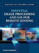
Paperback. Essential Image Processing and GIS for Remote Sensing is an accessible overview of the subject and successfully draws together these three key areas in a balanced and comprehensive manner. The book provides an overview of essential techniques and a selection of key case studies in a variety of application areas. Num Pages: 460 pages, black & white illustrations, colour illustrations, black & white line drawings, colour li. BIC Classification: RGW. Category: (P) Professional & Vocational. Dimension: 247 x 189 x 23. Weight in Grams: 898.
- Format
- Paperback
- Publication date
- 2009
- Publisher
- John Wiley & Sons Inc United Kingdom
- Edition
- 1st Edition
- Number of pages
- 460
- Condition
- New
- SKU
- V9780470510315
- ISBN
- 9780470510315
Paperback
Condition: New
€ 78.05
€ 78.05
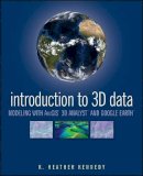
Paperback. Render three-dimensional data and maps with ease. Written as a self-study workbook, Introduction to 3D Data demystifies the sometimes confusing controls and procedures required for 3D modeling using software packages such as ArcGIS 3D Analyst and Google Earth. Num Pages: 360 pages, Illustrations. BIC Classification: RGW. Category: (P) Professional & Vocational. Dimension: 234 x 191 x 18. Weight in Grams: 606.
- Format
- Paperback
- Publication date
- 2009
- Publisher
- John Wiley and Sons Ltd United Kingdom
- Edition
- 1st Edition
- Number of pages
- 360
- Condition
- New
- SKU
- V9780470381243
- ISBN
- 9780470381243
Paperback
Condition: New
€ 97.71
€ 97.71
Hardcover. Geographic Information Analysis provides up-to-date coverage of the foundations of spatial data analysis through visualization and maps. This book covers key spatial concepts, including point pattern, line objects and networks, area objects, and continuous fields, as well as such new subjects as local statistics. Num Pages: 432 pages, ill. BIC Classification: RGW. Category: (U) Tertiary Education (US: College). Dimension: 204 x 205 x 25. Weight in Grams: 742.
- Format
- Hardback
- Publication date
- 2010
- Publisher
- John Wiley and Sons Ltd United Kingdom
- Edition
- 2nd Edition
- Number of pages
- 432
- Condition
- New
- SKU
- V9780470288573
- ISBN
- 9780470288573
Hardback
Condition: New
€ 133.34
€ 133.34
Paperback. This book discusses maps as data with data structure implications; roving windows; spatial data modeling and management; assessing variability, shape, and pattern of map features; overlaying maps; cost-benefit analysis; algorithms involved in slope, distance, and connectivity; and cartographic and spatial modeling. Num Pages: 246 pages, black & white illustrations. BIC Classification: RGW. Category: (P) Professional & Vocational; (UP) Postgraduate, Research & Scholarly; (UU) Undergraduate. Dimension: 229 x 156 x 17. Weight in Grams: 418.
- Format
- Paperback
- Publication date
- 1996
- Publisher
- John Wiley and Sons Ltd United Kingdom
- Edition
- 1st Edition
- Number of pages
- 246
- Condition
- New
- SKU
- V9780470236765
- ISBN
- 9780470236765
Paperback
Condition: New
€ 124.74
€ 124.74
Paperback. Spatial Reasoning for Effective GIS by Joseph K. Num Pages: 208 pages, black & white illustrations. BIC Classification: KJMD; RGW. Category: (P) Professional & Vocational; (UP) Postgraduate, Research & Scholarly; (UU) Undergraduate. Dimension: 234 x 162 x 13. Weight in Grams: 324.
- Format
- Paperback
- Publication date
- 1996
- Publisher
- John Wiley and Sons Ltd United Kingdom
- Number of pages
- 208
- Condition
- New
- SKU
- V9780470236338
- ISBN
- 9780470236338
Paperback
Condition: New
€ 124.74
€ 124.74
Hardcover. Covers the convergent use of GIS for Location Science analysis, written by two of the leading researchers in the field. Introduction to new field at juncture of two mature disciplines. Includes ArcGIS and LINGO application files and data sets which will accompany the end of chapter questions. Num Pages: 320 pages, Illustrations, maps. BIC Classification: KJMV4; RGW. Category: (P) Professional & Vocational. Dimension: 244 x 162 x 20. Weight in Grams: 578.
- Format
- Hardback
- Publication date
- 2008
- Publisher
- John Wiley and Sons Ltd United Kingdom
- Edition
- 1st Edition
- Number of pages
- 320
- Condition
- New
- SKU
- V9780470191064
- ISBN
- 9780470191064
Hardback
Condition: New
€ 149.32
€ 149.32
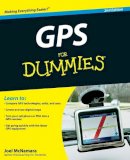
Paperback. Need directions? Are you good at getting lost? Then GPS is just the technology you've dreamed of, and GPS For Dummies is what you need to help you make the most of it. If you have a GPS unit or plan to buy one, GPS For Dummies, 2 nd Edition helps you compare GPS technologies, units, and uses. Num Pages: 412 pages, Illustrations, maps. BIC Classification: RGW. Category: (G) General (US: Trade); (P) Professional & Vocational. Dimension: 233 x 188 x 23. Weight in Grams: 618.
- Format
- Paperback
- Publication date
- 2008
- Publisher
- John Wiley and Sons Ltd United Kingdom
- Edition
- 2nd Edition
- Number of pages
- 412
- Condition
- New
- SKU
- V9780470156230
- ISBN
- 9780470156230
Paperback
Condition: New
€ 25.99€ 21.58
€ 25.99
€ 21.58
Hardback. The application of Geographic Information Systems (GIS) to issues in history is among the most exciting developments in both digital and spatial humanities. Describing a variety of applications, this book includes essays that highlight the methodological and substantive implications of a spatial approach to history. Editor(s): Gregory, Ian N.; Geddes, Alistair. Series: The Spatial Humanities. Num Pages: 234 pages, 46 b 4 tables. BIC Classification: HBAH; RGW. Category: (P) Professional & Vocational. Dimension: 5817 x 3887 x 15. Weight in Grams: 472.
- Format
- Hardback
- Publication date
- 2014
- Publisher
- Indiana University Press
- Condition
- New
- SKU
- V9780253011800
- ISBN
- 9780253011800
Hardback
Condition: New
€ 96.54
€ 96.54
Hardback. Focusing on the biodiversity of Costa Rica, the contributors to this book demonstrate the use of geographic information systems (GIS) to enhance conservation efforts. They give an overview of the spatial nature of conservation and management and the current status of digital mapping in Costa Rica. Editor(s): Savitsky, Basil G.; Lacher, Jr. Thomas E.; Lacher, T.E. Series: Biology and Resource Management Series. Num Pages: 278 pages, 73 illus, 28 photos. BIC Classification: 1KLCR; RGW; RNF; RNK. Category: (P) Professional & Vocational. Dimension: 254 x 178 x 24. Weight in Grams: 953.
- Format
- Hardback
- Publication date
- 1998
- Publisher
- Columbia University Press United States
- Edition
- 0th Edition
- Number of pages
- 278
- Condition
- New
- SKU
- V9780231100267
- ISBN
- 9780231100267
Hardback
Condition: New
€ 91.96€ 70.74
€ 91.96
€ 70.74
Hardcover. Mark Monmonier looks at the increased use of geographic data, satellite imagery, and location tracking across a wide range of fields. Could these diverse forms of geographic monitoring, he asks, lead to grave consequences for society? Num Pages: 264 pages, 7halftones, 58line drawings. BIC Classification: JPV; PDR; PDZ; RGW. Category: (G) General (US: Trade); (P) Professional & Vocational; (U) Tertiary Education (US: College). Dimension: 216 x 140 x 19. Weight in Grams: 502.
- Format
- Hardback
- Publication date
- 2002
- Publisher
- The University of Chicago Press United States
- Edition
- 1st Edition
- Number of pages
- 264
- Condition
- New
- SKU
- V9780226534275
- ISBN
- 9780226534275
Hardback
Condition: New
€ 48.99€ 37.63
€ 48.99
€ 37.63
hardcover. Presents case studies from across the geosciences to provide a fascinating and accessible introduction to this emerging field. Editor(s): Keller, G.Randy; Baru, Chaitanya. Num Pages: 388 pages, 46 b/w illus. 41 colour illus. 5 tables. BIC Classification: RB; RGW. Category: (P) Professional & Vocational. Dimension: 248 x 180 x 24. Weight in Grams: 960.
- Format
- Hardback
- Publication date
- 2011
- Publisher
- Cambridge University Press United Kingdom
- Edition
- Illustrated
- Number of pages
- 388
- Condition
- New
- SKU
- V9780521897150
- ISBN
- 9780521897150
Hardback
Condition: New
€ 79.18
€ 79.18
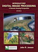
Hardcover. Num Pages: 544 pages, illustrations. BIC Classification: RGW; TTBM; UYT. Category: (P) Professional & Vocational. Dimension: 226 x 285 x 26. Weight in Grams: 1592.
- Format
- Hardback
- Publication date
- 2015
- Publisher
- Prentice Hall
- Edition
- 4th Edition
- Condition
- New
- SKU
- V9780134058160
- ISBN
- 9780134058160
Hardback
Condition: New
€ 240.71
€ 240.71


