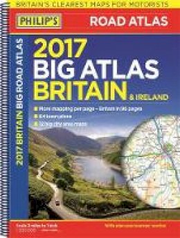

Stock image for illustration purposes only - book cover, edition or condition may vary.
Philipˊs Big Road Atlas Britain and Ireland 2017
Philip'S
€ 4.99
FREE Delivery in Ireland
Description for Philipˊs Big Road Atlas Britain and Ireland 2017
spiral_bound. Philip's Big Road Atlas Britain and Ireland 2017 is a large-format spiral-bound atlas featuring fully updated maps from the Philip's digital database, which has been voted Britain's clearest and most detailed in an independent consumer survey. Num Pages: 168 pages. BIC Classification: 1DBK; 1DBR; WTRD. Category: (G) General (US: Trade). Dimension: 296 x 397 x 15. Weight in Grams: 956. Clean copy showing some age and light shelf wear. Remains a very good copy
Philip's: Britain's clearest maps for motorists. Completely updated and revised for 2017. Good balance between detail and quality ... excellent town maps What Car? Practical 'more to view per page' format (A3). 96 pages of fully updated road maps at 3 miles to 1 inch. 2-page road map of Ireland. 64 fully indexed town and city plans. 16 pages of city approach maps with named arterial roads. 6-page extra-large-scale route-planning section. Philip's Big Road Atlas Britain and Ireland 2017 is a large-format spiral-bound atlas featuring fully updated ... Read more
Philip's: Britain's clearest maps for motorists. Completely updated and revised for 2017. Good balance between detail and quality ... excellent town maps What Car? Practical 'more to view per page' format (A3). 96 pages of fully updated road maps at 3 miles to 1 inch. 2-page road map of Ireland. 64 fully indexed town and city plans. 16 pages of city approach maps with named arterial roads. 6-page extra-large-scale route-planning section. Philip's Big Road Atlas Britain and Ireland 2017 is a large-format spiral-bound atlas featuring fully updated ... Read more
Product Details
Publication date
2016
Publisher
Octopus Publishing Group London
Condition
Used, Very Good
Number of Pages
168
Format
Spiral bound
Place of Publication
London, United Kingdom
ISBN
9781849074155
SKU
KMK0024221
Shipping Time
Usually ships in 2 to 4 working days
Ref
99-1
Reviews for Philipˊs Big Road Atlas Britain and Ireland 2017
