×


 x 

Shopping cart

Atlases & maps (Children’s/Teenage)

Results 41 - 48 of 48

Atlases & maps (Children’s/Teenage)

Paperback. An illustrated introduction to maps in which children can draw and engage with maps of rooms, towns, countries and continents. Num Pages: 172 pages, 150 colour and black and white illustrations. BIC Classification: YNM; YRW. Category: (J) Children / Juvenile. Dimension: 284 x 217 x 15. Weight in Grams: 632.
Format
Paperback
Publication date
2015
Publisher
Cicada Books
Edition
Act Csm
Condition
New
SKU
V9781908714206
ISBN
9781908714206
Paperback
Condition: New

€ 22.27

Paperback. Use the engaging approach of geog.123 to help students develop key locational knowledge and a better understanding of the world - and to enjoy maps. Email fiona.mccollum@oup.com to request your free poster! Num Pages: 112 pages, Full Colour. BIC Classification: 4KHN; YQG; YRW. Category: (ES) Secondary. Dimension: 291 x 225 x 8. Weight in Grams: 452.
Publisher
Oxford University Press United Kingdom
Number of pages
112
Format
Paperback
Publication date
2013
Edition
UK ed.
Condition
New
SKU
V9780198390756
ISBN
9780198390756
Paperback
Condition: New

€ 27.29

Hardcover. .
Publisher
Armadillo Books
Format
Hardback
Publication date
2017
Edition
Reprint
Condition
New
SKU
V9781843228936
ISBN
9781843228936
Hardback
Condition: New

€ 11.99
€ 10.89

Hardcover. This picture atlas takes young readers on a visual journey around the world, from the hot plains of Africa, to the frozen tundra of the Artic. Detailed pictorial maps reveal the richness and diversity of human and animal life around the world. Illustrator(s): Edwards, Linda. Num Pages: 48 pages, colour illustrations. BIC Classification: YRW. Category: (J) Children / Juvenile. Dimension: 313 x 238 x 12. Weight in Grams: 592.
Publisher
Usborne
Number of pages
48
Format
Hardback
Publication date
2003
Condition
New
SKU
V9780746047132
ISBN
9780746047132
Hardback
Condition: New

€ 13.99
€ 11.13

Paperback. An interactive journey around the world, on which children can place stickers of landmarks, animals and people in the right places, learning more about the world as they go. Fresh, modern illustrations make this a lively and inviting first atlas. Illustrator(s): Ragondet, Nathalie. Num Pages: 34 pages, Full colour throughout. BIC Classification: YBGS; YRW. Category: (J) Children / Juvenile. Dimension: 305 x 223 x 5. Weight in Grams: 292.
Publisher
Usborne Publishing Ltd
Format
Paperback
Publication date
2013
Condition
New
SKU
V9781409550013
ISBN
9781409550013
Paperback
Condition: New

€ 9.99
€ 9.15

Paperback. From Tokyo to New York, Alpine Mountains to Pedigree Parks, children are taken on a whirlwind journey around the globe, solving puzzles along the way. A brilliant introduction to maps without the aid of technology. Num Pages: 64 pages, full colour throughout. BIC Classification: 5AG; YBG; YNVP; YRW. Category: (JC) Children's (6-12); (JN) Preschool (0-5). Dimension: 305 x 248. .
Publisher
Usborne Publishing Ltd
Format
Paperback
Publication date
2017
Condition
New
SKU
V9781474921466
ISBN
9781474921466
Paperback
Condition: New

€ 10.99
€ 9.51

Hardback. Illustrator(s): Calder, Jill. Num Pages: 64 pages. BIC Classification: 5AF; YRW. Category: (G) General (US: Trade); (J) Children / Juvenile. Dimension: 305 x 237. .
Publisher
Bloomsbury Publishing PLC
Format
Hardback
Publication date
2017
Condition
New
SKU
V9781408884867
ISBN
9781408884867
Hardback
Condition: New

€ 19.99
€ 14.86

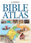
Paperback. A companion to the Candle Bible Handbook, with newly commissioned maps. Num Pages: 64 pages. BIC Classification: 5AK; YNRB; YRW. Category: (J) Children / Juvenile. Dimension: 240 x 172. .
Publisher
Lion Hudson Plc United Kingdom
Number of pages
64
Format
Paperback
Publication date
2020
Edition
New edition
Condition
New
SKU
V9781781283417
ISBN
9781781283417
Paperback
Condition: New

€ 16.99
€ 13.44

Page 3 of 3

Subscribe to our newsletter

News on special offers, signed editions & more!