Atlases & maps (Children’s/Teenage)
Results 1 - 20 of 43
Atlases & maps (Children’s/Teenage)
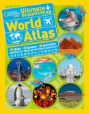
Paperback. Num Pages: 256 pages, 90. BIC Classification: YRW. Category: (J) Children / Juvenile. Dimension: 275 x 216 x 12. Weight in Grams: 634.
- Publisher
- National Geographic Kids
- Format
- Paperback
- Publication date
- 2014
- Condition
- New
- SKU
- V9781426314889
- ISBN
- 9781426314889
Paperback
Condition: New
€ 17.01
€ 17.01
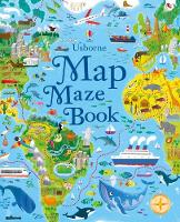
Paperback. From Tokyo to New York, Alpine Mountains to Pedigree Parks, children are taken on a whirlwind journey around the globe, solving puzzles along the way. A brilliant introduction to maps without the aid of technology. Num Pages: 64 pages, full colour throughout. BIC Classification: 5AG; YBG; YNVP; YRW. Category: (JC) Children's (6-12); (JN) Preschool (0-5). Dimension: 305 x 248. .
- Publisher
- Usborne Publishing Ltd
- Format
- Paperback
- Publication date
- 2017
- Condition
- New
- SKU
- V9781474921466
- ISBN
- 9781474921466
Paperback
Condition: New
€ 10.99€ 9.51
€ 10.99
€ 9.51
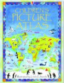
Hardcover. This picture atlas takes young readers on a visual journey around the world, from the hot plains of Africa, to the frozen tundra of the Artic. Detailed pictorial maps reveal the richness and diversity of human and animal life around the world. Illustrator(s): Edwards, Linda. Num Pages: 48 pages, colour illustrations. BIC Classification: YRW. Category: (J) Children / Juvenile. Dimension: 313 x 238 x 12. Weight in Grams: 592.
- Publisher
- Usborne
- Number of pages
- 48
- Format
- Hardback
- Publication date
- 2003
- Condition
- New
- SKU
- V9780746047132
- ISBN
- 9780746047132
Hardback
Condition: New
€ 13.99€ 11.13
€ 13.99
€ 11.13
Sheet map. Illustrator(s): Harper, Kourtney. Num Pages: 2 pages, 130 colour line drawings. BIC Classification: 1KBBFC; YRW. Category: (J) Children / Juvenile. Dimension: 154 x 111 x 2. Weight in Grams: 38.
- Publisher
- Guy Fox Publishing United Kingdom
- Number of pages
- 2
- Publication date
- 2008
- Edition
- 2nd
- Condition
- New
- SKU
- V9781904711087
- ISBN
- 9781904711087
Hardback
Condition: New
€ 7.31
€ 7.31
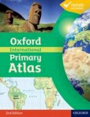
Paperback. Accessible and informative world atlas for all primary age children Editor(s): Wiegand, Patrick. Num Pages: 80 pages, Full colour. BIC Classification: 4KHJ; 5AH; YQG; YRW. Category: (EJ) Primary. Dimension: 291 x 227 x 5. Weight in Grams: 338.
- Publisher
- Oxford University Press United Kingdom
- Number of pages
- 80
- Format
- Paperback
- Publication date
- 2011
- Edition
- 2nd Revised edition
- Condition
- New
- SKU
- V9780198480228
- ISBN
- 9780198480228
Paperback
Condition: New
€ 14.99€ 12.42
€ 14.99
€ 12.42
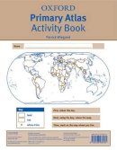
Paperback. The Oxford Primary Atlas Activity Book develops atlas skills and reinforces concepts introduced in the Oxford Primary Atlas. The Activity Book offers maps and activities to encourage pupils to work independently and to practise and develop their knowledge and understanding of the topics and themes covered in the atlas. Editor(s): Wiegand, Patrick. Num Pages: 32 pages, Full colour. BIC Classification: YQG; YRW. Category: (E) Primary & Secondary Education. Dimension: 280 x 225 x 2. Weight in Grams: 86.
- Publisher
- Oxford University Press United Kingdom
- Number of pages
- 32
- Format
- Paperback
- Publication date
- 2011
- Edition
- UK ed.
- Condition
- New
- SKU
- V9780198480181
- ISBN
- 9780198480181
Paperback
Condition: New
€ 14.37
€ 14.37
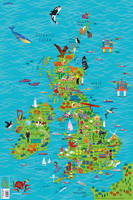
Paperback. Colourful Illustrated Map of the United Kingdom and Ireland Illustrator(s): Evans, Steve. BIC Classification: 2AB; 4KHF; YQG; YRW. Category: (E) Primary & Secondary Education; (J) Children / Juvenile. Dimension: 915 x 610. Weight in Grams: 270.
- Publisher
- HarperCollins Publishers
- Format
- Paperback
- Publication date
- 2017
- Condition
- New
- SKU
- V9780008212087
- ISBN
- 9780008212087
Paperback
Condition: New
€ 9.99€ 9.07
€ 9.99
€ 9.07
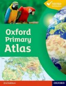
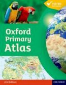
Hardback. The Oxford Primary Atlas is a clear, bright and informative atlas for all 7-11 year olds. It includes up-to-date country data and easy-to-read colourful mapping. It introduces primary school pupils to key geographical themes and topics, matched to curriculum requirements, including landscapes, water, settlements, connections, and environments. Editor(s): Wiegand, Patrick. Num Pages: 88 pages, col. Illustrations, col. maps. BIC Classification: 4KHJ; 5AH; YQ; YRW. Category: (EJ) Primary. Dimension: 300 x 232 x 12. Weight in Grams: 624.
- Publisher
- Oxford University Press
- Number of pages
- 88
- Format
- Hardback
- Publication date
- 2011
- Edition
- 2nd Edition
- Condition
- New
- SKU
- V9780198480167
- ISBN
- 9780198480167
Hardback
Condition: New
€ 17.99€ 14.55
€ 17.99
€ 14.55
Hardcover. The most engaging 14-18 atlas, now updated and even better. Num Pages: 176 pages, Full Colour. BIC Classification: 4KHN; YRW. Category: (E) Primary & Secondary Education. Dimension: 298 x 232 x 16. Weight in Grams: 978.
- Publisher
- Oxford University Press United Kingdom
- Number of pages
- 176
- Format
- Hardback
- Publication date
- 2012
- Edition
- UK ed.
- Condition
- New
- SKU
- V9780199136988
- ISBN
- 9780199136988
Hardback
Condition: New
€ 23.99€ 17.55
€ 23.99
€ 17.55
Paperback. A companion to the Candle Bible Handbook, with newly commissioned maps. Num Pages: 64 pages. BIC Classification: 5AK; YNRB; YRW. Category: (J) Children / Juvenile. Dimension: 240 x 172. .
- Publisher
- Lion Hudson Plc United Kingdom
- Number of pages
- 64
- Format
- Paperback
- Publication date
- 2020
- Edition
- New edition
- Condition
- New
- SKU
- V9781781283417
- ISBN
- 9781781283417
Paperback
Condition: New
€ 16.99€ 13.44
€ 16.99
€ 13.44
Hardback. Num Pages: 32 pages. BIC Classification: 5AG; YNN; YRW. Category: (J) Children / Juvenile. Dimension: 285 x 225 x 34. Weight in Grams: 838.
- Publisher
- Dorling Kindersley Ltd
- Format
- Hardback
- Publication date
- 2017
- Condition
- New
- SKU
- V9780241283035
- ISBN
- 9780241283035
Hardback
Condition: New
€ 19.99€ 14.86
€ 19.99
€ 14.86
Hardback. A follow-up to the best-selling Atlas of Adventures, this book collects together the most unmissable events, epic migrations and extraordinary behaviours of the animal kingdom, from around the world. Illustrator(s): Letherland, Lucy. Series: Atlas of. Num Pages: 96 pages. BIC Classification: YB; YRW. Category: (J) Children / Juvenile. Dimension: 282 x 379 x 16. Weight in Grams: 1060.
- Publisher
- Wide Eyed Editions
- Format
- Hardback
- Publication date
- 2016
- Condition
- New
- SKU
- V9781847807922
- ISBN
- 9781847807922
Hardback
Condition: New
€ 26.00€ 21.34
€ 26.00
€ 21.34
Paperback. Use the engaging approach of geog.123 to help students develop key locational knowledge and a better understanding of the world - and to enjoy maps. Email fiona.mccollum@oup.com to request your free poster! Num Pages: 112 pages, Full Colour. BIC Classification: 4KHN; YQG; YRW. Category: (ES) Secondary. Dimension: 291 x 225 x 8. Weight in Grams: 452.
- Publisher
- Oxford University Press United Kingdom
- Number of pages
- 112
- Format
- Paperback
- Publication date
- 2013
- Edition
- UK ed.
- Condition
- New
- SKU
- V9780198390756
- ISBN
- 9780198390756
Paperback
Condition: New
€ 27.29
€ 27.29
Paperback.
- Publisher
- Prim-Ed Publishing United Kingdom
- Number of pages
- 22
- Format
- Paperback
- Publication date
- 1993
- Edition
- 2nd
- Condition
- New
- SKU
- V9781864001334
- ISBN
- 9781864001334
Paperback
Condition: New
€ 21.98
€ 21.98
Paperback. BIC Classification: 1KJ; 2AB; 4P; YQG; YRW. Category: (E) Primary & Secondary Education; (Y) Teenage / Young Adult. Dimension: 312 x 226. Weight in Grams: 270.
- Publisher
- HarperCollins Publishers
- Format
- Paperback
- Publication date
- 2017
- Condition
- New
- SKU
- V9780008214326
- ISBN
- 9780008214326
Paperback
Condition: New
€ 19.99€ 18.49
€ 19.99
€ 18.49
Paperback. A simple introductory atlas with a narrative thread, encouraging young children to learn about the Earth in space, the world, continents, and countries. Editor(s): Wiegand, Patrick. Num Pages: 32 pages, Full colour. BIC Classification: YRW. Category: (E) Primary & Secondary Education. Dimension: 240 x 183 x 3. Weight in Grams: 108.
- Publisher
- Oxford University Press United Kingdom
- Number of pages
- 32
- Format
- Paperback
- Publication date
- 2011
- Edition
- UK ed.
- Condition
- New
- SKU
- V9780198487869
- ISBN
- 9780198487869
Paperback
Condition: New
€ 9.99€ 9.06
€ 9.99
€ 9.06
Paperback. This accurate, colour-coded map shows all areas according to their actual size, with the North-South lines running vertically and the East-West lines running parallel. BIC Classification: WTRM; YRW. Category: (G) General (US: Trade). Dimension: 770 x 531 x 1. Weight in Grams: 132.
- Publisher
- Schofield & Sims Ltd United Kingdom
- Format
- Paperback
- Publication date
- 2005
- Edition
- Lam Map
- Condition
- New
- SKU
- V9780721709338
- ISBN
- 9780721709338
Paperback
Condition: New
€ 24.99€ 21.75
€ 24.99
€ 21.75
Hardback. Travel the world without leaving your living room. Num Pages: 112 pages, maps (colour). BIC Classification: YNM; YRW. Category: (JC) Children's (6-12). Dimension: 283 x 521 x 17. Weight in Grams: 1234.
- Publisher
- Templar Publishing
- Format
- Hardback
- Publication date
- 2013
- Condition
- New
- SKU
- V9781848773011
- ISBN
- 9781848773011
Hardback
Condition: New
€ 33.99€ 22.28
€ 33.99
€ 22.28
Paperback. The Oxford Primary Atlas is a clear, bright and informative atlas for all 7-11 year olds. It includes up-to-date country data and easy-to-read colourful mapping. It introduces primary school pupils to key geographical themes and topics, matched to curriculum requirements, including landscapes, water, settlements, connections, and environments. Editor(s): Wiegand, Patrick. Num Pages: 88 pages, Full colour. BIC Classification: 4KHJ; YQG; YRW. Category: (E) Primary & Secondary Education. Dimension: 289 x 222 x 5. Weight in Grams: 340.
- Publisher
- Oxford University Press United Kingdom
- Number of pages
- 88
- Format
- Paperback
- Publication date
- 2011
- Edition
- 2nd Revised edition
- Condition
- New
- SKU
- V9780198480174
- ISBN
- 9780198480174
Paperback
Condition: New
€ 14.99€ 12.61
€ 14.99
€ 12.61
Hardcover. The most engaging 10-14 atlas, now updated and even better Num Pages: 96 pages, Full Colour. BIC Classification: 4KHN; YRW. Category: (E) Primary & Secondary Education. Dimension: 297 x 232 x 12. Weight in Grams: 688.
- Publisher
- Oxford University Press United Kingdom
- Number of pages
- 96
- Format
- Hardback
- Publication date
- 2012
- Edition
- 3rd UK ed.
- Condition
- New
- SKU
- V9780199137015
- ISBN
- 9780199137015
Hardback
Condition: New
€ 17.99€ 14.11
€ 17.99
€ 14.11

