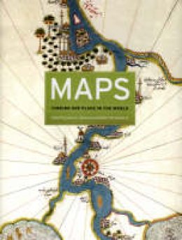
Stock image for illustration purposes only - book cover, edition or condition may vary.
Description for Maps
Hardcover. Presents an examination of the use of maps for wayfinding. This book considers maps whose makers employed the smallest of scales to envision the broadest of human stages. It looks at maps that are at the opposite end of the scale from cosmological and world maps. It shows ways in which certain maps can be linked to particular events in history. Editor(s): Akerman, James R.; Karrow, Robert W. Num Pages: 336 pages, 198 colour plates. BIC Classification: AGC; HBT; RGS; RGV. Category: (P) Professional & Vocational. Dimension: 284 x 222 x 33. Weight in Grams: 1912.
Maps are universal forms of communication, easily understood and appreciated regardless of culture or language. This truly magisterial book introduces readers to the widest range of maps ever considered in one volume: maps from different time periods and a variety of cultures; maps made for divergent purposes and depicting a range of environments; and maps that embody the famous, the important, the beautiful, the groundbreaking, and the amusing. Built around the functions of maps - the kinds of things maps do and have done - maps confirms the vital role of maps throughout history in commerce, art, literature, and national identity. The book begins by examining the use of maps for wayfinding, revealing that even maps as common and widely used as these products of historical circumstances and cultural differences. The second chapter considers maps whose makers employed the smallest of scales to envision the broadest of human stages - the world, the heavens, even the act of creation itself. The next chapter looks at maps that are, literally, at the opposite end of the scale from cosmological and world maps - maps that represent specific parts of the world and provide a close-up view of areas in which their makers lived, worked, and moved. Having shown how maps help us get around and make sense of our greater and lesser worlds, Maps then turns to the ways in which certain maps can be linked to particular events in history, exploring how they have helped Americans, for instance, to understand their past, cope with current events, and plan their national future. The fifth chapter considers maps that represent data from scientific instruments, population censuses, and historical records. These maps illustrate, for example, how diseases spread, what the ocean floor looks like, and how the weather is tracked and predicted. Next comes a turn to the imaginary, featuring maps that depict entire fictional worlds, from Hell to Utopia and from Middle Earth to the fantasy game World of Warcraft. The final chapter traces the origins of map consumption throughout history and ponders the impact of cartography on modern society. A companion volume to the most ambitious exhibition on the history of maps ever mounted in North America, Maps will challenge readers to stretch conventional thought about what constitutes a map and how many different ways we can understand graphically the environment in which we live. Collectors, historians, mapmakers and users, and anyone who has ever gotten lost in the lines and symbols of a map will find much to love and learn from in this book.
Product Details
Publisher
The University of Chicago Press United States
Number of pages
336
Format
Hardback
Publication date
2007
Condition
New
Weight
1911g
Number of Pages
336
Place of Publication
, United States
ISBN
9780226010755
SKU
V9780226010755
Shipping Time
Usually ships in 7 to 11 working days
Ref
99-1
About James R. Akerman
James R. Akerman is director of the Newberry Library's Hermon Dunlap Smith Center for the History of Cartography and editor of Cartographies of Travel and Navigation, also published by the University of Chicago Press. Robert W. Karrow Jr. is curator of special collections and maps in the Roger and Julie Baskes Department of Special Collections at the Newberry Library.
Reviews for Maps
Maps shows us that the content of a given map is as much determined by culture, historical circumstances, and the interests of mapmakers and map users as it is by the geography that it attempts to depict. From the earliest maps on clay tablets to today's in-car navigation systems, maps tell us not just where we are but who we are. They are artifacts of - and witnesses to - history. And they continue to inspire us to wonder about our place in the world, and mark it for others to see. - John W. McCarter Jr., from the Foreword
