Geographical information systems (GIS) & remote sensing
Results 21 - 40 of 71
Geographical information systems (GIS) & remote sensing
Hardcover. Editor(s): Nielson, Dayna. Num Pages: 248 pages. BIC Classification: RGW. Category: (P) Professional & Vocational. Dimension: 231 x 159 x 25. Weight in Grams: 620.
- Format
- Hardback
- Publication date
- 2014
- Publisher
- Nova Science Publishers, Inc.
- Condition
- New
- SKU
- V9781633212930
- ISBN
- 9781633212930
Hardback
Condition: New
€ 343.99€ 232.20
€ 343.99
€ 232.20
Hardcover. This book explains the concept of spatial data quality, a key theory for minimizing the risks of data misuse in a specific decision-making context. Editor(s): Devillers, Rodolphe; Jeansoulin, Robert. Series: Geographical Information Systems. Num Pages: 310 pages, Illustrations, maps. BIC Classification: RGW. Category: (P) Professional & Vocational. Dimension: 241 x 162 x 21. Weight in Grams: 588.
- Format
- Hardback
- Publication date
- 2006
- Publisher
- ISTE United Kingdom
- Edition
- 1st Edition
- Number of pages
- 310
- Condition
- New
- SKU
- V9781905209569
- ISBN
- 9781905209569
Hardback
Condition: New
€ 178.63
€ 178.63
Hardback. Editor(s): Alcantara, Enner Herenio de. Num Pages: 190 pages, illustrations. BIC Classification: RGW; TTBM. Category: (UP) Postgraduate, Research & Scholarly. Dimension: 238 x 159 x 16. Weight in Grams: 444.
- Publisher
- Nova Science Publishers Inc United States
- Number of pages
- 190
- Format
- Hardback
- Publication date
- 2013
- Condition
- New
- SKU
- V9781624171406
- ISBN
- 9781624171406
Hardback
Condition: New
€ 191.10€ 129.44
€ 191.10
€ 129.44
Hardcover. Modeling the occurrence and behaviour of groundwater is a critical aspect to any groundwater studies, whether they're being done to plan a clean-up project or in the preliminary site studies for a planned future development. This book defines what GIS is, how to perform it, and how to use GIS technology in modeling groundwater. Num Pages: 248 pages, Ill. BIC Classification: RBG; RBKF; RGW. Category: (P) Professional & Vocational; (UP) Postgraduate, Research & Scholarly; (UU) Undergraduate. Dimension: 235 x 163 x 18. Weight in Grams: 490.
- Format
- Hardback
- Publication date
- 2002
- Publisher
- John Wiley and Sons Ltd United States
- Edition
- 1st Edition
- Number of pages
- 248
- Condition
- New
- SKU
- V9780471084983
- ISBN
- 9780471084983
Hardback
Condition: New
€ 157.16
€ 157.16
Hardcover. Major new text which provides the state-of-the-art on laser scanning technology. Includes a wide range of applications. Num Pages: 336 pages, illustrated. BIC Classification: RGW; TTBL; TTBM. Category: (P) Professional & Vocational; (UP) Postgraduate, Research & Scholarly; (UU) Undergraduate. Dimension: 247 x 179 x 26. Weight in Grams: 966.
- Publisher
- Whittles Publishing United Kingdom
- Number of pages
- 336
- Format
- Hardback
- Publication date
- 2010
- Condition
- New
- SKU
- V9781904445876
- ISBN
- 9781904445876
Hardback
Condition: New
€ 98.39
€ 98.39
Paperback. Num Pages: 336 pages. BIC Classification: PDR; RGW. Category: (G) General (US: Trade); (P) Professional & Vocational; (U) Tertiary Education (US: College). Dimension: 198 x 129. .
- Publisher
- Granta Books
- Format
- Paperback
- Publication date
- 2017
- Condition
- New
- SKU
- V9781847087096
- ISBN
- 9781847087096
Paperback
Condition: New
€ 13.99€ 10.78
€ 13.99
€ 10.78
Paperback. Num Pages: 336 pages. BIC Classification: PDR; RGW. Category: (G) General (US: Trade); (P) Professional & Vocational; (U) Tertiary Education (US: College). Dimension: 155 x 234 x 27. Weight in Grams: 396.
- Publisher
- Granta Books
- Format
- Paperback
- Publication date
- 2016
- Condition
- New
- SKU
- KTG0015907
- ISBN
- 9781847087089
Paperback
Condition: New
€ 77.95€ 5.99
€ 77.95
€ 5.99
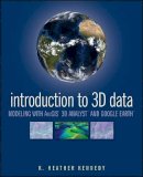
Paperback. Render three-dimensional data and maps with ease. Written as a self-study workbook, Introduction to 3D Data demystifies the sometimes confusing controls and procedures required for 3D modeling using software packages such as ArcGIS 3D Analyst and Google Earth. Num Pages: 360 pages, Illustrations. BIC Classification: RGW. Category: (P) Professional & Vocational. Dimension: 234 x 191 x 18. Weight in Grams: 606.
- Format
- Paperback
- Publication date
- 2009
- Publisher
- John Wiley and Sons Ltd United Kingdom
- Edition
- 1st Edition
- Number of pages
- 360
- Condition
- New
- SKU
- V9780470381243
- ISBN
- 9780470381243
Paperback
Condition: New
€ 100.72
€ 100.72
Paperback. Examines the ways in which Geographical Information Systems can be used to explore archaeological landscapes, and summarises the most appropriate methods to use. This title explores the applications of GIS to a wide variety of archaeological evidence including maps, aerial photographs and earthworks. Num Pages: 240 pages, Illustrations (some col.). BIC Classification: HDW; RGW. Category: (P) Professional & Vocational; (UP) Postgraduate, Research & Scholarly; (UU) Undergraduate. Dimension: 248 x 171 x 15. Weight in Grams: 536.
- Publisher
- The History Press Ltd United Kingdom
- Number of pages
- 240
- Format
- Paperback
- Publication date
- 2006
- Condition
- New
- SKU
- V9780752436036
- ISBN
- 9780752436036
Paperback
Condition: New
€ 36.99€ 26.77
€ 36.99
€ 26.77
Paperback. Num Pages: 480 pages, Illustrations, maps. BIC Classification: RGW. Category: (P) Professional & Vocational. Dimension: 264 x 217 x 22. Weight in Grams: 1132.
- Publisher
- Pearson Education Limited United Kingdom
- Number of pages
- 480
- Format
- Paperback
- Publication date
- 2011
- Edition
- 4th Edition
- Condition
- New
- SKU
- V9780273722595
- ISBN
- 9780273722595
Paperback
Condition: New
€ 88.73
€ 88.73
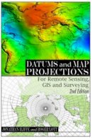
Paperback. A practical guide to coordinate reference systems. Num Pages: 224 pages, liberally illustrated with full colour. BIC Classification: RGV; RGW; RGY. Category: (P) Professional & Vocational; (U) Tertiary Education (US: College). Dimension: 156 x 235 x 14. Weight in Grams: 482.
- Publisher
- Whittles Publishing United Kingdom
- Number of pages
- 224
- Format
- Paperback
- Publication date
- 2008
- Edition
- 2Rev Ed
- Condition
- New
- SKU
- V9781904445470
- ISBN
- 9781904445470
Paperback
Condition: New
€ 56.12
€ 56.12
Hardcover. From selecting sites for new hospitals, schools, and factories, to managing forests and rivers, to creating and maintaining highways and bridges, public and private organizations are often called on to make decisions on geographic questions that involve a multitude of alternatives and often conflicting evaluation criteria. Num Pages: 408 pages, bibliography. BIC Classification: RGW. Category: (P) Professional & Vocational; (UP) Postgraduate, Research & Scholarly; (UU) Undergraduate. Dimension: 241 x 169 x 29. Weight in Grams: 766.
- Format
- Hardback
- Publication date
- 1999
- Publisher
- Wiley
- Number of pages
- 408
- Condition
- New
- SKU
- V9780471329442
- ISBN
- 9780471329442
Hardback
Condition: New
€ 211.91
€ 211.91
Hardcover. This is the only book to provide a comprehensive coverage of GIS applications in the business and organizational environment. Contains numerous real-world case studies demonstrating how GIS is currently making businesses better. Num Pages: 416 pages, Illustrations, maps. BIC Classification: KJQ; RGW. Category: (P) Professional & Vocational. Dimension: 244 x 197 x 29. Weight in Grams: 766.
- Format
- Hardback
- Publication date
- 2008
- Publisher
- John Wiley and Sons Ltd United States
- Edition
- 1st Edition
- Number of pages
- 416
- Condition
- New
- SKU
- V9780471729983
- ISBN
- 9780471729983
Hardback
Condition: New
€ 142.01
€ 142.01
Hardcover. Focusing on fundamentals and techniques, this book presents the integrated use of geotechnologies such as GIS, GPS, Digital Photogrammetry, and Visualization, along with underlying theory of GIS and GPS. Also included is discussion of instrumentation and guidelines for selecting the right device for the job. Num Pages: 280 pages, line drawings, photographs, references. BIC Classification: RGW; TN; TRLN. Category: (P) Professional & Vocational. Dimension: 236 x 161 x 18. Weight in Grams: 514.
- Format
- Hardback
- Publication date
- 2003
- Publisher
- John Wiley and Sons Ltd United States
- Edition
- 1st Edition
- Number of pages
- 280
- Condition
- New
- SKU
- V9780471244097
- ISBN
- 9780471244097
Hardback
Condition: New
€ 182.32
€ 182.32
Paperback. Num Pages: 293 pages, illustrations. BIC Classification: RGC; RGV; RGW. Category: (G) General (US: Trade); (U) Tertiary Education (US: College). Dimension: 180 x 254 x 18. Weight in Grams: 814.
- Publisher
- Guilford Publications
- Format
- Paperback
- Publication date
- 2016
- Edition
- 3rd Edition
- Condition
- New
- SKU
- V9781462509980
- ISBN
- 9781462509980
Paperback
Condition: New
€ 65.88
€ 65.88
Hardcover. Public and private sector organisations look towards spatial analysis and what it can do for their business or organisation. This book, structured in two complementary parts to convey this public private focus, provides readers with various global applications from business and local/national government. Editor(s): Stillwell, John; Clarke, Graham P. Num Pages: 420 pages, Illustrations (some col.), maps (some col.). BIC Classification: RGW. Category: (P) Professional & Vocational. Dimension: 251 x 177 x 36. Weight in Grams: 928.
- Format
- Hardback
- Publication date
- 2003
- Publisher
- John Wiley & Sons Inc United Kingdom
- Edition
- 1st Edition
- Number of pages
- 420
- Condition
- New
- SKU
- V9780470844090
- ISBN
- 9780470844090
Hardback
Condition: New
€ 209.24
€ 209.24
Paperback. This book discusses maps as data with data structure implications; roving windows; spatial data modeling and management; assessing variability, shape, and pattern of map features; overlaying maps; cost-benefit analysis; algorithms involved in slope, distance, and connectivity; and cartographic and spatial modeling. Num Pages: 246 pages, black & white illustrations. BIC Classification: RGW. Category: (P) Professional & Vocational; (UP) Postgraduate, Research & Scholarly; (UU) Undergraduate. Dimension: 229 x 156 x 17. Weight in Grams: 418.
- Format
- Paperback
- Publication date
- 1996
- Publisher
- John Wiley and Sons Ltd United Kingdom
- Edition
- 1st Edition
- Number of pages
- 246
- Condition
- New
- SKU
- V9780470236765
- ISBN
- 9780470236765
Paperback
Condition: New
€ 129.15
€ 129.15
Recent Advances in Remote Sensing & GIS in Sub-Sahara Africa
Kamusoko, Courage; Mundia, Charles Ndegwa; Mu...
Hardcover. Num Pages: 221 pages, illustrations. BIC Classification: RGW. Category: (G) General (US: Trade). Dimension: 244 x 169 x 18. Weight in Grams: 462.
- Format
- Hardback
- Publication date
- 2011
- Publisher
- Nova Science Publishers Inc United States
- Number of pages
- 221
- Condition
- New
- SKU
- V9781617610035
- ISBN
- 9781617610035
Hardback
Condition: New
€ 148.10€ 101.76
€ 148.10
€ 101.76
Hardcover. Num Pages: 384 pages, Illustrations (some col.), maps, ports. BIC Classification: RGW. Category: (P) Professional & Vocational. Dimension: 243 x 186 x 18. Weight in Grams: 698.
- Format
- Hardback
- Publication date
- 2010
- Publisher
- Pearson Education (US) United States
- Edition
- 5th Edition
- Number of pages
- 384
- Condition
- New
- SKU
- V9780131494985
- ISBN
- 9780131494985
Hardback
Condition: New
€ 234.46
€ 234.46
Hardcover. Mark Monmonier looks at the increased use of geographic data, satellite imagery, and location tracking across a wide range of fields. Could these diverse forms of geographic monitoring, he asks, lead to grave consequences for society? Num Pages: 264 pages, 7halftones, 58line drawings. BIC Classification: JPV; PDR; PDZ; RGW. Category: (G) General (US: Trade); (P) Professional & Vocational; (U) Tertiary Education (US: College). Dimension: 216 x 140 x 19. Weight in Grams: 502.
- Format
- Hardback
- Publication date
- 2002
- Publisher
- The University of Chicago Press United States
- Edition
- 1st Edition
- Number of pages
- 264
- Condition
- New
- SKU
- V9780226534275
- ISBN
- 9780226534275
Hardback
Condition: New
€ 52.56€ 45.18
€ 52.56
€ 45.18


