Geography
Results 741 - 760 of 1567
Geography
Paperback. Histories of the Darwinian revolution have often paid more attention to theoretical debates than to the researchers who struggled to comprehend the deeper evolutionary significance of fossils. This is an account of evolutionary morphology and its relationship with palaeontology and biogeography. Series: Science & Its Conceptual Foundations S. Num Pages: 530 pages, 35 halftones, 20 line drawings. BIC Classification: 3JH; 3JJ; PSAJ; RBX; RGM. Category: (P) Professional & Vocational; (UP) Postgraduate, Research & Scholarly; (UU) Undergraduate. Dimension: 156 x 230 x 29. Weight in Grams: 746.
- Format
- Paperback
- Publication date
- 1998
- Publisher
- The University of Chicago Press United States
- Edition
- 2
- Number of pages
- 530
- Condition
- New
- SKU
- V9780226069227
- ISBN
- 9780226069227
Paperback
Condition: New
€ 53.72
€ 53.72
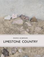
Hardcover. A book about farming, wildlife, culture and the personal experience of living in limestone country. Series: Little Toller Monographs. BIC Classification: RGL; WNR. Category: (G) General (US: Trade). .
- Publisher
- Little Toller Books
- Format
- Hardback
- Publication date
- 2017
- Condition
- New
- SKU
- V9781908213518
- ISBN
- 9781908213518
Hardback
Condition: New
€ 23.99€ 21.59
€ 23.99
€ 21.59
Hardcover. Many types of linear position sensors are used in commercial, industrial, and automotive products and equipment. This book explains the theory behind the various technologies used and shows how they are implemented in practice. Num Pages: 184 pages, Illustrations. BIC Classification: RGW; TG; TJF. Category: (P) Professional & Vocational. Dimension: 237 x 166 x 16. Weight in Grams: 418.
- Format
- Hardback
- Publication date
- 2003
- Publisher
- John Wiley and Sons Ltd United States
- Edition
- 1st Edition
- Number of pages
- 184
- Condition
- New
- SKU
- V9780471233268
- ISBN
- 9780471233268
Hardback
Condition: New
€ 190.09
€ 190.09
map. BIC Classification: RGS; WTR. Category: (G) General (US: Trade). Dimension: 220 x 110. .
- Publication date
- 2016
- Publisher
- Institut Geographique National France
- Edition
- 1.
- Condition
- New
- SKU
- V9782758535478
- ISBN
- 9782758535478
Hardback
Condition: New
€ 19.99€ 18.85
€ 19.99
€ 18.85
Paperback. Series: The New Critical Idiom. Num Pages: 192 pages. BIC Classification: DSA; RG. Category: (UP) Postgraduate, Research & Scholarly; (UU) Undergraduate. Dimension: 198 x 129. .
- Format
- Paperback
- Publication date
- 2022
- Publisher
- Taylor & Francis Ltd United Kingdom
- Edition
- 1st Edition
- Number of pages
- 192
- Condition
- New
- SKU
- V9781138013346
- ISBN
- 9781138013346
Paperback
Condition: New
€ 30.13
€ 30.13
Hardback. The desegregation crisis in Little Rock Central High School is a landmark of American history. Providing fresh perspectives on the individuals, especially the activists and policymakers, involved in this event, this title examines American racial politics in relation to changes in youth culture, sexuality, gender relations, and economics. Series: Politics and Society in Modern America. Num Pages: 328 pages, 12 halftones. BIC Classification: RG. Category: (P) Professional & Vocational; (UP) Postgraduate, Research & Scholarly; (UU) Undergraduate. Dimension: 229 x 152 x 25. Weight in Grams: 616.
- Format
- Hardback
- Publication date
- 2010
- Publisher
- Princeton University Press United States
- Edition
- First Edition
- Condition
- New
- SKU
- V9780691092935
- ISBN
- 9780691092935
Hardback
Condition: New
€ 79.30
€ 79.30
Paperback. An extensively revised edition of Tim Jeal's classic biography published to mark the bicentenary of the great explorer Num Pages: 432 pages, 16pp. b&w illustrations section. BIC Classification: 1HF; BGH; RGR. Category: (G) General (US: Trade). Dimension: 157 x 217 x 34. Weight in Grams: 616.
- Publisher
- Yale University Press
- Number of pages
- 432
- Format
- Paperback
- Publication date
- 2013
- Edition
- Revised, Expanded ed.
- Condition
- New
- SKU
- V9780300191004
- ISBN
- 9780300191004
Paperback
Condition: New
€ 24.99€ 22.08
€ 24.99
€ 22.08
In the wake of evidence demonstrating the irreparable damage humans have inflicted on the planet, some have adopted a defeatist attitude toward environmental crises. This book illustrates how local groups in both Japan and the United States are refusing to surrender the earth to a depleted and polluted fate. Editor(s): Karan, Pradyumna P.; Suganuma, Unryu. Num Pages: 336 pages, 60 photographs, 17 illustrations, 29 maps. BIC Classification: 1FPJ; 1KBB; RGL; RNK. Category: (P) Professional & Vocational; (UP) Postgraduate, Research & Scholarly; (UU) Undergraduate. Dimension: 279 x 216 x 28. Weight in Grams: 1134.
- Publication date
- 2008
- Publisher
- The University Press of Kentucky United States
- Number of pages
- 336
- Condition
- New
- SKU
- V9780813124889
- ISBN
- 9780813124889
Paperback
Condition: New
€ 52.86
€ 52.86
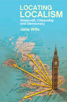
Paperback. Combines political theory with attention to political practice to explore the development of localism as a new mode of statecraft. It highlights the challenges of the state devolving itself and the importance of citizens having the freedom, incentives and institutions needed to act. Num Pages: 264 pages, 23 black & white illustrations, 22 black & white tables. BIC Classification: JPVH1; JPW; RGC. Category: (UP) Postgraduate, Research & Scholarly. Dimension: 158 x 234 x 24. Weight in Grams: 404.
- Publisher
- Policy Press
- Format
- Paperback
- Publication date
- 2016
- Edition
- Reprint
- Condition
- New
- SKU
- V9781447323044
- ISBN
- 9781447323044
Paperback
Condition: New
€ 47.39
€ 47.39
Paperback. Num Pages: 90 pages, illustrations. BIC Classification: KJF; RGCM. Category: (P) Professional & Vocational. Dimension: 217 x 141 x 8. Weight in Grams: 162.
- Format
- Paperback
- Publication date
- 2005
- Publisher
- Nova Science Publishers Inc United States
- Number of pages
- 90
- Condition
- New
- SKU
- V9781594546167
- ISBN
- 9781594546167
Paperback
Condition: New
€ 76.86€ 54.51
€ 76.86
€ 54.51
Hardback. Before Captain Cooks three voyages, the world was uncertain and dangerous; after them, it was clear and safe. Written as a conceptual field guide, this book offers a rereading of both the voyages and of modern political philosophy; the voyages offering new ways of thinking about the world and about the place of human beings have in that world. Num Pages: 256 pages, 25 b/w illustrations. BIC Classification: RGR. Category: (P) Professional & Vocational; (UP) Postgraduate, Research & Scholarly; (UU) Undergraduate. Dimension: 229 x 152. Weight in Grams: 549.
- Format
- Hardback
- Publication date
- 2005
- Publisher
- University of British Columbia Press
- Condition
- New
- SKU
- V9780774811897
- ISBN
- 9780774811897
Hardback
Condition: New
€ 141.13
€ 141.13
Paperback. This fascinating account offers a new understanding of Captain Cook's voyages and how they affected the European world view. Num Pages: 256 pages, 24 b/w photos. BIC Classification: BGH; HBG; RGR. Category: (G) General (US: Trade); (P) Professional & Vocational; (UP) Postgraduate, Research & Scholarly; (UU) Undergraduate. Dimension: 5817 x 3887 x 18. Weight in Grams: 349.
- Format
- Paperback
- Publication date
- 2006
- Publisher
- University of British Columbia Press Canada
- Number of pages
- 256
- Condition
- New
- Edition
- Illustrated
- SKU
- V9780774811903
- ISBN
- 9780774811903
Paperback
Condition: New
€ 56.36
€ 56.36
Paperback. Covering 92 million acres from Virginia to Texas, the longleaf pine ecosystem was one of the biologically diverse ecosystems. The author explores the history of these forests and the biodiversity within them, telling the story through first-person travel accounts and interviews with foresters, ecologists, biologists, botanists, and landowners. Num Pages: 336 pages, 34 illustrations, 1 map, notes, bibl., index. BIC Classification: 1KBBS; RGBL; RNF; RNKH; WNP. Category: (G) General (US: Trade). Dimension: 235 x 152 x 21. Weight in Grams: 490.
- Format
- Paperback
- Publication date
- 2006
- Publisher
- The University of North Carolina Press
- Edition
- Reprint
- Condition
- New
- SKU
- V9780807856994
- ISBN
- 9780807856994
Paperback
Condition: New
€ 48.87
€ 48.87
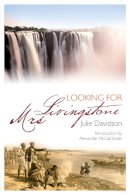
Paperback. The enthralling story of the courageous and stoical wife of the world-renowned explorer and missionary, David Livingstone. In the history books, Mary Livingstone is a shadow in the blaze of her husband's sun, a whisper in the thunderclap of his reputation. Yet she her own feats as an early traveller in uncharted Africa are unique. Num Pages: 448 pages. BIC Classification: 1H; BGH; RGR. Category: (G) General (US: Trade). Dimension: 233 x 158 x 23. Weight in Grams: 422.
- Publisher
- St Andrew Press
- Format
- Paperback
- Publication date
- 2013
- Condition
- New
- SKU
- V9780715209660
- ISBN
- 9780715209660
Paperback
Condition: New
€ 20.99€ 19.34
€ 20.99
€ 19.34
Hardback. * Explores the difference that space and spatiality makes to an understanding of power. * Moves forward the incorporation of ideas of space into social theory. * Presents a new understanding of the exercise, uses and manifestations of cultural, economic and political power in the second half of the twentieth century. Series: RGS-IBG Book Series. Num Pages: 232 pages, 0. BIC Classification: JHBA; JPA; JPV; RG. Category: (P) Professional & Vocational; (UP) Postgraduate, Research & Scholarly; (UU) Undergraduate. Dimension: 237 x 163 x 22. Weight in Grams: 486.
- Format
- Hardback
- Publication date
- 2003
- Publisher
- John Wiley and Sons Ltd United Kingdom
- Edition
- 1st Edition
- Number of pages
- 232
- Condition
- New
- SKU
- V9780631207283
- ISBN
- 9780631207283
Hardback
Condition: New
€ 97.95
€ 97.95
Paperback. * Explores the difference that space and spatiality makes to an understanding of power. * Moves forward the incorporation of ideas of space into social theory. * Presents a new understanding of the exercise, uses and manifestations of cultural, economic and political power in the second half of the twentieth century. Series: RGS-IBG Book Series. Num Pages: 232 pages, 0. BIC Classification: JHBA; JPA; JPV; RG. Category: (P) Professional & Vocational; (UP) Postgraduate, Research & Scholarly; (UU) Undergraduate. Dimension: 229 x 155 x 13. Weight in Grams: 322.
- Format
- Paperback
- Publication date
- 2003
- Publisher
- John Wiley and Sons Ltd
- Edition
- 0th Edition
- Condition
- New
- SKU
- V9780631207290
- ISBN
- 9780631207290
Paperback
Condition: New
€ 42.64
€ 42.64
Lost in Tibet: The Untold Story Of Five American Airmen, A Doomed Plan...
Starks, Richard; Murcutt, Miriam
paperback. Num Pages: 240 pages, black & white halftones, maps. BIC Classification: BG; HBW; HBWQ; JWG; RGR. Category: (G) General (US: Trade). Dimension: 203 x 142 x 17. Weight in Grams: 18.
- Format
- Paperback
- Publication date
- 2012
- Publisher
- Lyons Press United States
- Edition
- 2nd Edition
- Number of pages
- 240
- Condition
- New
- SKU
- V9780762781348
- ISBN
- 9780762781348
Paperback
Condition: New
€ 16.99€ 15.44
€ 16.99
€ 15.44
Hardcover. Num Pages: 396 pages, illustrations. BIC Classification: BM; JFSJ1; RGR. Category: (G) General (US: Trade). Dimension: 225 x 153 x 34. Weight in Grams: 660.
- Format
- Hardback
- Publication date
- 2015
- Publisher
- ECW Press
- Condition
- New
- SKU
- V9781770412521
- ISBN
- 9781770412521
Hardback
Condition: New
€ 25.99€ 24.69
€ 25.99
€ 24.69
Hardcover. Editor(s): Galvani, Adriana. Num Pages: 327 pages, black & white tables, figures. BIC Classification: RGBL; RNF. Category: (P) Professional & Vocational; (UP) Postgraduate, Research & Scholarly. Dimension: 265 x 178 x 23. Weight in Grams: 784.
- Format
- Hardback
- Publication date
- 2013
- Publisher
- Nova Science Publishers Inc United States
- Number of pages
- 327
- Condition
- New
- SKU
- V9781622574704
- ISBN
- 9781622574704
Hardback
Condition: New
€ 244.37€ 166.41
€ 244.37
€ 166.41
Paperback. In this biography Zweig brings to life the Age of Discovery by telling the tale of one of the era's most daring adventurers. In typically flowing and elegant prose he takes us on a fascinating journey of discovery ourselves. Translator(s): Cedar, Paul; Eden, Paul. Num Pages: 352 pages, Illustrations. BIC Classification: BGH; RGR. Category: (G) General (US: Trade). Dimension: 195 x 126 x 28. Weight in Grams: 286.
- Publisher
- Pushkin Press
- Number of pages
- 352
- Format
- Paperback
- Publication date
- 2010
- Edition
- 0th Edition
- Condition
- New
- SKU
- V9781906548490
- ISBN
- 9781906548490
Paperback
Condition: New
€ 16.99€ 14.25
€ 16.99
€ 14.25


