Geographical reference
Results 41 - 53 of 53
Geographical reference
Paperback. Num Pages: 284 pages, illustrations. BIC Classification: 1KB; GBGP; WT. Category: (G) General (US: Trade). Dimension: 259 x 177 x 19. Weight in Grams: 640.
- Format
- Paperback
- Publication date
- 1994
- Publisher
- Bonus Books Inc United States
- Number of pages
- 284
- Condition
- New
- SKU
- V9781566250047
- ISBN
- 9781566250047
Paperback
Condition: New
€ 17.98
€ 17.98
Hardback. Featuring over 640 maps created with the digital mapping techniques, this book provides an overview of the physical, political, economic and demographic geography of the world. Num Pages: 384 pages. BIC Classification: GBGM. Category: (G) General (US: Trade). Dimension: 330 x 240. .
- Publisher
- Dorling Kindersley Ltd United Kingdom
- Number of pages
- 384
- Format
- Hardback
- Publication date
- 2016
- Edition
- 7th
- Condition
- New
- SKU
- V9780241226346
- ISBN
- 9780241226346
Hardback
Condition: New
€ 24.99€ 20.23
€ 24.99
€ 20.23
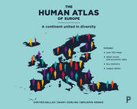
Paperback. Written by leading international authors, this timely atlas explores Europe's society, culture, economy, politics and environment using state of the art mapping techniques. It addresses fundamental questions around social cohesion and sustainable growth as Europe negotiates the UK's exit while continuing through the economic crisis. Num Pages: 256 pages. BIC Classification: 1D; GBG. Category: (G) General (US: Trade); (P) Professional & Vocational; (UP) Postgraduate, Research & Scholarly; (UU) Undergraduate. Dimension: 290 x 230. .
- Publisher
- Policy Press
- Format
- Paperback
- Publication date
- 2017
- Condition
- New
- SKU
- V9781447313540
- ISBN
- 9781447313540
Paperback
Condition: New
€ 32.99€ 31.37
€ 32.99
€ 31.37
Paperback. A gazetteer tracing the origin and meaning of more than 17,000 place-names throughout Britain, this A-Z is a treasury of information and fascinating facts. It is both an ideal guide for anybody exploring the British Isles and an authoritative resource for researchers and students interested in the study of place-names. Editor(s): Mills, David. Num Pages: 576 pages, 5 maps. BIC Classification: 1DB; GBGP. Category: (G) General (US: Trade). Dimension: 193 x 130 x 35. Weight in Grams: 416.
- Publisher
- Oxford University Press United Kingdom
- Number of pages
- 576
- Format
- Paperback
- Publication date
- 2011
- Edition
- Revised
- Condition
- New
- SKU
- V9780199609086
- ISBN
- 9780199609086
Paperback
Condition: New
€ 18.99€ 15.20
€ 18.99
€ 15.20
Paperback. .
- Publisher
- Policy Press
- Format
- Paperback
- Publication date
- 2016
- Edition
- Reprint
- Condition
- New
- SKU
- V9781447311379
- ISBN
- 9781447311379
Paperback
Condition: New
€ 34.99€ 31.76
€ 34.99
€ 31.76
Paperback. The Global Atlas of Marine Fisheries is the first and only book to provide accurate, country-by-country fishery data. This groundbreaking information has been gathered from independent sources by the world's foremost fisheries experts, and edited by Daniel Pauly and Dirk Zeller of the Sea Around Us Project. Num Pages: 550 pages, 600 maps, photogragphs, figures. BIC Classification: GBG; KNAF; RBKC. Category: (G) General (US: Trade). Dimension: 219 x 280 x 24. Weight in Grams: 1410.
- Publisher
- Island Press
- Format
- Paperback
- Publication date
- 2016
- Condition
- New
- SKU
- V9781610917698
- ISBN
- 9781610917698
Paperback
Condition: New
€ 113.40
€ 113.40
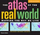
paperback. Includes 366 digitally modified maps known as cartograms that depict the areas and countries of the world by their demographic importance on a range of topics, ranging from basic data on population, health, wealth and occupation to how many toys we import and who's eating their vegetables. Num Pages: 416 pages, 382 colour images. BIC Classification: GBC; GBGM; RGC; RGV. Category: (G) General (US: Trade). Dimension: 236 x 273 x 35. Weight in Grams: 1960.
- Publication date
- 2010
- Publisher
- Thames and Hudson Ltd
- Condition
- New
- Format
- Paperback
- SKU
- 9780500288535
- ISBN
- 9780500288535
Paperback
Condition: New
€ 28.99€ 20.00
€ 28.99
€ 20.00
Paperback. The Zondervan Essential Atlas of the Bible by Carl G. Rasmussen is a concise, full-color atlas filled with stunning multidimensional and three-dimensional maps, photos, and charts designed to help you better understand the history and places of the Bible and its world. Num Pages: 160 pages, colour illustrations, maps. BIC Classification: GBGM; HRCG. Category: (G) General (US: Trade). Dimension: 232 x 188 x 12. Weight in Grams: 482.
- Format
- Paperback
- Publication date
- 2013
- Publisher
- Zondervan
- Condition
- New
- SKU
- V9780310318576
- ISBN
- 9780310318576
Paperback
Condition: New
€ 26.99€ 23.75
€ 26.99
€ 23.75
paperback. Num Pages: 218 pages, photographs. BIC Classification: 1KBBSX; GBGP; HBJK. Category: (G) General (US: Trade). Dimension: 214 x 141 x 14. Weight in Grams: 317.
- Format
- Paperback
- Publication date
- 1998
- Publisher
- Gulf Publishing Co United States
- Number of pages
- 218
- Condition
- New
- SKU
- V9780884158653
- ISBN
- 9780884158653
Paperback
Condition: New
€ 16.99€ 16.51
€ 16.99
€ 16.51
Hardcover. 176 pages, 100+ maps. Cateogry: (G) General (US: Trade). BIC Classification: GBGM. Dimension: 292 x 226 x 16. Weight: 918.
- Format
- Hardback
- Publication date
- 2009
- Publisher
- Anthem Press
- Edition
- 1st
- Number of pages
- 176
- Condition
- New
- SKU
- V9781843313069
- ISBN
- 9781843313069
Hardback
Condition: New
€ 28.19
€ 28.19
Hardback. Editor(s): Carandini, Andrea. Num Pages: 1280 pages, 452 color illus. 67 halftones. 13 line illus. 9 tables. 97 color maps. BIC Classification: 1QDAR; 3D; GBG; HBLA1. Category: (P) Professional & Vocational; (U) Tertiary Education (US: College). Dimension: 293 x 238 x 101. Weight in Grams: 4294.
- Publisher
- Princeton University Press
- Format
- Hardback
- Publication date
- 2017
- Edition
- Two-volume slipcased set
- Condition
- New
- SKU
- V9780691163475
- ISBN
- 9780691163475
Hardback
Condition: New
€ 344.28
€ 344.28
Paperback. Series: Discover Dorset. Num Pages: 96 pages, 9 b./w. BIC Classification: 1DBKEWT; GBGP. Category: (G) General (US: Trade). Dimension: 205 x 141 x 7. Weight in Grams: 198.
- Publisher
- Dovecote Press United Kingdom
- Number of pages
- 96
- Format
- Paperback
- Publication date
- 2008
- Condition
- New
- SKU
- V9781904349624
- ISBN
- 9781904349624
Paperback
Condition: New
€ 11.30
€ 11.30
Paperback. A unique gazetteer that clearly explains the fascinating origins and meanings behind the names of over 1,700 places, streets, and areas within the English capital, including the Greater London Boroughs. It also features maps, an extended introduction on the development of these place-names, a detailed glossary, and recommended web links. Num Pages: 352 pages, maps of London. BIC Classification: 1DBKESL; GBC; GBGP. Category: (G) General (US: Trade). Dimension: 196 x 137 x 24. Weight in Grams: 262.
- Publisher
- Oxford University Press United Kingdom
- Number of pages
- 352
- Format
- Paperback
- Publication date
- 2010
- Edition
- 2nd Edition
- Condition
- New
- SKU
- V9780199566785
- ISBN
- 9780199566785
Paperback
Condition: New
€ 16.99€ 13.35
€ 16.99
€ 13.35


