Active outdoor pursuits
Results 341 - 360 of 2213
Active outdoor pursuits
Paperback. .
- Publisher
- Pocket Mountains Ltd
- Format
- Paperback
- Publication date
- 2016
- Condition
- New
- SKU
- V9781907025532
- ISBN
- 9781907025532
Paperback
Condition: New
€ 10.37
€ 10.37
Paperback. .
- Publisher
- Birlinn General
- Format
- Paperback
- Publication date
- 2014
- Condition
- New
- SKU
- V9781780271880
- ISBN
- 9781780271880
Paperback
Condition: New
€ 15.99€ 14.50
€ 15.99
€ 14.50
Paperback. Series: RAF Survival Guide. Num Pages: 80 pages. BIC Classification: WSZV. Category: (G) General (US: Trade). Dimension: 135 x 106. .
- Publisher
- Penguin Books Ltd
- Format
- Paperback
- Publication date
- 2017
- Condition
- New
- SKU
- V9781405931687
- ISBN
- 9781405931687
Paperback
Condition: New
€ 6.32
€ 6.32
Paperback. Series: RAF Survival Guide. Num Pages: 48 pages. BIC Classification: WSZV. Category: (G) General (US: Trade). Dimension: 135 x 106. .
- Publisher
- Penguin Books Ltd
- Format
- Paperback
- Publication date
- 2017
- Condition
- New
- SKU
- V9781405931656
- ISBN
- 9781405931656
Paperback
Condition: New
€ 7.12
€ 7.12
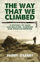
Paperback. Hillwalking is Ireland's most widely practised leisure activity today. Rock climbing has developed to a level of technical excellence with crags in almost every county. This history recounts the adventures, dangers, successes and failures of these multifaceted activities. Num Pages: 344 pages, B&W photos. BIC Classification: 1DBR; 3JJ; 3JM; HBJD1; WSZG. Category: (G) General (US: Trade). Dimension: 216 x 141 x 26. Weight in Grams: 452.
- Publisher
- Gill
- Format
- Paperback
- Publication date
- 2015
- Condition
- New
- SKU
- V9781848892422
- ISBN
- 9781848892422
Paperback
Condition: New
€ 22.99€ 18.38
€ 22.99
€ 18.38
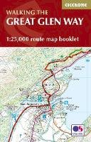
Paperback. Map of the 77-mile (123km) Great Glen Way (one of Scotland's Great Trails), between Fort William and Inverness. This booklet of Ordnance Survey 1:25,000 maps shows the full route, providing all of the mapping you need to complete the trail. The route typically takes a week to walk, and is suitable for walkers at all levels of experience. Num Pages: 48 pages. BIC Classification: 1DBKSH; WSZC; WTRM. Category: (G) General (US: Trade). Dimension: 166 x 106 x 5. .
- Publisher
- Cicerone Press
- Format
- Paperback
- Publication date
- 2016
- Condition
- New
- SKU
- V9781852848958
- ISBN
- 9781852848958
Paperback
Condition: New
€ 13.99€ 11.69
€ 13.99
€ 11.69
Paperback. .
- Publisher
- Cicerone Press Limited
- Format
- Paperback
- Publication date
- 2015
- Edition
- Lam
- Condition
- New
- SKU
- V9781852846039
- ISBN
- 9781852846039
Paperback
Condition: New
€ 23.49
€ 23.49
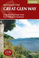
Paperback. Guidebook to walking the Great Glen Way, a 77-mile National Trail along the Caledonia Canal from Fort William to Inverness. Easily walked within a week in all seasons, the Great Glen Way is an ideal introduction to long-distance walking in Scotland. The route is described in both directions, and a separate OS 1:25K mapping booklet is included. Num Pages: 160 pages, 45 colour maps and 68 colour photographs. BIC Classification: 1DBKSH; WSZC. Category: (G) General (US: Trade). Dimension: 172 x 116 x 15. .
- Publisher
- Cicerone Press Limited
- Format
- Paperback
- Publication date
- 2016
- Edition
- 2nd Edition
- Condition
- New
- SKU
- V9781852848019
- ISBN
- 9781852848019
Paperback
Condition: New
€ 23.99€ 17.61
€ 23.99
€ 17.61
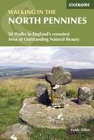
Paperback. This guidebook describes 50 day walks across the North Pennines, England's remotest Area of Outstanding Natural Beauty taking in parts of Cumbria, County Durham and Northumberland. Most of the routes are circular and they range from 5 to 14 miles, with something to suit all abilities. Route descriptions are accompanied by 1:50K OS mapping. Num Pages: 256 pages, 60 colour maps and over 80 colour photographs. BIC Classification: 1DBKEY; WSZC. Category: (G) General (US: Trade). Dimension: 118 x 172 x 15. Weight in Grams: 282.
- Publisher
- Cicerone Press
- Format
- Paperback
- Publication date
- 2016
- Edition
- 3rd Revised edition
- Condition
- New
- SKU
- V9781852849054
- ISBN
- 9781852849054
Paperback
Condition: New
€ 17.99€ 14.20
€ 17.99
€ 14.20
Paperback. This inspirational guidebook looks at each of the UK's 19 National Trails, with information that allows ease of comparison and contrast, inspiring you to find out more and to take up a long-distance challenge. Some Trails are short and easy, others much longer, many have strong themes - they may follow a coastline, or traverse ranges of hills. Num Pages: 272 pages, 150 colour photos and 60 maps and profiles. BIC Classification: 1DBK; WSZC. Category: (G) General (US: Trade). Dimension: 174 x 241 x 26. Weight in Grams: 802.
- Publisher
- Cicerone Press Limited
- Format
- Paperback
- Publication date
- 2016
- Edition
- 2nd Edition
- Condition
- New
- SKU
- V9781852847883
- ISBN
- 9781852847883
Paperback
Condition: New
€ 25.99€ 19.49
€ 25.99
€ 19.49
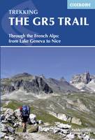
Flexibound. An essential guidebook for walking the GR5 trail, 660km from Lac Leman (Lake Geneva) to Nice or Menton, through the French Alps. Includes all the main variant routes as it passes Mont Blanc, then through the Vanoise, the Queyras and the Mercantour National Parks. Includes accommodation, profiles and maps. Suitable for fairly experienced hikers. Num Pages: 320 pages, 106 images, 1 overview map, 7 stage maps and 48 details maps. BIC Classification: 1DDF; 1DFHA; WSZC. Category: (G) General (US: Trade). Dimension: 172 x 116 x 21. .
- Publisher
- Cicerone Press United Kingdom
- Number of pages
- 320
- Publication date
- 2016
- Edition
- 3rd Edition
- Condition
- New
- SKU
- V9781852848286
- ISBN
- 9781852848286
Paperback
Condition: New
€ 25.99€ 19.32
€ 25.99
€ 19.32
Flexibound. .
- Publisher
- Cicerone Press Limited
- Publication date
- 2015
- Edition
- 2nd Edition
- Condition
- New
- SKU
- V9781852848057
- ISBN
- 9781852848057
Paperback
Condition: New
€ 32.99€ 27.98
€ 32.99
€ 27.98
Flexibound. .
- Publisher
- Cicerone Press Limited
- Publication date
- 2017
- Edition
- 4th Edition
- Condition
- New
- SKU
- V9781852849061
- ISBN
- 9781852849061
Paperback
Condition: New
€ 24.99€ 18.46
€ 24.99
€ 18.46
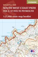
Paperback. Map of part of the southern section of the 630 mile (1014km) South West Coast Path National Trail. Covers the trail from St Ives to Plymouth along the west Cornwall and Devon coastline. This convenient and compact booklet of Ordnance Survey 1:25,000 maps shows the route, providing all of the mapping you need to walk the trail in either direction. Num Pages: 88 pages, OS 1:25,000 mapping and map legend. BIC Classification: 1DBKEW; WSZC; WTR. Category: (G) General (US: Trade). Dimension: 121 x 179 x 8. Weight in Grams: 120.
- Publisher
- Cicerone Press
- Format
- Paperback
- Publication date
- 2017
- Condition
- New
- SKU
- V9781852849375
- ISBN
- 9781852849375
Paperback
Condition: New
€ 17.99€ 14.16
€ 17.99
€ 14.16
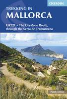
Paperback. Guidebook to walking the GR221 Drystone Route (Ruta de Pedra en Sec) traversing Mallorca's Serra de Tramuntana between Pollenca and Andratx. Following rock, paved paths and mule tracks between welcoming villages, the 140km (87 mile) trek is in 10 day stages and showcases the island's forests, mountains and drystone structures. Num Pages: 216 pages, 54 colour photos, 17 maps. BIC Classification: 1DSEB; WSZC; WTH. Category: (G) General (US: Trade). Dimension: 172 x 116 x 13. .
- Publisher
- Cicerone Press Limited
- Format
- Paperback
- Publication date
- 2017
- Edition
- 2nd Edition
- Condition
- New
- SKU
- V9781852848507
- ISBN
- 9781852848507
Paperback
Condition: New
€ 23.99€ 17.61
€ 23.99
€ 17.61
Hardcover. Inspiration and information to help you plan (and dream about) your next big trek. Num Pages: 224 pages, 115 photographs. BIC Classification: WSZ; WTH. Category: (G) General (US: Trade). Dimension: 280 x 223 x 20. Weight in Grams: 1052.
- Format
- Hardback
- Publication date
- 2005
- Publisher
- WW Norton & Co United States
- Number of pages
- 160
- Condition
- New
- SKU
- V9780393057966
- ISBN
- 9780393057966
Hardback
Condition: New
€ 43.99€ 36.23
€ 43.99
€ 36.23
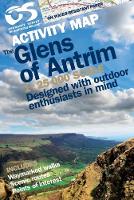
Sheet map, folded. Series: Irish Activity Map. Num Pages: both sides, col. BIC Classification: 1DBKN; WSZC; WTRM. Category: (G) General (US: Trade). Dimension: 217 x 156 x 8. Weight in Grams: 146.
- Publisher
- Land & Property Services
- Publication date
- 2012
- Condition
- New
- SKU
- V9781905306671
- ISBN
- 9781905306671
Hardback
Condition: New
€ 15.99€ 15.43
€ 15.99
€ 15.43
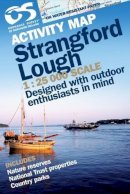
Sheet map, folded. Series: Irish Activity Map. Num Pages: both sides, colour. BIC Classification: 1DBKN; WSZ; WTRM. Category: (G) General (US: Trade). Dimension: 213 x 149 x 11. Weight in Grams: 146.
- Publisher
- Ordnance Survey of Northern Ireland
- Publication date
- 2008
- Condition
- New
- SKU
- V9781905306275
- ISBN
- 9781905306275
Hardback
Condition: New
€ 15.99€ 15.18
€ 15.99
€ 15.18
Paperback. Series: Irish Discovery Series. BIC Classification: 1DBR; WSZC; WTRM. Category: (G) General (US: Trade). Dimension: 204 x 180 x 7. Weight in Grams: 74.
- Format
- Paperback
- Publication date
- 2011
- Publisher
- Ordnance Survey Ireland
- Condition
- New
- SKU
- KKE0000912
- ISBN
- 9781907122569
Paperback
Condition: New
€ 4.99
€ 4.99
Paperback. Series: Irish Discovery Series. BIC Classification: 1DBR; WSZC; WTRM. Category: (G) General (US: Trade). Dimension: 204 x 180 x 7. Weight in Grams: 74.
- Format
- Paperback
- Publication date
- 2011
- Publisher
- Ordnance Survey Ireland
- Condition
- New
- SKU
- KCW0018449
- ISBN
- 9781907122569
Paperback
Condition: New
€ 4.99
€ 4.99


