Active outdoor pursuits
Results 1441 - 1460 of 2213
Active outdoor pursuits
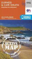
Sheet map, folded. OS Explorer is the Ordnance Survey's most detailed map and is recommended for anyone enjoying outdoor activities such as walking, horse riding and off-road cycling. The series provides complete GB coverage and can now be used in all weathers thanks to OS Explorer - Active, a tough, versatile version of OS Explorer. Series: OS Explorer Map Active. BIC Classification: 1DBKEWD; WSZC; WTRM. Category: (G) General (US: Trade). Dimension: 142 x 242 x 26. Weight in Grams: 206.
- Publisher
- Ordnance Survey
- Publication date
- 2015
- Edition
- May 2015 ed
- Condition
- New
- SKU
- V9780319469460
- ISBN
- 9780319469460
Condition: New
€ 19.99€ 19.88
€ 19.99
€ 19.88
Sheet map, folded. .
- Publisher
- Ordnance Survey
- Publication date
- 2016
- Edition
- February 2016 ed
- Condition
- New
- SKU
- V9780319262016
- ISBN
- 9780319262016
Condition: New
€ 17.99€ 14.32
€ 17.99
€ 14.32
Paperback. 20 simple, circular routes covering the whole of the county and all between 2 and 5 miles in length. Most begin at a popular pub that serves good food. Series: Waterside Walks. Num Pages: 96 pages. BIC Classification: 1DBKESH; WSZC; WTH. Category: (G) General (US: Trade). Dimension: 150 x 210 x 7. Weight in Grams: 212.
- Publisher
- Countryside Books
- Format
- Paperback
- Publication date
- 2016
- Edition
- Illustrated edition
- Condition
- New
- SKU
- V9781846743399
- ISBN
- 9781846743399
Paperback
Condition: New
€ 13.99€ 13.49
€ 13.99
€ 13.49
Sheet map, folded. .
- Publisher
- Ordnance Survey
- Publication date
- 2015
- Edition
- September 2015 ed
- Condition
- New
- SKU
- V9780319243299
- ISBN
- 9780319243299
Paperback
Condition: New
€ 17.99€ 14.35
€ 17.99
€ 14.35
Sheet map, folded. Series: OS Explorer Map. BIC Classification: 1DBKESX; WSZC; WTRM. Category: (G) General (US: Trade). Dimension: 136 x 241 x 37. Weight in Grams: 128.
- Publisher
- Ordnance Survey
- Publication date
- 2015
- Edition
- September 2015 ed
- Condition
- New
- SKU
- V9780319243282
- ISBN
- 9780319243282
Paperback
Condition: New
€ 17.99€ 14.29
€ 17.99
€ 14.29
Paperback. The South West Coast Path is the longest of Britain's National Trails, following the spectacular coastline for 630 miles around the southernmost tip of England, from Somerset all the way to Dorset. Num Pages: 144 pages, 1 colour illustrations. BIC Classification: 1DBKEWC; WSZC; WTH. Category: (G) General (US: Trade). Dimension: 210 x 130. .
- Publisher
- Aurum Press
- Format
- Paperback
- Publication date
- 2018
- Edition
- Reissue
- Condition
- New
- SKU
- V9781781315804
- ISBN
- 9781781315804
Paperback
Condition: New
€ 19.99€ 15.31
€ 19.99
€ 15.31
Sheet map, folded. .
- Publisher
- Ordnance Survey
- Publication date
- 2015
- Edition
- September 2015 ed
- Condition
- New
- SKU
- V9780319243688
- ISBN
- 9780319243688
Paperback
Condition: New
€ 17.99€ 14.32
€ 17.99
€ 14.32
.
- Publisher
- Ordnance Survey
- Publication date
- 2015
- Edition
- September 2015 ed
- Condition
- New
- SKU
- V9780319246405
- ISBN
- 9780319246405
Paperback
Condition: New
€ 17.99€ 14.35
€ 17.99
€ 14.35
.
- Publisher
- Ordnance Survey
- Publication date
- 2015
- Edition
- September 2015 ed
- Condition
- New
- SKU
- V9780319472415
- ISBN
- 9780319472415
Paperback
Condition: New
€ 23.99€ 17.75
€ 23.99
€ 17.75
Paperback. Fully researched and updated for 2017, Tiny Campsites is a handpicked selection of Britain's loveliest little campsites, all under an acre. Including up-to-date practical information on getting to each campsite via pushbike and public transport, together with info on pubs and shops in the area, and what to see and do. Num Pages: 208 pages, 100 Colour Photographs. BIC Classification: 1DBK; WSZR; WTHH1. Category: (G) General (US: Trade). Dimension: 210 x 150. .
- Publisher
- Automobile Association
- Format
- Paperback
- Publication date
- 2017
- Condition
- New
- SKU
- V9780749578480
- ISBN
- 9780749578480
Paperback
Condition: New
€ 16.99€ 12.21
€ 16.99
€ 12.21
Paperback. Volume 3 of The Ultimate Guide to the Munros explores the dramatic landscape of the Northern Central Highlands. With all the features which made Volume 1 and 2 so popular, full colour maps and photographs throughout, details of all the practicable ascents up all the Munros and a comprehensive grading system, this is a must for hillwalkers. Series: The Ultimate Guide to the Munros. Num Pages: 256 pages, colour throughout. BIC Classification: 1DBKSH; WSZC; WTH. Category: (G) General (US: Trade). Dimension: 169 x 121 x 17. Weight in Grams: 318.
- Publisher
- Luath Press Ltd United Kingdom
- Number of pages
- 256
- Format
- Paperback
- Publication date
- 2010
- Edition
- 1st Edition
- Condition
- New
- SKU
- V9781906817565
- ISBN
- 9781906817565
Paperback
Condition: New
€ 19.99€ 15.06
€ 19.99
€ 15.06
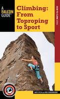
Paperback. This handy, pocket-size manual provides easy-to-understand, step-by-step guidance to climbers transitioning from basic rock climbing to sport climbing, which involves scaling larger, more challenging rock walls that have fixed anchors. Num Pages: 144 pages, 80 colour illustrations. BIC Classification: WSZG; WSZV. Category: (G) General (US: Trade). Dimension: 178 x 108. .
- Publisher
- Rowman & Littlefield
- Format
- Paperback
- Publication date
- 2016
- Condition
- New
- SKU
- V9781493016396
- ISBN
- 9781493016396
Paperback
Condition: New
€ 16.99€ 15.35
€ 16.99
€ 15.35
Paperback. The Nuttalls are hills over 2000ft high in England and Wales. The 190 Nuttalls in Wales are split into: Carneddau, Glyders, Snowdon, Moel Hebog, Moelwyns, Arenigs, Berwyns, Arans, Rhinogs, Cadair Idris, central Wales, Black Mountains, Brecon Beacons. Definitive lists, detailed route descriptions, maps and drawings of Wales' highest peaks. Num Pages: 250 pages, 70 b&w line drawings and 68 sketch maps. BIC Classification: 1DBKE; 1DBKW; WSZC; WTH. Category: (G) General (US: Trade). Dimension: 179 x 125 x 18. Weight in Grams: 318. 250 pages, 70 b&w line drawings and 68 sketch maps. The Nuttalls are hills over 2000ft high in England and Wales. The 190 Nuttalls in Wales are split into: Carneddau, Glyders, Snowdon, Moel Hebog, Moelwyns, Arenigs, Berwyns, Arans, Rhinogs, Cadair Idris, central Wales, Black Mountains, Brecon Beacons. Definitive lists, detailed route descriptions, maps and drawings of Wales' highest peaks. Cateogry: (G) General (US: Trade). BIC Classification: 1DBKE; 1DBKW; WSZC; WTH. Dimension: 179 x 125 x 18. Weight: 336.
- Publisher
- Cicerone Press
- Number of pages
- 250
- Format
- Paperback
- Publication date
- 2009
- Edition
- 3rd Revised edition
- Condition
- New
- SKU
- V9781852845940
- ISBN
- 9781852845940
Paperback
Condition: New
€ 23.99€ 17.77
€ 23.99
€ 17.77
Sheet map, folded. Series: OS Landranger Map. BIC Classification: 1DBKSH; WSZC; WTRM. Category: (G) General (US: Trade). Dimension: 136 x 228 x 43. Weight in Grams: 98.
- Publisher
- Ordnance Survey
- Publication date
- 2016
- Edition
- February 2016 ed
- Condition
- New
- SKU
- V9780319261323
- ISBN
- 9780319261323
Paperback
Condition: New
€ 17.99€ 14.31
€ 17.99
€ 14.31
Paperback. 40 Town and Country Walks. Series: Pocket Mountains S. 96 pages, full colour illustrations throughout. The tranquil borderland of the Marches, offers a varied landscape truncated by rivers meandering to lowland plains. This title explores all the best places to visit in this area of the country. Cateogry: (G) General (US: Trade). BIC Classification: 1DBKW; WSZC; WTH. Dimension: 102 x 146 x 8. Weight: 124.
- Publisher
- Pocket Mountains
- Number of pages
- 96
- Format
- Paperback
- Publication date
- 2012
- Condition
- New
- SKU
- V9781907025181
- ISBN
- 9781907025181
Paperback
Condition: New
€ 10.38
€ 10.38
.
- Publisher
- Ordnance Survey
- Publication date
- 2015
- Edition
- September 2015 ed
- Condition
- New
- SKU
- V9780319471579
- ISBN
- 9780319471579
Paperback
Condition: New
€ 23.99€ 17.71
€ 23.99
€ 17.71
Paperback. Fiona Danks and Jo Schofield offer suggestions for things to do with a stick, in the way of adventures and bushcraft, creative and imaginative play, games, woodcraft and conservation, music and more. Num Pages: 128 pages, 100 colour photographs. BIC Classification: WN; WSZ. Category: (G) General (US: Trade). Dimension: 199 x 138 x 9. Weight in Grams: 272.
- Publisher
- Quarto Publishing PLC
- Number of pages
- 128
- Format
- Paperback
- Publication date
- 2012
- Condition
- New
- SKU
- V9780711232419
- ISBN
- 9780711232419
Paperback
Condition: New
€ 15.99€ 12.06
€ 15.99
€ 12.06
Sheet map, folded. .
- Publisher
- Ordnance Survey
- Publication date
- 2017
- Edition
- December 2016 ed
- Condition
- New
- SKU
- V9780319263402
- ISBN
- 9780319263402
Paperback
Condition: New
€ 17.99€ 14.32
€ 17.99
€ 14.32
Series: OS Explorer Map. BIC Classification: 1DBKEYD; 1DBKEYK; WSZC; WTRM. Category: (G) General (US: Trade). Dimension: 135 x 229 x 49. Weight in Grams: 98.
- Publisher
- Ordnance Survey
- Publication date
- 2015
- Edition
- September 2015 ed
- Condition
- New
- SKU
- V9780319245569
- ISBN
- 9780319245569
Paperback
Condition: New
€ 17.99€ 14.27
€ 17.99
€ 14.27
Sheet map, folded. .
- Publisher
- Ordnance Survey
- Publication date
- 2015
- Edition
- September 2015 ed
- Condition
- New
- SKU
- V9780319472989
- ISBN
- 9780319472989
Paperback
Condition: New
€ 23.99€ 17.75
€ 23.99
€ 17.75


