Active outdoor pursuits
Results 385 - 408 of 2212
Active outdoor pursuits
Paperback. On 8 June 1924, George Leigh Mallory and Andrew 'Sandy' Irvine were last seen climbing towards the summit of Everest. In 1999, Conrad Anker found the body of Mallory on Mount Everest. This title assesses the clues provided by the body, its position, and the possibility that Mallory had successfully climbed the Second Step, a 90-foot sheer cliff. Num Pages: 208 pages, b&w plates. BIC Classification: 1FKN; BGH; RGR; WSZG. Category: (G) General (US: Trade). Dimension: 203 x 129 x 13. Weight in Grams: 234.
- Format
- Paperback
- Publication date
- 2000
- Publisher
- Robinson Publishing
- Edition
- 1st
- Condition
- New
- SKU
- V9781841192116
- ISBN
- 9781841192116
Paperback
Condition: New
€ 15.99€ 11.89
€ 15.99
€ 11.89
Paperback. Guidebook to the Lea Valley Walk, a 53-mile path from Luton to the Thames. The walk traces the River Lea from Leagrave, near Luton to East India Dock opposite Greenwich where it joins the Thames Path. Features an alternative finish at Limehouse and an optional tour of the Olympic Park. Split into 9 stages, the walk is suitable for all abilities. Num Pages: 144 pages, 90 colour photos 28 OS map extracts. BIC Classification: 1DBKES; WSZC. Category: (G) General (US: Trade). Dimension: 173 x 117 x 9. Weight in Grams: 168.
- Publisher
- Cicerone Press
- Format
- Paperback
- Publication date
- 2015
- Edition
- 3rd Revised edition
- Condition
- New
- SKU
- V9781852847746
- ISBN
- 9781852847746
Paperback
Condition: New
€ 17.99€ 14.25
€ 17.99
€ 14.25
Paperback. This unique guide will prove a fascinating and illuminating companion for both sophisticated visitors to the Eternal City and armchair travelers seeking a novel perspective into Rome's rich history. Num Pages: 600 pages, 32, 15 black & white illustrations, 16 maps, 1 black & white line drawings. BIC Classification: 1DST; WSZC; WTH. Category: (G) General (US: Trade). Dimension: 208 x 152 x 37. Weight in Grams: 782.
- Publisher
- Johns Hopkins University Press
- Number of pages
- 600
- Format
- Paperback
- Publication date
- 2009
- Condition
- New
- SKU
- V9780801891502
- ISBN
- 9780801891502
Paperback
Condition: New
€ 38.99€ 33.11
€ 38.99
€ 33.11
Hardback. This unique guide will prove a fascinating and illuminating companion for both sophisticated visitors to the Eternal City and armchair travelers seeking a novel perspective into Rome's rich history. Num Pages: 576 pages, 32, 15 black & white illustrations, 16 maps, 1 black & white line drawings. BIC Classification: 1DST; WSZC; WTH. Category: (G) General (US: Trade). Dimension: 217 x 162 x 40. Weight in Grams: 840.
- Format
- Hardback
- Publication date
- 2009
- Publisher
- Johns Hopkins University Press United States
- Number of pages
- 576
- Condition
- New
- SKU
- V9780801891496
- ISBN
- 9780801891496
Hardback
Condition: New
€ 87.55
€ 87.55
Paperback.
- Format
- Paperback
- Publication date
- 2011
- Publisher
- WW Norton & Co
- Number of pages
- 302
- Condition
- New
- SKU
- V9780393339970
- ISBN
- 9780393339970
Paperback
Condition: New
€ 18.99€ 17.43
€ 18.99
€ 17.43
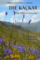
Paperback. The Kackar Mountains are part of the Pontic Alps, a glaciated, granite mountain range which hugs the south coast of the Black Sea, extending from the Caucasus towards Istanbul. This 2nd edition of the guidebook and map describe over 30 days of trekking on eight major routes around the Kackar National Park. Num Pages: 160 pages, 32 colour pages of photos, includes detachable, double-sided full colour contour map. BIC Classification: 1DVT; WSZC; WTH. Category: (G) General (US: Trade). Dimension: 161 x 235 x 14. Weight in Grams: 320.
- Publisher
- Upcountry (Turkey) Ltd
- Number of pages
- 160
- Format
- Paperback
- Publication date
- 2012
- Edition
- 2nd Revised edition
- Condition
- New
- SKU
- V9780957154704
- ISBN
- 9780957154704
Paperback
Condition: New
€ 23.99€ 20.71
€ 23.99
€ 20.71
Paperback.
- Format
- Paperback
- Publication date
- 2005
- Publisher
- Luath Press Ltd United Kingdom
- Edition
- Revised
- Number of pages
- 145
- Condition
- New
- SKU
- V9781842820698
- ISBN
- 9781842820698
Paperback
Condition: New
€ 9.99€ 9.11
€ 9.99
€ 9.11
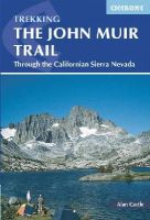
Paperback. Guidebook to walking the John Muir Trail through California's High Sierra from Yosemite (El Capitan and Half Dome) to the summit of Mount Witney. The 216 mile hike is split into 21 daily stages, with full information on preparation, permits, wilderness, bears, water and trekking skills. Part of the Pacific Crest Trail. Num Pages: 224 pages, 85 colour photos and 20 maps and profiles. BIC Classification: 1KBBWF; WSZC; WTH. Category: (G) General (US: Trade). Dimension: 172 x 117 x 16. Weight in Grams: 244.
- Publisher
- Cicerone Press Limited
- Format
- Paperback
- Publication date
- 2015
- Edition
- 2nd Edition
- Condition
- New
- SKU
- V9781852847906
- ISBN
- 9781852847906
Paperback
Condition: New
€ 23.99€ 23.33
€ 23.99
€ 23.33
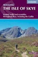
Flexibound. Guidebook with 87 walks and scrambles on the Isle of Skye. Walks visit the most awe-inspiring scenery on Skye, including Sleat and South-East Skye, Strath, Minginish, Duirinish, Waternish, Trotternish and the Cuillin. Walks range from coastal walks to Munros with exposure for experienced scramblers. Includes history, geology and local information. Num Pages: 288 pages, 87 colour OS map extracts. BIC Classification: 1DBKSHQ; WSZC; WTH. Category: (G) General (US: Trade). Dimension: 124 x 173 x 14. Weight in Grams: 354.
- Publisher
- Cicerone Press Limited
- Publication date
- 2015
- Edition
- 4th Edition
- Condition
- New
- SKU
- V9781852847890
- ISBN
- 9781852847890
Paperback
Condition: New
€ 23.99€ 17.61
€ 23.99
€ 17.61
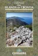
Paperback. This guidebook describes 30 day walks on the islands of the Croatian Adriatic, ranging from short, easy coastal strolls to more challenging, full day outings over rocky ridges and summits, with spectacular views of the Dalmatian coast. Featuring routes on 14 Croatian islands, including the islands of Hvar and Mljet, as well as quieter islands. Num Pages: 240 pages, Over 100 photos and 50 maps. BIC Classification: 1DVWYC; WSZC; WTH. Category: (G) General (US: Trade). Dimension: 118 x 174 x 14. Weight in Grams: 290.
- Publisher
- Cicerone Press Limited
- Format
- Paperback
- Publication date
- 2014
- Edition
- 1st Edition
- Condition
- New
- SKU
- V9781852847036
- ISBN
- 9781852847036
Paperback
Condition: New
€ 23.99€ 17.61
€ 23.99
€ 17.61
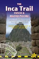
Paperback. All-in-one guide to The Inca Trail, Machu Picchu and Cusco. Detailed trail descriptions, maps, planning your trip and what to see and do in the region. Num Pages: 394 pages, 60 trail maps, 10 town plans, 15 site plans; 50 colour photos. BIC Classification: 1KLSR; WSZC; WTHA. Category: (G) General (US: Trade). Dimension: 180 x 120 x 23. Weight in Grams: 381.
- Publisher
- Trailblazer Publications
- Format
- Paperback
- Publication date
- 2018
- Edition
- 6th Edition
- Condition
- New
- SKU
- V9781905864881
- ISBN
- 9781905864881
Paperback
Condition: New
€ 21.99€ 20.35
€ 21.99
€ 20.35
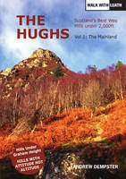
Paperback. .
- Publisher
- Luath Press Ltd
- Format
- Paperback
- Publication date
- 2015
- Condition
- New
- SKU
- V9781910745038
- ISBN
- 9781910745038
Paperback
Condition: New
€ 19.99€ 15.06
€ 19.99
€ 15.06
Paperback. Series: A Latitude 20 Book. Num Pages: 416 pages. BIC Classification: 1MKPH; WSZC; WTH. Category: (G) General (US: Trade). Dimension: 229 x 152 x 23. Weight in Grams: 544.
- Publisher
- Univ Hawaii Pr
- Format
- Paperback
- Publication date
- 2013
- Edition
- Updated and Expanded
- Condition
- New
- SKU
- V9780824838997
- ISBN
- 9780824838997
Paperback
Condition: New
€ 25.99€ 24.62
€ 25.99
€ 24.62
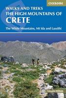
Paperback. Guidebook of walking routes in Crete's mountains, covering the Lefka Ori (White Mountains), Mount Ida (the Psiloritis range), the Lassithi mountains and E4 trail. Each of the 87 walks is graded, in a range between 2 and 28km with various longer options, covering a multitude of terrains from rugged mountain ridges to forested crags and beaches. Num Pages: 400 pages, 122 colour photos and 23 maps. BIC Classification: 1DVGSC; WSZC; WTH. Category: (G) General (US: Trade). Dimension: 175 x 117 x 23. Weight in Grams: 428.
- Publisher
- Cicerone Press Limited
- Format
- Paperback
- Publication date
- 2015
- Edition
- 1st Edition
- Condition
- New
- SKU
- V9781852847999
- ISBN
- 9781852847999
Paperback
Condition: New
€ 23.99€ 17.61
€ 23.99
€ 17.61
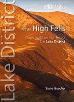
Paperback. A guide that gives walkers the ten finest, classic routes on the Lake District's High Fells in a popular pocketable format. It features high fells such as: Skiddaw, Helvellyn, Coledale Horseshoe, Litte Dale Round, Scafell Pike, Great Gable, Bow Fell and Esk Pike, Langdale Pikes, Fairfield Horseshoe, and, Coniston Old Man. Series: Lake District: Top 10 Walks. Num Pages: 64 pages, full colour/panoramic photographs. BIC Classification: WSZC. Category: (G) General (US: Trade). Dimension: 147 x 110 x 6. Weight in Grams: 98. Classic Walks on Lakeland's Highest Fells. Series: Lake District Top 10 Walks. 64 pages, full colour/panoramic photographs. A guide that gives walkers the ten finest, classic routes on the Lake District's High Fells in a popular pocketable format. It features high fells such as: Skiddaw, Helvellyn, Coledale Horseshoe, Litte Dale Round, Scafell Pike, Great Gable, Bow Fell and Esk Pike, Langdale Pikes, Fairfield Horseshoe, and, Coniston Old Man. Cateogry: (G) General (US: Trade). BIC Classification: WSZC. Dimension: 147 x 110 x 6. Weight: 90.
- Publisher
- Northern Eye Books
- Number of pages
- 64
- Format
- Paperback
- Publication date
- 2011
- Condition
- New
- SKU
- V9780955355783
- ISBN
- 9780955355783
Paperback
Condition: New
€ 9.16
€ 9.16
Paperback.
- Format
- Paperback
- Publication date
- 2010
- Publisher
- Sigma Press United Kingdom
- Number of pages
- 128
- Condition
- New
- SKU
- V9781850588573
- ISBN
- 9781850588573
Paperback
Condition: New
€ 11.99€ 11.62
€ 11.99
€ 11.62
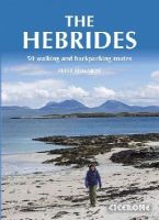
Paperback. Inspirational guidebook to 50 varied walking and backpacking routes in the Hebrides, featuring classics such as the Skye Cuillin and the Paps of Jura, but also many lesser-known routes on Jura, Scarba, Islay, Colonsay, Rum, Eigg, Canna, Muck, Coll, Tiree, Mull, Skye, Raasay, Harris, Lewis, Berneray, North Uist, South Uist, Barra and St Kilda. Num Pages: 256 pages. BIC Classification: 1DBKSHL; 1DBKSHQ; WSZC. Category: (G) General (US: Trade). Dimension: 173 x 241 x 20. Weight in Grams: 718.
- Publisher
- Cicerone Press Limited
- Format
- Paperback
- Publication date
- 2015
- Edition
- 1st Edition
- Condition
- New
- SKU
- V9781852847050
- ISBN
- 9781852847050
Paperback
Condition: New
€ 25.99€ 19.36
€ 25.99
€ 19.36
Paperback. .
- Publisher
- Cicerone Press
- Format
- Paperback
- Publication date
- 2017
- Condition
- New
- SKU
- V9781852847272
- ISBN
- 9781852847272
Paperback
Condition: New
€ 23.99€ 17.61
€ 23.99
€ 17.61
The Hayduke Trail. A Guide to the Backcountry Hiking Trail on the Colo...
Mitchell, Joe; Coronella, Mike
Paperback / so. Traversing six national parks, a national recreation area, a national monument, and various wilderness study areas, the Hayduke Trail is a challenging, 800-mile backcountry route on the Colorado Plateau. This guide book is designed for experienced desert trekkers seeking a thorough-hiking experience on a well-tested route. Num Pages: illustrations. BIC Classification: WSZC. Category: (G) General (US: Trade). Dimension: 233 x 155 x 18. Weight in Grams: 467.
- Format
- Paperback
- Publication date
- 2005
- Publisher
- University of Utah Press,U.S. United States
- Condition
- New
- SKU
- V9780874808131
- ISBN
- 9780874808131
Paperback
Condition: New
€ 24.57
€ 24.57
Paperback. .
- Publisher
- Blue Birch
- Format
- Paperback
- Publication date
- 2015
- Edition
- 2nd edition
- Condition
- New
- SKU
- V9780993162800
- ISBN
- 9780993162800
Paperback
Condition: New
€ 15.00
€ 15.00
Paperback. .
- Publisher
- Reardon Publishing
- Format
- Paperback
- Publication date
- 2014
- Condition
- New
- SKU
- V9781874192862
- ISBN
- 9781874192862
Paperback
Condition: New
€ 13.91
€ 13.91
Paperback. The Green London Way is an alternative approach to the exploration of London. The book describes a hundred mile walk circling the capital, but, uniquely, also offers insightful histories of London's people and a commentary on its abundant local wildlife. Num Pages: 217 pages, maps. BIC Classification: 1DBKESL; WQH; WSZC; WTHC. Category: (G) General (US: Trade). Dimension: 233 x 154 x 9. Weight in Grams: 434. Walking the City's History and Wildlife. 217 pages, maps. The Green London Way is an alternative approach to the exploration of London. The book describes a hundred mile walk circling the capital, but, uniquely, also offers insightful histories of London's people and a commentary on its abundant local wildlife. Cateogry: (G) General (US: Trade). BIC Classification: 1DBKESL; WQH; WSZC; WTHC. Dimension: 233 x 154 x 9. Weight: 422.
- Publisher
- Lawrence & Wishart
- Number of pages
- 217
- Format
- Paperback
- Publication date
- 2012
- Edition
- 2nd Revised edition
- Condition
- New
- SKU
- V9781907103452
- ISBN
- 9781907103452
Paperback
Condition: New
€ 18.99€ 17.65
€ 18.99
€ 17.65
Paperback. "A classic of backpacking literature" (Backpacker), now updated with a brand-new foreword by environmentalist and best-selling author Bill McKibben Num Pages: 304 pages, illustrations. BIC Classification: WSZC; WSZR. Category: (G) General (US: Trade). Dimension: 163 x 228 x 27. Weight in Grams: 420.
- Format
- Paperback
- Publication date
- 2016
- Publisher
- WW Norton & Co United States
- Edition
- 3 Rev ed
- Number of pages
- 304
- Condition
- New
- SKU
- V9781581573947
- ISBN
- 9781581573947
Paperback
Condition: New
€ 20.99€ 20.17
€ 20.99
€ 20.17
Hardcover. .
- Publisher
- Vertebrate Publishing
- Format
- Hardback
- Publication date
- 2014
- Edition
- 1st, November 2014
- Condition
- New
- SKU
- V9781906148898
- ISBN
- 9781906148898
Hardback
Condition: New
€ 46.99€ 39.08
€ 46.99
€ 39.08


