Active outdoor pursuits
Results 521 - 540 of 2204
Active outdoor pursuits
Sheet map, folded. .
- Publisher
- Ordnance Survey
- Publication date
- 2016
- Edition
- February 2016 ed
- Condition
- New
- SKU
- V9780319474501
- ISBN
- 9780319474501
Condition: New
€ 23.99€ 17.75
€ 23.99
€ 17.75
Sheet map, folded. .
- Publisher
- Ordnance Survey
- Publication date
- 2015
- Edition
- September 2015 ed
- Condition
- New
- SKU
- V9780319469880
- ISBN
- 9780319469880
Condition: New
€ 23.99€ 17.75
€ 23.99
€ 17.75
Sheet map, folded. Series: OS Explorer Map. BIC Classification: 1DBKEWC; WSZC; WTRM. Category: (G) General (US: Trade). Dimension: 135 x 240 x 34. Weight in Grams: 130.
- Publisher
- Ordnance Survey
- Publication date
- 2015
- Edition
- September 2015 ed
- Condition
- New
- SKU
- V9780319243091
- ISBN
- 9780319243091
Condition: New
€ 17.99€ 14.11
€ 17.99
€ 14.11
Sheet map, folded. .
- Publisher
- Ordnance Survey
- Publication date
- 2015
- Edition
- September 2015 ed
- Condition
- New
- SKU
- V9780319243756
- ISBN
- 9780319243756
Condition: New
€ 17.99€ 14.35
€ 17.99
€ 14.35
Sheet map, folded. .
- Publisher
- Ordnance Survey
- Publication date
- 2015
- Edition
- September 2015 ed
- Condition
- New
- SKU
- V9780319470541
- ISBN
- 9780319470541
Condition: New
€ 23.99€ 17.73
€ 23.99
€ 17.73
Sheet map, folded. Series: OS Landranger Map. BIC Classification: 1DBKWV; WSZC; WTRM. Category: (G) General (US: Trade). Dimension: 137 x 227 x 20. Weight in Grams: 110.
- Publisher
- Ordnance Survey
- Publication date
- 2016
- Edition
- February 2016 ed
- Condition
- New
- SKU
- V9780319262559
- ISBN
- 9780319262559
Condition: New
€ 17.99€ 14.31
€ 17.99
€ 14.31
Sheet map, folded. .
- Publisher
- Ordnance Survey
- Publication date
- 2016
- Edition
- February 2016 ed
- Condition
- New
- SKU
- V9780319474808
- ISBN
- 9780319474808
Condition: New
€ 23.99€ 17.80
€ 23.99
€ 17.80
Series: OS Landranger Map. BIC Classification: 1DBKSC; WSZC; WTRM. Category: (G) General (US: Trade). Dimension: 136 x 228 x 38. Weight in Grams: 100.
- Publisher
- Ordnance Survey
- Publication date
- 2016
- Edition
- February 2016 ed
- Condition
- New
- SKU
- V9780319261576
- ISBN
- 9780319261576
Condition: New
€ 17.99€ 14.28
€ 17.99
€ 14.28
.
- Publisher
- Ordnance Survey
- Publication date
- 2016
- Edition
- February 2016 ed
- Condition
- New
- SKU
- V9780319473825
- ISBN
- 9780319473825
Condition: New
€ 23.99€ 17.69
€ 23.99
€ 17.69
Sheet map, folded. .
- Publisher
- Ordnance Survey
- Publication date
- 2015
- Edition
- September 2015 ed
- Condition
- New
- SKU
- V9780319246184
- ISBN
- 9780319246184
Condition: New
€ 17.99€ 14.32
€ 17.99
€ 14.32
Sheet map, folded. .
- Publisher
- Ordnance Survey
- Publication date
- 2015
- Edition
- September 2015 ed
- Condition
- New
- SKU
- V9780319472385
- ISBN
- 9780319472385
Condition: New
€ 23.99€ 17.65
€ 23.99
€ 17.65
Paperback. Presented from a coaching perspective, this rock climbing instructional book helps you learn how to succeed at one of the toughest sports. Containing inspirational photos and funny illustrations, it focuses on the improvements that climbers can make immediately, without embarking on lengthy training programs. Num Pages: 192 pages, many full colour photos. BIC Classification: WSZG. Category: (G) General (US: Trade). Dimension: 210 x 192 x 16. Weight in Grams: 376. The Positive Approach to Improve Your Climbing. 192 pages, many full colour photos. Presented from a coaching perspective, this rock climbing instructional book helps you learn how to succeed at one of the toughest sports. Containing inspirational photos and funny illustrations, it focuses on the improvements that climbers can make immediately, without embarking on lengthy training programs. Cateogry: (G) General (US: Trade). BIC Classification: WSZG. Dimension: 210 x 192 x 16. Weight: 374.
- Publisher
- Rockfax Ltd
- Number of pages
- 192
- Format
- Paperback
- Publication date
- 2006
- Condition
- New
- SKU
- V9781873341865
- ISBN
- 9781873341865
Paperback
Condition: New
€ 26.99€ 23.74
€ 26.99
€ 23.74
Sheet map, folded. .
- Publisher
- Ordnance Survey
- Publication date
- 2015
- Edition
- September 2015 ed
- Condition
- New
- SKU
- V9780319244425
- ISBN
- 9780319244425
Paperback
Condition: New
€ 17.99€ 14.35
€ 17.99
€ 14.35
.
- Publisher
- Ordnance Survey
- Publication date
- 2015
- Edition
- September 2015 ed
- Condition
- New
- SKU
- V9780319471210
- ISBN
- 9780319471210
Paperback
Condition: New
€ 23.99€ 17.75
€ 23.99
€ 17.75
Paperback. The Costa Blanca has long been the best known Hot Rock winter sun venue for climbers. It has easy access, loads of quality accommodation, and an amazing amount of fantastic climbing on everything from roadside boulders to magnificent mountains. This edition features 4,000 routes and a complete new set of crag shots along with action pictures. Series: Rockfax Climbing Guide. Num Pages: 480 pages, colour photos & colour photo-topos. BIC Classification: 1DSE; WSZG. Category: (G) General (US: Trade). Dimension: 210 x 154 x 24. Weight in Grams: 876. 480 pages, colour photos & colour photo-topos. The Costa Blanca has long been the best known Hot Rock winter sun venue for climbers. It has easy access, loads of quality accommodation, and an amazing amount of fantastic climbing on everything from roadside boulders to magnificent mountains. This edition features 4,000 routes and a complete new set of crag shots along with action pictures. Cateogry: (G) General (US: Trade). BIC Classification: 1DSE; WSZG. Dimension: 210 x 154 x 24. Weight: 868.
- Publisher
- Rockfax Ltd
- Number of pages
- 480
- Format
- Paperback
- Publication date
- 2013
- Edition
- 5th Revised edition
- Condition
- New
- SKU
- V9781873341674
- ISBN
- 9781873341674
Paperback
Condition: New
€ 49.99€ 41.28
€ 49.99
€ 41.28
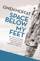
Paperback. A classic mountaineering memoir by one of the UK's foremost female climbers. Num Pages: 272 pages, illustrations. BIC Classification: BGSA; WSZG. Category: (G) General (US: Trade). Dimension: 144 x 197 x 22. Weight in Grams: 302.
- Publisher
- Orion Publishing Co United Kingdom
- Number of pages
- 272
- Format
- Paperback
- Publication date
- 2013
- Condition
- New
- SKU
- V9781780226323
- ISBN
- 9781780226323
Paperback
Condition: New
€ 17.99€ 13.48
€ 17.99
€ 13.48
Series: OS Explorer Map. BIC Classification: 1DBKEAS; WSZC; WTRM. Category: (G) General (US: Trade). Dimension: 136 x 240 x 14. Weight in Grams: 128.
- Publisher
- Ordnance Survey
- Publication date
- 2015
- Edition
- September 2015 ed
- Condition
- New
- SKU
- V9780319244241
- ISBN
- 9780319244241
Paperback
Condition: New
€ 17.99€ 14.29
€ 17.99
€ 14.29
.
- Publisher
- Ordnance Survey
- Publication date
- 2015
- Edition
- September 2015 ed
- Condition
- New
- SKU
- V9780319471036
- ISBN
- 9780319471036
Paperback
Condition: New
€ 23.99€ 17.75
€ 23.99
€ 17.75
Sheet map, folded. Series: OS Explorer Map. BIC Classification: 1DBKENL; WSZC; WTRM. Category: (G) General (US: Trade). Dimension: 136 x 227 x 50. Weight in Grams: 100.
- Publisher
- Ordnance Survey
- Publication date
- 2015
- Edition
- September 2015 ed
- Condition
- New
- SKU
- V9780319244821
- ISBN
- 9780319244821
Paperback
Condition: New
€ 17.99€ 14.35
€ 17.99
€ 14.35
.
- Publisher
- Ordnance Survey
- Publication date
- 2015
- Edition
- September 2015 ed
- Condition
- New
- SKU
- V9780319471579
- ISBN
- 9780319471579
Paperback
Condition: New
€ 23.99€ 17.71
€ 23.99
€ 17.71

