Active outdoor pursuits
Results 741 - 760 of 2213
Active outdoor pursuits
Paperback.
- Format
- Paperback
- Publication date
- 2009
- Publisher
- Human Kinetics Publishers United States
- Edition
- Pap/Cdr
- Number of pages
- 434
- Condition
- New
- SKU
- V9780736071314
- ISBN
- 9780736071314
Paperback
Condition: New
€ 64.50€ 61.05
€ 64.50
€ 61.05
Sheet map, folded. OS Explorer is the Ordnance Survey's most detailed map and is recommended for anyone enjoying outdoor activities like walking, horse riding and off-road cycling. Providing complete GB coverage the series details essential information such as youth hostels, pubs and visitor information as well as rights of way, permissive paths and bridleways. Series: OS Explorer Map. BIC Classification: 1DBKEWT; WSZC; WTRM. Category: (G) General (US: Trade). Dimension: 134 x 240 x 53. Weight in Grams: 130.
- Publisher
- Ordnance Survey
- Publication date
- 2015
- Edition
- May 2015 ed
- Condition
- New
- SKU
- V9780319242544
- ISBN
- 9780319242544
Paperback
Condition: New
€ 17.99€ 14.31
€ 17.99
€ 14.31
Sheet map, folded. OS Explorer is the Ordnance Survey's most detailed map and is recommended for anyone enjoying outdoor activities such as walking, horse riding and off-road cycling. The series provides complete GB coverage and can now be used in all weathers thanks to OS Explorer - Active, a tough, versatile version of OS Explorer. Series: OS Explorer Map Active. BIC Classification: 1DBKEWT; WSZC; WTRM. Category: (G) General (US: Trade). Dimension: 245 x 137 x 25. Weight in Grams: 208.
- Publisher
- Ordnance Survey
- Publication date
- 2015
- Edition
- May 2015 ed
- Condition
- New
- SKU
- V9780319469330
- ISBN
- 9780319469330
Paperback
Condition: New
€ 23.99€ 17.80
€ 23.99
€ 17.80
Paperback. Series: Yorkshire Dales: Top 10 Walks. Num Pages: 64 pages, Full colour/panoramic photographs. BIC Classification: 1DBKEYK; WSZC; WTHR. Category: (G) General (US: Trade). Dimension: 151 x 109 x 5. Weight in Grams: 94.
- Publisher
- Northern Eye Books
- Format
- Paperback
- Publication date
- 2014
- Condition
- New
- SKU
- V9781908632104
- ISBN
- 9781908632104
Paperback
Condition: New
€ 10.25
€ 10.25
Paperback. A guide that gives walkers ten of the finest walks to Lakeland pubs. With clear information, an overview and introduction for each walk, it offers expertly written numbered directions, large scale Ordnance Survey maps, panoramic photographs, and interpretation of points of interest along the way. Series: Lake District: Top 10 Walks. Num Pages: 64 pages, full colour/panoramic photographs. BIC Classification: 1DBKENM; WSZC; WTH. Category: (G) General (US: Trade). Dimension: 150 x 109 x 7. Weight in Grams: 102. Walks to Cumbria's Best Pubs. Series: Lake District Top 10 Walks. 64 pages, full colour/panoramic photographs. A guide that gives walkers ten of the finest walks to Lakeland pubs. With clear information, an overview and introduction for each walk, it offers expertly written numbered directions, large scale Ordnance Survey maps, panoramic photographs, and interpretation of points of interest along the way. Cateogry: (G) General (US: Trade). BIC Classification: 1DBKENM; WSZC; WTH. Dimension: 150 x 109 x 7. Weight: 92.
- Publisher
- Northern Eye
- Number of pages
- 64
- Format
- Paperback
- Publication date
- 2012
- Condition
- New
- SKU
- V9781908632012
- ISBN
- 9781908632012
Paperback
Condition: New
€ 10.21
€ 10.21
Paperback. Series: Pub Walks. Num Pages: 96 pages, Photographs and maps. BIC Classification: 1DBKES; WSZC; WTH. Category: (G) General (US: Trade). Dimension: 211 x 148 x 7. Weight in Grams: 210.
- Publisher
- Countryside Books United Kingdom
- Number of pages
- 96
- Format
- Paperback
- Publication date
- 2009
- Edition
- New edition
- Condition
- New
- SKU
- V9781846741326
- ISBN
- 9781846741326
Paperback
Condition: New
€ 13.99€ 13.48
€ 13.99
€ 13.48
Paperback. Series: Pub Walks. Num Pages: 96 pages, Maps and photographs. BIC Classification: 1DBKEAN; WSZC; WTH. Category: (G) General (US: Trade). Dimension: 209 x 148 x 7. Weight in Grams: 214.
- Publisher
- Countryside Books United Kingdom
- Number of pages
- 96
- Format
- Paperback
- Publication date
- 2010
- Condition
- New
- SKU
- V9781846742064
- ISBN
- 9781846742064
Paperback
Condition: New
€ 13.99€ 13.41
€ 13.99
€ 13.41
Paperback. Series: Pub Walks. Num Pages: 96 pages, Sketch maps and photographs. BIC Classification: 1DBKEMD; WSZC; WTH. Category: (G) General (US: Trade). Dimension: 210 x 149 x 7. Weight in Grams: 194.
- Publisher
- Countryside Books United Kingdom
- Number of pages
- 96
- Format
- Paperback
- Publication date
- 2008
- Edition
- New ed
- Condition
- New
- SKU
- V9781846740923
- ISBN
- 9781846740923
Paperback
Condition: New
€ 11.36
€ 11.36
Paperback. Words like boldness, adventure and risk are surely coined especially for Andy Kirkpatrick. As one of the world's accomplished mountaineers and big-wall climbers, he goes vertically where other climbers fear to tread. This autobiography provides his thirteen-day ascent of Reticent Wall on El Capitan in California - the hardest big-wall climb. Num Pages: 288 pages, 16. BIC Classification: BGSA; WSZG. Category: (G) General (US: Trade). Dimension: 197 x 130 x 20. Weight in Grams: 230.
- Publisher
- Cornerstone
- Number of pages
- 288
- Format
- Paperback
- Publication date
- 2009
- Condition
- New
- SKU
- V9780099519522
- ISBN
- 9780099519522
Paperback
Condition: New
€ 15.99€ 11.90
€ 15.99
€ 11.90
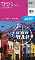
Sheet map, folded. Series: OS Landranger Map. BIC Classification: 1DBKENL; WSZC; WTRM. Category: (G) General (US: Trade). Dimension: 136 x 229 x 16. Weight in Grams: 98.
- Publisher
- Ordnance Survey
- Publication date
- 2016
- Edition
- February 2016 ed
- Condition
- New
- SKU
- V9780319262009
- ISBN
- 9780319262009
Paperback
Condition: New
€ 17.99€ 14.29
€ 17.99
€ 14.29
Sheet map, folded. .
- Publisher
- Ordnance Survey
- Publication date
- 2016
- Edition
- February 2016 ed
- Condition
- New
- SKU
- V9780319474259
- ISBN
- 9780319474259
Paperback
Condition: New
€ 23.99€ 17.73
€ 23.99
€ 17.73
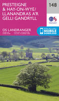
Sheet map, folded. Series: OS Landranger Map. BIC Classification: 1DBKWC; WSZC; WTRM. Category: (G) General (US: Trade). Dimension: 135 x 229 x 73. Weight in Grams: 108.
- Publisher
- Ordnance Survey
- Publication date
- 2016
- Edition
- February 2016 ed
- Condition
- New
- SKU
- V9780319262467
- ISBN
- 9780319262467
Paperback
Condition: New
€ 17.99€ 14.31
€ 17.99
€ 14.31
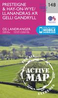
Sheet map, folded. .
- Publisher
- Ordnance Survey
- Publication date
- 2016
- Edition
- February 2016 ed
- Condition
- New
- SKU
- V9780319474716
- ISBN
- 9780319474716
Paperback
Condition: New
€ 23.99€ 17.75
€ 23.99
€ 17.75
Paperback. Series: Preppers. Num Pages: 200 pages, 40 B&W photos. BIC Classification: VFB; WSZV. Category: (G) General (US: Trade). Dimension: 227 x 153 x 13. Weight in Grams: 178.
- Publisher
- Ulysses Press
- Format
- Paperback
- Publication date
- 2015
- Condition
- New
- SKU
- V9781612434964
- ISBN
- 9781612434964
Paperback
Condition: New
€ 21.99€ 16.79
€ 21.99
€ 16.79
Paperback. Num Pages: illustrations. BIC Classification: VFB; WSZV. Category: (G) General (US: Trade). Dimension: 248 x 192 x 21. Weight in Grams: 907.
- Format
- Paperback
- Publication date
- 2014
- Publisher
- Weldon Owen
- Condition
- New
- SKU
- V9781616286736
- ISBN
- 9781616286736
Paperback
Condition: New
€ 31.99€ 29.24
€ 31.99
€ 29.24
Paperback. The fascinating story of Aberdeen-born Alexander Kellas, and his contribution to mountaineering from the 20th century to the present day. Num Pages: 288 pages. BIC Classification: BGS; WSZG. Category: (G) General (US: Trade). Dimension: 233 x 157 x 23. Weight in Grams: 504.
- Publisher
- Luath Press Ltd
- Format
- Paperback
- Publication date
- 2014
- Edition
- 1st Edition
- Condition
- New
- SKU
- V9781910021224
- ISBN
- 9781910021224
Paperback
Condition: New
€ 16.99€ 12.68
€ 16.99
€ 12.68
.
- Publisher
- Ordnance Survey
- Publication date
- 2016
- Edition
- February 2016 ed
- Condition
- New
- SKU
- V9780319262221
- ISBN
- 9780319262221
Paperback
Condition: New
€ 17.99€ 14.27
€ 17.99
€ 14.27
Sheet map, folded. .
- Publisher
- Ordnance Survey
- Publication date
- 2016
- Edition
- February 2016 ed
- Condition
- New
- SKU
- V9780319474471
- ISBN
- 9780319474471
Paperback
Condition: New
€ 23.99€ 17.74
€ 23.99
€ 17.74
Paperback. Series: Pocket Pub Walks. Num Pages: 80 pages, Photographs & maps. BIC Classification: 1DBKEML; 1DBKEMR; WSZC; WTH. Category: (G) General (US: Trade). Dimension: 172 x 118 x 7. Weight in Grams: 122. Series: Pocket Pub Walks. 80 pages, Photographs & maps. Cateogry: (G) General (US: Trade). BIC Classification: 1DBKEML; 1DBKEMR; WSZC; WTH. Dimension: 172 x 118 x 7. Weight: 122.
- Publisher
- Countryside Books (GB)
- Number of pages
- 80
- Format
- Paperback
- Publication date
- 2011
- Condition
- New
- SKU
- V9781846742347
- ISBN
- 9781846742347
Paperback
Condition: New
€ 9.34
€ 9.34
Sheet map, folded. Series: OS Landranger Map. BIC Classification: 1DBKEWC; 1DBKEWD; WSZC; WTRM. Category: (G) General (US: Trade). Dimension: 137 x 228 x 14. Weight in Grams: 100.
- Publisher
- Ordnance Survey
- Publication date
- 2016
- Edition
- February 2016 ed
- Condition
- New
- SKU
- V9780319262993
- ISBN
- 9780319262993
Paperback
Condition: New
€ 17.99€ 14.29
€ 17.99
€ 14.29


