Active outdoor pursuits
Results 801 - 820 of 2212
Active outdoor pursuits
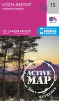
Sheet map, folded. .
- Publisher
- Ordnance Survey
- Publication date
- 2016
- Edition
- February 2016 ed
- Condition
- New
- SKU
- V9780319474990
- ISBN
- 9780319474990
Condition: New
€ 23.99€ 17.75
€ 23.99
€ 17.75
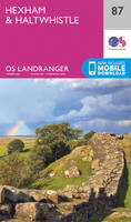
Sheet map, folded. .
- Publisher
- Ordnance Survey
- Publication date
- 2015
- Edition
- September 2015 ed
- Condition
- New
- SKU
- V9780319244265
- ISBN
- 9780319244265
Condition: New
€ 17.99€ 14.23
€ 17.99
€ 14.23
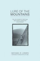
Paperback. Num Pages: 288 pages, Illustrations (2 col.), maps, 1 port. BIC Classification: TRLN; WSZK. Category: (G) General (US: Trade); (UF) Further/Higher Education. Dimension: 215 x 138 x 15. Weight in Grams: 334. 288 pages, Illustrations (2 col.), maps, 1 port. Cateogry: (G) General (US: Trade); (UF) Further/Higher Education. BIC Classification: TRLN; WSZK. Dimension: 215 x 138 x 15. Weight: 304.
- Publisher
- Dover Publications Inc.
- Number of pages
- 288
- Format
- Paperback
- Publication date
- 2003
- Edition
- Illustrated
- Condition
- New
- SKU
- V9780486406138
- ISBN
- 9780486406138
Paperback
Condition: New
€ 15.99€ 12.61
€ 15.99
€ 12.61
Sheet map, folded. .
- Publisher
- Ordnance Survey
- Publication date
- 2016
- Edition
- February 2016 ed
- Condition
- New
- SKU
- V9780319262382
- ISBN
- 9780319262382
Paperback
Condition: New
€ 17.99€ 14.29
€ 17.99
€ 14.29
Paperback. 'Scouting for Boys' (1908) is both a handbook and a philosophy for a way of living that replaces self with service, puts country before individual, and duty above all. It also details how to light fires, stalk men and animals. This edition reveals its maverick complexity, exploring its contradictions about sexuality, the environment and the empire. Editor(s): Boehmer, Elleke. Num Pages: 448 pages, numerous line drawings. BIC Classification: HBTB; JFSV; WSZR. Category: (G) General (US: Trade). Dimension: 196 x 128 x 27. Weight in Grams: 328.
- Edition
- Annotated
- Publisher
- Oxford University Press, USA
- Number of pages
- 448
- Format
- Paperback
- Publication date
- 2001
- Condition
- New
- SKU
- V9780192802460
- ISBN
- 9780192802460
Paperback
Condition: New
€ 13.99€ 11.68
€ 13.99
€ 11.68
Paperback. Angus is the historical heartland of Scotland, a county where the past has left an indelible mark on the present. This book features 40 walks, combining exploration of the county's stunning coastline where rocky cliffs and coves reveal swathes of golden sand, with gentle inland trails and more adventurous forays into the celebrated Angus Glens. Num Pages: 96 pages, full colour illustrations throughout. BIC Classification: 1DBKSH; WSZC; WTH. Category: (G) General (US: Trade). Dimension: 160 x 101 x 9. Weight in Grams: 126. 40 Coast and Country Walks. 96 pages, full colour illustrations throughout. Angus is the historical heartland of Scotland, a county where the past has left an indelible mark on the present. This book features 40 walks, combining exploration of the county's stunning coastline where rocky cliffs and coves reveal swathes of golden sand, with gentle inland trails and more adventurous forays into the celebrated Angus Glens. Cateogry: (G) General (US: Trade). BIC Classification: 1DBKSH; WSZC; WTH. Dimension: 160 x 101 x 9. Weight: 126.
- Publisher
- Pocket Mountains
- Number of pages
- 96
- Format
- Paperback
- Publication date
- 2011
- Condition
- New
- SKU
- V9781907025150
- ISBN
- 9781907025150
Paperback
Condition: New
€ 10.37
€ 10.37
Series: OS Explorer Map. BIC Classification: 1DBKSH; WSZC; WTRM. Category: (G) General (US: Trade). Dimension: 138 x 240 x 40. Weight in Grams: 130.
- Publisher
- Ordnance Survey
- Publication date
- 2015
- Edition
- September 2015 ed
- Condition
- New
- SKU
- V9780319246627
- ISBN
- 9780319246627
Paperback
Condition: New
€ 17.99€ 14.35
€ 17.99
€ 14.35
Hardcover. .
- Publisher
- Vertebrate Publishing
- Format
- Hardback
- Publication date
- 2014
- Condition
- New
- SKU
- V9781906148942
- ISBN
- 9781906148942
Hardback
Condition: New
€ 17.99€ 16.58
€ 17.99
€ 16.58
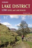
Paperback. .
- Publisher
- Cicerone Press Limited
- Format
- Paperback
- Publication date
- 2015
- Condition
- New
- SKU
- V9781852847340
- ISBN
- 9781852847340
Paperback
Condition: New
€ 14.20
€ 14.20
Sheet map, folded. .
- Publisher
- Ordnance Survey
- Publication date
- 2016
- Edition
- February 2016 ed
- Condition
- New
- SKU
- V9780319473382
- ISBN
- 9780319473382
Paperback
Condition: New
€ 23.99€ 17.80
€ 23.99
€ 17.80
Sheet map, folded. .
- Publisher
- Ordnance Survey
- Publication date
- 2016
- Edition
- February 2016 ed
- Condition
- New
- SKU
- V9780319261859
- ISBN
- 9780319261859
Paperback
Condition: New
€ 17.99€ 14.23
€ 17.99
€ 14.23
Paperback. Brings together more than 150 of the best walks, tracks or trails in Queensland's Tropics, located within the coastal strip between Rockhampton and Cooktown. Walks vary from short boardwalk strolls in the lowland rainforests of Daintree National Park to 4-6 day hiking and camping trips on Hinchinbrook Island. Num Pages: 288 pages, 500 full colour photographs, 120 maps. BIC Classification: 1MBFQ; WSZC; WTHC. Category: (G) General (US: Trade); (P) Professional & Vocational. Dimension: 175 x 241 x 18. Weight in Grams: 696.
- Publisher
- CSIRO Publishing
- Format
- Paperback
- Publication date
- 2016
- Condition
- New
- SKU
- V9781486303076
- ISBN
- 9781486303076
Paperback
Condition: New
€ 39.56
€ 39.56
.
- Publisher
- Ordnance Survey
- Publication date
- 2015
- Edition
- September 2015 ed
- Condition
- New
- SKU
- V9780319245521
- ISBN
- 9780319245521
Paperback
Condition: New
€ 17.99€ 14.27
€ 17.99
€ 14.27
Sheet map, folded. .
- Publisher
- Ordnance Survey
- Publication date
- 2015
- Edition
- September 2015 ed
- Condition
- New
- SKU
- V9780319246917
- ISBN
- 9780319246917
Paperback
Condition: New
€ 17.99€ 14.32
€ 17.99
€ 14.32
Sheet map, folded. .
- Publisher
- Ordnance Survey
- Publication date
- 2015
- Edition
- September 2015 ed
- Condition
- New
- SKU
- V9780319244166
- ISBN
- 9780319244166
Paperback
Condition: New
€ 17.99€ 14.29
€ 17.99
€ 14.29
Paperback. Inspirational guidebook to 50 varied walking and backpacking routes in the Hebrides, featuring classics such as the Skye Cuillin and the Paps of Jura, but also many lesser-known routes on Jura, Scarba, Islay, Colonsay, Rum, Eigg, Canna, Muck, Coll, Tiree, Mull, Skye, Raasay, Harris, Lewis, Berneray, North Uist, South Uist, Barra and St Kilda. Num Pages: 256 pages. BIC Classification: 1DBKSHL; 1DBKSHQ; WSZC. Category: (G) General (US: Trade). Dimension: 173 x 241 x 20. Weight in Grams: 718.
- Publisher
- Cicerone Press Limited
- Format
- Paperback
- Publication date
- 2015
- Edition
- 1st Edition
- Condition
- New
- SKU
- V9781852847050
- ISBN
- 9781852847050
Paperback
Condition: New
€ 25.99€ 19.36
€ 25.99
€ 19.36
Paperback. .
- Publisher
- Hallewell Publications
- Format
- Paperback
- Publication date
- 2012
- Edition
- 0th Edition
- Condition
- New
- SKU
- V9781872405605
- ISBN
- 9781872405605
Paperback
Condition: New
€ 6.51
€ 6.51
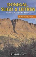
Paperback. The northwest of Ireland provides a diversity of walks, from the wild, untamed landscape of Donegal, with its mountains, sea-cliffs and glens, to the gentler hills, green valleys and picturesque escarpments of Sligo and Leitrim. Quality photographs and maps will inspire one to get the walking boots on and start exploring this majestic landscape. Num Pages: 160 pages, Maps and photographs. BIC Classification: 1DBR; WSZC; WTH. Category: (G) General (US: Trade). Dimension: 203 x 128 x 11. Weight in Grams: 252.
- Publisher
- Gill
- Number of pages
- 160
- Format
- Paperback
- Publication date
- 2012
- Condition
- New
- SKU
- V9781848891395
- ISBN
- 9781848891395
Paperback
Condition: New
€ 16.99€ 14.51
€ 16.99
€ 14.51
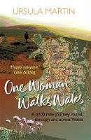
Paperback. Num Pages: 304 pages. BIC Classification: 1DBKW; JKSN1; MJCL; WSZC; WTL. Category: (G) General (US: Trade). Dimension: 198 x 129. .
- Publisher
- Honno Ltd
- Format
- Paperback
- Publication date
- 2018
- Condition
- New
- SKU
- V9781909983601
- ISBN
- 9781909983601
Paperback
Condition: New
€ 17.99€ 14.35
€ 17.99
€ 14.35
Paperback. .
- Publisher
- Countryside Books
- Format
- Paperback
- Publication date
- 2014
- Condition
- New
- SKU
- V9781846743214
- ISBN
- 9781846743214
Paperback
Condition: New
€ 12.36
€ 12.36

