Active outdoor pursuits
Results 985 - 1008 of 2213
Active outdoor pursuits
Series: OS Explorer Map. BIC Classification: 1DBKEY; WSZC; WTRM. Category: (G) General (US: Trade). Dimension: 135 x 240 x 31. Weight in Grams: 126.
- Publisher
- Ordnance Survey
- Publication date
- 2015
- Edition
- September 2015 ed
- Condition
- New
- SKU
- V9780319245606
- ISBN
- 9780319245606
Condition: New
€ 17.99€ 14.20
€ 17.99
€ 14.20
.
- Publisher
- Ordnance Survey
- Publication date
- 2015
- Edition
- May 2015 ed
- Condition
- New
- SKU
- V9780319242766
- ISBN
- 9780319242766
Condition: New
€ 17.99€ 14.28
€ 17.99
€ 14.28
Paperback. .
- Publisher
- Northern Eye Books
- Number of pages
- 64
- Format
- Paperback
- Publication date
- 2013
- Condition
- New
- SKU
- V9781908632210
- ISBN
- 9781908632210
Paperback
Condition: New
€ 9.16
€ 9.16
.
- Publisher
- Ordnance Survey
- Publication date
- 2015
- Edition
- September 2015 ed
- Condition
- New
- SKU
- V9780319243787
- ISBN
- 9780319243787
Paperback
Condition: New
€ 17.99€ 14.35
€ 17.99
€ 14.35
Sheet map, folded. Series: OS Landranger Map. BIC Classification: 1DBKWC; WSZC; WTRM. Category: (G) General (US: Trade). Dimension: 135 x 228 x 59. Weight in Grams: 108.
- Publisher
- Ordnance Survey
- Publication date
- 2016
- Edition
- February 2016 ed
- Condition
- New
- SKU
- V9780319262450
- ISBN
- 9780319262450
Paperback
Condition: New
€ 17.99€ 14.32
€ 17.99
€ 14.32
Sheet map, folded. Series: OS Landranger Map. BIC Classification: 1DBKEYK; WSZC; WTRM. Category: (G) General (US: Trade). Dimension: 136 x 228 x 42. Weight in Grams: 100.
- Publisher
- Ordnance Survey
- Publication date
- 2016
- Edition
- February 2016 ed
- Condition
- New
- SKU
- V9780319261996
- ISBN
- 9780319261996
Paperback
Condition: New
€ 17.99€ 14.31
€ 17.99
€ 14.31
Sheet map, folded. .
- Publisher
- Ordnance Survey
- Publication date
- 2016
- Edition
- February 2016 ed
- Condition
- New
- SKU
- V9780319473481
- ISBN
- 9780319473481
Paperback
Condition: New
€ 23.99€ 17.75
€ 23.99
€ 17.75
Sheet map, folded. Series: OS Landranger Map. BIC Classification: 1DBKSH; WSZC; WTRM. Category: (G) General (US: Trade). Dimension: 137 x 227 x 42. Weight in Grams: 100.
- Publisher
- Ordnance Survey
- Publication date
- 2016
- Edition
- February 2016 ed
- Condition
- New
- SKU
- V9780319261422
- ISBN
- 9780319261422
Paperback
Condition: New
€ 17.99€ 14.32
€ 17.99
€ 14.32
Paperback. This first ever complete guide to Scottish bothies reveals the country's unique and often hidden network of bothy cabins and mountain huts. Scattered across Scotland's most beautiful landscapes, these evocative abandoned crofts and farmsteads are free to stay in and offer a chance to experience the ultimate in wild adventure living. Num Pages: 304 pages, 100. BIC Classification: 1DBKS; WSZ; WTH. Category: (G) General (US: Trade). Dimension: 212 x 173 x 24. Weight in Grams: 746.
- Publisher
- Wild Things Publishing Ltd
- Format
- Paperback
- Publication date
- 2017
- Condition
- New
- SKU
- V9781910636107
- ISBN
- 9781910636107
Paperback
Condition: New
€ 23.99€ 17.75
€ 23.99
€ 17.75
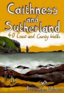
Paperback. Sutherland and Caithness are the most northerly parts of mainland Britain. Northwest Sutherland is a landscape of sandy beaches and sweeping moorland studded with glittering lochans, overlooked by some of Scotland's most remarkable mountains, individual peaks each with great character. This guide features 40 of the best walks in this popular area. Num Pages: 96 pages, full colour illustrations. BIC Classification: 1DBKS; WSZC. Category: (G) General (US: Trade). Dimension: 146 x 109 x 9. Weight in Grams: 126. 40 Coast and Country Walks. 96 pages, full colour illustrations. Sutherland and Caithness are the most northerly parts of mainland Britain. Northwest Sutherland is a landscape of sandy beaches and sweeping moorland studded with glittering lochans, overlooked by some of Scotland's most remarkable mountains, individual peaks each with great character. This guide features 40 of the best walks in this popular area. Cateogry: (G) General (US: Trade). BIC Classification: 1DBKS; WSZC. Dimension: 146 x 109 x 9. Weight: 128.
- Publisher
- Pocket Mountains Ltd
- Number of pages
- 96
- Format
- Paperback
- Publication date
- 2010
- Condition
- New
- SKU
- V9781907025082
- ISBN
- 9781907025082
Paperback
Condition: New
€ 10.30
€ 10.30
paperback. A guide to living in the wild. It includes topics ranging from mastering the art of making the perfect campfire and constructing the best camp, to navigating safely through all terrains in all weathers - with or without a map. Num Pages: 256 pages, Illustrations (some col.), maps (some col.). BIC Classification: WSZ. Category: (G) General (US: Trade). Dimension: 235 x 168 x 22. Weight in Grams: 732.
- Publisher
- Channel 4 Books
- Number of pages
- 256
- Format
- Paperback
- Publication date
- 2010
- Edition
- 42857th
- Condition
- New
- SKU
- V9781905026654
- ISBN
- 9781905026654
Paperback
Condition: New
€ 25.99€ 17.98
€ 25.99
€ 17.98
Paperback. Tells the story of the extraordinary Polish adventurers who emerged from under the blanket of oppression following the Second World War to become the world's leading Himalayan climbers. This book weaves a passionate and literary tale of adventure, politics, suffering, death and - ultimately - inspiration. Num Pages: 256 pages, b&w text with colour plates. BIC Classification: WSZG. Category: (G) General (US: Trade). Dimension: 233 x 157 x 16. Weight in Grams: 462.
- Publisher
- Vertebrate Graphics Ltd United Kingdom
- Number of pages
- 256
- Format
- Paperback
- Publication date
- 2012
- Condition
- New
- SKU
- V9781906148447
- ISBN
- 9781906148447
Paperback
Condition: New
€ 17.99€ 16.49
€ 17.99
€ 16.49
Sheet map, folded. .
- Publisher
- Ordnance Survey
- Publication date
- 2015
- Edition
- September 2015 ed
- Condition
- New
- SKU
- V9780319243824
- ISBN
- 9780319243824
Paperback
Condition: New
€ 17.99€ 14.32
€ 17.99
€ 14.32
Sheet map, folded. Series: OS Landranger Map. BIC Classification: 1DBKWV; WSZC; WTRM. Category: (G) General (US: Trade). Dimension: 137 x 227 x 18. Weight in Grams: 110.
- Publisher
- Ordnance Survey
- Publication date
- 2016
- Edition
- February 2016 ed
- Condition
- New
- SKU
- V9780319262566
- ISBN
- 9780319262566
Paperback
Condition: New
€ 17.99€ 14.27
€ 17.99
€ 14.27
Sheet map, folded. Series: OS Explorer Map. BIC Classification: 1DBKEAN; WSZC; WTRM. Category: (G) General (US: Trade). Dimension: 136 x 228 x 36. Weight in Grams: 102.
- Publisher
- Ordnance Survey
- Publication date
- 2015
- Edition
- September 2015 ed
- Condition
- New
- SKU
- V9780319244234
- ISBN
- 9780319244234
Paperback
Condition: New
€ 17.99€ 14.23
€ 17.99
€ 14.23
Paperback. Num Pages: 256 pages, 25 colour illustrations. BIC Classification: WSZV. Category: (G) General (US: Trade). Dimension: 229 x 152. .
- Publisher
- Rowman & Littlefield
- Format
- Paperback
- Publication date
- 2017
- Condition
- New
- SKU
- V9781493027354
- ISBN
- 9781493027354
Paperback
Condition: New
€ 20.99€ 19.65
€ 20.99
€ 19.65
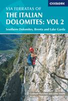
Paperback. Guidebook to 77 via ferrata routes in the Italian Dolomites in the southern regions, Brenta and Garda. Part of a two-volume set of guides to the Dolomite via ferratas. There are graded routes covering 14 mountain groups including the Civetta, around Trento and the Adige valley, with guidance on the best base for each of the via ferrata routes. Num Pages: 320 pages, col. Illustrations, col. maps. BIC Classification: 1DST; WSZG; WTH. Category: (G) General (US: Trade). Dimension: 183 x 120 x 20. Weight in Grams: 384. Southern Dolomites, Brenta and Lake Garda Area. 320 pages, illustrations. This handy pocket-sized guidebook contains detailed route descriptions for via ferrata routes in the Italian Dolomites. This volume covers the Southern Dolomites, Brenta, Trento, Lake Garda and the Adige valley areas. There are 77 graded routes covering 14 mountain groups with guidance on choosing the best base for each of the via ferrata routes. Cateogry: (G) General (US: Trade). BIC Classification: 1DST; WSZG; WTH. Dimension: 183 x 120 x 20. Weight: 406.
- Format
- Paperback
- Publisher
- Cicerone Press Limited
- Number of pages
- 320
- Publication date
- 2005
- Edition
- 01st Edition
- Condition
- New
- SKU
- V9781852843809
- ISBN
- 9781852843809
Paperback
Condition: New
€ 25.99€ 19.40
€ 25.99
€ 19.40
Sheet map, folded. .
- Publisher
- Ordnance Survey
- Publication date
- 2015
- Edition
- September 2015 ed
- Condition
- New
- SKU
- V9780319246665
- ISBN
- 9780319246665
Paperback
Condition: New
€ 17.99€ 14.32
€ 17.99
€ 14.32
Paperback. Book 3 of a new set of Walkers Editions of Alfred Wainwright's Pictorial Guides to the Lakeland Fells, fully updated and checked by Clive Hutchby. Num Pages: 256 pages, Hand-drawn maps, diagrams and illustrations. BIC Classification: 1DBKENM; WSZC. Category: (G) General (US: Trade). Dimension: 184 x 115 x 21. Weight in Grams: 232.
- Format
- Paperback
- Publisher
- Quarto Publishing PLC
- Publication date
- 2016
- Condition
- New
- SKU
- V9780711236561
- ISBN
- 9780711236561
Paperback
Condition: New
€ 19.99€ 15.36
€ 19.99
€ 15.36
Paperback. Num Pages: 40 pages, b&w maps and drawings. BIC Classification: 1DBKW; WSZC. Category: (G) General (US: Trade). Dimension: 212 x 177 x 9. Weight in Grams: 100.
- Publisher
- Kittiwake Press United Kingdom
- Number of pages
- 40
- Format
- Paperback
- Publication date
- 2012
- Edition
- UK ed.
- Condition
- New
- SKU
- V9781902302812
- ISBN
- 9781902302812
Paperback
Condition: New
€ 10.23
€ 10.23
.
- Publisher
- Ordnance Survey
- Publication date
- 2015
- Edition
- September 2015 ed
- Condition
- New
- SKU
- V9780319471302
- ISBN
- 9780319471302
Paperback
Condition: New
€ 23.99€ 17.75
€ 23.99
€ 17.75
.
- Publisher
- Ordnance Survey
- Publication date
- 2015
- Edition
- September 2015 ed
- Condition
- New
- SKU
- V9780319472644
- ISBN
- 9780319472644
Paperback
Condition: New
€ 23.99€ 17.73
€ 23.99
€ 17.73
Hardcover. A guide to 20 of popular walking routes on the MacGillycuddy's Reeks contains full-colour maps specially commissioned from the Ordnance Survey, photographs and map references. This guide also encompasses the history of the area, its geology and natural history, its place names and people. It offers useful information on travel and accommodation. Num Pages: 128 pages, colour maps & photos. BIC Classification: 1DBR; WSZC; WTH. Category: (G) General (US: Trade). Dimension: 208 x 135 x 14. Weight in Grams: 240.
- Publisher
- The Collins Press
- Number of pages
- 128
- Format
- Hardback
- Publication date
- 2006
- Condition
- New
- SKU
- V9781905172337
- ISBN
- 9781905172337
Hardback
Condition: New
€ 16.99€ 14.51
€ 16.99
€ 14.51
Paperback. Series: Start-Up Sports. Num Pages: 144 pages, b/w photos. BIC Classification: WSZC; WT. Category: (G) General (US: Trade). Dimension: 216 x 138 x 9. Weight in Grams: 208.
- Publisher
- Tracks Publishing,U.S. United States
- Number of pages
- 144
- Format
- Paperback
- Publication date
- 1999
- Condition
- New
- SKU
- V9781884654107
- ISBN
- 9781884654107
Paperback
Condition: New
€ 11.89
€ 11.89


