Active outdoor pursuits
Results 1321 - 1340 of 2213
Active outdoor pursuits
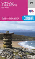
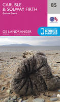
Sheet map, folded. Series: OS Landranger Map. BIC Classification: 1DBKSH; WSZC; WTRM. Category: (G) General (US: Trade). Dimension: 136 x 227 x 43. Weight in Grams: 100.
- Publisher
- Ordnance Survey
- Publication date
- 2016
- Edition
- February 2016 ed
- Condition
- New
- SKU
- V9780319261170
- ISBN
- 9780319261170
Condition: New
€ 17.99€ 14.32
€ 17.99
€ 14.32
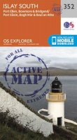
Sheet map, folded. .
- Publisher
- Ordnance Survey
- Publication date
- 2016
- Edition
- February 2016 ed
- Condition
- New
- SKU
- V9780319262948
- ISBN
- 9780319262948
Condition: New
€ 17.99€ 14.35
€ 17.99
€ 14.35
Sheet map, folded. .
- Publisher
- Ordnance Survey
- Publication date
- 2015
- Edition
- September 2015 ed
- Condition
- New
- SKU
- V9780319472231
- ISBN
- 9780319472231
Condition: New
€ 23.99€ 17.73
€ 23.99
€ 17.73
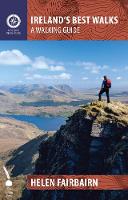
Paperback. In a country richly endowed with wild mountain ranges, secluded valleys and untamed coastlines, the best natural landscapes can only be explored on foot. Here are over sixty of the greatest one-day walking routes in Ireland, varying from short strolls to full-day treks. Every part of the Republic and Northern Ireland is featured. Num Pages: 224 pages, maps and colour photos. BIC Classification: 1DBR; WSZC; WTH. Category: (G) General (US: Trade). Dimension: 199 x 176 x 14. Weight in Grams: 350.
- Publisher
- The Collins Press
- Format
- Paperback
- Publication date
- 2014
- Condition
- New
- SKU
- V9781848892118
- ISBN
- 9781848892118
Paperback
Condition: New
€ 16.99€ 14.51
€ 16.99
€ 14.51
Paperback. 'THE MOST VITAL DOCUMENT ABOUT LONDON IN YEARS' - TIMEOUT ***** Num Pages: 288 pages, map. BIC Classification: 1DBKESL; RGB; WSZC. Category: (G) General (US: Trade). Dimension: 196 x 141 x 22. Weight in Grams: 196.
- Publisher
- Hodder & Stoughton
- Format
- Paperback
- Publication date
- 2013
- Condition
- New
- SKU
- V9781444723397
- ISBN
- 9781444723397
Paperback
Condition: New
€ 15.99€ 11.89
€ 15.99
€ 11.89
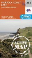
Sheet map, folded. Series: OS Explorer Active Map. BIC Classification: 1DBKEAN; WSZC; WTRM. Category: (G) General (US: Trade). Dimension: 139 x 244 x 23. Weight in Grams: 212.
- Publisher
- Ordnance Survey
- Publication date
- 2015
- Edition
- September 2015 ed
- Condition
- New
- SKU
- V9780319471241
- ISBN
- 9780319471241
Paperback
Condition: New
€ 23.99€ 17.80
€ 23.99
€ 17.80
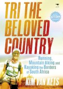
Paperback. What makes a working mother and average athlete decide to take on a massive physical and mental challenge to run, cycle and kayak the perimeter of South Africa, covering 6 772 km in less than five months? Kim van Kets was inspired by her desire to demonstrate to her daughter the fact that mothers are heroes too. Num Pages: 184 pages. BIC Classification: BM; WSSN5; WSZ. Category: (G) General (US: Trade). Dimension: 211 x 150 x 14. Weight in Grams: 214.
- Publisher
- Jacana Media (Pty) Ltd
- Format
- Paperback
- Publication date
- 2015
- Condition
- New
- SKU
- V9781431421343
- ISBN
- 9781431421343
Paperback
Condition: New
€ 16.99€ 15.42
€ 16.99
€ 15.42
Paperback. .
- Publisher
- Sandstone Press Ltd
- Format
- Paperback
- Publication date
- 2016
- Condition
- New
- SKU
- V9781910124727
- ISBN
- 9781910124727
Paperback
Condition: New
€ 11.99€ 10.51
€ 11.99
€ 10.51
Hardback. The essential camping destination guide featuring beautiful photographs and practical how-tos Num Pages: 224 pages, 40 colour photographs. BIC Classification: WSZR; WTH. Category: (G) General (US: Trade). Dimension: 194 x 213 x 29. Weight in Grams: 838.
- Publisher
- Abrams
- Format
- Hardback
- Publication date
- 2016
- Condition
- New
- SKU
- V9781419718267
- ISBN
- 9781419718267
Hardback
Condition: New
€ 26.99€ 19.68
€ 26.99
€ 19.68
Paperback. A guide that gives walkers ten of the finest walks to Lakeland waterfalls. Presented in a pocketable format, it includes waterfalls such as: Lodore Falls, Aira Force, Scale Force, Stock Ghyll, Skelwith Force, Colwith Force, Stanley Ghyll Force, Tom Gill, The Howk and Holme Force. Series: Lake District: Top 10 Walks. Num Pages: 64 pages, full colour/panoramic photographs. BIC Classification: 1DBKENM; WSZC; WTH. Category: (G) General (US: Trade). Dimension: 143 x 127 x 6. Weight in Grams: 100. Walks to Cumbria's Best Waterfalls. Series: Lake District Top 10 Walks. 64 pages, full colour/panoramic photographs. A guide that gives walkers ten of the finest walks to Lakeland waterfalls. Presented in a pocketable format, it includes waterfalls such as: Lodore Falls, Aira Force, Scale Force, Stock Ghyll, Skelwith Force, Colwith Force, Stanley Ghyll Force, Tom Gill, The Howk and Holme Force. Cateogry: (G) General (US: Trade). BIC Classification: 1DBKENM; WSZC; WTH. Dimension: 143 x 127 x 6. Weight: 88.
- Publisher
- Northern Eye
- Number of pages
- 64
- Format
- Paperback
- Publication date
- 2012
- Condition
- New
- SKU
- V9781908632005
- ISBN
- 9781908632005
Paperback
Condition: New
€ 10.25
€ 10.25
Sheet map, folded. .
- Publisher
- Ordnance Survey
- Publication date
- 2015
- Edition
- September 2015 ed
- Condition
- New
- SKU
- V9780319244050
- ISBN
- 9780319244050
Paperback
Condition: New
€ 17.99€ 14.29
€ 17.99
€ 14.29
Sheet map, folded. .
- Publisher
- Harvey Map Services Ltd
- Publication date
- 2015
- Edition
- 1st
- Condition
- New
- SKU
- V9781851375486
- ISBN
- 9781851375486
Paperback
Condition: New
€ 21.46
€ 21.46
Sheet map, folded. .
- Publisher
- Ordnance Survey
- Publication date
- 2015
- Edition
- September 2015 ed
- Condition
- New
- SKU
- V9780319246498
- ISBN
- 9780319246498
Paperback
Condition: New
€ 17.99€ 14.29
€ 17.99
€ 14.29
Paperback. A guide to reaching the summit of every country in Europe - driving, walking and climbing routes to the tops of 50 countries in Europe. Detailed route descriptions, sketch maps - advice on transport, seasons, grading and gear. From afternoon strolls in Malta to three-day mountaineering ascents on classic Alpine routes such as Mont Blanc. Num Pages: 256 pages, 150 colour photos, 50 colour maps and 50 flags. BIC Classification: 1D; WSZG; WTH. Category: (G) General (US: Trade). Dimension: 210 x 149 x 17. Weight in Grams: 472. Getting to the Top in 50 Countries. 256 pages, 150 colour photos, 50 colour maps and 50 flags. A guide to reaching the summit of every country in Europe - driving, walking and climbing routes to the tops of 50 countries in Europe. Detailed route descriptions, sketch maps - advice on transport, seasons, grading and gear. From afternoon strolls in Malta to three-day mountaineering ascents on classic Alpine routes such as Mont Blanc. Cateogry: (G) General (US: Trade). BIC Classification: 1D; WSZG; WTH. Dimension: 210 x 149 x 17. Weight: 470.
- Publisher
- Cicerone Press Limited
- Number of pages
- 256
- Format
- Paperback
- Publication date
- 2010
- Edition
- 1st Edition
- Condition
- New
- SKU
- V9781852845773
- ISBN
- 9781852845773
Paperback
Condition: New
€ 19.99€ 16.00
€ 19.99
€ 16.00
Sheet map, folded. .
- Publisher
- Ordnance Survey
- Publication date
- 2016
- Edition
- February 2016 ed
- Condition
- New
- SKU
- V9780319474396
- ISBN
- 9780319474396
Paperback
Condition: New
€ 23.99€ 17.73
€ 23.99
€ 17.73
Paperback. Num Pages: 192 pages. BIC Classification: 1KBBWF; WSZC; WTL. Category: (G) General (US: Trade). Dimension: 217 x 152 x 12. Weight in Grams: 284.
- Publisher
- Beaufort Books
- Format
- Paperback
- Publication date
- 2014
- Condition
- New
- SKU
- V9780825307362
- ISBN
- 9780825307362
Paperback
Condition: New
€ 16.99€ 16.14
€ 16.99
€ 16.14
Paperback. The Costa Blanca has long been the best known Hot Rock winter sun venue for climbers. It has easy access, loads of quality accommodation, and an amazing amount of fantastic climbing on everything from roadside boulders to magnificent mountains. This edition features 4,000 routes and a complete new set of crag shots along with action pictures. Series: Rockfax Climbing Guide. Num Pages: 480 pages, colour photos & colour photo-topos. BIC Classification: 1DSE; WSZG. Category: (G) General (US: Trade). Dimension: 210 x 154 x 24. Weight in Grams: 876. 480 pages, colour photos & colour photo-topos. The Costa Blanca has long been the best known Hot Rock winter sun venue for climbers. It has easy access, loads of quality accommodation, and an amazing amount of fantastic climbing on everything from roadside boulders to magnificent mountains. This edition features 4,000 routes and a complete new set of crag shots along with action pictures. Cateogry: (G) General (US: Trade). BIC Classification: 1DSE; WSZG. Dimension: 210 x 154 x 24. Weight: 868.
- Publisher
- Rockfax Ltd
- Number of pages
- 480
- Format
- Paperback
- Publication date
- 2013
- Edition
- 5th Revised edition
- Condition
- New
- SKU
- V9781873341674
- ISBN
- 9781873341674
Paperback
Condition: New
€ 49.99€ 41.28
€ 49.99
€ 41.28
Sheet map, folded. .
- Publisher
- Ordnance Survey
- Publication date
- 2015
- Edition
- September 2015 ed
- Condition
- New
- SKU
- V9780319246146
- ISBN
- 9780319246146
Paperback
Condition: New
€ 17.99€ 14.35
€ 17.99
€ 14.35
Sheet map, folded. .
- Publisher
- Ordnance Survey
- Publication date
- 2016
- Edition
- February 2016 ed
- Condition
- New
- SKU
- V9780319261835
- ISBN
- 9780319261835
Paperback
Condition: New
€ 17.99€ 14.32
€ 17.99
€ 14.32
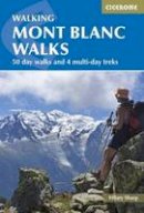
Flexibound. Guidebook to 50 day walks in the Mont Blanc region near Chamonix and Courmayeur, with outlines of 4 multi-day treks around both sides of the Mont Blanc massif. The walks range from 3km to 20km and cover a variety of terrains from easy valley walks to more challenging routes over boulders, scree and on via ferratas. Num Pages: 288 pages, 66 maps 114 colour photos. BIC Classification: 1DFHA; WSZC; WSZG; WTH. Category: (G) General (US: Trade). Dimension: 172 x 116 x 16. .
- Publisher
- Cicerone Press United Kingdom
- Number of pages
- 288
- Publication date
- 2016
- Edition
- 3rd Edition
- Condition
- New
- SKU
- V9781852848194
- ISBN
- 9781852848194
Paperback
Condition: New
€ 24.99€ 18.58
€ 24.99
€ 18.58

