Active outdoor pursuits
Results 1417 - 1440 of 2220
Active outdoor pursuits
Sheet map, folded. .
- Publisher
- Ordnance Survey
- Publication date
- 2015
- Edition
- September 2015 ed
- Condition
- New
- SKU
- V9780319244265
- ISBN
- 9780319244265
Condition: New
€ 17.99€ 14.23
€ 17.99
€ 14.23
Sheet map, folded. .
- Publisher
- Ordnance Survey
- Publication date
- 2016
- Edition
- February 2016 ed
- Condition
- New
- SKU
- V9780319474990
- ISBN
- 9780319474990
Condition: New
€ 23.99€ 17.47
€ 23.99
€ 17.47
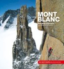
Hardcover. Mont Blanc - The Finest Routes is a collection of the 100 must-do climbing routes in the Mont Blanc Massif. Author Philippe Batoux gives a comprehensive account of each route, outlining its history and giving all the technical information needed to climb it. Each route has written descriptions, photo diagrams and topos, and stunning photos. Translator(s): Henderson, Paul. Num Pages: 216 pages, colour photographs and diagrams throughout. BIC Classification: 1DDF; 1DFH; 1DFHA; WSZG. Category: (G) General (US: Trade). Dimension: 292 x 267 x 22. Weight in Grams: 1510.
- Publisher
- Vertebrate Graphics Ltd United Kingdom
- Number of pages
- 216
- Format
- Hardback
- Publication date
- 2001
- Condition
- New
- SKU
- V9781906148645
- ISBN
- 9781906148645
Hardback
Condition: New
€ 46.99€ 39.08
€ 46.99
€ 39.08
Sheet map, folded. Series: OS Explorer Map. BIC Classification: 1DBKSH; WSZC; WTRM. Category: (G) General (US: Trade). Dimension: 135 x 227 x 58. Weight in Grams: 98.
- Publisher
- Ordnance Survey
- Publication date
- 2015
- Edition
- September 2015 ed
- Condition
- New
- SKU
- V9780319246252
- ISBN
- 9780319246252
Hardback
Condition: New
€ 17.99€ 14.28
€ 17.99
€ 14.28
.
- Publisher
- Ordnance Survey
- Publication date
- 2015
- Edition
- September 2015 ed
- Condition
- New
- SKU
- V9780319472132
- ISBN
- 9780319472132
Hardback
Condition: New
€ 23.99€ 17.55
€ 23.99
€ 17.55
Paperback. Charts a 6-day circular walk throughout the Peak District, covering 84 miles and passing 51 great country pubs along the way. In this title, the circular walking route takes in the very best of the Peak District from the wilds of Kinder Scout to the Eastern Edges, gentle pastoral landscape of Chatsworth and the limestone dales of the White Peak. Num Pages: 224 pages, 24 pen & ink drawings, 18 hand-drawn maps, 8 pages of colour photos. BIC Classification: 1DBKEMD; WSZC; WTH. Category: (G) General (US: Trade). Dimension: 210 x 149 x 12. Weight in Grams: 420. The Complete and Unique Guide to a Circular Walk in the Peak District. 224 pages, 24 pen & ink drawings, 18 hand-drawn maps, 8 pages of colour photos. Charts a 6-day circular walk throughout the Peak District, covering 84 miles and passing 51 great country pubs along the way. In this title, the circular walking route takes in the very best of the Peak District from the wilds of Kinder Scout to the Eastern Edges, gentle pastoral landscape of Chatsworth and the limestone dales of the White Peak. Cateogry: (G) General (US: Trade). BIC Classification: 1DBKEMD; WSZC; WTH. Dimension: 210 x 149 x 12. Weight: 420.
- Publisher
- Innway Publications
- Number of pages
- 224
- Format
- Paperback
- Publication date
- 2012
- Edition
- 2nd edition
- Condition
- New
- SKU
- V9781902001197
- ISBN
- 9781902001197
Paperback
Condition: New
€ 15.99€ 14.32
€ 15.99
€ 14.32
Paperback. .
- Publisher
- Icon Books United Kingdom
- Number of pages
- 8
- Format
- Paperback
- Publication date
- 2011
- Condition
- New
- SKU
- V9781780500072
- ISBN
- 9781780500072
Paperback
Condition: New
€ 5.04
€ 5.04
Paperback. 28 circular, graded walks all tried and tested by seasoned walkers. The routes range from extended strolls to exhilarating hikes, so there is something for everyone. Series: Pathfinder Guide. Num Pages: 95 pages. BIC Classification: 1DBKEWD; WSZC; WTRM. Category: (G) General (US: Trade). Dimension: 135 x 227 x 7. Weight in Grams: 210.
- Publisher
- Ordnance Survey/Crimson
- Format
- Paperback
- Publication date
- 2016
- Edition
- Revised edition
- Condition
- New
- SKU
- V9780319090305
- ISBN
- 9780319090305
Paperback
Condition: New
€ 17.99€ 14.27
€ 17.99
€ 14.27
Sheet map, folded. .
- Publisher
- Ordnance Survey
- Publication date
- 2016
- Edition
- February 2016 ed
- Condition
- New
- SKU
- V9780319475164
- ISBN
- 9780319475164
Paperback
Condition: New
€ 23.99€ 17.69
€ 23.99
€ 17.69
.
- Publisher
- Ordnance Survey
- Publication date
- 2016
- Edition
- February 2016 ed
- Condition
- New
- SKU
- V9780319262696
- ISBN
- 9780319262696
Paperback
Condition: New
€ 17.99€ 14.28
€ 17.99
€ 14.28
Paperback. .
- Publisher
- Somerset Archaeological and Natural History Society United Kingdom
- Number of pages
- 112
- Format
- Paperback
- Publication date
- 2011
- Edition
- 9th edition
- Condition
- New
- SKU
- V9780861834488
- ISBN
- 9780861834488
Paperback
Condition: New
€ 12.45
€ 12.45
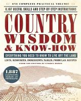
Paperback. The most complete volume on every aspect of country living--one Black Dog's best-selling titles -- is now available in a convenient, compact size. Num Pages: 1072 pages, 1000 illustrations, black and white. BIC Classification: WSZV. Category: (G) General (US: Trade). Dimension: 204 x 253 x 50. Weight in Grams: 1448.
- Publisher
- Black Dog & Leventhal
- Format
- Paperback
- Publication date
- 2017
- Edition
- Reissue
- Condition
- New
- SKU
- V9780316276962
- ISBN
- 9780316276962
Paperback
Condition: New
€ 30.99€ 20.63
€ 30.99
€ 20.63
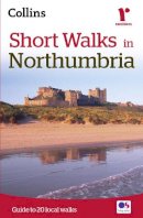
Paperback. A practical little walk guide to Northumbria endorsed by the Ramblers. All of the 20 walks are 5 miles or under in length and can easily be completed in less than 3 hours. Clear Ordnance Survey maps show the route, along with easy-to-follow walk descriptions. Num Pages: 96 pages. BIC Classification: 1DBKEYN; WSZC; WTH. Category: (G) General (US: Trade). Dimension: 180 x 118 x 9. Weight in Grams: 146.
- Publisher
- HarperCollins UK
- Format
- Paperback
- Publication date
- 2015
- Edition
- New edition
- Condition
- New
- SKU
- V9780008101589
- ISBN
- 9780008101589
Paperback
Condition: New
€ 9.99€ 8.44
€ 9.99
€ 8.44
Sheet map, folded. .
- Publisher
- Ordnance Survey
- Publication date
- 2015
- Edition
- September 2015 ed
- Condition
- New
- SKU
- V9780319245637
- ISBN
- 9780319245637
Paperback
Condition: New
€ 17.99€ 14.29
€ 17.99
€ 14.29
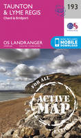
Sheet map, folded. Series: OS Landranger Map. BIC Classification: 1DBKSC; WSZC; WTRM. Category: (G) General (US: Trade). Dimension: 136 x 228 x 41. Weight in Grams: 98.
- Publisher
- Ordnance Survey
- Publication date
- 2016
- Edition
- February 2016 ed
- Condition
- New
- SKU
- V9780319261583
- ISBN
- 9780319261583
Paperback
Condition: New
€ 17.99€ 14.28
€ 17.99
€ 14.28
Paperback. .
- Publisher
- Ordnance Survey/Crimson
- Format
- Paperback
- Publication date
- 2016
- Condition
- New
- SKU
- V9780319090206
- ISBN
- 9780319090206
Paperback
Condition: New
€ 17.99€ 14.27
€ 17.99
€ 14.27
Sheet map, folded. Series: OS Landranger Map. BIC Classification: 1DBKEYN; WSZC; WTRM. Category: (G) General (US: Trade). Dimension: 136 x 229 x 50. Weight in Grams: 100.
- Publisher
- Ordnance Survey
- Publication date
- 2016
- Edition
- February 2016 ed
- Condition
- New
- SKU
- V9780319261781
- ISBN
- 9780319261781
Paperback
Condition: New
€ 17.99€ 14.28
€ 17.99
€ 14.28
Paperback. The Dales Way runs for 79 miles (127 km) from Ilkley in the Yorkshire Dales to Bowness in the Lake District, through limestone scenery with stone walls and fine wildlife. You pass Bolton Priory, soaring railway viaducts and heritage centres and stay in well-spaced villages with B&Bs and welcoming pubs. This guidebook tells a walker all they need. Num Pages: 64 pages, 60+ colour photographs. BIC Classification: 1DBKEYK; WSZC; WTH. Category: (G) General (US: Trade). Dimension: 147 x 216 x 10. Weight in Grams: 176.
- Publisher
- Rucksack Readers United Kingdom
- Number of pages
- 64
- Format
- Paperback
- Publication date
- 2011
- Edition
- 1st Edition
- Condition
- New
- SKU
- V9781898481423
- ISBN
- 9781898481423
Paperback
Condition: New
€ 15.99€ 14.37
€ 15.99
€ 14.37
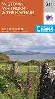
Sheet map, folded. Series: OS Explorer Map. BIC Classification: 1DBKSHL; WSZC; WTRM. Category: (G) General (US: Trade). Dimension: 135 x 240 x 44. Weight in Grams: 128.
- Publisher
- Ordnance Survey
- Publication date
- 2015
- Edition
- September 2015 ed
- Condition
- New
- SKU
- V9780319246986
- ISBN
- 9780319246986
Paperback
Condition: New
€ 17.99€ 14.11
€ 17.99
€ 14.11
Paperback. The Beach Book presents a whole host of activities and adventures to be enjoyed on the water's edge by the sea, lakes and rivers. Num Pages: 128 pages, 100 images. BIC Classification: WSZ. Category: (G) General (US: Trade). Dimension: 203 x 141 x 11. Weight in Grams: 272.
- Publisher
- Quarto Publishing PLC
- Format
- Paperback
- Publication date
- 2015
- Condition
- New
- SKU
- V9780711235779
- ISBN
- 9780711235779
Paperback
Condition: New
€ 19.99€ 15.19
€ 19.99
€ 15.19
Sheet map, folded. .
- Publisher
- Ordnance Survey
- Publication date
- 2015
- Edition
- September 2015 ed
- Condition
- New
- SKU
- V9780319247204
- ISBN
- 9780319247204
Paperback
Condition: New
€ 17.99€ 14.20
€ 17.99
€ 14.20
Sheet map, folded. .
- Publisher
- Ordnance Survey
- Publication date
- 2015
- Edition
- September 2015 ed
- Condition
- New
- SKU
- V9780319244425
- ISBN
- 9780319244425
Paperback
Condition: New
€ 17.99€ 14.23
€ 17.99
€ 14.23
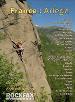
Paperback. The Ariege region of Southern France is the compact area where the Ariege River cuts through the Pyrenees on its way from Andorra to the coast. In this title, the areas covered are in and around the main Ariege river valley which runs down from Andorra through Tarascon-sur-Ariege and Foix. Series: Rockfax Climbing Guide Series. Num Pages: 312 pages, colour photo action shots, plus colour photo topos. BIC Classification: WSZG. Category: (G) General (US: Trade). Dimension: 152 x 210 x 17. Weight in Grams: 616. Rockfax Rock Climbing Guidebook. Series: Rockfax Climbing Guide S. 312 pages, colour photo action shots, plus colour photo topos. The Ariege region of Southern France is the compact area where the Ariege River cuts through the Pyrenees on its way from Andorra to the coast. In this title, the areas covered are in and around the main Ariege river valley which runs down from Andorra through Tarascon-sur-Ariege and Foix. Cateogry: (G) General (US: Trade). BIC Classification: WSZG. Dimension: 152 x 210 x 17. Weight: 614.
- Publisher
- Rockfax Ltd
- Number of pages
- 312
- Format
- Paperback
- Publication date
- 2012
- Condition
- New
- SKU
- V9781873341872
- ISBN
- 9781873341872
Paperback
Condition: New
€ 33.99€ 28.76
€ 33.99
€ 28.76
Series: OS Explorer Map. BIC Classification: 1DBKSHQ; WSZC; WTRM. Category: (G) General (US: Trade). Dimension: 242 x 135 x 51. Weight in Grams: 128.
- Publisher
- Ordnance Survey
- Publication date
- 2015
- Edition
- September 2015 ed
- Condition
- New
- SKU
- V9780319246467
- ISBN
- 9780319246467
Paperback
Condition: New
€ 17.99€ 14.27
€ 17.99
€ 14.27


