Active outdoor pursuits
Results 1969 - 1992 of 2173
Active outdoor pursuits
Hardcover. Luxury edition of the bestselling survival guide Num Pages: 400 pages, With index. BIC Classification: WSZV. Category: (G) General (US: Trade). Dimension: 254 x 199 x 36. Weight in Grams: 1406.
- Edition
- Gift edition
- Publisher
- HarperCollins Publishers
- Format
- Hardback
- Publication date
- 2009
- Condition
- New
- SKU
- V9780007312856
- ISBN
- 9780007312856
Hardback
Condition: New
€ 33.99€ 22.03
€ 33.99
€ 22.03
Paperback. Practical guide with 27 detailed route maps covering not only the classic treks but also the wild routes: Everest expedition route, Rolwaling, trekking from Lukla, Salpa-Arun, the Gokyo trek, high passes, trekking peaks including Mera and Island Peak. What to see, where to stay and eat, Kathmandu and getting to Nepal. Num Pages: 320 pages, 34 colour photos, 27 detailed route maps, 52 village plans. BIC Classification: 1FKAH; WSZG; WTH. Category: (G) General (US: Trade). Dimension: 180 x 120 x 18. Weight in Grams: 311.
- Publisher
- Trailblazer Publications
- Format
- Paperback
- Publication date
- 2018
- Edition
- 6th Revised edition
- Condition
- New
- SKU
- V9781905864812
- ISBN
- 9781905864812
Paperback
Condition: New
€ 21.99€ 16.79
€ 21.99
€ 16.79
Paperback. Presents an account of the author and Simon's (author's climbing partner) terrifying adventure in the Peruvian Andes. This book shows how the pair dealt with the psychological traumas. It not only tells the story of their survival but is a compelling testament of their friendship. Num Pages: 224 pages. BIC Classification: BGA; WSZG; WSZV. Category: (G) General (US: Trade). Dimension: 199 x 129 x 15. Weight in Grams: 192.
- Publisher
- Vintage Classics
- Number of pages
- 224
- Format
- Paperback
- Publication date
- 2008
- Condition
- New
- SKU
- V9780099511748
- ISBN
- 9780099511748
Paperback
Condition: New
€ 15.99€ 11.82
€ 15.99
€ 11.82
Paperback. .
- Publisher
- Sigma Press United Kingdom
- Number of pages
- 192
- Format
- Paperback
- Publication date
- 2010
- Edition
- New ed.
- Condition
- New
- SKU
- V9781850588580
- ISBN
- 9781850588580
Paperback
Condition: New
€ 13.99€ 12.68
€ 13.99
€ 12.68
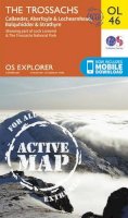
Sheet map, folded. OS Explorer is the Ordnance Survey's most detailed map and is recommended for anyone enjoying outdoor activities like walking, horse riding and off-road cycling. Providing complete GB coverage the series details essential information such as youth hostels, pubs and visitor information as well as rights of way, permissive paths and bridleways. Series: OS Explorer Map. BIC Classification: 1DBKSH; WSZC; WTRM. Category: (G) General (US: Trade). Dimension: 237 x 325 x 39. Weight in Grams: 100.
- Publisher
- Ordnance Survey
- Publication date
- 2015
- Edition
- May 2015 ed
- Condition
- New
- SKU
- V9780319242964
- ISBN
- 9780319242964
Paperback
Condition: New
€ 17.99€ 14.31
€ 17.99
€ 14.31
Sheet map, folded. .
- Publisher
- Ordnance Survey
- Publication date
- 2015
- Edition
- September 2015 ed
- Condition
- New
- SKU
- V9780319246016
- ISBN
- 9780319246016
Paperback
Condition: New
€ 17.99€ 14.32
€ 17.99
€ 14.32
Paperback. Illustrator(s): Isherwood, Christine. Series: Clan Walk Guides. Num Pages: 144 pages, illustrations & maps. BIC Classification: 1DBKSHL; WSZC; WTH. Category: (G) General (US: Trade). Dimension: 211 x 150 x 12. Weight in Grams: 196.
- Publisher
- Clan Books
- Format
- Paperback
- Publication date
- 2012
- Edition
- Rev Ed
- Condition
- New
- SKU
- V9781873597279
- ISBN
- 9781873597279
Paperback
Condition: New
€ 13.07
€ 13.07
Sheet map, folded. Series: OS Explorer Map. BIC Classification: 1DBKEAC; WSZC; WTRM. Category: (G) General (US: Trade). Dimension: 138 x 241 x 41. Weight in Grams: 128.
- Publisher
- Ordnance Survey
- Publication date
- 2015
- Edition
- September 2015 ed
- Condition
- New
- SKU
- V9780319244029
- ISBN
- 9780319244029
Paperback
Condition: New
€ 17.99€ 14.20
€ 17.99
€ 14.20
Paperback. Series: Red Dog Guides. Num Pages: 192 pages, schematic maps, colour photos. BIC Classification: 1DDF; WSZC; WTH. Category: (G) General (US: Trade). Dimension: 210 x 137 x 10. Weight in Grams: 322. Mont St-Michel to Morlaix. Series: Red Dog Guides. 192 pages, schematic maps, colour photos. Cateogry: (G) General (US: Trade). BIC Classification: 1DDF; WSZC; WTH. Dimension: 210 x 137 x 10. Weight: 320.
- Publisher
- RED DOG BOOKS
- Number of pages
- 192
- Format
- Paperback
- Publication date
- 2008
- Condition
- New
- SKU
- V9780955708800
- ISBN
- 9780955708800
Paperback
Condition: New
€ 13.99€ 13.37
€ 13.99
€ 13.37
Sheet map, folded. Series: OS Explorer Map. BIC Classification: 1DBKSH; WSZC; WTRM. Category: (G) General (US: Trade). Dimension: 136 x 240 x 30. Weight in Grams: 130.
- Publisher
- Ordnance Survey
- Publication date
- 2015
- Edition
- September 2015 ed
- Condition
- New
- SKU
- V9780319246658
- ISBN
- 9780319246658
Paperback
Condition: New
€ 17.99€ 14.32
€ 17.99
€ 14.32
.
- Publisher
- Ordnance Survey
- Publication date
- 2015
- Edition
- September 2015 ed
- Condition
- New
- SKU
- V9780319470350
- ISBN
- 9780319470350
Paperback
Condition: New
€ 23.99€ 17.75
€ 23.99
€ 17.75
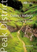
Paperback. Editor(s): Bowerman, Tony. Series: Peak District Top 10 Walks. Num Pages: 64 pages, Illustrations. BIC Classification: 1DBKEMD; WSZC. Category: (G) General (US: Trade). Dimension: 151 x 111 x 6. Weight in Grams: 100.
- Publisher
- Northern Eye Books
- Number of pages
- 64
- Format
- Paperback
- Publication date
- 2013
- Edition
- 0th Edition
- Condition
- New
- SKU
- V9781908632050
- ISBN
- 9781908632050
Paperback
Condition: New
€ 10.22
€ 10.22
Series: OS Explorer Map. BIC Classification: 1DBKWV; WSZC; WTRM. Category: (G) General (US: Trade). Dimension: 137 x 229 x 26. Weight in Grams: 102.
- Publisher
- Ordnance Survey
- Publication date
- 2015
- Edition
- September 2015 ed
- Condition
- New
- SKU
- V9780319243916
- ISBN
- 9780319243916
Paperback
Condition: New
€ 17.99€ 14.28
€ 17.99
€ 14.28
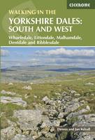
Paperback. Part of a two-book set, this guidebook describes 44 walks in the southern and western Yorkshire Dales, including the famous 23 mile Three Peaks circuit over Pen-y-Ghent, Whernside and Ingleborough. The other, mostly circular routes of 31/2 to 13 miles cover the scenic region between Sedbergh, Kirkby Lonsdale, Settle, Skipton and Grassington. Num Pages: 256 pages, 101 colour photos, 46 maps. BIC Classification: 1DBKEYK; WSZC; WTH. Category: (G) General (US: Trade). Dimension: 172 x 116 x 14. .
- Publisher
- Cicerone Press
- Format
- Paperback
- Publication date
- 2017
- Edition
- 2nd Revised edition
- Condition
- New
- SKU
- V9781852848859
- ISBN
- 9781852848859
Paperback
Condition: New
€ 17.99€ 14.20
€ 17.99
€ 14.20
Paperback. .
- Publisher
- Blue Birch
- Format
- Paperback
- Publication date
- 2015
- Edition
- 2nd edition
- Condition
- New
- SKU
- V9780993162800
- ISBN
- 9780993162800
Paperback
Condition: New
€ 15.00
€ 15.00
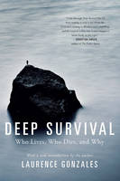
Paperback. Now with a new introduction on how this book can help readers overcome any of life's obstacles, Deep Survival motivates and enlightens. Num Pages: 336 pages. BIC Classification: WSZV. Category: (G) General (US: Trade). Dimension: 212 x 139 x 25. Weight in Grams: 262.
- Publisher
- WW Norton & Co
- Format
- Paperback
- Publication date
- 2017
- Edition
- 1st Edition
- Condition
- New
- SKU
- V9780393353716
- ISBN
- 9780393353716
Paperback
Condition: New
€ 18.99€ 17.58
€ 18.99
€ 17.58
Sheet map, folded. .
- Publisher
- Ordnance Survey
- Publication date
- 2015
- Edition
- September 2015 ed
- Condition
- New
- SKU
- V9780319243558
- ISBN
- 9780319243558
Paperback
Condition: New
€ 17.99€ 14.20
€ 17.99
€ 14.20
.
- Publisher
- Ordnance Survey
- Publication date
- 2015
- Edition
- May 2015 ed
- Condition
- New
- SKU
- V9780319469644
- ISBN
- 9780319469644
Paperback
Condition: New
€ 23.99€ 17.75
€ 23.99
€ 17.75
Sheet map, folded. .
- Publisher
- Ordnance Survey
- Publication date
- 2016
- Edition
- February 2016 ed
- Condition
- New
- SKU
- V9780319261866
- ISBN
- 9780319261866
Paperback
Condition: New
€ 17.99€ 14.23
€ 17.99
€ 14.23
Hardcover. Tells the story of the author's 2700 kilometre ski up the entire length of Norway, followed by his 3100 kilometre kayak down the whole of Norway's coast. In this guide, the entire 6200 kilometres of the outdoor expedition has been split into 35 sections. Each section is around 200 kilometres, or a week's duration. Num Pages: 448 pages, 810 colour photos plus 36 maps & 6 drawings. BIC Classification: WSZ. Category: (G) General (US: Trade). Dimension: 254 x 183 x 33. Weight in Grams: 1492. A Ski and Kayak Odyssey in Europe's Great Wilderness. 448 pages, 810 colour photos plus 36 maps & 6 drawings. Tells the story of the author's 2700 kilometre ski up the entire length of Norway, followed by his 3100 kilometre kayak down the whole of Norway's coast. In this guide, the entire 6200 kilometres of the outdoor expedition has been split into 35 sections. Each section is around 200 kilometres, or a week's duration. Cateogry: (G) General (US: Trade). BIC Classification: WSZ. Dimension: 254 x 183 x 33. Weight: 1480.
- Publisher
- Scandinavian Publishing
- Number of pages
- 448
- Format
- Hardback
- Publication date
- 2012
- Condition
- New
- SKU
- V9780955049712
- ISBN
- 9780955049712
Hardback
Condition: New
€ 26.99€ 23.78
€ 26.99
€ 23.78
Paperback. .
- Publisher
- Icon Books United Kingdom
- Number of pages
- 8
- Format
- Paperback
- Publication date
- 2011
- Condition
- New
- SKU
- V9781780500188
- ISBN
- 9781780500188
Paperback
Condition: New
€ 5.04
€ 5.04
Paperback. .
- Publisher
- Vertebrate Publishing
- Number of pages
- 160
- Format
- Paperback
- Publication date
- 2013
- Condition
- New
- SKU
- V9781906148683
- ISBN
- 9781906148683
Paperback
Condition: New
€ 16.99€ 15.54
€ 16.99
€ 15.54
Sheet map, folded. .
- Publisher
- Ordnance Survey
- Publication date
- 2015
- Edition
- May 2015 ed
- Condition
- New
- SKU
- V9780319469446
- ISBN
- 9780319469446
Paperback
Condition: New
€ 23.99€ 17.74
€ 23.99
€ 17.74
Paperback. Series: 100 Walks. Num Pages: 192 pages, 89 colour maps. BIC Classification: 1DBKEYD; WSZC. Category: (G) General (US: Trade). Dimension: 196 x 128 x 13. Weight in Grams: 289.
- Publisher
- The Crowood Press Ltd
- Format
- Paperback
- Publication date
- 2017
- Condition
- New
- SKU
- V9781785003066
- ISBN
- 9781785003066
Paperback
Condition: New
€ 15.99€ 14.52
€ 15.99
€ 14.52


