Active outdoor pursuits
Results 1241 - 1260 of 2010
Active outdoor pursuits
Sheet map, folded. .
- Publisher
- Ordnance Survey
- Publication date
- 2016
- Edition
- February 2016 ed
- Condition
- New
- SKU
- V9780319262856
- ISBN
- 9780319262856
Condition: New
€ 17.99€ 14.33
€ 17.99
€ 14.33
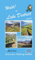
Spiral bound. Including GPS Waypoint lists and a Place Name Index, this 160-page colour book contains walking routes within the Lake District South region. Wire-O spiral binding allows it to lay flat and be folded back on itself without damage. It features: route summary of exertion rating; refreshments rating; time, distance, ascents/descents; and more. Series: Walk!. Num Pages: 160 pages. BIC Classification: 1DBKENM; WSZC; WTH. Category: (G) General (US: Trade). Dimension: 207 x 129 x 15. Weight in Grams: 252. Series: Walk!. 160 pages. Including GPS Waypoint lists and a Place Name Index, this 160-page colour book contains walking routes within the Lake District South region. Wire-O spiral binding allows it to lay flat and be folded back on itself without damage. It features: route summary of exertion rating; refreshments rating; time, distance, ascents/descents; and more. Cateogry: (G) General (US: Trade). BIC Classification: 1DBKENM; WSZC; WTH. Dimension: 207 x 129 x 15. Weight: 252.
- Publisher
- Discovery Walking Guides Ltd
- Number of pages
- 160
- Format
- Spiralbound
- Publication date
- 2006
- Condition
- New
- SKU
- V9781904946168
- ISBN
- 9781904946168
Spiralbound
Condition: New
€ 17.99€ 14.33
€ 17.99
€ 14.33
Sheet map, folded. .
- Publisher
- Ordnance Survey
- Publication date
- 2015
- Edition
- May 2015 ed
- Condition
- New
- SKU
- V9780319242865
- ISBN
- 9780319242865
Spiralbound
Condition: New
€ 17.99€ 14.33
€ 17.99
€ 14.33
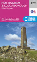
Series: OS Landranger Map. BIC Classification: 1DBKWN; WSZC; WTRM. Category: (G) General (US: Trade). Dimension: 135 x 228 x 67. Weight in Grams: 108.
- Publisher
- Ordnance Survey
- Publication date
- 2016
- Edition
- February 2016 ed
- Condition
- New
- SKU
- V9780319262122
- ISBN
- 9780319262122
Spiralbound
Condition: New
€ 17.99€ 14.25
€ 17.99
€ 14.25
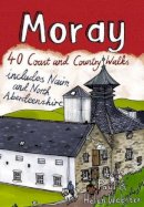
Paperback. The Moray coastline has a string of superb sandy beaches, and towns such as Buckie, Lossiemouth and Nairn (historically part of Morayshire) have long been popular for family holidays. This pocket guide features 40 of the best walks in this popular area. Num Pages: 96 pages, full colour illustrations. BIC Classification: 1DBKS; WSZC. Category: (G) General (US: Trade). Dimension: 151 x 112 x 9. Weight in Grams: 126.
- Publisher
- Pocket Mountains Ltd United Kingdom
- Number of pages
- 96
- Format
- Paperback
- Publication date
- 2010
- Condition
- New
- SKU
- V9781907025136
- ISBN
- 9781907025136
Paperback
Condition: New
€ 10.39
€ 10.39
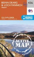
Sheet map, folded. Series: OS Explorer Map. BIC Classification: 1DBKENC; WSZC; WTRM. Category: (G) General (US: Trade). Dimension: 136 x 227 x 32. Weight in Grams: 100.
- Publisher
- Ordnance Survey
- Publication date
- 2015
- Edition
- September 2015 ed
- Condition
- New
- SKU
- V9780319244531
- ISBN
- 9780319244531
Paperback
Condition: New
€ 17.99€ 14.31
€ 17.99
€ 14.31
Paperback. .
- Publisher
- Vertebrate Publishing
- Format
- Paperback
- Publication date
- 2015
- Condition
- New
- SKU
- V9781910240557
- ISBN
- 9781910240557
Paperback
Condition: New
€ 19.99€ 18.64
€ 19.99
€ 18.64
Paperback. .
- Publisher
- Northern Eye Books
- Number of pages
- 64
- Format
- Paperback
- Publication date
- 2013
- Condition
- New
- SKU
- V9781908632203
- ISBN
- 9781908632203
Paperback
Condition: New
€ 9.19
€ 9.19
.
- Publisher
- Ordnance Survey
- Publication date
- 2016
- Edition
- February 2016 ed
- Condition
- New
- SKU
- V9780319474877
- ISBN
- 9780319474877
Paperback
Condition: New
€ 23.99€ 17.77
€ 23.99
€ 17.77
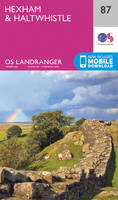
Sheet map, folded. Series: OS Landranger Map. BIC Classification: 1DBKEML; 1DBKEMN; WSZC; WTRM. Category: (G) General (US: Trade). Dimension: 135 x 229 x 58. Weight in Grams: 98.
- Publisher
- Ordnance Survey
- Publication date
- 2016
- Edition
- February 2016 ed
- Condition
- New
- SKU
- V9780319262276
- ISBN
- 9780319262276
Paperback
Condition: New
€ 17.99€ 14.28
€ 17.99
€ 14.28
.
- Publisher
- Ordnance Survey
- Publication date
- 2015
- Edition
- September 2015 ed
- Condition
- New
- SKU
- V9780319472880
- ISBN
- 9780319472880
Paperback
Condition: New
€ 23.99€ 17.77
€ 23.99
€ 17.77
Paperback. .
- Publisher
- Countryside Books
- Format
- Paperback
- Publication date
- 2014
- Condition
- New
- SKU
- V9781846743214
- ISBN
- 9781846743214
Paperback
Condition: New
€ 12.44
€ 12.44
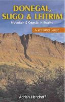
Paperback. The northwest of Ireland provides a diversity of walks, from the wild, untamed landscape of Donegal, with its mountains, sea-cliffs and glens, to the gentler hills, green valleys and picturesque escarpments of Sligo and Leitrim. Quality photographs and maps will inspire one to get the walking boots on and start exploring this majestic landscape. Num Pages: 160 pages, Maps and photographs. BIC Classification: 1DBR; WSZC; WTH. Category: (G) General (US: Trade). Dimension: 203 x 128 x 11. Weight in Grams: 252.
- Publisher
- Gill
- Number of pages
- 160
- Format
- Paperback
- Publication date
- 2012
- Condition
- New
- SKU
- V9781848891395
- ISBN
- 9781848891395
Paperback
Condition: New
€ 16.99€ 14.51
€ 16.99
€ 14.51
Paperback. .
- Publisher
- Hallewell Publications
- Format
- Paperback
- Publication date
- 2012
- Edition
- 0th Edition
- Condition
- New
- SKU
- V9781872405605
- ISBN
- 9781872405605
Paperback
Condition: New
€ 6.52
€ 6.52
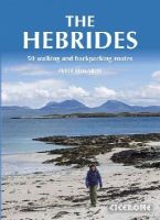
Paperback. Inspirational guidebook to 50 varied walking and backpacking routes in the Hebrides, featuring classics such as the Skye Cuillin and the Paps of Jura, but also many lesser-known routes on Jura, Scarba, Islay, Colonsay, Rum, Eigg, Canna, Muck, Coll, Tiree, Mull, Skye, Raasay, Harris, Lewis, Berneray, North Uist, South Uist, Barra and St Kilda. Num Pages: 256 pages. BIC Classification: 1DBKSHL; 1DBKSHQ; WSZC. Category: (G) General (US: Trade). Dimension: 173 x 241 x 20. Weight in Grams: 718.
- Publisher
- Cicerone Press Limited
- Format
- Paperback
- Publication date
- 2015
- Edition
- 1st Edition
- Condition
- New
- SKU
- V9781852847050
- ISBN
- 9781852847050
Paperback
Condition: New
€ 25.99€ 19.45
€ 25.99
€ 19.45
Sheet map, folded. .
- Publisher
- Ordnance Survey
- Publication date
- 2015
- Edition
- September 2015 ed
- Condition
- New
- SKU
- V9780319244166
- ISBN
- 9780319244166
Paperback
Condition: New
€ 17.99€ 14.31
€ 17.99
€ 14.31
Sheet map, folded. .
- Publisher
- Ordnance Survey
- Publication date
- 2015
- Edition
- September 2015 ed
- Condition
- New
- SKU
- V9780319246917
- ISBN
- 9780319246917
Paperback
Condition: New
€ 17.99€ 14.33
€ 17.99
€ 14.33
.
- Publisher
- Ordnance Survey
- Publication date
- 2015
- Edition
- September 2015 ed
- Condition
- New
- SKU
- V9780319245521
- ISBN
- 9780319245521
Paperback
Condition: New
€ 17.99€ 14.33
€ 17.99
€ 14.33
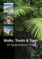
Paperback. Brings together more than 150 of the best walks, tracks or trails in Queensland's Tropics, located within the coastal strip between Rockhampton and Cooktown. Walks vary from short boardwalk strolls in the lowland rainforests of Daintree National Park to 4-6 day hiking and camping trips on Hinchinbrook Island. Num Pages: 288 pages, 500 full colour photographs, 120 maps. BIC Classification: 1MBFQ; WSZC; WTHC. Category: (G) General (US: Trade); (P) Professional & Vocational. Dimension: 175 x 241 x 18. Weight in Grams: 696.
- Publisher
- CSIRO Publishing
- Format
- Paperback
- Publication date
- 2016
- Condition
- New
- SKU
- V9781486303076
- ISBN
- 9781486303076
Paperback
Condition: New
€ 39.87
€ 39.87
Sheet map, folded. .
- Publisher
- Ordnance Survey
- Publication date
- 2016
- Edition
- February 2016 ed
- Condition
- New
- SKU
- V9780319261859
- ISBN
- 9780319261859
Paperback
Condition: New
€ 17.99€ 14.36
€ 17.99
€ 14.36


