Sport
Results 2353 - 2376 of 7639
Sport
Paperback. Num Pages: 320 pages, 20. BIC Classification: 1KBB; JFCA; JFSJ1; WSBX; WSTC. Category: (G) General (US: Trade). Dimension: 229 x 152. .
- Publisher
- ECW Press,Canada
- Format
- Paperback
- Publication date
- 2017
- Condition
- New
- SKU
- V9781770413078
- ISBN
- 9781770413078
Paperback
Condition: New
€ 24.99€ 18.54
€ 24.99
€ 18.54
Sisterhood in Sports takes a look at the unique needs of girls in sports and how to respond to and support those needs. Here, the author casts a light on the importance of friendships, relationships, and communication among girl athletes, and shows how parents and coaches can work with them to keep them engaged and progressing at every level. Num Pages: 216 pages. BIC Classification: JFSJ1; WS. Category: (G) General (US: Trade). Dimension: 240 x 162 x 29. Weight in Grams: 508.
- Publication date
- 2014
- Publisher
- Rowman & Littlefield United States
- Number of pages
- 216
- Condition
- New
- SKU
- V9781442230330
- ISBN
- 9781442230330
Paperback
Condition: New
€ 67.09
€ 67.09
Paperback. The most sought-after sports book of all time Num Pages: 448 pages, 2 x 8pp colour photos. BIC Classification: BGSA; WSJA. Category: (G) General (US: Trade). Dimension: 129 x 197 x 30. Weight in Grams: 316.
- Publication date
- 2008
- Number of pages
- 448
- Condition
- New
- Format
- Paperback
- Publisher
- Headline
- Edition
- 1st Paperback Printing
- SKU
- V9780755316205
- ISBN
- 9780755316205
Paperback
Condition: New
€ 17.99€ 13.37
€ 17.99
€ 13.37
Paperback. Num Pages: 310 pages, colour & b/w photos. BIC Classification: 1DBKENL; BGS; WSJA. Category: (G) General (US: Trade). Dimension: 180 x 113 x 21. Weight in Grams: 204.
- Publication date
- 2003
- Publisher
- Empire Publications Ltd United Kingdom
- Number of pages
- 310
- Condition
- New
- Format
- Paperback
- SKU
- V9781901746310
- ISBN
- 9781901746310
Paperback
Condition: New
€ 11.99€ 10.31
€ 11.99
€ 10.31
Paperback. Fifty fixtures that defined the most successful British manager ever. Series: Fifty Defining Fixtures. Num Pages: 160 pages, illustrations. BIC Classification: WSJA. Category: (G) General (US: Trade). Dimension: 232 x 155 x 13. Weight in Grams: 308.
- Format
- Paperback
- Publication date
- 2013
- Publisher
- Amberley Publishing United Kingdom
- Number of pages
- 160
- Condition
- New
- SKU
- V9781445621470
- ISBN
- 9781445621470
Paperback
Condition: New
€ 17.99€ 14.27
€ 17.99
€ 14.27
Paperback. Num Pages: 256 pages, black & white illustrations. BIC Classification: WSSN3. Category: (G) General (US: Trade). Dimension: 231 x 190 x 12. Weight in Grams: 438.
- Publisher
- McGraw-Hill Education - Europe
- Format
- Paperback
- Publication date
- 2014
- Edition
- 1st Edition
- Condition
- New
- SKU
- V9780071836531
- ISBN
- 9780071836531
Paperback
Condition: New
€ 36.99€ 31.01
€ 36.99
€ 31.01
Hardback. Num Pages: 208 pages, illustrations. BIC Classification: HBTM; RGR; WSSN. Category: (G) General (US: Trade). Dimension: 229 x 152 x 25. Weight in Grams: 454.
- Format
- Hardback
- Publication date
- 1999
- Publisher
- Sheridan House Australia Pty Ltd Australia
- Number of pages
- 208
- Condition
- New
- SKU
- V9781574090727
- ISBN
- 9781574090727
Hardback
Condition: New
€ 24.99€ 23.11
€ 24.99
€ 23.11
Paperback. 8vo .Illustrated. First edition..The Gaelic Athletic Association is an Irish amateur sporting and cultural organisation.It promotes traditional Irish sports including hurling ,gaelic football camogie and handball.
- Format
- Paperback
- Publication date
- 2011
- Condition
- Used, Very Good
- Edition
- 1st
- Publisher
- Halleluaj Press
- SKU
- KEX0307913
- ISBN
- 9780956661517
Paperback
Condition: Used, Very Good
€ 15.00
€ 15.00
Paperback. Wing Chun is a logical, scientific yet simple Chinese martial art system, which was developed for practical and effective self-defence. This book includes the fundamental principles together with a scientific and anatomical explanation of the basic principles underlying the Wing Chun system. Num Pages: 160 pages, 130 diagrams. BIC Classification: WSTM. Category: (G) General (US: Trade). Dimension: 233 x 165 x 11. Weight in Grams: 390. 160 pages, 130 diagrams. Wing Chun is a logical, scientific yet simple Chinese martial art system, which was developed for practical and effective self-defence. This book includes the fundamental principles together with a scientific and anatomical explanation of the basic principles underlying the Wing Chun system. Cateogry: (G) General (US: Trade). BIC Classification: WSTM. Dimension: 233 x 165 x 11. Weight: 372.
- Publisher
- Crowood Press
- Number of pages
- 160
- Format
- Paperback
- Publication date
- 2003
- Condition
- New
- SKU
- V9781861265968
- ISBN
- 9781861265968
Paperback
Condition: New
€ 19.99€ 18.49
€ 19.99
€ 18.49
Paperback. Num Pages: 124 pages, b/w illus. BIC Classification: WSJZ. Category: (G) General (US: Trade). Dimension: 208 x 142 x 10. Weight in Grams: 170.
- Publisher
- Burford Books,U.S. United States
- Number of pages
- 124
- Format
- Paperback
- Publication date
- 1998
- Condition
- New
- SKU
- V9781580800617
- ISBN
- 9781580800617
Paperback
Condition: New
€ 14.99€ 13.81
€ 14.99
€ 13.81
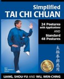
Paperback. With every movement presented in 2-4 large photos along with instructions, this title includes two popular sequences: Simplified 24 Posture Sequence created in China in 1956 to popularize tai chi worldwide, and the Standard 48 Posture Sequence created in 1976 to help intermediate students experience traditional movements in a mid-length form. Num Pages: 240 pages, 22 black & white illustrations, 595 black & white halftones. BIC Classification: WSTM. Category: (G) General (US: Trade). Dimension: 187 x 241 x 21. Weight in Grams: 694.
- Publisher
- Ymaa Publication Center
- Format
- Paperback
- Publication date
- 2014
- Edition
- Revised
- Condition
- New
- SKU
- V9781594392788
- ISBN
- 9781594392788
Paperback
Condition: New
€ 19.99€ 18.54
€ 19.99
€ 18.54
Paperback.
- Format
- Paperback
- Publication date
- 2013
- Publisher
- YMAA Publication Center United States
- Edition
- 2 Revised
- Number of pages
- 144
- Condition
- New
- SKU
- V9781594392696
- ISBN
- 9781594392696
Paperback
Condition: New
€ 17.99€ 16.49
€ 17.99
€ 16.49
Paperback. Num Pages: 176 pages, illustrations. BIC Classification: WSXF. Category: (G) General (US: Trade). Dimension: 186 x 232 x 8. Weight in Grams: 416.
- Publisher
- Stackpole Books
- Format
- Paperback
- Publication date
- 2015
- Condition
- New
- SKU
- V9780811713566
- ISBN
- 9780811713566
Paperback
Condition: New
€ 24.99€ 20.44
€ 24.99
€ 20.44
Paperback. Taking us back to the early nineteenth century, when baseball was played in the meadows and streets of Rochester, New York, this title retraces the careers of the players and managers who honed their skills at Silver Stadium and later at Frontier Field. Num Pages: 400 pages, 63 black-&-white illustrations, index. BIC Classification: 1KBBEY; 3JJ; WSJT. Category: (G) General (US: Trade). Dimension: 229 x 152 x 23. Weight in Grams: 544.
- Format
- Paperback
- Publication date
- 2010
- Publisher
- Syracuse University Press
- Edition
- 2nd Edition
- Condition
- New
- SKU
- V9780815609513
- ISBN
- 9780815609513
Paperback
Condition: New
€ 22.10
€ 22.10
Paperback. Silent Mind Golf removes the mystery behind the mental prowess that lies at the heart of peak performance. Num Pages: 160 pages. BIC Classification: WSDP; WSJG. Category: (G) General (US: Trade). Dimension: 199 x 126 x 7. Weight in Grams: 118. How to Empty Your Mind and Play Golf Instinctively. 160 pages. Silent Mind Golf removes the mystery behind the mental prowess that lies at the heart of peak performance. Cateogry: (G) General (US: Trade). BIC Classification: WSDP; WSJG. Dimension: 199 x 126 x 7. Weight: 158.
- Edition
- UK ed.
- Publisher
- Quarto Publishing PLC
- Number of pages
- 160
- Format
- Paperback
- Publication date
- 2012
- Condition
- New
- SKU
- V9781845138103
- ISBN
- 9781845138103
Paperback
Condition: New
€ 19.99€ 15.31
€ 19.99
€ 15.31
Paperback. At the 1968 Olympics, Tommie Smith came in first in the 200-meter dash. As they received their medals, he and bronze winner John Carlos each raised a black-gloved fist, creating an indelible image of courage and protest that still resonates forty years later. This autobiography presents the story of that moment. Num Pages: 288 pages, 15 b&w illustrations. BIC Classification: BGSA; WSK. Category: (G) General (US: Trade). Dimension: 227 x 154 x 16. Weight in Grams: 430.
- Publisher
- Temple University Press,U.S. United States
- Number of pages
- 288
- Format
- Paperback
- Publication date
- 2008
- Edition
- Reprint
- Condition
- New
- SKU
- V9781592136407
- ISBN
- 9781592136407
Paperback
Condition: New
€ 32.99€ 29.67
€ 32.99
€ 29.67
Paperback. Num Pages: 140 pages, 4 black & white illustrations, 55 black & white halftones. BIC Classification: WSSN. Category: (G) General (US: Trade). Dimension: 215 x 138 x 9. Weight in Grams: 180.
- Format
- Paperback
- Publication date
- 2010
- Publisher
- Rowman & Littlefield United States
- Number of pages
- 140
- Condition
- New
- SKU
- V9781574093094
- ISBN
- 9781574093094
Paperback
Condition: New
€ 18.99€ 17.37
€ 18.99
€ 17.37
Paperback. For the author, sports stadiums are cultural barometers. Empty or full, ultra-modern or decrepit, they offer an understanding of how fans and entire communities operate. Starting with Olympia and ending up at the venue for the 2000 Games in Sydney, he delivers a series of sporting tales. Num Pages: 320 pages, portraits. BIC Classification: WSBV. Category: (G) General (US: Trade). Dimension: 197 x 129 x 19. Weight in Grams: 240. Good clean copy with some minor shelf wear
- Format
- Paperback
- Publication date
- 2001
- Publisher
- Yellow Jersey
- Condition
- Used, Very Good
- SKU
- KKD0005228
- ISBN
- 9780224059695
Paperback
Condition: Used, Very Good
€ 17.95
€ 17.95
Paperback. Offers the sight-fishing tactics for various species, including striped bass, bluefish, spotted sea trout, snook, permit, bonefish, and barracuda. This book tells how to choose fly-fishing tackle, flies, spinning gear, and boats to maximize your flats fishing, and provides tips on sight-fishing the surf, mini-flats, tidal ponds, and shallow water. Num Pages: 106 pages, 100 colour photos & 7 b/w drawings. BIC Classification: WSXF. Category: (G) General (US: Trade). Dimension: 278 x 216 x 9. Weight in Grams: 464.
- Format
- Paperback
- Publication date
- 2008
- Publisher
- Stackpole Books
- Edition
- First American Edition
- Condition
- New
- SKU
- V9780811734653
- ISBN
- 9780811734653
Paperback
Condition: New
€ 23.99€ 19.69
€ 23.99
€ 19.69
Hardback. Num Pages: 194 pages, 235 colour photos & 36 b/w illus. BIC Classification: WSXF. Category: (G) General (US: Trade). Dimension: 240 x 190 x 19. Weight in Grams: 748.
- Publisher
- Stackpole Books United States
- Number of pages
- 194
- Format
- Hardback
- Publication date
- 2009
- Condition
- New
- SKU
- V9780811705516
- ISBN
- 9780811705516
Hardback
Condition: New
€ 37.99€ 29.47
€ 37.99
€ 29.47
Paperback. Even by the standards of a sport that requires enormous stamina and capacity for suffering, Jens Voigt is in a class on his own. Beloved by cycling fans for his madcap one-man breakaways as much as his sense of humour and quotable catchphrases, Jens is one of the most popular personalities in cycling. This book tells his story. Num Pages: 320 pages. BIC Classification: BGSA; WSBT; WSQ. Category: (G) General (US: Trade). Dimension: 198 x 129. .
- Publisher
- Ebury Press
- Format
- Paperback
- Publication date
- 2017
- Condition
- New
- SKU
- V9781785031755
- ISBN
- 9781785031755
Paperback
Condition: New
€ 19.99€ 15.07
€ 19.99
€ 15.07
Sheet map, folded. Series: OS Explorer Map. BIC Classification: 1DBKEMP; WSZC; WTRM. Category: (G) General (US: Trade). Dimension: 135 x 227 x 44. Weight in Grams: 98.
- Publisher
- Ordnance Survey
- Publication date
- 2015
- Edition
- September 2015 ed
- Condition
- New
- SKU
- V9780319244340
- ISBN
- 9780319244340
Paperback
Condition: New
€ 17.99€ 14.23
€ 17.99
€ 14.23
.
- Publisher
- Ordnance Survey
- Publication date
- 2015
- Edition
- September 2015 ed
- Condition
- New
- SKU
- V9780319471135
- ISBN
- 9780319471135
Paperback
Condition: New
€ 23.99€ 17.71
€ 23.99
€ 17.71
Sheet map, folded. .
- Publisher
- Ordnance Survey
- Publication date
- 2016
- Edition
- February 2016 ed
- Condition
- New
- SKU
- V9780319262245
- ISBN
- 9780319262245
Paperback
Condition: New
€ 17.99€ 14.32
€ 17.99
€ 14.32


