Travel
Results 3481 - 3504 of 6080
Travel
Paperback. From the bestselling author of Awakenings, The Man Who Mistook His Wife for a Hat and Musicophilia. Num Pages: 384 pages, Illustrations. BIC Classification: 1QSPS; JHM; PDZ; PSX; WTL. Category: (G) General (US: Trade). Dimension: 195 x 130 x 25. Weight in Grams: 314.
- Publisher
- Picador USA
- Number of pages
- 384
- Format
- Paperback
- Publication date
- 2012
- Condition
- New
- SKU
- V9780330526104
- ISBN
- 9780330526104
Paperback
Condition: New
€ 14.99€ 11.65
€ 14.99
€ 11.65
Paperback. Num Pages: 240 pages. BIC Classification: DNF; WTL. Category: (G) General (US: Trade). Dimension: 208 x 140 x 13. Weight in Grams: 222.
- Format
- Paperback
- Publication date
- 2013
- Publisher
- Poetry Wales Press United Kingdom
- Number of pages
- 168
- Condition
- New
- SKU
- V9781781721292
- ISBN
- 9781781721292
Paperback
Condition: New
€ 18.99€ 17.89
€ 18.99
€ 17.89
Paperback. Num Pages: 320 pages. BIC Classification: 1DBKSHQ; WTL. Category: (G) General (US: Trade). Dimension: 132 x 197 x 22. Weight in Grams: 230.
- Publisher
- Pan Macmillan
- Format
- Paperback
- Publication date
- 2016
- Edition
- Reprint
- Condition
- New
- SKU
- V9781509800773
- ISBN
- 9781509800773
Paperback
Condition: New
€ 14.99€ 11.80
€ 14.99
€ 11.80
Hardcover. Celebrating the achievements of Isabella Bird, this is a lavish pictorial record of her last great journey through China, in the closing years of the 19th century. Num Pages: 240 pages, full colour throughout, includes photographs, includes illustrations. BIC Classification: 1FPC; 3JH; AJCR; WTLC. Category: (G) General (US: Trade). Dimension: 285 x 244 x 31. Weight in Grams: 1642.
- Publisher
- GMC Publications
- Format
- Hardback
- Publication date
- 2015
- Condition
- New
- SKU
- V9781781450970
- ISBN
- 9781781450970
Hardback
Condition: New
€ 33.99€ 23.02
€ 33.99
€ 23.02
Paperback. A white-knuckle ride around Australia on a green bike. From the author of Don't Tell Mum I Work on the Rigs (She Thinks I'm a Piano Player in a Whorehouse). Num Pages: 288 pages. BIC Classification: 1MBF; WGCK; WTL. Category: (G) General (US: Trade). Dimension: 201 x 131 x 29. Weight in Grams: 206.
- Publisher
- Nicholas Brealey Publishing
- Format
- Paperback
- Publication date
- 2016
- Condition
- New
- SKU
- V9781857886535
- ISBN
- 9781857886535
Paperback
Condition: New
€ 13.99€ 11.12
€ 13.99
€ 11.12
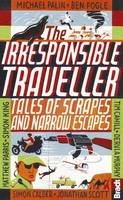
Paperback. The Irresponsible Traveller - Travel literature collection of travels gone awry including stories by top travel writers and celebrities on the roads less travelled. This guide includes tales by Michael Palin, Ben Fogle and Simon Calder as well as other stories of adventurous, off-the-beaten-track travels, ideal holiday reading, travel inspiration. Editor(s): Barclay, Jennifer; Phillips, Adrian. Series: Bradt Travel Guides (Travel Literature). Num Pages: 240 pages, black & white illustrations. BIC Classification: WTL. Category: (G) General (US: Trade). Dimension: 132 x 198 x 19. Weight in Grams: 284.
- Publisher
- Globe Pequot Press
- Format
- Paperback
- Publication date
- 2014
- Edition
- 1st Edition
- Condition
- New
- SKU
- V9781841625621
- ISBN
- 9781841625621
Paperback
Condition: New
€ 19.99€ 17.30
€ 19.99
€ 17.30
Num Pages: 176 pages, 460 color photos. BIC Classification: WT. Category: (G) General (US: Trade). Dimension: 286 x 221 x 20. Weight in Grams: 1186.
- Publication date
- 2009
- Publisher
- Schiffer Publishing Ltd United States
- Number of pages
- 176
- Condition
- New
- SKU
- V9780764332623
- ISBN
- 9780764332623
Paperback
Condition: New
€ 54.02€ 39.73
€ 54.02
€ 39.73
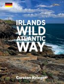
paperback. Take a photographic journey along the Wild Atlantic Way with this sumptuous book of 200 photographs, maps, and quotations the west coast of Ireland. In German. Translator(s): Krieger, Ina. Num Pages: 160 pages. BIC Classification: AJ; WTH. Category: (G) General (US: Trade). Dimension: 199 x 261 x 13. Weight in Grams: 648.
- Format
- Paperback
- Publication date
- 2016
- Publisher
- O'Brien Press Ltd
- Condition
- New
- SKU
- 9781847178367
- ISBN
- 9781847178367
Paperback
Condition: New
€ 13.23
€ 13.23
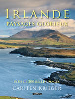
Paperback. An atmospheric collection of over 200 wonderful photographs showing the beauty and diversity of Ireland's landscape. Translator(s): Pironko, Svetlana. Num Pages: 144 pages, 205 colour illustrations. BIC Classification: AJC; WTM. Category: (G) General (US: Trade). Dimension: 259 x 197 x 10. Weight in Grams: 592.
- Publisher
- O´Brien Press Ltd
- Number of pages
- 144
- Format
- Paperback
- Publication date
- 2013
- Condition
- New
- SKU
- V9781847173621
- ISBN
- 9781847173621
Paperback
Condition: New
€ 14.99€ 13.21
€ 14.99
€ 13.21
Paperback. This unique reference book is an excellent resource for learners of Irish, and, in addition, provides invaluable information essential for the traveller to Ireland, including: English phrases translated into Irish, clear pronunciations for each phrase, useful phrases for every situation, and comprehensive vocabulary sections. Num Pages: 256 pages. BIC Classification: 2AFR; WTK. Category: (G) General (US: Trade). Dimension: 105 x 147 x 34. Weight in Grams: 138.
- Publisher
- Geddes & Grosset
- Format
- Paperback
- Publication date
- 2007
- Condition
- New
- SKU
- V9781842051122
- ISBN
- 9781842051122
Paperback
Condition: New
€ 6.57
€ 6.57
Paperback. Series: Pocket Guides. Num Pages: 128 pages. BIC Classification: 1DBR; AMKL; WTH. Category: (G) General (US: Trade). Dimension: 188 x 122 x 11. Weight in Grams: 138.
- Publisher
- Appletree Press Ltd
- Format
- Paperback
- Publication date
- 2006
- Edition
- New edition
- Condition
- New
- SKU
- V9780862819910
- ISBN
- 9780862819910
Paperback
Condition: New
€ 9.70
€ 9.70
Hardback. "This tribute to the Land of Welcomes captures the spirit of the Irish people in traditional blessings and classic verse. Featuring beautiful full-color photographs of the Emerald Isle, this inspiring" Num Pages: 128 pages, 30 colour photos. BIC Classification: 1DBR; AJC; JFHF; WTM. Category: (G) General (US: Trade). Dimension: 145 x 171 x 14. Weight in Grams: 64.
- Publisher
- Running Press United States
- Number of pages
- 128
- Format
- Hardback
- Publication date
- 1999
- Condition
- New
- SKU
- V9780762404506
- ISBN
- 9780762404506
Hardback
Condition: New
€ 8.36
€ 8.36
Paperback. Renowned walking guide author Helen Fairbairn explores the best walking routes of Ireland's Wild Atlantic Way. Illustrated with colour photos and detailed maps, this comprehensive guide is all that's needed to plan a walk on the Wild Atlantic Way whatever your level of expertise. Series: The Collins Press Guide. Num Pages: 176 pages, 60 colour photos and maps. BIC Classification: 1DBR; WSZC; WTH. Category: (G) General (US: Trade). Dimension: 200 x 238 x 11. Weight in Grams: 270.
- Publisher
- The Collins Press
- Format
- Paperback
- Publication date
- 2016
- Condition
- New
- SKU
- V9781848892675
- ISBN
- 9781848892675
Paperback
Condition: New
€ 16.99€ 14.51
€ 16.99
€ 14.51
Paperback. Take a photographic journey along the Wild Atlantic Way with this sumptuous book of 200 photographs, maps, and quotations about the west coast of Ireland. Num Pages: 160 pages, illustrations. BIC Classification: 1DBR; WTM. Category: (G) General (US: Trade). Dimension: 261 x 200 x 13. Weight in Grams: 650.
- Format
- Paperback
- Publication date
- 2015
- Publisher
- O´Brien Press Ltd
- Condition
- New
- SKU
- 9781847176967
- ISBN
- 9781847176967
Paperback
Condition: New
€ 16.99€ 13.23
€ 16.99
€ 13.23
Paperback. This definitive guide explains everything you need to know as a walker before setting out on your County High Point quests. Each county-focused chapter contains a brief county profile and detailed walking route descriptions accompanied by easy-to-read maps. Num Pages: 192 pages, Maps and photographs. BIC Classification: 1DBR; WSZC; WTH. Category: (G) General (US: Trade). Dimension: 203 x 141 x 11. Weight in Grams: 304.
- Publisher
- Gill
- Number of pages
- 192
- Format
- Paperback
- Publication date
- 2012
- Condition
- New
- SKU
- V9781848891401
- ISBN
- 9781848891401
Paperback
Condition: New
€ 16.99€ 14.51
€ 16.99
€ 14.51
Paperback. Ireland's Coast showcases Ireland's landscape, wildlife and people, interspersed with stories and anecdotes compiled over the author's two years of travel. This evocative collection of images of Ireland's coast in all its splendour is perfect for native or visitor. Num Pages: 144 pages. BIC Classification: 1DBR; AJC; WT. Category: (G) General (US: Trade). Dimension: 260 x 198. .
- Publisher
- O´Brien Press Ltd
- Number of pages
- 144
- Format
- Paperback
- Publication date
- 2016
- Condition
- New
- SKU
- V9781847178220
- ISBN
- 9781847178220
Paperback
Condition: New
€ 14.99€ 13.21
€ 14.99
€ 13.21
Paperback. In a country richly endowed with wild mountain ranges, secluded valleys and untamed coastlines, the best natural landscapes can only be explored on foot. Here are over sixty of the greatest one-day walking routes in Ireland, varying from short strolls to full-day treks. Every part of the Republic and Northern Ireland is featured. Num Pages: 224 pages, maps and colour photos. BIC Classification: 1DBR; WSZC; WTH. Category: (G) General (US: Trade). Dimension: 199 x 176 x 14. Weight in Grams: 350.
- Publisher
- The Collins Press
- Format
- Paperback
- Publication date
- 2014
- Condition
- New
- SKU
- V9781848892118
- ISBN
- 9781848892118
Paperback
Condition: New
€ 16.99€ 14.51
€ 16.99
€ 14.51
Paperback. From the cliffs of Slieve League to the columns of the Giant's Causeway, from Belfast's copper domes to Donegal's pale sands, Ireland's Beautiful North introduces the complex rewards of Ulster. Num Pages: 112 pages. BIC Classification: 1DBR; WTH; WTM. Category: (G) General (US: Trade). Dimension: 260 x 198 x 8. .
- Format
- Paperback
- Publication date
- 2017
- Publisher
- O´Brien Press Ltd
- Condition
- New
- SKU
- 9781847178350
- ISBN
- 9781847178350
Paperback
Condition: New
€ 12.99€ 11.92
€ 12.99
€ 11.92
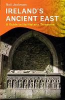
Paperback. Ireland's Ancient East is a new campaign that offers visitors a view of a different Ireland. This first guide to this brand new venture showcases 100 sites across the region. Num Pages: 272 pages, 100 colour photos. BIC Classification: 1DBR; HBJD1; HDD; WTH. Category: (G) General (US: Trade). Dimension: 130 x 199 x 22. Weight in Grams: 542.
- Publisher
- The Collins Press
- Format
- Paperback
- Publication date
- 2016
- Condition
- New
- SKU
- V9781848892705
- ISBN
- 9781848892705
Paperback
Condition: New
€ 19.99€ 16.44
€ 19.99
€ 16.44
Paperback. Keywords: "Special Features - Used Books - Travel & Holiday - Guidebook Series - Lonely Planet,Subjects - Travel & Holiday - Countries & Regions - Europe - Ireland - General,Subjects - Travel & Holiday - Guidebo"
- Condition
- Used, Good
- Publisher
- Lonely Planet Publications Australia
- Format
- Paperback
- Publication date
- 1996
- Edition
- 2nd Edition
- SKU
- KEX0182965
- ISBN
- 9780864423528
Paperback
Condition: Used, Good
€ 4.99
€ 4.99
Sheet map, folded.
- Condition
- Used, Like New
- Publisher
- HarperCollins Publishers Glasgow
- Publication date
- 2010
- Edition
- New edition
- SKU
- KRS0003363
- ISBN
- 9780007320721
Paperback
Condition: Used, Like New
€ 8.49
€ 8.49
Paperback. ?Everything the food lover traveling in Ireland needs to know: an evocative, highly illustrated region-by-region guide, explaining where to find and buy the best local foods, where to eat themand how to cook them at home. Num Pages: 316 pages, Full colour photography throughout. BIC Classification: 1DBR; WTH; WTHR. Category: (G) General (US: Trade). Dimension: 254 x 200 x 19. Weight in Grams: 1064.
- Publisher
- Georgina Campbell's Guides Ltd Dublin
- Number of pages
- 316
- Format
- Paperback
- Publication date
- 2011
- Condition
- New
- SKU
- V9781903164297
- ISBN
- 9781903164297
Paperback
Condition: New
€ 20.00€ 16.97
€ 20.00
€ 16.97
Hardback. Very good copy with light shelf wear
- Publication date
- 1986
- Condition
- Used, Very Good
- Format
- Hardback
- Publisher
- Mount Eagle Publications Ltd
- SKU
- KCW0005338
- ISBN
- 9780863220821
Hardback
Condition: Used, Very Good
€ 4.99
€ 4.99
Paperback. Series: Culture Smart!. Num Pages: 168 pages. BIC Classification: 1DBR; JFCA; WTH. Category: (G) General (US: Trade). .
- Publisher
- Kuperard
- Format
- Paperback
- Publication date
- 2016
- Edition
- 2nd Edition
- Condition
- New
- SKU
- V9781857338423
- ISBN
- 9781857338423
Paperback
Condition: New
€ 11.36
€ 11.36


