Travel maps & atlases
Results 25 - 33 of 33
Travel maps & atlases
Paperback. First published in 1953, the year that saw thousands descend on London to watch the coronation of Queen Elizabeth II, this is a lexicon of the city's curiosities, from the Achilles statue in Hyde Park 'erected by the women of England to honour (if not to resemble) the Duke of Wellington', to zebra crossings (relative newcomers to London in 1953). Num Pages: 152 pages, illustrations. BIC Classification: 1DBKESL; WTRS. Category: (G) General (US: Trade). Dimension: 111 x 179 x 19. Weight in Grams: 124.
- Format
- Paperback
- Publication date
- 2016
- Publisher
- Thames & Hudson Ltd
- Condition
- New
- SKU
- 9780500292471
- ISBN
- 9780500292471
Paperback
Condition: New
€ 8.99€ 5.70
€ 8.99
€ 5.70
Paperback. Vikings were more than just marine warriors. This atlas shows their development as traders and craftsmen, explorers, settlers and mercenaries. It contains over sixty colour maps, and follows the tracks of the Viking merchants who travelled deep into Russia, and of Viking mercenaries who served in the emperor's bodyguard at Constantinople. Num Pages: 144 pages, colour illustrations, maps, diagrams, further reading, index. BIC Classification: 1DN; HBJD; HBLC; WTRM. Category: (G) General (US: Trade). Dimension: 246 x 179 x 9. Weight in Grams: 394.
- Edition
- 01st Edition
- Publisher
- Penguin
- Format
- Paperback
- Publication date
- 1995
- Condition
- New
- SKU
- V9780140513288
- ISBN
- 9780140513288
Paperback
Condition: New
€ 27.99€ 18.16
€ 27.99
€ 18.16
Hardcover. Provides an illustrated account of the role that charts have played in planning, preventing, conducting and recording war on water. An introduction discusses the major themes with regard to naval warfare, navigation, and chart-making. The first chapter covers the period from earliest recorded history to the fifteenth century. Num Pages: 160 pages, 150 illustrations. BIC Classification: HBTM; JWF; TRLN; WTRM. Category: (G) General (US: Trade). Dimension: 313 x 290 x 17. Weight in Grams: 1306.
- Format
- Hardback
- Publication date
- 2006
- Publisher
- Conway
- Condition
- New
- SKU
- 9781844860319
- ISBN
- 9781844860319
Hardback
Condition: New
€ 23.99€ 8.87
€ 23.99
€ 8.87
Sheet map. Series: Insight Flexi Maps. Num Pages: 1 pages. BIC Classification: 1HFMS; WTRS. Category: (G) General (US: Trade). Dimension: 170 x 217 x 9. Weight in Grams: 56.
- Edition
- 3rd Edition
- Publisher
- APA Publications
- Publication date
- 2012
- Condition
- New
- SKU
- KRD0000083
- ISBN
- 9781780054162
Hardback
Condition: New
€ 4.99
€ 4.99
Sheet map. The main railway line from London Waterloo to the Atlantic coast of Devon and Cornwall was never planned as a complete through route. This title shows the route and local features of the Southern Railway as it was in 1924, and includes historical and contextual information about the line, its construction and its use in the days of steam. Series: Old House. BIC Classification: 1DBK; WGF; WTR. Category: (G) General (US: Trade). Dimension: 152 x 209 x 6. Weight in Grams: 116. New.
- Publisher
- Old House Books
- Publication date
- 2011
- Condition
- New
- SKU
- 9781908402042
- ISBN
- 9781908402042
Hardback
Condition: New
€ 12.23
€ 12.23
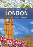
hardcover. Features 6 colour-coded districts, each with its own large-scale fold-out map. In this title, a spread at the front highlights the 10 sights you shouldn't miss; one at the back highlights the 10 best things to do when in London. It details of more than 100 restaurants, bars, cafes, shops, clubs, markets and art galleries. Editor(s): Pisano, Sandra. Num Pages: 56 pages. BIC Classification: 1DBKESL; WTH; WTRS. Category: (G) General (US: Trade). Dimension: 135 x 272 x 23. Weight in Grams: 190.
- Format
- Hardback
- Publication date
- 2012
- Publisher
- Everyman Citymap Guides
- Condition
- New
- SKU
- 9781841595702
- ISBN
- 9781841595702
Hardback
Condition: New
€ 8.99€ 5.80
€ 8.99
€ 5.80
Sheet map, folded.
- Condition
- Used, Like New
- Publisher
- HarperCollins Publishers Glasgow
- Publication date
- 2010
- Edition
- New edition
- SKU
- KRS0003363
- ISBN
- 9780007320721
Hardback
Condition: Used, Like New
€ 8.49
€ 8.49
Sheet map. Series: Insight Travel Maps. Num Pages: 2 pages, colour. BIC Classification: 1KBBWF; WTRD. Category: (G) General (US: Trade). Dimension: 243 x 132 x 16. Weight in Grams: 158.
- Publisher
- APA Publications
- Publication date
- 2012
- Condition
- New
- SKU
- KSG0015474
- ISBN
- 9781780054346
Hardback
Condition: New
€ 4.99
€ 4.99
map. Series: Michelin Local Maps. BIC Classification: 1DDF; WTRM. Category: (G) General (US: Trade). Dimension: 116 x 252 x 16. Weight in Grams: 116.
- Publication date
- 2016
- Publisher
- Travel House Media
- Condition
- New
- SKU
- 9782067210806
- ISBN
- 9782067210806
Hardback
Condition: New
€ 12.99€ 6.23
€ 12.99
€ 6.23
.png)


