Travel maps & atlases
Results 1181 - 1200 of 1250
Travel maps & atlases
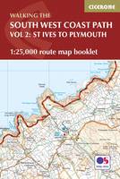
Paperback. Map of part of the southern section of the 630 mile (1014km) South West Coast Path National Trail. Covers the trail from St Ives to Plymouth along the west Cornwall and Devon coastline. This convenient and compact booklet of Ordnance Survey 1:25,000 maps shows the route, providing all of the mapping you need to walk the trail in either direction. Num Pages: 88 pages, OS 1:25,000 mapping and map legend. BIC Classification: 1DBKEW; WSZC; WTR. Category: (G) General (US: Trade). Dimension: 121 x 179 x 8. Weight in Grams: 120.
- Publisher
- Cicerone Press
- Format
- Paperback
- Publication date
- 2017
- Condition
- New
- SKU
- V9781852849375
- ISBN
- 9781852849375
Paperback
Condition: New
€ 17.99€ 14.13
€ 17.99
€ 14.13
Paperback. Map of the 77-mile (123km) Great Glen Way (one of Scotland's Great Trails), between Fort William and Inverness. This booklet of Ordnance Survey 1:25,000 maps shows the full route, providing all of the mapping you need to complete the trail. The route typically takes a week to walk, and is suitable for walkers at all levels of experience. Num Pages: 48 pages. BIC Classification: 1DBKSH; WSZC; WTRM. Category: (G) General (US: Trade). Dimension: 166 x 106 x 5. .
- Publisher
- Cicerone Press
- Format
- Paperback
- Publication date
- 2016
- Condition
- New
- SKU
- V9781852848958
- ISBN
- 9781852848958
Paperback
Condition: New
€ 13.99€ 11.60
€ 13.99
€ 11.60
Sheet map. Num Pages: 1 pages, 7 city plans; 3 area maps. BIC Classification: 1FMV; WTRM. Category: (G) General (US: Trade). Dimension: 250 x 115 x 8. Weight in Grams: 72.
- Publisher
- Periplus Editions (HK) ltd.
- Publication date
- 2014
- Edition
- 8th Edition
- Condition
- New
- SKU
- V9780794607494
- ISBN
- 9780794607494
Paperback
Condition: New
€ 10.99€ 9.37
€ 10.99
€ 9.37
Sheet map, folded. Num Pages: 1 City Plan; 1 Area Map. BIC Classification: 1FPC; WTRM. Category: (G) General (US: Trade). Dimension: 214 x 109 x 4. Weight in Grams: 70.
- Publisher
- Periplus Editions United States
- Publication date
- 2011
- Edition
- 5 Rev ed
- Condition
- New
- SKU
- V9780794606428
- ISBN
- 9780794606428
Paperback
Condition: New
€ 9.99€ 9.66
€ 9.99
€ 9.66
Sheet map, folded. BIC Classification: 1FPCH; 1FPCM; WTRM. Category: (G) General (US: Trade). Dimension: 251 x 113 x 8. Weight in Grams: 70.
- Publisher
- Periplus Editions (HK) ltd.
- Publication date
- 2013
- Edition
- 6th Revised edition
- Condition
- New
- SKU
- V9780794607111
- ISBN
- 9780794607111
Paperback
Condition: New
€ 9.99€ 9.54
€ 9.99
€ 9.54
Sheet map, folded. Each of the maps in the Periplus Wall Maps series are all available in a user-friendly format. Num Pages: 1 pages. BIC Classification: 1FMP; WTR. Category: (G) General (US: Trade). Dimension: 281 x 276 x 11. Weight in Grams: 156.
- Publisher
- Periplus Editions (HK) ltd.
- Publication date
- 2016
- Edition
- 2 Fol Map
- Condition
- New
- SKU
- V9780794607869
- ISBN
- 9780794607869
Paperback
Condition: New
€ 10.99€ 10.07
€ 10.99
€ 10.07
map. Num Pages: 7 Area Maps; 6 City Plans. BIC Classification: 1FMN; WTRM. Category: (G) General (US: Trade). Dimension: 260 x 77 x 3. Weight in Grams: 70.
- Publisher
- Periplus Editions
- Publication date
- 2012
- Edition
- Fifth
- Condition
- New
- SKU
- V9780794607005
- ISBN
- 9780794607005
Paperback
Condition: New
€ 9.99€ 9.55
€ 9.99
€ 9.55
Sheet map, folded. Num Pages: 5 City Plans; 7 Area Maps. BIC Classification: 1FML; WTR. Category: (G) General (US: Trade). Dimension: 214 x 110 x 10. Weight in Grams: 60.
- Publisher
- Periplus Editions (HK) ltd.
- Publication date
- 2013
- Edition
- 3 Fol Map
- Condition
- New
- SKU
- V9780794607319
- ISBN
- 9780794607319
Paperback
Condition: New
€ 9.99€ 9.47
€ 9.99
€ 9.47
Paperback. Num Pages: 144 pages. BIC Classification: 1FMNB; WTRS. Category: (G) General (US: Trade). Dimension: 272 x 199 x 8. Weight in Grams: 384.
- Publisher
- Tuttle Publishing
- Format
- Paperback
- Publication date
- 2015
- Edition
- 4th Edition
- Condition
- New
- SKU
- V9780804845298
- ISBN
- 9780804845298
Paperback
Condition: New
€ 19.99€ 14.71
€ 19.99
€ 14.71
Sheet map, folded. Num Pages: 6 city plans; 6 area maps. BIC Classification: 1FPJ; WTR. Category: (G) General (US: Trade). Dimension: 113 x 261 x 8. Weight in Grams: 70.
- Publisher
- Tuttle Publishing
- Publication date
- 2015
- Edition
- Bilingual
- Condition
- New
- SKU
- V9784805313381
- ISBN
- 9784805313381
Paperback
Condition: New
€ 9.99€ 9.58
€ 9.99
€ 9.58
Sheet map, folded. Num Pages: 8 city plans; 4 area maps. BIC Classification: 1FMT; WTR. Category: (G) General (US: Trade). Dimension: 262 x 112 x 8. Weight in Grams: 102.
- Publisher
- Periplus Editions (HK) ltd.
- Publication date
- 2015
- Edition
- 7th Revised edition
- Condition
- New
- SKU
- V9780794607081
- ISBN
- 9780794607081
Paperback
Condition: New
€ 10.99€ 9.30
€ 10.99
€ 9.30
Sheet map, folded. Num Pages: 5 city plans, 4 area maps. BIC Classification: 1FPC; WTRM. Category: (G) General (US: Trade). Dimension: 263 x 111 x 10. Weight in Grams: 72.
- Publisher
- Periplus Editions (HK) ltd.
- Publication date
- 2015
- Edition
- 8th ed.
- Condition
- New
- SKU
- V9780794607715
- ISBN
- 9780794607715
Paperback
Condition: New
€ 9.99€ 9.54
€ 9.99
€ 9.54
Sheet map, folded. Num Pages: 1 pages, maps. BIC Classification: 1FKA; WTRM. Category: (G) General (US: Trade). Dimension: 232 x 110 x 9. Weight in Grams: 72.
- Publisher
- Periplus Editions (HK) ltd.
- Number of pages
- 1
- Publication date
- 2013
- Edition
- 3rd edition
- Condition
- New
- SKU
- V9780794607265
- ISBN
- 9780794607265
Paperback
Condition: New
€ 9.99€ 9.57
€ 9.99
€ 9.57
Sheet map, folded. Num Pages: 5 city plans; 8 area maps. BIC Classification: 1MBF; WTRM. Category: (G) General (US: Trade). Dimension: 112 x 262 x 9. Weight in Grams: 70.
- Publisher
- Periplus Editions (HK) ltd.
- Publication date
- 2015
- Edition
- 6th Edition
- Condition
- New
- SKU
- V9780794607685
- ISBN
- 9780794607685
Paperback
Condition: New
€ 9.99€ 9.54
€ 9.99
€ 9.54
Sheet map, folded. Num Pages: colour illustrations, maps. BIC Classification: 1FMM; WTRM. Category: (G) General (US: Trade). Dimension: 260 x 83 x 5. Weight in Grams: 70.
- Publisher
- Periplus Editions United States
- Publication date
- 2012
- Edition
- 7 Map
- Condition
- New
- SKU
- V9780794607043
- ISBN
- 9780794607043
Paperback
Condition: New
€ 10.99€ 9.30
€ 10.99
€ 9.30
Sheet map, folded. Num Pages: 1 pages, 2 City Plans; 2 Area Maps. BIC Classification: 1FMS; WTRM. Category: (G) General (US: Trade). Dimension: 124 x 218 x 8. Weight in Grams: 70.
- Publisher
- Periplus Editions (HK) ltd.
- Publication date
- 2014
- Edition
- 13th ed.
- Condition
- New
- SKU
- V9780794607616
- ISBN
- 9780794607616
Paperback
Condition: New
€ 10.99€ 9.30
€ 10.99
€ 9.30
Sheet map, folded. Num Pages: 1 pages, maps. BIC Classification: 1FMN; WTRM. Category: (G) General (US: Trade). Dimension: 113 x 262 x 3. Weight in Grams: 72.
- Publisher
- Tuttle Publishing United States
- Number of pages
- 1
- Publication date
- 2013
- Edition
- 5th ed.
- Condition
- New
- SKU
- V9780794607258
- ISBN
- 9780794607258
Paperback
Condition: New
€ 9.99€ 9.54
€ 9.99
€ 9.54
Sheet map, folded. Num Pages: 1 Area Map; 5 City Plans. BIC Classification: 1FMB; WTR. Category: (G) General (US: Trade). Dimension: 261 x 116 x 7. Weight in Grams: 74.
- Publisher
- Periplus Editions (HK) ltd.
- Publication date
- 2014
- Edition
- 4th Edition
- Condition
- New
- SKU
- V9780794607623
- ISBN
- 9780794607623
Paperback
Condition: New
€ 9.99€ 9.61
€ 9.99
€ 9.61
Sheet map, folded. Num Pages: 4 Area Maps; 2 City Plans. BIC Classification: 1FMN; 1FMNB; WTRM. Category: (G) General (US: Trade). Dimension: 249 x 112 x 7. Weight in Grams: 72.
- Publisher
- Periplus Editions (HK) ltd.
- Publication date
- 2013
- Edition
- 4th ed.
- Condition
- New
- SKU
- V9780794607425
- ISBN
- 9780794607425
Paperback
Condition: New
€ 9.99€ 9.54
€ 9.99
€ 9.54
Hardcover. The years between the end of the American Revolution and the beginning of the Civil War were crucial ones in the history of American coastal charting. This volume contains these navigational charts, as well as a detailed look at the hydrographers and companies who produced them. Num Pages: 272 pages, 140 charts. BIC Classification: 1KBB; 3JF; 3JH; WC; WTRM. Category: (G) General (US: Trade). Dimension: 312 x 234 x 24. Weight in Grams: 1526.
- Publisher
- Schiffer Publishing
- Format
- Hardback
- Publication date
- 1999
- Edition
- First Edition
- Condition
- New
- SKU
- V9780887400193
- ISBN
- 9780887400193
Hardback
Condition: New
€ 63.92€ 46.24
€ 63.92
€ 46.24


