Travel maps & atlases
Results 25 - 33 of 33
Travel maps & atlases
Sheet map. Series: Insight Travel Maps. Num Pages: 2 pages, colour. BIC Classification: 1KBBWF; WTRD. Category: (G) General (US: Trade). Dimension: 243 x 132 x 16. Weight in Grams: 158.
- Publisher
- APA Publications
- Publication date
- 2012
- Condition
- New
- SKU
- KSG0015474
- ISBN
- 9781780054346
Condition: New
€ 4.99
€ 4.99
spiral_bound. Philip's Big Road Atlas Britain and Ireland 2017 is a large-format spiral-bound atlas featuring fully updated maps from the Philip's digital database, which has been voted Britain's clearest and most detailed in an independent consumer survey. Num Pages: 168 pages. BIC Classification: 1DBK; 1DBR; WTRD. Category: (G) General (US: Trade). Dimension: 296 x 397 x 15. Weight in Grams: 956.
- Publisher
- Octopus Publishing Group London
- Format
- Spiralbound
- Publication date
- 2016
- Condition
- New
- SKU
- KTG0016199
- ISBN
- 9781849074155
Spiralbound
Condition: New
€ 4.99
€ 4.99
Sheet map, folded. Step into the fun and thrills of Orlando & Walt Disney World with this handy, pop-up map. This pocket-sized Orlando map includes 2 PopOut maps of Greater Orlando & Walt Disney World and detail maps of Universal Orlando, Seaworld and a locator map of Central Florida. Ideal to pop in a pocket or bag for quick reference while enjoying the parks. Series: PopOut Maps. Num Pages: 2 pages. BIC Classification: 1KBBFL; WTRS. Category: (G) General (US: Trade). Dimension: 97 x 132 x 6. Weight in Grams: 36.
- Publisher
- Compass Maps
- Publication date
- 2014
- Edition
- Map
- Condition
- New
- SKU
- KAK0001989
- ISBN
- 9781845879853
Spiralbound
Condition: New
€ 4.99
€ 4.99
Paperback. Vikings were more than just marine warriors. This atlas shows their development as traders and craftsmen, explorers, settlers and mercenaries. It contains over sixty colour maps, and follows the tracks of the Viking merchants who travelled deep into Russia, and of Viking mercenaries who served in the emperor's bodyguard at Constantinople. Num Pages: 144 pages, colour illustrations, maps, diagrams, further reading, index. BIC Classification: 1DN; HBJD; HBLC; WTRM. Category: (G) General (US: Trade). Dimension: 246 x 179 x 9. Weight in Grams: 394.
- Edition
- 01st Edition
- Publisher
- Penguin
- Format
- Paperback
- Publication date
- 1995
- Condition
- New
- SKU
- V9780140513288
- ISBN
- 9780140513288
Paperback
Condition: New
€ 27.99€ 18.16
€ 27.99
€ 18.16
Sheet map. Series: Insight Flexi Maps. Num Pages: 1 pages. BIC Classification: 1HFMS; WTRS. Category: (G) General (US: Trade). Dimension: 170 x 217 x 9. Weight in Grams: 56.
- Edition
- 3rd Edition
- Publisher
- APA Publications
- Publication date
- 2012
- Condition
- New
- SKU
- KRD0000083
- ISBN
- 9781780054162
Paperback
Condition: New
€ 4.99
€ 4.99
Sheet map, folded. Scale: 7.5 miles to 1inch. Handy little full colour map of Ireland. It is double-sided with the south of Ireland up to and including Dublin on one side and from Dublin northwards on the reverse. Ideal for the pocket, bag or glovebox of the car. BIC Classification: 1DBR; WTR. Category: (G) General (US: Trade). Dimension: 140 x 90. Weight in Grams: 38.
- Publisher
- HarperCollins Publishers
- Publication date
- 2010
- Condition
- Used, Like New
- SKU
- KRS0003693
- ISBN
- 9780007349210
Paperback
Condition: Used, Like New
€ 4.99
€ 4.99
Sheet map, folded.
- Publisher
- Ordnance Survey Ireland
- Publication date
- 2003
- Edition
- 2nd Revised edition
- Condition
- New
- SKU
- 9781903974308
- ISBN
- 9781903974308
Paperback
Condition: New
€ 7.41
€ 7.41
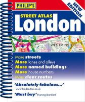
Spiral bound. A new edition of this handy mini spiral format that fits easily into a pocket, briefcase or handbag. This detailed colour mini street atlas covers all of London from Richmond to Greenwich and from Highgate to Streatham, with enlarged maps of central London from Earl's Court to Tower Bridge. Series: Philip's Street Atlases. Num Pages: 320 pages, colour maps. BIC Classification: 1DBKESL; WTRS. Category: (G) General (US: Trade). Dimension: 146 x 120 x 20. Weight in Grams: 224.
- Publisher
- Octopus Publishing Group
- Format
- Spiralbound
- Publication date
- 2012
- Condition
- New
- SKU
- KRS0029196
- ISBN
- 9781849072083
Spiralbound
Condition: New
€ 4.99
€ 4.99
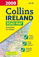
Sheet map, folded. Full colour map of Ireland at 9 miles to 1 inch (1:570,240), with clear, detailed road network and counties and administrative areas shown in colour. Num Pages: With index. BIC Classification: 1DBR; WTR. Category: (G) General (US: Trade). Dimension: 245 x 140. Weight in Grams: 79.
- Condition
- Used, Like New
- Publisher
- HarperCollins Publishers Cheltenham
- Publication date
- 2008
- Edition
- New edition
- SKU
- KRS0003573
- ISBN
- 9780007272518
Spiralbound
Condition: Used, Like New
€ 4.99
€ 4.99
.png)
