Travel maps & atlases
Results 481 - 500 of 1173
Travel maps & atlases
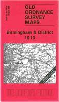
Sheet map, folded. Series: Old O.S. One Inch Maps. BIC Classification: WQH; WTRM. Category: (G) General (US: Trade). Dimension: 201 x 88 x 3. Weight in Grams: 26. One Inch Sheet 168. Series: Old O.S. One Inch Maps. Cateogry: (G) General (US: Trade). BIC Classification: WQH; WTRM. Dimension: 201 x 88 x 3. Weight: 24.
- Publisher
- The Godfrey Edition
- Publication date
- 2004
- Condition
- New
- SKU
- V9781841517261
- ISBN
- 9781841517261
Condition: New
€ 7.01
€ 7.01
Sheet map, folded. Num Pages: 1 City Plan; 1 Area Map. BIC Classification: 1FPC; WTRM. Category: (G) General (US: Trade). Dimension: 214 x 109 x 4. Weight in Grams: 70.
- Publisher
- Periplus Editions United States
- Publication date
- 2011
- Edition
- 5 Rev ed
- Condition
- New
- SKU
- V9780794606428
- ISBN
- 9780794606428
Condition: New
€ 9.99€ 9.61
€ 9.99
€ 9.61
Sheet map, folded. .
- Publisher
- Ordnance Survey
- Publication date
- 2015
- Edition
- September 2015 ed
- Condition
- New
- SKU
- V9780319246801
- ISBN
- 9780319246801
Condition: New
€ 16.99€ 14.25
€ 16.99
€ 14.25
Sheet map, folded. .
- Publisher
- Ordnance Survey
- Publication date
- 2016
- Edition
- February 2016 ed
- Condition
- New
- SKU
- V9780319474709
- ISBN
- 9780319474709
Condition: New
€ 21.99€ 17.53
€ 21.99
€ 17.53
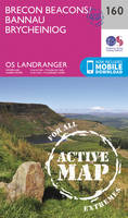
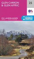
Series: OS Landranger Map. BIC Classification: 1DBKSB; WSZC; WTRM. Category: (G) General (US: Trade). Dimension: 136 x 227 x 39. Weight in Grams: 100.
- Publisher
- Ordnance Survey
- Publication date
- 2016
- Edition
- February 2016 ed
- Condition
- New
- SKU
- V9780319261729
- ISBN
- 9780319261729
Condition: New
€ 16.99€ 14.08
€ 16.99
€ 14.08
Sheet map, folded. .
- Publisher
- Ordnance Survey
- Publication date
- 2016
- Edition
- February 2016 ed
- Condition
- New
- SKU
- V9780319473566
- ISBN
- 9780319473566
Condition: New
€ 21.99€ 17.59
€ 21.99
€ 17.59
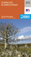
Series: OS Explorer Map. BIC Classification: 1DBKEWT; WSZC; WTRM. Category: (G) General (US: Trade). Dimension: 229 x 136 x 34. Weight in Grams: 100.
- Publisher
- Ordnance Survey
- Publication date
- 2015
- Edition
- September 2015 ed
- Condition
- New
- SKU
- V9780319243183
- ISBN
- 9780319243183
Condition: New
€ 16.99€ 14.20
€ 16.99
€ 14.20
Sheet map, folded. Num Pages: 1 pages. BIC Classification: 1FPJ; WTR. Category: (G) General (US: Trade). Dimension: 268 x 141 x 10. Weight in Grams: 126.
- Publisher
- Kodansha America, Inc United States
- Number of pages
- 1
- Publication date
- 2012
- Edition
- 3rd Edition
- Condition
- New
- SKU
- V9781568365077
- ISBN
- 9781568365077
Condition: New
€ 18.99€ 15.66
€ 18.99
€ 15.66
hardcover. Traced through a wide-ranging series of texts, and through a tapestry of images, this book includes photographs, archival material, satellite images and artworks. Num Pages: 464 pages, col. Illustrations, col. maps, ports. (some col.). BIC Classification: 1DBR; WTRS. Category: (G) General (US: Trade). Dimension: 299 x 237 x 39. Weight in Grams: 2572.
- Edition
- Illustrated
- Publisher
- Cork University Press
- Number of pages
- 464
- Format
- Hardback
- Publication date
- 2005
- Condition
- New
- SKU
- V9781859183809
- ISBN
- 9781859183809
Hardback
Condition: New
€ 59.00€ 45.48
€ 59.00
€ 45.48
Sheet map, folded. .
- Publisher
- Ordnance Survey
- Publication date
- 2016
- Edition
- February 2016 ed
- Condition
- New
- SKU
- V9780319474839
- ISBN
- 9780319474839
Hardback
Condition: New
€ 21.99€ 17.59
€ 21.99
€ 17.59
.
- Publisher
- Ordnance Survey
- Publication date
- 2016
- Edition
- February 2016 ed
- Condition
- New
- SKU
- V9780319474174
- ISBN
- 9780319474174
Hardback
Condition: New
€ 21.99€ 17.45
€ 21.99
€ 17.45
Sheet map, folded. .
- Publisher
- Ordnance Survey
- Publication date
- 2015
- Edition
- September 2015 ed
- Condition
- New
- SKU
- V9780319246054
- ISBN
- 9780319246054
Hardback
Condition: New
€ 16.99€ 14.25
€ 16.99
€ 14.25
Sheet map, folded. .
- Publisher
- Ordnance Survey
- Publication date
- 2015
- Edition
- September 2015 ed
- Condition
- New
- SKU
- V9780319245620
- ISBN
- 9780319245620
Hardback
Condition: New
€ 16.99€ 14.15
€ 16.99
€ 14.15
Sheet map, folded. .
- Publisher
- Ordnance Survey
- Publication date
- 2016
- Edition
- February 2016 ed
- Condition
- New
- SKU
- V9780319261132
- ISBN
- 9780319261132
Hardback
Condition: New
€ 16.99€ 14.21
€ 16.99
€ 14.21
Series: Old Ordnance Survey Maps of Manchester. BIC Classification: 1DBKENL; 3JH; WQH; WTRM. Category: (G) General (US: Trade). Dimension: 210 x 114 x 1. Weight in Grams: 26. Manchester Sheet 39. Series: Old Ordnance Survey Maps of Manchester. Cateogry: (G) General (US: Trade). BIC Classification: 1DBKENL; 3JH; WQH; WTR. Dimension: 210 x 114 x 1. Weight: 26.
- Publisher
- Alan Godfrey Maps
- Publication date
- 1995
- Edition
- Facsimile of 1848 ed
- Condition
- New
- SKU
- V9780850547191
- ISBN
- 9780850547191
Hardback
Condition: New
€ 7.01
€ 7.01
Sheet map, folded. .
- Publisher
- Ordnance Survey
- Publication date
- 2016
- Edition
- February 2016 ed
- Condition
- New
- SKU
- V9780319261231
- ISBN
- 9780319261231
Hardback
Condition: New
€ 16.99€ 14.25
€ 16.99
€ 14.25
Sheet map, folded. .
- Publisher
- Ordnance Survey
- Publication date
- 2015
- Edition
- September 2015 ed
- Condition
- New
- SKU
- V9780319472316
- ISBN
- 9780319472316
Hardback
Condition: New
€ 21.99€ 17.59
€ 21.99
€ 17.59
Sheet map, folded. .
- Publisher
- Ordnance Survey
- Publication date
- 2015
- Edition
- September 2015 ed
- Condition
- New
- SKU
- V9780319244302
- ISBN
- 9780319244302
Hardback
Condition: New
€ 16.99€ 14.25
€ 16.99
€ 14.25
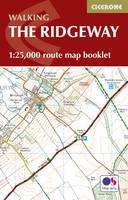
Paperback. Map of the 87 mile (139km) Ridgeway National Trail through the south of England from Avebury in Wiltshire to Ivinghoe Beacon in Buckinghamshire. This booklet is included with the Cicerone guidebook to the trail, and shows the full route on Ordnance Survey 1:25,000 maps. Presented in 12 stages in the guidebook, the trail typically takes 6-8 days. Num Pages: 56 pages, 56 pages of OS 1:25,000 mapping. BIC Classification: 1DBKE; WSZC; WTRM. Category: (G) General (US: Trade). Dimension: 115 x 170 x 7. Weight in Grams: 74.
- Publisher
- Cicerone Press
- Format
- Paperback
- Publication date
- 2016
- Condition
- New
- SKU
- V9781852849351
- ISBN
- 9781852849351
Paperback
Condition: New
€ 10.99€ 9.93
€ 10.99
€ 9.93
Sheet map, folded. .
- Publisher
- Ordnance Survey
- Publication date
- 2015
- Edition
- May 2015 ed
- Condition
- New
- SKU
- V9780319242919
- ISBN
- 9780319242919
Paperback
Condition: New
€ 16.99€ 14.19
€ 16.99
€ 14.19

