Travel maps & atlases
Results 101 - 120 of 1225
Travel maps & atlases
OS Explorer is the Ordnance Survey's most detailed map and is recommended for anyone enjoying outdoor activities like walking, horse riding and off-road cycling. Providing complete GB coverage the series details essential information such as youth hostels, pubs and visitor information as well as rights of way, permissive paths and bridleways. Series: OS Explorer Map. BIC Classification: 1DBKSC; WSZC; WTRM. Category: (G) General (US: Trade). Dimension: 135 x 227 x 41. Weight in Grams: 98.
- Publisher
- Ordnance Survey
- Publication date
- 2015
- Edition
- May 2015 ed
- Condition
- New
- SKU
- V9780319242858
- ISBN
- 9780319242858
Condition: New
€ 17.99€ 13.88
€ 17.99
€ 13.88
.
- Publisher
- Ordnance Survey
- Publication date
- 2015
- Edition
- May 2015 ed
- Condition
- New
- SKU
- V9780319469644
- ISBN
- 9780319469644
Condition: New
€ 21.99€ 17.59
€ 21.99
€ 17.59
Paperback. Num Pages: 192 pages, 600 photos, illustrations. BIC Classification: 1HFGT; WTR. Category: (G) General (US: Trade). Dimension: 149 x 202 x 12. Weight in Grams: 364.
- Publisher
- Papyrus Publications
- Format
- Paperback
- Publication date
- 2006
- Edition
- 4Rev e.
- Condition
- New
- SKU
- V9780620341912
- ISBN
- 9780620341912
Paperback
Condition: New
€ 17.99€ 13.13
€ 17.99
€ 13.13
Paperback. Map of part of the southern section of the 630 mile (1014km) South West Coast Path National Trail. Covers the trail from St Ives to Plymouth along the west Cornwall and Devon coastline. This convenient and compact booklet of Ordnance Survey 1:25,000 maps shows the route, providing all of the mapping you need to walk the trail in either direction. Num Pages: 88 pages, OS 1:25,000 mapping and map legend. BIC Classification: 1DBKEW; WSZC; WTR. Category: (G) General (US: Trade). Dimension: 121 x 179 x 8. Weight in Grams: 120.
- Publisher
- Cicerone Press
- Format
- Paperback
- Publication date
- 2017
- Condition
- New
- SKU
- V9781852849375
- ISBN
- 9781852849375
Paperback
Condition: New
€ 16.99€ 14.05
€ 16.99
€ 14.05
Sheet map, folded. .
- Publisher
- Ordnance Survey
- Publication date
- 2016
- Edition
- February 2016 ed
- Condition
- New
- SKU
- V9780319262948
- ISBN
- 9780319262948
Paperback
Condition: New
€ 17.99€ 14.25
€ 17.99
€ 14.25
Sheet map, folded. .
- Publisher
- Ordnance Survey
- Publication date
- 2016
- Edition
- February 2016 ed
- Condition
- New
- SKU
- V9780319475195
- ISBN
- 9780319475195
Paperback
Condition: New
€ 21.99€ 17.59
€ 21.99
€ 17.59
Paperback. Num Pages: 180 pages, colour illustrations. BIC Classification: HB; WTRM. Category: (G) General (US: Trade). Dimension: 348 x 276 x 14. Weight in Grams: 1230.
- Format
- Paperback
- Publication date
- 2003
- Publisher
- Square One Publishers United States
- Edition
- 2
- Number of pages
- 180
- Condition
- New
- SKU
- V9780757001611
- ISBN
- 9780757001611
Paperback
Condition: New
€ 32.17
€ 32.17
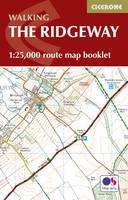
Paperback. Map of the 87 mile (139km) Ridgeway National Trail through the south of England from Avebury in Wiltshire to Ivinghoe Beacon in Buckinghamshire. This booklet is included with the Cicerone guidebook to the trail, and shows the full route on Ordnance Survey 1:25,000 maps. Presented in 12 stages in the guidebook, the trail typically takes 6-8 days. Num Pages: 56 pages, 56 pages of OS 1:25,000 mapping. BIC Classification: 1DBKE; WSZC; WTRM. Category: (G) General (US: Trade). Dimension: 115 x 170 x 7. Weight in Grams: 74.
- Publisher
- Cicerone Press
- Format
- Paperback
- Publication date
- 2016
- Condition
- New
- SKU
- V9781852849351
- ISBN
- 9781852849351
Paperback
Condition: New
€ 10.99€ 9.93
€ 10.99
€ 9.93
Paperback. Includes all the flags of the world and updated political boundaries. This title contains information that reflects worldwide political changes. Num Pages: 24 pages, colour maps. BIC Classification: WTRM. Category: (G) General (US: Trade). Dimension: 205 x 166 x 12. Weight in Grams: 126.
- Format
- Paperback
- Publisher
- Penguin Books Ltd United Kingdom
- Number of pages
- 24
- Publication date
- 2002
- Condition
- New
- SKU
- V9780140515282
- ISBN
- 9780140515282
Paperback
Condition: New
€ 11.99€ 10.19
€ 11.99
€ 10.19
Paperback. Traces the rise and fall of the Roman Empire. This book is illustrated and features more than sixty full-colour maps. It looks at its provinces and cities, its trade and economy, its armies and frontier defences; follows its foreign ward and internecine struggles; and charts its transformation into a Christian theocracy and its fall in 476. Num Pages: 144 pages, colour illustrations, maps, diagrams, further reading, index. BIC Classification: 1QDAR; HBJD; HBLA; WTRM. Category: (G) General (US: Trade). Dimension: 247 x 180 x 10. Weight in Grams: 394.
- Publisher
- Penguin Books Ltd United Kingdom
- Number of pages
- 144
- Format
- Paperback
- Publication date
- 1995
- Edition
- Reprint
- Condition
- New
- SKU
- V9780140513295
- ISBN
- 9780140513295
Paperback
Condition: New
€ 19.99€ 14.95
€ 19.99
€ 14.95
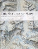
Hardcover. Cartographers know that maps are more than just representations of the world; rather, every map reflects the agendas and intentions of its creators. Employing several nature maps, this book explores the different aspects of maps' self-presentation: from place names to titles and legends. Num Pages: 231 pages, 179 colour plates, 16 halftones. BIC Classification: WTRM. Category: (P) Professional & Vocational. Dimension: 279 x 279 x 23. Weight in Grams: 1606.
- Format
- Hardback
- Publication date
- 2009
- Publisher
- The University of Chicago Press United States
- Number of pages
- 231
- Condition
- New
- SKU
- V9780226906041
- ISBN
- 9780226906041
Hardback
Condition: New
€ 70.93
€ 70.93
Paperback. Num Pages: 72 pages, Full colour throughout. BIC Classification: 1DBKESL; WTH; WTRM. Category: (G) General (US: Trade). Dimension: 147 x 175 x 3. Weight in Grams: 118.
- Format
- Paperback
- Publisher
- Penguin Books Ltd United Kingdom
- Number of pages
- 72
- Publication date
- 2013
- Edition
- 8th ed.
- Condition
- New
- SKU
- V9780241967362
- ISBN
- 9780241967362
Paperback
Condition: New
€ 13.99€ 10.98
€ 13.99
€ 10.98
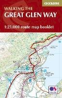
Paperback. Map of the 77-mile (123km) Great Glen Way (one of Scotland's Great Trails), between Fort William and Inverness. This booklet of Ordnance Survey 1:25,000 maps shows the full route, providing all of the mapping you need to complete the trail. The route typically takes a week to walk, and is suitable for walkers at all levels of experience. Num Pages: 48 pages. BIC Classification: 1DBKSH; WSZC; WTRM. Category: (G) General (US: Trade). Dimension: 166 x 106 x 5. .
- Publisher
- Cicerone Press
- Format
- Paperback
- Publication date
- 2016
- Condition
- New
- SKU
- V9781852848958
- ISBN
- 9781852848958
Paperback
Condition: New
€ 13.99€ 11.60
€ 13.99
€ 11.60
Sheet map, folded. OS Explorer is the Ordnance Survey's most detailed map and is recommended for anyone enjoying outdoor activities like walking, horse riding and off-road cycling. Providing complete GB coverage the series details essential information such as youth hostels, pubs and visitor information as well as rights of way, permissive paths and bridleways. Series: OS Explorer Map. BIC Classification: 1DBKEWG; WSZC; WTRM. Category: (G) General (US: Trade). Dimension: 243 x 134 x 39. Weight in Grams: 128.
- Publisher
- Ordnance Survey
- Publication date
- 2015
- Edition
- May 2015 ed
- Condition
- New
- SKU
- V9780319242841
- ISBN
- 9780319242841
Paperback
Condition: New
€ 17.99€ 14.15
€ 17.99
€ 14.15
Sheet map, folded. OS Explorer is the Ordnance Survey's most detailed map and is recommended for anyone enjoying outdoor activities such as walking, horse riding and off-road cycling. The series provides complete GB coverage and can now be used in all weathers thanks to OS Explorer - Active, a tough, versatile version of OS Explorer. Series: OS Explorer Map Active. BIC Classification: 1DBKEWG; WSZC; WTRM. Category: (G) General (US: Trade). Dimension: 140 x 242 x 23. Weight in Grams: 204.
- Publisher
- Ordnance Survey
- Publication date
- 2015
- Edition
- May 2015 ed
- Condition
- New
- SKU
- V9780319469637
- ISBN
- 9780319469637
Paperback
Condition: New
€ 21.99€ 17.57
€ 21.99
€ 17.57
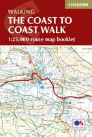
Paperback. Map of the 190 miles (300km) Coast to Coast Walk, between St Bees Head in Cumbria and Robin Hood's Bay in Yorkshire. This booklet is included with the Cicerone guidebook to the trail, and shows the full route on Ordnance Survey 1:25,000 maps. This popular long-distance route typically takes a fortnight to walk. Num Pages: 104 pages, 92 pages of OS 1:25,000 mapping. BIC Classification: 1DBKEY; WSZC; WTRM. Category: (G) General (US: Trade). Dimension: 122 x 225 x 7. Weight in Grams: 138.
- Publisher
- Cicerone Press
- Format
- Paperback
- Publication date
- 2017
- Condition
- New
- SKU
- V9781852849269
- ISBN
- 9781852849269
Paperback
Condition: New
€ 16.99€ 14.19
€ 16.99
€ 14.19
.
- Publisher
- Ordnance Survey
- Publication date
- 2015
- Edition
- May 2015 ed
- Condition
- New
- SKU
- V9780319242551
- ISBN
- 9780319242551
Paperback
Condition: New
€ 17.99€ 14.08
€ 17.99
€ 14.08
map. .
- Publisher
- Ordnance Survey
- Publication date
- 2016
- Edition
- February 2016 ed
- Condition
- New
- SKU
- V9780319474846
- ISBN
- 9780319474846
Paperback
Condition: New
€ 21.99€ 17.18
€ 21.99
€ 17.18
Paperback. .
- Publisher
- Ordnance Survey/Crimson
- Format
- Paperback
- Publication date
- 2016
- Edition
- Revised edition
- Condition
- New
- SKU
- V9780319090053
- ISBN
- 9780319090053
Paperback
Condition: New
€ 17.99€ 14.25
€ 17.99
€ 14.25
Sheet map, folded. Num Pages: 8 city plans; 4 area maps. BIC Classification: 1FMT; WTR. Category: (G) General (US: Trade). Dimension: 262 x 112 x 8. Weight in Grams: 102.
- Publisher
- Periplus Editions (HK) ltd.
- Publication date
- 2015
- Edition
- 7th Revised edition
- Condition
- New
- SKU
- V9780794607081
- ISBN
- 9780794607081
Paperback
Condition: New
€ 10.99€ 9.30
€ 10.99
€ 9.30


