Travel maps & atlases
Results 1081 - 1100 of 1174
Travel maps & atlases
.
- Publisher
- Ordnance Survey
- Publication date
- 2015
- Edition
- September 2015 ed
- Condition
- New
- SKU
- V9780319472187
- ISBN
- 9780319472187
Condition: New
€ 21.99€ 17.59
€ 21.99
€ 17.59
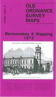
Paperback. Series: Old O.S. Maps of London. BIC Classification: 1DBKESL; 3JH; WQH; WTRM. Category: (G) General (US: Trade). Dimension: 210 x 121 x 2. Weight in Grams: 26.
- Publisher
- Alan Godfrey Maps United Kingdom
- Format
- Paperback
- Publication date
- 1995
- Edition
- Facsim.of 1872 Ed
- Condition
- New
- SKU
- V9780850547733
- ISBN
- 9780850547733
Paperback
Condition: New
€ 7.01
€ 7.01
Hardcover. Features 6 colour-coded districts, each with its own large-scale fold-out map. In this title, a spread at the front highlights the 10 sights you shouldn't miss; one at the back highlights the 10 best things to do when in Berlin. It details of more than 100 restaurants, bars, cafes, shops, clubs, markets and art galleries. Num Pages: 56 pages. BIC Classification: 1DFG; WTH; WTRS. Category: (G) General (US: Trade). Dimension: 125 x 175 x 17. Weight in Grams: 138.
- Publisher
- Everyman Guides
- Format
- Hardback
- Publication date
- 2012
- Edition
- Revised edition
- Condition
- New
- SKU
- V9781841595696
- ISBN
- 9781841595696
Hardback
Condition: New
€ 9.99€ 8.63
€ 9.99
€ 8.63
Sheet map, folded. .
- Publisher
- Ordnance Survey
- Publication date
- 2015
- Edition
- September 2015 ed
- Condition
- New
- SKU
- V9780319473054
- ISBN
- 9780319473054
Hardback
Condition: New
€ 21.99€ 17.67
€ 21.99
€ 17.67
Sheet map, folded. Series: OS Landranger Map. BIC Classification: 1DBKSHL; WSZC; WTRM. Category: (G) General (US: Trade). Dimension: 136 x 228 x 30. Weight in Grams: 100.
- Publisher
- Ordnance Survey
- Publication date
- 2016
- Edition
- February 2016 ed
- Condition
- New
- SKU
- V9780319261200
- ISBN
- 9780319261200
Hardback
Condition: New
€ 17.99€ 14.17
€ 17.99
€ 14.17
Sheet map, folded. .
- Publisher
- Ordnance Survey
- Publication date
- 2016
- Edition
- February 2016 ed
- Condition
- New
- SKU
- V9780319473450
- ISBN
- 9780319473450
Hardback
Condition: New
€ 21.99€ 17.57
€ 21.99
€ 17.57
Sheet map, folded. .
- Publisher
- Ordnance Survey
- Publication date
- 2015
- Edition
- September 2015 ed
- Condition
- New
- SKU
- V9780319246801
- ISBN
- 9780319246801
Hardback
Condition: New
€ 17.99€ 14.25
€ 17.99
€ 14.25
Sheet map, folded. .
- Publisher
- Ordnance Survey
- Publication date
- 2015
- Edition
- September 2015 ed
- Condition
- New
- SKU
- V9780319472897
- ISBN
- 9780319472897
Hardback
Condition: New
€ 21.99€ 17.59
€ 21.99
€ 17.59
.
- Publisher
- Ordnance Survey
- Publication date
- 2015
- Edition
- May 2015 ed
- Condition
- New
- SKU
- V9780319242872
- ISBN
- 9780319242872
Hardback
Condition: New
€ 17.99€ 14.25
€ 17.99
€ 14.25
.
- Publisher
- Ordnance Survey
- Publication date
- 2015
- Edition
- May 2015 ed
- Condition
- New
- SKU
- V9780319469668
- ISBN
- 9780319469668
Hardback
Condition: New
€ 21.99€ 17.67
€ 21.99
€ 17.67
Sheet map, folded. .
- Publisher
- Ordnance Survey
- Publication date
- 2015
- Edition
- September 2015 ed
- Condition
- New
- SKU
- V9780319246863
- ISBN
- 9780319246863
Hardback
Condition: New
€ 17.99€ 14.20
€ 17.99
€ 14.20
Sheet map, folded. .
- Publisher
- Ordnance Survey
- Publication date
- 2015
- Edition
- September 2015 ed
- Condition
- New
- SKU
- V9780319472958
- ISBN
- 9780319472958
Hardback
Condition: New
€ 21.99€ 17.59
€ 21.99
€ 17.59
.
- Publisher
- Ordnance Survey
- Publication date
- 2015
- Edition
- May 2015 ed
- Condition
- New
- SKU
- V9780319469682
- ISBN
- 9780319469682
Hardback
Condition: New
€ 21.99€ 17.45
€ 21.99
€ 17.45
.
- Publisher
- Ordnance Survey
- Publication date
- 2015
- Edition
- September 2015 ed
- Condition
- New
- SKU
- V9780319246689
- ISBN
- 9780319246689
Hardback
Condition: New
€ 17.99€ 14.25
€ 17.99
€ 14.25
.
- Publisher
- Ordnance Survey
- Publication date
- 2015
- Edition
- September 2015 ed
- Condition
- New
- SKU
- V9780319472880
- ISBN
- 9780319472880
Hardback
Condition: New
€ 21.99€ 17.59
€ 21.99
€ 17.59
Sheet map, folded. Series: OS Landranger Map. BIC Classification: 1DBKSH; WSZC; WTRM. Category: (G) General (US: Trade). Dimension: 136 x 228 x 14. Weight in Grams: 98.
- Publisher
- Ordnance Survey
- Publication date
- 2016
- Edition
- February 2016 ed
- Condition
- New
- SKU
- V9780319261187
- ISBN
- 9780319261187
Hardback
Condition: New
€ 17.99€ 14.21
€ 17.99
€ 14.21
Sheet map, folded. .
- Publisher
- Ordnance Survey
- Publication date
- 2016
- Edition
- February 2016 ed
- Condition
- New
- SKU
- V9780319473436
- ISBN
- 9780319473436
Hardback
Condition: New
€ 21.99€ 17.80
€ 21.99
€ 17.80
Num Pages: 84 pages. BIC Classification: 1DBKES; WNW; WTRM. Category: (G) General (US: Trade). Dimension: 266 x 156 x 16. Weight in Grams: 380. South. Cateogry: (G) General (US: Trade). BIC Classification: 1DBKES; WNW; WTRM. Dimension: 266 x 156 x 16. Weight: 380.
- Publisher
- British Geological Survey
- Publication date
- 2007
- Condition
- New
- SKU
- V9780852726068
- ISBN
- 9780852726068
Hardback
Condition: New
€ 19.99€ 18.58
€ 19.99
€ 18.58
Sheet map, folded. .
- Publisher
- Ordnance Survey
- Publication date
- 2016
- Edition
- February 2016 ed
- Condition
- New
- SKU
- V9780319262511
- ISBN
- 9780319262511
Hardback
Condition: New
€ 17.99€ 14.16
€ 17.99
€ 14.16
Sheet map, folded. .
- Publisher
- Ordnance Survey
- Publication date
- 2016
- Edition
- February 2016 ed
- Condition
- New
- SKU
- V9780319474761
- ISBN
- 9780319474761
Hardback
Condition: New
€ 21.99€ 17.59
€ 21.99
€ 17.59


