Travel maps & atlases
Results 25 - 33 of 33
Travel maps & atlases
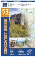
Paperback. Series: Irish Discovery Series. BIC Classification: 1DBR; WSZC; WTRM. Category: (G) General (US: Trade). Dimension: 204 x 180 x 7. Weight in Grams: 74.
- Format
- Paperback
- Publication date
- 2011
- Publisher
- Ordnance Survey Ireland
- Condition
- New
- SKU
- KKE0000912
- ISBN
- 9781907122569
Paperback
Condition: New
€ 4.99
€ 4.99
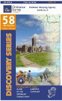
Paperback. Series: Irish Discovery Series. BIC Classification: 1DBR; WSZC; WTRM. Category: (G) General (US: Trade). Dimension: 204 x 180 x 7. Weight in Grams: 74.
- Format
- Paperback
- Publication date
- 2011
- Publisher
- Ordnance Survey Ireland
- Condition
- New
- SKU
- KCW0018449
- ISBN
- 9781907122569
Paperback
Condition: New
€ 4.99
€ 4.99
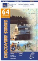
Paperback. Series: Irish Discovery Series. BIC Classification: 1DBR; WTRM. Category: (G) General (US: Trade). Dimension: 192 x 113 x 7. Weight in Grams: 72.
- Format
- Paperback
- Publication date
- 2013
- Publisher
- Ordnance Survey Ireland
- Condition
- New
- SKU
- KCW0018452
- ISBN
- 9781907122903
Paperback
Condition: New
€ 4.99
€ 4.99
Sheet map, folded. Series: OS Explorer Map. BIC Classification: 1DBKSC; WSZC; WTRM. Category: (G) General (US: Trade). Dimension: 136 x 227 x 41. Weight in Grams: 100.
- Publication date
- 2015
- Publisher
- Ordnance Survey
- Condition
- New
- SKU
- 9780319246139
- ISBN
- 9780319246139
Paperback
Condition: New
€ 10.99€ 9.92
€ 10.99
€ 9.92
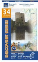
Sheet map, folded. Series: Irish Discovery Series. BIC Classification: 1DBR; WTRD. Category: (G) General (US: Trade). Dimension: 189 x 112 x 6. Weight in Grams: 74. Good clean copy with minor shelf wear
- Publication date
- 2012
- Publisher
- Ordnance Survey Ireland
- Condition
- Used, Very Good
- SKU
- KSS0005758
- ISBN
- 9781907122934
Paperback
Condition: Used, Very Good
€ 4.99
€ 4.99
Hardcover. Provides an illustrated account of the role that charts have played in planning, preventing, conducting and recording war on water. An introduction discusses the major themes with regard to naval warfare, navigation, and chart-making. The first chapter covers the period from earliest recorded history to the fifteenth century. Num Pages: 160 pages, 150 illustrations. BIC Classification: HBTM; JWF; TRLN; WTRM. Category: (G) General (US: Trade). Dimension: 313 x 290 x 17. Weight in Grams: 1306.
- Format
- Hardback
- Publication date
- 2006
- Publisher
- Conway
- Condition
- New
- SKU
- 9781844860319
- ISBN
- 9781844860319
Hardback
Condition: New
€ 23.99€ 8.87
€ 23.99
€ 8.87
Sheet map, folded. Series: Irish Discovery Series. BIC Classification: 1DBR; WSZC; WTR. Category: (G) General (US: Trade). Dimension: 195 x 149 x 8. Weight in Grams: 74.
- Publication date
- 2011
- Publisher
- Ordnance Survey Ireland
- Condition
- New
- SKU
- 9781907122545
- ISBN
- 9781907122545
Hardback
Condition: New
€ 4.99
€ 4.99
hardcover. Traced through a wide-ranging series of texts, and through a tapestry of images, this book includes photographs, archival material, satellite images and artworks. Num Pages: 464 pages, col. Illustrations, col. maps, ports. (some col.). BIC Classification: 1DBR; WTRS. Category: (G) General (US: Trade). Dimension: 299 x 237 x 39. Weight in Grams: 2572.
- Edition
- Illustrated
- Publisher
- Cork University Press
- Number of pages
- 464
- Format
- Hardback
- Publication date
- 2005
- Condition
- New
- SKU
- V9781859183809
- ISBN
- 9781859183809
Hardback
Condition: New
€ 59.00€ 45.48
€ 59.00
€ 45.48
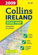
Sheet map, folded. Full colour map of Ireland at 9 miles to 1 inch (1:570,240), with clear, detailed road network and counties and administrative areas shown in colour. Num Pages: With index. BIC Classification: 1DBR; WTR. Category: (G) General (US: Trade). Dimension: 245 x 140. Weight in Grams: 79.
- Condition
- Used, Like New
- Publisher
- HarperCollins Publishers Cheltenham
- Publication date
- 2008
- Edition
- New edition
- SKU
- KRS0003573
- ISBN
- 9780007272518
Hardback
Condition: Used, Like New
€ 4.99
€ 4.99
.png)
