Travel maps & atlases
Results 341 - 360 of 1250
Travel maps & atlases
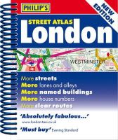
Spiral bound. A new edition of this handy mini spiral format that fits easily into a pocket, briefcase or handbag. This detailed colour mini street atlas covers all of London from Richmond to Greenwich and from Highgate to Streatham, with enlarged maps of central London from Earl's Court to Tower Bridge. Series: Philip's Street Atlases. Num Pages: 320 pages, colour maps. BIC Classification: 1DBKESL; WTRS. Category: (G) General (US: Trade). Dimension: 146 x 120 x 20. Weight in Grams: 224.
- Format
- Spiralbound
- Publication date
- 2012
- Publisher
- Octopus Publishing Group
- Condition
- New
- SKU
- KSG0018450
- ISBN
- 9781849072083
Spiralbound
Condition: New
€ 4.99
€ 4.99
Spiral bound. A new edition of this handy mini spiral format that fits easily into a pocket, briefcase or handbag. This detailed colour mini street atlas covers all of London from Richmond to Greenwich and from Highgate to Streatham, with enlarged maps of central London from Earl's Court to Tower Bridge. Series: Philip's Street Atlases. Num Pages: 320 pages, colour maps. BIC Classification: 1DBKESL; WTRS. Category: (G) General (US: Trade). Dimension: 146 x 120 x 20. Weight in Grams: 224.
- Publisher
- Octopus Publishing Group
- Format
- Spiralbound
- Publication date
- 2012
- Condition
- New
- SKU
- KRS0029196
- ISBN
- 9781849072083
Spiralbound
Condition: New
€ 4.99
€ 4.99
Sheet map, folded. Each of the maps in the Periplus Wall Maps series are all available in a user-friendly format. Num Pages: 1 pages. BIC Classification: 1FMP; WTR. Category: (G) General (US: Trade). Dimension: 281 x 276 x 11. Weight in Grams: 156.
- Publisher
- Periplus Editions (HK) ltd.
- Publication date
- 2016
- Edition
- 2 Fol Map
- Condition
- New
- SKU
- V9780794607869
- ISBN
- 9780794607869
Spiralbound
Condition: New
€ 10.99€ 10.07
€ 10.99
€ 10.07
Paperback. This accurate, colour-coded map shows all areas according to their actual size, with the North-South lines running vertically and the East-West lines running parallel. BIC Classification: WTRM; YRW. Category: (G) General (US: Trade). Dimension: 770 x 531 x 1. Weight in Grams: 132.
- Publisher
- Schofield & Sims Ltd United Kingdom
- Format
- Paperback
- Publication date
- 2005
- Edition
- Lam Map
- Condition
- New
- SKU
- V9780721709338
- ISBN
- 9780721709338
Paperback
Condition: New
€ 24.99€ 21.46
€ 24.99
€ 21.46
Sheet map, folded. .
- Publisher
- Ordnance Survey
- Publication date
- 2015
- Edition
- September 2015 ed
- Condition
- New
- SKU
- V9780319246597
- ISBN
- 9780319246597
Paperback
Condition: New
€ 17.99€ 14.17
€ 17.99
€ 14.17
.
- Publisher
- Ordnance Survey
- Publication date
- 2015
- Edition
- September 2015 ed
- Condition
- New
- SKU
- V9780319472798
- ISBN
- 9780319472798
Paperback
Condition: New
€ 23.99€ 17.59
€ 23.99
€ 17.59
Sheet map, folded. .
- Publisher
- Ordnance Survey
- Publication date
- 2016
- Edition
- February 2016 ed
- Condition
- New
- SKU
- V9780319262405
- ISBN
- 9780319262405
Paperback
Condition: New
€ 17.99€ 14.35
€ 17.99
€ 14.35
Sheet map, folded. .
- Publisher
- Ordnance Survey
- Publication date
- 2016
- Edition
- February 2016 ed
- Condition
- New
- SKU
- V9780319474655
- ISBN
- 9780319474655
Paperback
Condition: New
€ 23.99€ 17.53
€ 23.99
€ 17.53
Sheet map, folded. Series: OS Explorer Map. BIC Classification: 1DBKEAC; WSZC; WTRM. Category: (G) General (US: Trade). Dimension: 136 x 227 x 27. Weight in Grams: 100.
- Publisher
- Ordnance Survey
- Publication date
- 2015
- Edition
- September 2015 ed
- Condition
- New
- SKU
- V9780319244203
- ISBN
- 9780319244203
Paperback
Condition: New
€ 17.99€ 14.19
€ 17.99
€ 14.19
Sheet map, folded. .
- Publisher
- Ordnance Survey
- Publication date
- 2015
- Edition
- September 2015 ed
- Condition
- New
- SKU
- V9780319470992
- ISBN
- 9780319470992
Paperback
Condition: New
€ 23.99€ 17.59
€ 23.99
€ 17.59
.
- Publisher
- Ordnance Survey
- Publication date
- 2015
- Edition
- September 2015 ed
- Condition
- New
- SKU
- V9780319246160
- ISBN
- 9780319246160
Paperback
Condition: New
€ 17.99€ 14.16
€ 17.99
€ 14.16
Sheet map, folded. Series: OS Landranger Map. BIC Classification: 1DBKSH; WSZC; WTRM. Category: (G) General (US: Trade). Dimension: 137 x 229 x 14. Weight in Grams: 100.
- Publisher
- Ordnance Survey
- Publication date
- 2016
- Edition
- February 2016 ed
- Condition
- New
- SKU
- V9780319261569
- ISBN
- 9780319261569
Paperback
Condition: New
€ 17.99€ 14.20
€ 17.99
€ 14.20
Sheet map, folded. .
- Publisher
- Ordnance Survey
- Publication date
- 2016
- Edition
- February 2016 ed
- Condition
- New
- SKU
- V9780319473818
- ISBN
- 9780319473818
Paperback
Condition: New
€ 23.99€ 17.59
€ 23.99
€ 17.59
Sheet map, folded. .
- Publisher
- Ordnance Survey
- Publication date
- 2015
- Edition
- September 2015 ed
- Condition
- New
- SKU
- V9780319245965
- ISBN
- 9780319245965
Paperback
Condition: New
€ 17.99€ 14.19
€ 17.99
€ 14.19
.
- Publisher
- Ordnance Survey
- Publication date
- 2015
- Condition
- New
- SKU
- V9780319472163
- ISBN
- 9780319472163
Paperback
Condition: New
€ 23.99€ 17.54
€ 23.99
€ 17.54
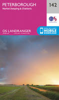
Sheet map, folded. Series: OS Landranger Map. BIC Classification: 1DBKENM; WSZC; WTM; WTRM. Category: (G) General (US: Trade). Dimension: 136 x 276 x 46. Weight in Grams: 100.
- Publisher
- Ordnance Survey
- Publication date
- 2017
- Edition
- December 2016 ed
- Condition
- New
- SKU
- V9780319263372
- ISBN
- 9780319263372
Paperback
Condition: New
€ 17.99€ 14.15
€ 17.99
€ 14.15
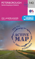
Sheet map, folded. Series: OS Landranger Active Map. BIC Classification: 1DBKENM; WSZC; WTM; WTRM. Category: (G) General (US: Trade). Dimension: 138 x 230 x 23. Weight in Grams: 160.
- Publisher
- Ordnance Survey
- Publication date
- 2017
- Edition
- December 2016 ed
- Condition
- New
- SKU
- V9780319475393
- ISBN
- 9780319475393
Paperback
Condition: New
€ 23.99€ 17.80
€ 23.99
€ 17.80
Paperback. Vikings were more than just marine warriors. This atlas shows their development as traders and craftsmen, explorers, settlers and mercenaries. It contains over sixty colour maps, and follows the tracks of the Viking merchants who travelled deep into Russia, and of Viking mercenaries who served in the emperor's bodyguard at Constantinople. Num Pages: 144 pages, colour illustrations, maps, diagrams, further reading, index. BIC Classification: 1DN; HBJD; HBLC; WTRM. Category: (G) General (US: Trade). Dimension: 246 x 179 x 9. Weight in Grams: 394.
- Edition
- 01st Edition
- Publisher
- Penguin
- Format
- Paperback
- Publication date
- 1995
- Condition
- New
- SKU
- V9780140513288
- ISBN
- 9780140513288
Paperback
Condition: New
€ 25.99€ 18.00
€ 25.99
€ 18.00
Sheet map, folded. Series: OS Landranger Map. BIC Classification: 1DBKSB; WSZC; WTRM. Category: (G) General (US: Trade). Dimension: 136 x 230 x 49. Weight in Grams: 100.
- Publisher
- Ordnance Survey
- Publication date
- 2016
- Edition
- February 2016 ed
- Condition
- New
- SKU
- V9780319261712
- ISBN
- 9780319261712
Paperback
Condition: New
€ 17.99€ 14.27
€ 17.99
€ 14.27
Sheet map, folded. .
- Publisher
- Ordnance Survey
- Publication date
- 2015
- Edition
- September 2015 ed
- Condition
- New
- SKU
- V9780319245897
- ISBN
- 9780319245897
Paperback
Condition: New
€ 17.99€ 14.20
€ 17.99
€ 14.20

