Travel maps & atlases
Results 361 - 384 of 1184
Travel maps & atlases
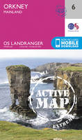
Sheet map, folded. Series: OS Landranger Active Map. BIC Classification: 1DBKSHF; WSZC; WTRM. Category: (G) General (US: Trade). Dimension: 138 x 229 x 23. Weight in Grams: 160.
- Publisher
- Ordnance Survey
- Publication date
- 2016
- Edition
- February 2016 ed
- Condition
- New
- SKU
- V9780319473290
- ISBN
- 9780319473290
Condition: New
€ 21.99€ 17.59
€ 21.99
€ 17.59
Sheet map, folded. .
- Publisher
- Ordnance Survey
- Publication date
- 2015
- Edition
- September 2015 ed
- Condition
- New
- SKU
- V9780319247136
- ISBN
- 9780319247136
Condition: New
€ 17.99€ 14.15
€ 17.99
€ 14.15
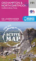
Sheet map, folded. Series: OS Explorer Active Map. BIC Classification: 1DBKSHF; WSZC; WTRM. Category: (G) General (US: Trade). Dimension: 139 x 230 x 23. Weight in Grams: 164.
- Publisher
- Ordnance Survey
- Publication date
- 2015
- Edition
- September 2015 ed
- Condition
- New
- SKU
- V9780319473139
- ISBN
- 9780319473139
Condition: New
€ 21.99€ 17.59
€ 21.99
€ 17.59
Paperback. Part of the volume entitled "Treasures of the Greek Museums" which introduces the reader to the priceless works of art housed in the museums of Greece, this title written by experts, furnish details of the historical and cultural context of these masterpieces. It also presents the most important archaeological sites, with aerial photographs. Editor(s): Karpodini-Dimitriadi, E. Translator(s): De Jongh, Brian. Num Pages: 80 pages, 73 illus. BIC Classification: 1DVG; WTHM; WTR. Category: (G) General (US: Trade). Dimension: 172 x 240 x 8. Weight in Grams: 286. 80 pages, 73 illus. Editor(s): Karpodini-Dimitriadi, E. Cateogry: (G) General (US: Trade). BIC Classification: 1DVG; WTHM; WTR. Dimension: 238 x 169 x 7. Weight: 282. Translator(s): De Jongh, Brian.
- Publisher
- Ekdotike Athenon
- Format
- Paperback
- Publication date
- 1994
- Condition
- New
- SKU
- V9789602130469
- ISBN
- 9789602130469
Paperback
Condition: New
€ 20.35
€ 20.35
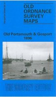
Series: Old O.S. Maps of Hampshire. BIC Classification: 1DBKESH; 3JH; WQH; WTRM. Category: (G) General (US: Trade). Dimension: 122 x 209 x 4. Weight in Grams: 24. Hampshire Sheet 83.11. Series: Old O.S. Maps of Hampshire. Cateogry: (G) General (US: Trade). BIC Classification: 1DBKESH; 3JH; WQH; WTRM. Dimension: 211 x 117 x 3. Weight: 26.
- Publisher
- The Godfrey Edition
- Publication date
- 1992
- Edition
- Facsimile of 1896 ed
- Condition
- New
- SKU
- V9780850545289
- ISBN
- 9780850545289
Paperback
Condition: New
€ 7.04
€ 7.04
Sheet map, folded. Num Pages: 6 city plans; 6 area maps. BIC Classification: 1FPJ; WTR. Category: (G) General (US: Trade). Dimension: 113 x 261 x 8. Weight in Grams: 70.
- Publisher
- Tuttle Publishing
- Publication date
- 2015
- Edition
- Bilingual
- Condition
- New
- SKU
- V9784805313381
- ISBN
- 9784805313381
Paperback
Condition: New
€ 9.99€ 9.58
€ 9.99
€ 9.58
Sheet map, folded. Series: OS Explorer Map. BIC Classification: 1DBKEWD; WSZC; WTRM. Category: (G) General (US: Trade). Dimension: 136 x 241 x 29. Weight in Grams: 130.
- Publisher
- Ordnance Survey
- Publication date
- 2015
- Edition
- September 2015 ed
- Condition
- New
- SKU
- V9780319243145
- ISBN
- 9780319243145
Paperback
Condition: New
€ 17.99€ 14.21
€ 17.99
€ 14.21
.
- Publisher
- Ordnance Survey
- Publication date
- 2015
- Edition
- September 2015 ed
- Condition
- New
- SKU
- V9780319469934
- ISBN
- 9780319469934
Paperback
Condition: New
€ 21.99€ 17.59
€ 21.99
€ 17.59
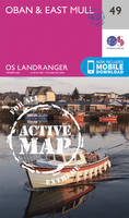
Sheet map, folded. Series: OS Landranger Active Map. BIC Classification: 1DBKEWD; WSZC; WTRM. Category: (G) General (US: Trade). Dimension: 138 x 228 x 22. Weight in Grams: 160.
- Publisher
- Ordnance Survey
- Publication date
- 2016
- Edition
- February 2016 ed
- Condition
- New
- SKU
- V9780319475140
- ISBN
- 9780319475140
Paperback
Condition: New
€ 21.99€ 17.59
€ 21.99
€ 17.59
Paperback. Map of the 177-mile (283km) Offa's Dyke Path National Trail, between Sedbury (nr Chepstow) and Prestatyn. The trail takes a fortnight to walk, and is suitable for walkers at all levels of experience. This compact booklet of Ordnance Survey 1:25,000 maps shows the full route, providing all of the mapping you need to complete the trail. Num Pages: 96 pages. BIC Classification: 1DBKW; WSZC; WTR. Category: (G) General (US: Trade). Dimension: 172 x 116 x 10. .
- Publisher
- Cicerone Press
- Format
- Paperback
- Publication date
- 2016
- Condition
- New
- SKU
- V9781852848941
- ISBN
- 9781852848941
Paperback
Condition: New
€ 17.99€ 14.16
€ 17.99
€ 14.16
Sheet map, folded.
- Publisher
- Ordnance Survey Ireland
- Publication date
- 2003
- Edition
- 2nd Revised edition
- Condition
- New
- SKU
- 9781903974308
- ISBN
- 9781903974308
Paperback
Condition: New
€ 7.41
€ 7.41
.
- Publisher
- Ordnance Survey
- Publication date
- 2015
- Edition
- September 2015 ed
- Condition
- New
- SKU
- V9780319246108
- ISBN
- 9780319246108
Paperback
Condition: New
€ 17.99€ 14.08
€ 17.99
€ 14.08
.
- Publisher
- Ordnance Survey
- Publication date
- 2015
- Edition
- September 2015 ed
- Condition
- New
- SKU
- V9780319472309
- ISBN
- 9780319472309
Paperback
Condition: New
€ 21.99€ 17.59
€ 21.99
€ 17.59
Series: OS Explorer Map. BIC Classification: 1DBKSC; WSZC; WTRM. Category: (G) General (US: Trade). Dimension: 137 x 242 x 36. Weight in Grams: 128.
- Publisher
- Ordnance Survey
- Publication date
- 2015
- Edition
- September 2015 ed
- Condition
- New
- SKU
- V9780319246238
- ISBN
- 9780319246238
Paperback
Condition: New
€ 17.99€ 14.25
€ 17.99
€ 14.25
Sheet map, folded. .
- Publisher
- Ordnance Survey
- Publication date
- 2016
- Edition
- February 2016 ed
- Condition
- New
- SKU
- V9780319261477
- ISBN
- 9780319261477
Paperback
Condition: New
€ 17.99€ 14.19
€ 17.99
€ 14.19
Sheet map, folded. .
- Publisher
- Ordnance Survey
- Publication date
- 2016
- Edition
- February 2016 ed
- Condition
- New
- SKU
- V9780319473726
- ISBN
- 9780319473726
Paperback
Condition: New
€ 21.99€ 17.59
€ 21.99
€ 17.59
Sheet map, folded. .
- Publisher
- Ordnance Survey
- Publication date
- 2015
- Edition
- September 2015 ed
- Condition
- New
- SKU
- V9780319244258
- ISBN
- 9780319244258
Paperback
Condition: New
€ 17.99€ 14.20
€ 17.99
€ 14.20
Sheet map, folded. .
- Publisher
- Alan Godfrey Maps
- Publication date
- 2006
- Condition
- New
- SKU
- V9781841518855
- ISBN
- 9781841518855
Paperback
Condition: New
€ 6.97
€ 6.97
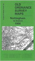
Sheet map, folded. Series: Old O.S. Maps of England and Wales. BIC Classification: 1DBKEMN; 3JJC; WQH; WTRM. Category: (G) General (US: Trade). Dimension: 146 x 120 x 27. Weight in Grams: 24. One Inch Map 126. Series: Old O.S. Maps of England and Wales. Cateogry: (G) General (US: Trade). BIC Classification: 1DBKEMN; 3JJC; WQH; WTRM. Dimension: 146 x 120 x 27. Weight: 24.
- Publisher
- Alan Godfrey Maps
- Publication date
- 2001
- Edition
- Facsimile of 1906 ed
- Condition
- New
- SKU
- V9781841512785
- ISBN
- 9781841512785
Paperback
Condition: New
€ 6.97
€ 6.97
Sheet map, folded. Series: OS Landranger Map. BIC Classification: 1DBKEML; 1DBKEMN; WSZC; WTRM. Category: (G) General (US: Trade). Dimension: 135 x 229 x 58. Weight in Grams: 98.
- Publisher
- Ordnance Survey
- Publication date
- 2016
- Edition
- February 2016 ed
- Condition
- New
- SKU
- V9780319262276
- ISBN
- 9780319262276
Paperback
Condition: New
€ 17.99€ 14.25
€ 17.99
€ 14.25
Sheet map, folded. .
- Publisher
- Ordnance Survey
- Publication date
- 2016
- Edition
- February 2016 ed
- Condition
- New
- SKU
- V9780319474525
- ISBN
- 9780319474525
Paperback
Condition: New
€ 21.99€ 17.59
€ 21.99
€ 17.59
Sheet map, folded. .
- Publisher
- Ordnance Survey
- Publication date
- 2015
- Edition
- September 2015 ed
- Condition
- New
- SKU
- V9780319244302
- ISBN
- 9780319244302
Paperback
Condition: New
€ 17.99€ 14.25
€ 17.99
€ 14.25
Paperback. Num Pages: 8 pages, colour illus. BIC Classification: 2ACSN; WTK; WTRM. Category: (G) General (US: Trade). Dimension: 257 x 115 x 2. Weight in Grams: 48.
- Format
- Paperback
- Publisher
- Bilingual Books Inc.,U.S. United States
- Number of pages
- 8
- Publication date
- 2000
- Edition
- Phrasebook
- Condition
- New
- SKU
- V9780944502129
- ISBN
- 9780944502129
Paperback
Condition: New
€ 10.54
€ 10.54
Sheet map, folded. .
- Publisher
- Ordnance Survey
- Publication date
- 2015
- Edition
- September 2015 ed
- Condition
- New
- SKU
- V9780319471395
- ISBN
- 9780319471395
Paperback
Condition: New
€ 21.99€ 17.59
€ 21.99
€ 17.59

