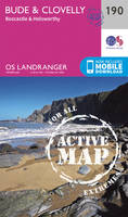
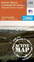
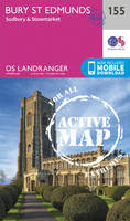
Travel maps & atlases
Results 145 - 168 of 1184
Travel maps & atlases
Sheet map, folded. Series: OS Landranger Map. BIC Classification: 1DBKWC; WSZC; WTRM. Category: (G) General (US: Trade). Dimension: 135 x 229 x 71. Weight in Grams: 110.
- Publisher
- Ordnance Survey
- Publication date
- 2016
- Edition
- February 2016 ed
- Condition
- New
- SKU
- V9780319262580
- ISBN
- 9780319262580
Condition: New
€ 17.99€ 14.19
€ 17.99
€ 14.19
Paperback. 28 fabulous country walks in the Becon Beacons National Park, graded by length and ranging from 3 to 10 miles. All routes come with a clear, large-scale OS map, GPS waypoints and highlight where to park, good pubs and places of interest en route. Series: Pathfinder Guides. Num Pages: 95 pages. BIC Classification: 1DBKWS; WSZC; WTRM. Category: (G) General (US: Trade). Dimension: 135 x 228 x 15. Weight in Grams: 208.
- Publisher
- Ordnance Survey/Crimson
- Format
- Paperback
- Publication date
- 2016
- Edition
- 9th Revised edition
- Condition
- New
- SKU
- V9780319090015
- ISBN
- 9780319090015
Paperback
Condition: New
€ 17.99€ 14.19
€ 17.99
€ 14.19
Sheet map, folded. .
- Publisher
- Ordnance Survey
- Publication date
- 2015
- Edition
- May 2015 ed
- Condition
- New
- SKU
- V9780319469316
- ISBN
- 9780319469316
Paperback
Condition: New
€ 21.99€ 17.65
€ 21.99
€ 17.65
Sheet map, folded. OS Explorer is the Ordnance Survey's most detailed map and is recommended for anyone enjoying outdoor activities like walking, horse riding and off-road cycling. Providing complete GB coverage the series details essential information such as youth hostels, pubs and visitor information as well as rights of way, permissive paths and bridleways. Series: OS Explorer Map. BIC Classification: 1DBKWS; WSZC; WTRM. Category: (G) General (US: Trade). Dimension: 243 x 133 x 32. Weight in Grams: 126.
- Publisher
- Ordnance Survey
- Publication date
- 2015
- Edition
- May 2015 ed
- Condition
- New
- SKU
- V9780319242520
- ISBN
- 9780319242520
Paperback
Condition: New
€ 17.99€ 14.21
€ 17.99
€ 14.21
Sheet map, folded. OS Explorer is the Ordnance Survey's most detailed map and is recommended for anyone enjoying outdoor activities such as walking, horse riding and off-road cycling. The series provides complete GB coverage and can now be used in all weathers thanks to OS Explorer - Active, a tough, versatile version of OS Explorer. Series: OS Explorer Map Active. BIC Classification: 1DBKWS; WSZC; WTRM. Category: (G) General (US: Trade). Dimension: 139 x 246 x 25. Weight in Grams: 204.
- Publisher
- Ordnance Survey
- Publication date
- 2015
- Edition
- May 2015 ed
- Condition
- New
- SKU
- V9780319469309
- ISBN
- 9780319469309
Paperback
Condition: New
€ 21.99€ 17.53
€ 21.99
€ 17.53
Sheet map, folded. OS Explorer is the Ordnance Survey's most detailed map and is recommended for anyone enjoying outdoor activities like walking, horse riding and off-road cycling. Providing complete GB coverage the series details essential information such as youth hostels, pubs and visitor information as well as rights of way, permissive paths and bridleways. Series: OS Explorer Map. BIC Classification: 1DBKWS; WSZC; WTRM. Category: (G) General (US: Trade). Dimension: 136 x 241 x 34. Weight in Grams: 128.
- Publisher
- Ordnance Survey
- Publication date
- 2015
- Edition
- May 2015 ed
- Condition
- New
- SKU
- V9780319242513
- ISBN
- 9780319242513
Paperback
Condition: New
€ 17.99€ 14.25
€ 17.99
€ 14.25
Sheet map, folded. .
- Publisher
- Ordnance Survey
- Publication date
- 2015
- Edition
- September 2015 ed
- Condition
- New
- SKU
- V9780319471678
- ISBN
- 9780319471678
Paperback
Condition: New
€ 21.99€ 17.57
€ 21.99
€ 17.57
Sheet map, folded. .
- Publisher
- Ordnance Survey
- Publication date
- 2015
- Edition
- September 2015 ed
- Condition
- New
- SKU
- V9780319245477
- ISBN
- 9780319245477
Paperback
Condition: New
€ 17.99€ 14.25
€ 17.99
€ 14.25
Sheet map, folded. Series: OS Landranger Active Map. BIC Classification: 1DBKEWG; 1DBKEWS; WSZC; WTRM. Category: (G) General (US: Trade). Dimension: 138 x 230 x 20. Weight in Grams: 160.
- Publisher
- Ordnance Survey
- Publication date
- 2016
- Edition
- February 2016 ed
- Condition
- New
- SKU
- V9780319474952
- ISBN
- 9780319474952
Paperback
Condition: New
€ 21.99€ 17.59
€ 21.99
€ 17.59
Sheet map, folded. Series: OS Landranger Map. BIC Classification: 1DBKEWG; 1DBKEWS; WSZC; WTRM. Category: (G) General (US: Trade). Dimension: 136 x 228 x 40. Weight in Grams: 100.
- Publisher
- Ordnance Survey
- Publication date
- 2016
- Edition
- February 2016 ed
- Condition
- New
- SKU
- V9780319262702
- ISBN
- 9780319262702
Paperback
Condition: New
€ 17.99€ 14.20
€ 17.99
€ 14.20
Sheet map, folded. Series: Old O.S. Maps of Gloucestershire. BIC Classification: 1DBKEWS; 3JJC; WQH; WTRM. Category: (G) General (US: Trade). Dimension: 210 x 120 x 2. Weight in Grams: 26. Gloucestershire Sheet 72.14. Series: Old O.S. Maps of Gloucestershire. Cateogry: (G) General (US: Trade). BIC Classification: 1DBKEWS; 3JJC; WQH; WTRM. Dimension: 210 x 120 x 2. Weight: 26.
- Publisher
- Alan Godfrey Maps
- Publication date
- 2002
- Edition
- Facsimile
- Condition
- New
- SKU
- V9781841514246
- ISBN
- 9781841514246
Paperback
Condition: New
€ 7.01
€ 7.01
Sheet map, folded. Series: Old O.S. Maps of Gloucestershire. BIC Classification: 1DBKEWS; WQH; WTRM. Category: (G) General (US: Trade). Dimension: 210 x 122 x 3. Weight in Grams: 26. Gloucestershire Sheet 75.04. Series: Old O.S. Maps of Gloucestershire. Cateogry: (G) General (US: Trade). BIC Classification: 1DBKEWS; WQH; WTRM. Dimension: 210 x 122 x 3. Weight: 24.
- Publisher
- Alan Godfrey Maps
- Publication date
- 1998
- Edition
- Facsimile of 1902 ed
- Condition
- New
- SKU
- V9781841510095
- ISBN
- 9781841510095
Paperback
Condition: New
€ 7.00
€ 7.00
Sheet map, folded. .
- Publisher
- Ordnance Survey
- Publication date
- 2015
- Edition
- September 2015 ed
- Condition
- New
- SKU
- V9780319470275
- ISBN
- 9780319470275
Paperback
Condition: New
€ 21.99€ 17.65
€ 21.99
€ 17.65
Sheet map, folded. .
- Publisher
- Ordnance Survey
- Publication date
- 2015
- Edition
- September 2015 ed
- Condition
- New
- SKU
- V9780319470268
- ISBN
- 9780319470268
Paperback
Condition: New
€ 21.99€ 17.59
€ 21.99
€ 17.59
Sheet map, folded. .
- Publisher
- Ordnance Survey
- Publication date
- 2015
- Edition
- September 2015 ed
- Condition
- New
- SKU
- V9780319243473
- ISBN
- 9780319243473
Paperback
Condition: New
€ 17.99€ 14.25
€ 17.99
€ 14.25
.
- Publisher
- Ordnance Survey
- Publication date
- 2015
- Edition
- September 2015 ed
- Condition
- New
- SKU
- V9780319472767
- ISBN
- 9780319472767
Paperback
Condition: New
€ 21.99€ 17.59
€ 21.99
€ 17.59
Sheet map, folded. .
- Publisher
- Ordnance Survey
- Publication date
- 2015
- Edition
- September 2015 ed
- Condition
- New
- SKU
- V9780319246566
- ISBN
- 9780319246566
Paperback
Condition: New
€ 17.99€ 14.20
€ 17.99
€ 14.20
.
- Publisher
- Ordnance Survey
- Publication date
- 2015
- Edition
- September 2015 ed
- Condition
- New
- SKU
- V9780319470640
- ISBN
- 9780319470640
Paperback
Condition: New
€ 21.99€ 17.59
€ 21.99
€ 17.59
Sheet map, folded. .
- Publisher
- Ordnance Survey
- Publication date
- 2015
- Edition
- September 2015 ed
- Condition
- New
- SKU
- V9780319243855
- ISBN
- 9780319243855
Paperback
Condition: New
€ 17.99€ 14.19
€ 17.99
€ 14.19
Sheet map, folded. .
- Publisher
- Ordnance Survey
- Publication date
- 2016
- Edition
- February 2016 ed
- Condition
- New
- SKU
- V9780319475133
- ISBN
- 9780319475133
Paperback
Condition: New
€ 21.99€ 17.67
€ 21.99
€ 17.67
Sheet map, folded. Series: OS Landranger Map. BIC Classification: 1DBKEWC; 1DBKEWD; WSZC; WTRM. Category: (G) General (US: Trade). Dimension: 135 x 228 x 16. Weight in Grams: 100.
- Publisher
- Ordnance Survey
- Publication date
- 2016
- Edition
- February 2016 ed
- Condition
- New
- SKU
- V9780319262887
- ISBN
- 9780319262887
Paperback
Condition: New
€ 17.99€ 14.21
€ 17.99
€ 14.21
.
- Publisher
- Ordnance Survey
- Publication date
- 2015
- Edition
- September 2015 ed
- Condition
- New
- SKU
- V9780319470602
- ISBN
- 9780319470602
Paperback
Condition: New
€ 21.99€ 17.67
€ 21.99
€ 17.67
Paperback. .
- Publisher
- Imray,Laurie,Norie & Wilson Ltd United Kingdom
- Number of pages
- 107
- Format
- Paperback
- Publication date
- 2006
- Edition
- First Edition
- Condition
- New
- SKU
- V9780852889107
- ISBN
- 9780852889107
Paperback
Condition: New
€ 26.99€ 23.67
€ 26.99
€ 23.67
Sheet map, folded. .
- Publisher
- Ordnance Survey
- Publication date
- 2016
- Edition
- February 2016 ed
- Condition
- New
- SKU
- V9780319474785
- ISBN
- 9780319474785
Paperback
Condition: New
€ 21.99€ 17.45
€ 21.99
€ 17.45

