Travel maps & atlases
Results 673 - 696 of 1234
Travel maps & atlases
Sheet map, folded. Series: OS Landranger Map. BIC Classification: 1DBKSH; WSZC; WTRM. Category: (G) General (US: Trade). Dimension: 136 x 228 x 41. Weight in Grams: 98.
- Publisher
- Ordnance Survey
- Publication date
- 2016
- Edition
- February 2016 ed
- Condition
- New
- SKU
- V9780319261538
- ISBN
- 9780319261538
Condition: New
€ 16.99€ 14.19
€ 16.99
€ 14.19
Sheet map, folded. .
- Publisher
- Ordnance Survey
- Publication date
- 2015
- Edition
- September 2015 ed
- Condition
- New
- SKU
- V9780319472293
- ISBN
- 9780319472293
Condition: New
€ 21.99€ 17.67
€ 21.99
€ 17.67
Sheet map, folded. .
- Publisher
- Ordnance Survey
- Publication date
- 2015
- Edition
- September 2015 ed
- Condition
- New
- SKU
- V9780319246092
- ISBN
- 9780319246092
Condition: New
€ 16.99€ 13.88
€ 16.99
€ 13.88
Sheet map, folded. .
- Publisher
- Ordnance Survey
- Publication date
- 2015
- Edition
- May 2015 ed
- Condition
- New
- SKU
- V9780319469781
- ISBN
- 9780319469781
Condition: New
€ 21.99€ 17.59
€ 21.99
€ 17.59
Sheet map, folded. .
- Publisher
- Ordnance Survey
- Publication date
- 2015
- Edition
- May 2015 ed
- Condition
- New
- SKU
- V9780319242995
- ISBN
- 9780319242995
Condition: New
€ 16.99€ 14.25
€ 16.99
€ 14.25
.
- Publisher
- Ordnance Survey
- Publication date
- 2015
- Edition
- May 2015 ed
- Condition
- New
- SKU
- V9780319469712
- ISBN
- 9780319469712
Condition: New
€ 21.99€ 17.45
€ 21.99
€ 17.45
.
- Publisher
- Ordnance Survey
- Publication date
- 2015
- Edition
- May 2015 ed
- Condition
- New
- SKU
- V9780319242926
- ISBN
- 9780319242926
Condition: New
€ 16.99€ 13.83
€ 16.99
€ 13.83
Paperback. First published in 1953, the year that saw thousands descend on London to watch the coronation of Queen Elizabeth II, this is a lexicon of the city's curiosities, from the Achilles statue in Hyde Park 'erected by the women of England to honour (if not to resemble) the Duke of Wellington', to zebra crossings (relative newcomers to London in 1953). Num Pages: 152 pages, illustrations. BIC Classification: 1DBKESL; WTRS. Category: (G) General (US: Trade). Dimension: 111 x 179 x 19. Weight in Grams: 124.
- Format
- Paperback
- Publication date
- 2016
- Publisher
- Thames & Hudson Ltd
- Condition
- New
- SKU
- 9780500292471
- ISBN
- 9780500292471
Paperback
Condition: New
€ 8.99€ 5.70
€ 8.99
€ 5.70
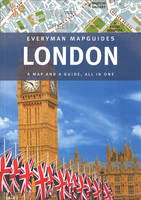
hardcover. Features 6 colour-coded districts, each with its own large-scale fold-out map. In this title, a spread at the front highlights the 10 sights you shouldn't miss; one at the back highlights the 10 best things to do when in London. It details of more than 100 restaurants, bars, cafes, shops, clubs, markets and art galleries. Editor(s): Pisano, Sandra. Num Pages: 56 pages. BIC Classification: 1DBKESL; WTH; WTRS. Category: (G) General (US: Trade). Dimension: 135 x 272 x 23. Weight in Grams: 190.
- Format
- Hardback
- Publication date
- 2012
- Publisher
- Everyman Citymap Guides
- Condition
- New
- SKU
- 9781841595702
- ISBN
- 9781841595702
Hardback
Condition: New
€ 8.99€ 5.80
€ 8.99
€ 5.80
Sheet map, folded. .
- Publisher
- Ordnance Survey
- Publication date
- 2015
- Edition
- September 2015 ed
- Condition
- New
- SKU
- V9780319470459
- ISBN
- 9780319470459
Hardback
Condition: New
€ 21.99€ 17.53
€ 21.99
€ 17.53
.
- Publisher
- Ordnance Survey
- Publication date
- 2015
- Edition
- September 2015 ed
- Condition
- New
- SKU
- V9780319243664
- ISBN
- 9780319243664
Hardback
Condition: New
€ 16.99€ 13.83
€ 16.99
€ 13.83
.
- Publisher
- Ordnance Survey
- Publication date
- 2015
- Edition
- September 2015 ed
- Condition
- New
- SKU
- V9780319470336
- ISBN
- 9780319470336
Hardback
Condition: New
€ 21.99€ 17.59
€ 21.99
€ 17.59
paperback. Beginning in the pioneering Victorian age, the author charts the evolution of architecture, branding, typeface, map design, interior and textile styles, posters, signage and graphic design and how these came together to shape the Underground's identity, and the character of London itself. Num Pages: 288 pages, illustrations. BIC Classification: 1DBKESL; ACX; AKC; WGF; WTR. Category: (G) General (US: Trade). Dimension: 186 x 221 x 19. Weight in Grams: 808.
- Publisher
- Penguin
- Number of pages
- 288
- Format
- Paperback
- Publication date
- 2013
- Condition
- New
- SKU
- V9781846144172
- ISBN
- 9781846144172
Paperback
Condition: New
€ 32.99€ 22.62
€ 32.99
€ 22.62
Sheet map, folded. Num Pages: 2 pages. BIC Classification: 1DBKSC; WTR. Category: (G) General (US: Trade). Dimension: 98 x 198 x 10. Weight in Grams: 34.
- Publisher
- Lonely Planet Global Limited
- Publication date
- 2017
- Edition
- 1st Edition
- Condition
- New
- SKU
- V9781786575098
- ISBN
- 9781786575098
Paperback
Condition: New
€ 7.40
€ 7.40
Sheet map, folded. Num Pages: 2 pages. BIC Classification: 1DBK; WTR. Category: (G) General (US: Trade). Dimension: 197 x 95. Weight in Grams: 500.
- Publisher
- Lonely Planet Global Limited
- Publication date
- 2017
- Edition
- 1st Edition
- Condition
- New
- SKU
- V9781786579058
- ISBN
- 9781786579058
Paperback
Condition: New
€ 7.40
€ 7.40
Sheet map, folded. Num Pages: 2 pages. BIC Classification: 1DST; WTR. Category: (G) General (US: Trade). Dimension: 197 x 95. Weight in Grams: 500.
- Publisher
- Lonely Planet Global Limited
- Publication date
- 2017
- Edition
- 1st Edition
- Condition
- New
- SKU
- V9781786579072
- ISBN
- 9781786579072
Paperback
Condition: New
€ 7.40
€ 7.40
Sheet map, folded. Num Pages: 2 pages. BIC Classification: 1KBBSL; WTR. Category: (G) General (US: Trade). Dimension: 99 x 198 x 10. Weight in Grams: 34.
- Publisher
- Lonely Planet Global Limited
- Publication date
- 2017
- Edition
- 1st Edition
- Condition
- New
- SKU
- V9781786575067
- ISBN
- 9781786575067
Paperback
Condition: New
€ 7.39
€ 7.39
Sheet map, folded. Num Pages: 2 pages. BIC Classification: 1MBN; WTR. Category: (G) General (US: Trade). Dimension: 197 x 95. Weight in Grams: 500.
- Publisher
- Lonely Planet Global Limited
- Publication date
- 2017
- Edition
- 1st Edition
- Condition
- New
- SKU
- V9781786579041
- ISBN
- 9781786579041
Paperback
Condition: New
€ 7.40
€ 7.40
Sheet map, folded. Num Pages: 2 pages. BIC Classification: 1DVKC; WTR. Category: (G) General (US: Trade). Dimension: 98 x 200 x 9. Weight in Grams: 34.
- Publisher
- Lonely Planet Global Limited
- Publication date
- 2017
- Edition
- 1st Edition
- Condition
- New
- SKU
- V9781786577863
- ISBN
- 9781786577863
Paperback
Condition: New
€ 8.99€ 8.67
€ 8.99
€ 8.67
Sheet map, folded. Num Pages: 2 pages. BIC Classification: 1KBBWF; WTRS. Category: (G) General (US: Trade). Dimension: 206 x 252 x 12. Weight in Grams: 34.
- Publisher
- Lonely Planet Global Limited
- Publication date
- 2016
- Edition
- 1st Edition
- Condition
- New
- SKU
- V9781786577818
- ISBN
- 9781786577818
Paperback
Condition: New
€ 7.39
€ 7.39
Sheet map, folded. Num Pages: 2 pages. BIC Classification: 1KBBFC; WTRS. Category: (G) General (US: Trade). Dimension: 199 x 267 x 9. Weight in Grams: 34.
- Publisher
- Lonely Planet Global Limited
- Publication date
- 2016
- Edition
- 1st Edition
- Condition
- New
- SKU
- V9781786577849
- ISBN
- 9781786577849
Paperback
Condition: New
€ 8.99€ 8.67
€ 8.99
€ 8.67
.
- Publisher
- Ordnance Survey
- Publication date
- 2015
- Edition
- September 2015 ed
- Condition
- New
- SKU
- V9780319471180
- ISBN
- 9780319471180
Paperback
Condition: New
€ 21.99€ 17.59
€ 21.99
€ 17.59
Series: OS Explorer Map. BIC Classification: 1DBKEML; WSZC; WTRM. Category: (G) General (US: Trade). Dimension: 135 x 241 x 42. Weight in Grams: 126.
- Publisher
- Ordnance Survey
- Publication date
- 2015
- Edition
- September 2015 ed
- Condition
- New
- SKU
- V9780319244395
- ISBN
- 9780319244395
Paperback
Condition: New
€ 16.99€ 14.25
€ 16.99
€ 14.25
Sheet map, folded. .
- Publisher
- Ordnance Survey
- Publication date
- 2015
- Edition
- September 2015 ed
- Condition
- New
- SKU
- V9780319471555
- ISBN
- 9780319471555
Paperback
Condition: New
€ 21.99€ 17.59
€ 21.99
€ 17.59

