Travel maps & atlases
Results 1341 - 1352 of 1352
Travel maps & atlases
Hardcover. Provides an illustrated account of the role that charts have played in planning, preventing, conducting and recording war on water. An introduction discusses the major themes with regard to naval warfare, navigation, and chart-making. The first chapter covers the period from earliest recorded history to the fifteenth century. Num Pages: 160 pages, 150 illustrations. BIC Classification: HBTM; JWF; TRLN; WTRM. Category: (G) General (US: Trade). Dimension: 313 x 290 x 17. Weight in Grams: 1306.
- Format
- Hardback
- Publication date
- 2006
- Publisher
- Conway
- Condition
- New
- SKU
- 9781844860319
- ISBN
- 9781844860319
Hardback
Condition: New
€ 23.99€ 8.87
€ 23.99
€ 8.87
Paperback. First published in 1953, the year that saw thousands descend on London to watch the coronation of Queen Elizabeth II, this is a lexicon of the city's curiosities, from the Achilles statue in Hyde Park 'erected by the women of England to honour (if not to resemble) the Duke of Wellington', to zebra crossings (relative newcomers to London in 1953). Num Pages: 152 pages, illustrations. BIC Classification: 1DBKESL; WTRS. Category: (G) General (US: Trade). Dimension: 111 x 179 x 19. Weight in Grams: 124.
- Format
- Paperback
- Publication date
- 2016
- Publisher
- Thames & Hudson Ltd
- Condition
- New
- SKU
- 9780500292471
- ISBN
- 9780500292471
Paperback
Condition: New
€ 8.99€ 5.70
€ 8.99
€ 5.70
Paperback. Series: Irish Maps, Atlases and Guides. BIC Classification: 1DBR; WTRD. Category: (G) General (US: Trade). Dimension: 264 x 189 x 12. Weight in Grams: 92.
- Format
- Paperback
- Publication date
- 2011
- Publisher
- Ordnance Survey Ireland
- Condition
- New
- Edition
- 4th Edition
- SKU
- KSS0005537
- ISBN
- 9781907122385
Paperback
Condition: New
€ 4.99
€ 4.99
Spiral bound. A new edition of this handy mini spiral format that fits easily into a pocket, briefcase or handbag. This detailed colour mini street atlas covers all of London from Richmond to Greenwich and from Highgate to Streatham, with enlarged maps of central London from Earl's Court to Tower Bridge. Series: Philip's Street Atlases. Num Pages: 320 pages, colour maps. BIC Classification: 1DBKESL; WTRS. Category: (G) General (US: Trade). Dimension: 146 x 120 x 20. Weight in Grams: 224.
- Format
- Spiralbound
- Publication date
- 2012
- Publisher
- Octopus Publishing Group
- Condition
- New
- SKU
- KSG0018450
- ISBN
- 9781849072083
Spiralbound
Condition: New
€ 4.99
€ 4.99
Sheet map, folded. Series: OS Explorer Map. BIC Classification: 1DBKSC; WSZC; WTRM. Category: (G) General (US: Trade). Dimension: 136 x 227 x 41. Weight in Grams: 100.
- Publication date
- 2015
- Publisher
- Ordnance Survey
- Condition
- New
- SKU
- 9780319246139
- ISBN
- 9780319246139
Spiralbound
Condition: New
€ 10.99€ 9.92
€ 10.99
€ 9.92
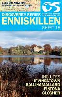
Sheet map, folded. Series: Irish Discoverer Series. BIC Classification: 1DBKN; WTRD. Category: (G) General (US: Trade). Dimension: 170 x 116 x 13. Weight in Grams: 80.
- Publication date
- 2012
- Publisher
- Land & Property Services
- Condition
- New
- SKU
- KTG0021737
- ISBN
- 9781905306633
Spiralbound
Condition: New
€ 14.99€ 4.99
€ 14.99
€ 4.99
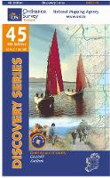
Sheet map, folded. Series: Irish Discovery Series. BIC Classification: 1DBR; WTRD. Category: (G) General (US: Trade). Dimension: 189 x 112 x 6. Weight in Grams: 74. Good clean copy with minor shelf wear
- Publication date
- 2012
- Publisher
- Ordnance Survey Ireland
- Condition
- Used, Very Good
- SKU
- KSS0005758
- ISBN
- 9781907122934
Spiralbound
Condition: Used, Very Good
€ 4.99
€ 4.99
Sheet map, folded. Series: Irish Discovery Series. BIC Classification: 1DBR; WTRD. Category: (G) General (US: Trade). Dimension: 190 x 111 x 7. Weight in Grams: 74.
- Publication date
- 2012
- Publisher
- Ordnance Survey Ireland
- Condition
- New
- SKU
- KSS0005756
- ISBN
- 9781907122866
Spiralbound
Condition: New
€ 4.99
€ 4.99
Paperback. Scale; 3.17 inches to 1 mile. This brand new pocket atlas features clear, user-friendly mapping without compromising on detail. It is ideal for the visitor who wants a compact atlas. BIC Classification: WTRS. Dimension: 152 x 102. Weight in Grams: 105. Good clean copy with some minor shelf wear
- Format
- Paperback
- Publication date
- 2002
- Publisher
- HarperCollins Publishers
- Condition
- Used, Very Good
- SKU
- KKD0006077
- ISBN
- 9780007143672
Paperback
Condition: Used, Very Good
€ 17.95
€ 17.95
Sheet map, folded. Series: Old O.S. Maps of England and Wales. BIC Classification: 1DBKEYK; WQH; WTRM. Category: (G) General (US: Trade). Dimension: 212 x 125 x 3. Weight in Grams: 24. One Inch Sheet 034. Series: Old O.S. Maps of England and Wales. Cateogry: (G) General (US: Trade). BIC Classification: 1DBKEYK; WQH; WTRM. Dimension: 212 x 125 x 3. Weight: 26.
- Publication date
- 2001
- Publisher
- The Godfrey Edition
- Edition
- Facsim.of 1865-1884 Ed
- Condition
- New
- SKU
- V9781841512662
- ISBN
- 9781841512662
Paperback
Condition: New
€ 7.00
€ 7.00
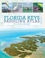
Paperback. A detailed color atlas of the Florida Keys from Key Largo to Key West designed for kayakers and other water enthusiasts interested in shallow water exploration. Series: Paddling Series. Num Pages: 128 pages, 180 colour illustrations, 53 maps. BIC Classification: 1KBBFL; WSSN5; WTR. Category: (G) General (US: Trade). Dimension: 280 x 216. .
- Format
- Paperback
- Publication date
- 2017
- Publisher
- Rowman & Littlefield
- Edition
- 2nd Edition
- Condition
- New
- SKU
- V9781493025510
- ISBN
- 9781493025510
Paperback
Condition: New
€ 37.99€ 29.74
€ 37.99
€ 29.74
Sheet map, folded.
- Publication date
- 2012
- Publisher
- National Geographic Maps United States
- Edition
- 2009th Edition
- Number of pages
- 1
- Condition
- New
- SKU
- V9781566954716
- ISBN
- 9781566954716
Paperback
Condition: New
€ 15.58
€ 15.58

