Travel maps & atlases
Results 625 - 648 of 1280
Travel maps & atlases
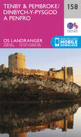
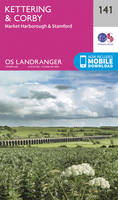
Sheet map, folded. .
- Publisher
- Ordnance Survey
- Publication date
- 2015
- Edition
- September 2015 ed
- Condition
- New
- SKU
- V9780319243824
- ISBN
- 9780319243824
Condition: New
€ 17.99€ 14.16
€ 17.99
€ 14.16
Sheet map, folded. Series: OS Landranger Map. BIC Classification: 1DBKWV; WSZC; WTRM. Category: (G) General (US: Trade). Dimension: 137 x 227 x 18. Weight in Grams: 110.
- Publisher
- Ordnance Survey
- Publication date
- 2016
- Edition
- February 2016 ed
- Condition
- New
- SKU
- V9780319262566
- ISBN
- 9780319262566
Condition: New
€ 17.99€ 14.27
€ 17.99
€ 14.27
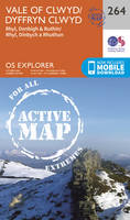
Sheet map, folded. Series: OS Explorer Map. BIC Classification: 1DBKEAN; WSZC; WTRM. Category: (G) General (US: Trade). Dimension: 136 x 228 x 36. Weight in Grams: 102.
- Publisher
- Ordnance Survey
- Publication date
- 2015
- Edition
- September 2015 ed
- Condition
- New
- SKU
- V9780319244234
- ISBN
- 9780319244234
Condition: New
€ 17.99€ 14.23
€ 17.99
€ 14.23
Sheet map, folded. .
- Publisher
- Ordnance Survey
- Publication date
- 2015
- Edition
- September 2015 ed
- Condition
- New
- SKU
- V9780319246665
- ISBN
- 9780319246665
Condition: New
€ 17.99€ 14.16
€ 17.99
€ 14.16
.
- Publisher
- Ordnance Survey
- Publication date
- 2015
- Edition
- September 2015 ed
- Condition
- New
- SKU
- V9780319471302
- ISBN
- 9780319471302
Condition: New
€ 23.99€ 17.55
€ 23.99
€ 17.55
.
- Publisher
- Ordnance Survey
- Publication date
- 2015
- Edition
- September 2015 ed
- Condition
- New
- SKU
- V9780319472644
- ISBN
- 9780319472644
Condition: New
€ 23.99€ 17.73
€ 23.99
€ 17.73
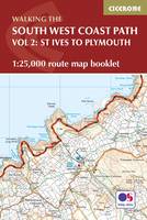
Paperback. Map of part of the southern section of the 630 mile (1014km) South West Coast Path National Trail. Covers the trail from St Ives to Plymouth along the west Cornwall and Devon coastline. This convenient and compact booklet of Ordnance Survey 1:25,000 maps shows the route, providing all of the mapping you need to walk the trail in either direction. Num Pages: 88 pages, OS 1:25,000 mapping and map legend. BIC Classification: 1DBKEW; WSZC; WTR. Category: (G) General (US: Trade). Dimension: 121 x 179 x 8. Weight in Grams: 120.
- Publisher
- Cicerone Press
- Format
- Paperback
- Publication date
- 2017
- Condition
- New
- SKU
- V9781852849375
- ISBN
- 9781852849375
Paperback
Condition: New
€ 17.99€ 14.16
€ 17.99
€ 14.16
Sheet map, folded. .
- Publisher
- Ordnance Survey
- Publication date
- 2015
- Edition
- May 2015 ed
- Condition
- New
- SKU
- V9780319242605
- ISBN
- 9780319242605
Paperback
Condition: New
€ 17.99€ 14.29
€ 17.99
€ 14.29
Sheet map, folded. .
- Publisher
- Ordnance Survey
- Publication date
- 2016
- Edition
- February 2016 ed
- Condition
- New
- SKU
- V9780319474112
- ISBN
- 9780319474112
Paperback
Condition: New
€ 23.99€ 17.73
€ 23.99
€ 17.73
Sheet map, folded. Series: Michelin Regional Maps. Num Pages: Colour Mapping. BIC Classification: 1DST; WTRM. Category: (G) General (US: Trade). Dimension: 154 x 250 x 9. Weight in Grams: 110.
- Publisher
- Michelin Travel Publications United Kingdom
- Publication date
- 2011
- Edition
- Fol Map
- Condition
- New
- SKU
- V9782067126732
- ISBN
- 9782067126732
Paperback
Condition: New
€ 8.99€ 8.02
€ 8.99
€ 8.02
.
- Publisher
- Ordnance Survey
- Publication date
- 2015
- Edition
- September 2015 ed
- Condition
- New
- SKU
- V9780319243589
- ISBN
- 9780319243589
Paperback
Condition: New
€ 17.99€ 14.28
€ 17.99
€ 14.28
.
- Publisher
- Ordnance Survey
- Publication date
- 2015
- Edition
- September 2015 ed
- Condition
- New
- SKU
- V9780319471142
- ISBN
- 9780319471142
Paperback
Condition: New
€ 23.99€ 17.55
€ 23.99
€ 17.55
Series: OS Explorer Map. BIC Classification: 1DBKEYK; WSZC; WTRM. Category: (G) General (US: Trade). Dimension: 137 x 241 x 29. Weight in Grams: 126.
- Publisher
- Ordnance Survey
- Publication date
- 2016
- Edition
- August 2016 ed
- Condition
- New
- SKU
- V9780319263358
- ISBN
- 9780319263358
Paperback
Condition: New
€ 17.99€ 14.32
€ 17.99
€ 14.32
map. Series: Route Map. Num Pages: 1 pages, 1 map. BIC Classification: 1DBKEYN; WSZC; WTRM. Category: (G) General (US: Trade). Dimension: 247 x 139 x 5. Weight in Grams: 72.
- Edition
- New ed.
- Publisher
- Harvey Map Services Ltd United Kingdom
- Number of pages
- 1
- Publication date
- 2007
- Condition
- New
- SKU
- V9781851374380
- ISBN
- 9781851374380
Paperback
Condition: New
€ 21.84
€ 21.84
Sheet map, folded. .
- Publisher
- Ordnance Survey
- Publication date
- 2015
- Edition
- September 2015 ed
- Condition
- New
- SKU
- V9780319244807
- ISBN
- 9780319244807
Paperback
Condition: New
€ 17.99€ 14.16
€ 17.99
€ 14.16
Sheet map, folded. .
- Publisher
- Ordnance Survey
- Publication date
- 2015
- Edition
- September 2015 ed
- Condition
- New
- SKU
- V9780319244364
- ISBN
- 9780319244364
Paperback
Condition: New
€ 17.99€ 14.11
€ 17.99
€ 14.11
Sheet map, folded. Series: OS Explorer Map. BIC Classification: 1DBKSC; WSZC; WTRM. Category: (G) General (US: Trade). Dimension: 135 x 243 x 52. Weight in Grams: 130.
- Publisher
- Ordnance Survey
- Publication date
- 2015
- Edition
- September 2015 ed
- Condition
- New
- SKU
- V9780319245705
- ISBN
- 9780319245705
Paperback
Condition: New
€ 17.99€ 14.20
€ 17.99
€ 14.20
Series: OS Explorer Map. BIC Classification: 1DBKEAS; WSZC; WTRM. Category: (G) General (US: Trade). Dimension: 136 x 240 x 14. Weight in Grams: 128.
- Publisher
- Ordnance Survey
- Publication date
- 2015
- Edition
- September 2015 ed
- Condition
- New
- SKU
- V9780319244241
- ISBN
- 9780319244241
Paperback
Condition: New
€ 17.99€ 14.29
€ 17.99
€ 14.29
Sheet map, folded. BIC Classification: WSZC; WTRM. Category: (G) General (US: Trade). Dimension: 245 x 114 x 4. Weight in Grams: 72.
- Publisher
- Harvey Map Services Ltd
- Publication date
- 2014
- Condition
- New
- SKU
- V9781851375264
- ISBN
- 9781851375264
Paperback
Condition: New
€ 21.31
€ 21.31
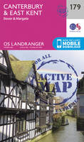
Sheet map, folded. Series: OS Landranger Map. BIC Classification: 1DBKEMM; WSZC; WTRM. Category: (G) General (US: Trade). Dimension: 135 x 228 x 39. Weight in Grams: 98.
- Publisher
- Ordnance Survey
- Publication date
- 2016
- Edition
- February 2016 ed
- Condition
- New
- SKU
- V9780319262399
- ISBN
- 9780319262399
Paperback
Condition: New
€ 17.99€ 14.11
€ 17.99
€ 14.11
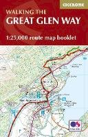
Paperback. Map of the 77-mile (123km) Great Glen Way (one of Scotland's Great Trails), between Fort William and Inverness. This booklet of Ordnance Survey 1:25,000 maps shows the full route, providing all of the mapping you need to complete the trail. The route typically takes a week to walk, and is suitable for walkers at all levels of experience. Num Pages: 48 pages. BIC Classification: 1DBKSH; WSZC; WTRM. Category: (G) General (US: Trade). Dimension: 166 x 106 x 5. .
- Publisher
- Cicerone Press
- Format
- Paperback
- Publication date
- 2016
- Condition
- New
- SKU
- V9781852848958
- ISBN
- 9781852848958
Paperback
Condition: New
€ 13.99€ 11.69
€ 13.99
€ 11.69
Paperback. Using colourful graphics, this book traces the history of urban transport systems, including rare and historic maps, diagrams, and photographs. Num Pages: 176 pages. BIC Classification: WG; WTR. Category: (G) General (US: Trade). Dimension: 243 x 278 x 15. Weight in Grams: 932.
- Publisher
- Penguin Books Ltd
- Format
- Paperback
- Publication date
- 2015
- Condition
- New
- SKU
- V9780141981444
- ISBN
- 9780141981444
Paperback
Condition: New
€ 33.99€ 23.03
€ 33.99
€ 23.03
Sheet map, folded. .
- Publisher
- Ordnance Survey
- Publication date
- 2015
- Edition
- September 2015 ed
- Condition
- New
- SKU
- V9780319471364
- ISBN
- 9780319471364
Paperback
Condition: New
€ 23.99€ 17.55
€ 23.99
€ 17.55
Sheet map, folded. .
- Publisher
- Ordnance Survey
- Publication date
- 2016
- Edition
- February 2016 ed
- Condition
- New
- SKU
- V9780319475027
- ISBN
- 9780319475027
Paperback
Condition: New
€ 23.99€ 17.47
€ 23.99
€ 17.47


