Travel maps & atlases
Results 1141 - 1160 of 1181
Travel maps & atlases
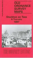
Sheet map, folded. Series: Old Ordnance Survey Maps of County Durham. BIC Classification: 1DBKEYD; 1DBKEYK; 3JH; WQH; WTRM. Category: (G) General (US: Trade). Dimension: 213 x 123 x 3. Weight in Grams: 26. Durham Sheet 50.16. Series: Old Ordnance Survey Maps of County Durham. Cateogry: (G) General (US: Trade). BIC Classification: 1DBKEYD; 1DBKEYK; 3JH; WQH; WTR. Dimension: 213 x 123 x 3. Weight: 24.
- Publisher
- Alan Godfrey Maps
- Publication date
- 1993
- Edition
- Facsimile
- Condition
- New
- SKU
- V9780850546163
- ISBN
- 9780850546163
Condition: New
€ 7.01
€ 7.01
.
- Publisher
- Alan Godfrey Maps
- Publication date
- 1989
- Edition
- Facsim.of 1901 Ed
- Condition
- New
- SKU
- V9780850542271
- ISBN
- 9780850542271
Condition: New
€ 6.97
€ 6.97
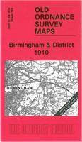
Sheet map, folded. Series: Old O.S. One Inch Maps. BIC Classification: WQH; WTRM. Category: (G) General (US: Trade). Dimension: 201 x 88 x 3. Weight in Grams: 26. One Inch Sheet 168. Series: Old O.S. One Inch Maps. Cateogry: (G) General (US: Trade). BIC Classification: WQH; WTRM. Dimension: 201 x 88 x 3. Weight: 24.
- Publisher
- The Godfrey Edition
- Publication date
- 2004
- Condition
- New
- SKU
- V9781841517261
- ISBN
- 9781841517261
Condition: New
€ 7.01
€ 7.01
.
- Publisher
- Ordnance Survey
- Publication date
- 2015
- Edition
- September 2015 ed
- Condition
- New
- SKU
- V9780319469972
- ISBN
- 9780319469972
Condition: New
€ 21.99€ 17.59
€ 21.99
€ 17.59
Sheet map, folded. Series: Old O.S. Maps of Wales. BIC Classification: 1DBKWS; WQH; WTRM. Category: (G) General (US: Trade). Dimension: 207 x 121 x 2. Weight in Grams: 24. One Inch Sheet 263. Series: Old O.S. Maps of Wales. Cateogry: (G) General (US: Trade). BIC Classification: 1DBKWS; WQH; WTRM. Dimension: 207 x 121 x 2. Weight: 24.
- Publisher
- Alan Godfrey Maps
- Publication date
- 1999
- Edition
- New ed of 1890 ed
- Condition
- New
- SKU
- V9781841511238
- ISBN
- 9781841511238
Condition: New
€ 7.01
€ 7.01
.
- Publisher
- Ordnance Survey
- Publication date
- 2015
- Edition
- September 2015 ed
- Condition
- New
- SKU
- V9780319469965
- ISBN
- 9780319469965
Condition: New
€ 21.99€ 17.45
€ 21.99
€ 17.45
.
- Publisher
- Ordnance Survey
- Publication date
- 2016
- Edition
- February 2016 ed
- Condition
- New
- SKU
- V9780319473658
- ISBN
- 9780319473658
Condition: New
€ 21.99€ 17.59
€ 21.99
€ 17.59
.
- Publisher
- Ordnance Survey
- Publication date
- 2016
- Edition
- February 2016 ed
- Condition
- New
- SKU
- V9780319474976
- ISBN
- 9780319474976
Condition: New
€ 21.99€ 17.59
€ 21.99
€ 17.59
.
- Publisher
- Ordnance Survey
- Publication date
- 2016
- Edition
- February 2016 ed
- Condition
- New
- SKU
- V9780319474068
- ISBN
- 9780319474068
Condition: New
€ 21.99€ 17.59
€ 21.99
€ 17.59
Paperback. Scale; 3.17 inches to 1 mile. This brand new pocket atlas features clear, user-friendly mapping without compromising on detail. It is ideal for the visitor who wants a compact atlas. BIC Classification: WTRS. Dimension: 152 x 102. Weight in Grams: 105. Good clean copy with some minor shelf wear
- Format
- Paperback
- Publication date
- 2002
- Publisher
- HarperCollins Publishers
- Condition
- Used, Very Good
- SKU
- KKD0006077
- ISBN
- 9780007143672
Paperback
Condition: Used, Very Good
€ 17.95
€ 17.95
Sheet map, folded. .
- Publisher
- Alan Godfrey Maps
- Publication date
- 2006
- Condition
- New
- SKU
- V9781841518855
- ISBN
- 9781841518855
Paperback
Condition: New
€ 6.97
€ 6.97
Sheet map, folded. Num Pages: 2 pages. BIC Classification: 1DBKE; WSQ; WTRM. Category: (G) General (US: Trade). Dimension: 232 x 142 x 11. Weight in Grams: 66.
- Publisher
- Heron Maps
- Publication date
- 2015
- Condition
- New
- SKU
- V9781908851161
- ISBN
- 9781908851161
Paperback
Condition: New
€ 9.75
€ 9.75
Sheet map, folded. BIC Classification: TRLN; WSSN3; WTRM. Category: (G) General (US: Trade); (P) Professional & Vocational. Dimension: 283 x 190 x 2. Weight in Grams: 74.
- Publisher
- Royal Yachting Association United Kingdom
- Publication date
- 2007
- Condition
- New
- SKU
- V9781906435110
- ISBN
- 9781906435110
Paperback
Condition: New
€ 11.84
€ 11.84
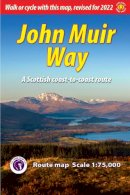
Sheet map, folded. The John Muir Way is a coast-to-coast route across Scotland from Helensburgh on the Clyde to Dunbar on the Forth, launched in April 2014. This map (scale 1:75,000) is designed for cyclists and walkers and has been created in partnership with Scottish Natural Heritage. It complements the Rucksack Readers guidebook with the same title. BIC Classification: 1DBKS; WTRM. Category: (G) General (US: Trade). Dimension: 152 x 223 x 2. Weight in Grams: 50.
- Publisher
- Rucksack Readers
- Publication date
- 2014
- Condition
- New
- SKU
- V9781898481607
- ISBN
- 9781898481607
Paperback
Condition: New
€ 9.27
€ 9.27
- Publisher
- Thailand
- Edition
- Fol Map
- Condition
- New
- SKU
- V9789749511442
- ISBN
- 9789749511442
Paperback
Condition: New
€ 15.99€ 14.09
€ 15.99
€ 14.09
Paperback. .
- Publisher
- Vertebrate Publishing
- Format
- Paperback
- Publication date
- 2015
- Condition
- New
- SKU
- V9781910240557
- ISBN
- 9781910240557
Paperback
Condition: New
€ 19.99€ 18.45
€ 19.99
€ 18.45
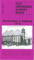
Paperback. Series: Old O.S. Maps of London. BIC Classification: 1DBKESL; 3JH; WQH; WTRM. Category: (G) General (US: Trade). Dimension: 210 x 121 x 2. Weight in Grams: 26.
- Publisher
- Alan Godfrey Maps United Kingdom
- Format
- Paperback
- Publication date
- 1995
- Edition
- Facsim.of 1872 Ed
- Condition
- New
- SKU
- V9780850547733
- ISBN
- 9780850547733
Paperback
Condition: New
€ 7.01
€ 7.01
Sheet map, folded. .
- Publisher
- Alan Godfrey Maps
- Publication date
- 2006
- Condition
- New
- SKU
- V9781841518824
- ISBN
- 9781841518824
Paperback
Condition: New
€ 7.04
€ 7.04
Hardback. .
- Publisher
- Pen & Sword Books Ltd
- Format
- Hardback
- Publication date
- 2016
- Condition
- New
- SKU
- V9781473833760
- ISBN
- 9781473833760
Hardback
Condition: New
€ 26.99€ 20.12
€ 26.99
€ 20.12
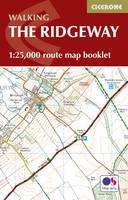
Paperback. Map of the 87 mile (139km) Ridgeway National Trail through the south of England from Avebury in Wiltshire to Ivinghoe Beacon in Buckinghamshire. This booklet is included with the Cicerone guidebook to the trail, and shows the full route on Ordnance Survey 1:25,000 maps. Presented in 12 stages in the guidebook, the trail typically takes 6-8 days. Num Pages: 56 pages, 56 pages of OS 1:25,000 mapping. BIC Classification: 1DBKE; WSZC; WTRM. Category: (G) General (US: Trade). Dimension: 115 x 170 x 7. Weight in Grams: 74.
- Publisher
- Cicerone Press
- Format
- Paperback
- Publication date
- 2016
- Condition
- New
- SKU
- V9781852849351
- ISBN
- 9781852849351
Paperback
Condition: New
€ 10.99€ 9.93
€ 10.99
€ 9.93

