Travel maps & atlases
Results 361 - 380 of 1162
Travel maps & atlases
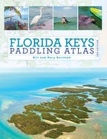
Paperback. A detailed color atlas of the Florida Keys from Key Largo to Key West designed for kayakers and other water enthusiasts interested in shallow water exploration. Series: Paddling Series. Num Pages: 128 pages, 180 colour illustrations, 53 maps. BIC Classification: 1KBBFL; WSSN5; WTR. Category: (G) General (US: Trade). Dimension: 280 x 216. .
- Format
- Paperback
- Publication date
- 2017
- Publisher
- Rowman & Littlefield
- Edition
- 2nd Edition
- Condition
- New
- SKU
- V9781493025510
- ISBN
- 9781493025510
Paperback
Condition: New
€ 35.99€ 28.38
€ 35.99
€ 28.38
Sheet map, folded. .
- Publisher
- Ordnance Survey
- Publication date
- 2015
- Edition
- September 2015 ed
- Condition
- New
- SKU
- V9780319246887
- ISBN
- 9780319246887
Paperback
Condition: New
€ 16.99€ 14.19
€ 16.99
€ 14.19
Sheet map, folded. .
- Publisher
- Ordnance Survey
- Publication date
- 2015
- Edition
- May 2015 ed
- Condition
- New
- SKU
- V9780319469590
- ISBN
- 9780319469590
Paperback
Condition: New
€ 21.99€ 17.59
€ 21.99
€ 17.59
Sheet map, folded. OS Explorer is the Ordnance Survey's most detailed map and is recommended for anyone enjoying outdoor activities like walking, horse riding and off-road cycling. Providing complete GB coverage the series details essential information such as youth hostels, pubs and visitor information as well as rights of way, permissive paths and bridleways. Series: OS Explorer Map. BIC Classification: 1DBKENL; WSZC; WTRM. Category: (G) General (US: Trade). Dimension: 242 x 135 x 38. Weight in Grams: 128.
- Publisher
- Ordnance Survey
- Publication date
- 2015
- Edition
- May 2015 ed
- Condition
- New
- SKU
- V9780319242803
- ISBN
- 9780319242803
Paperback
Condition: New
€ 16.99€ 14.08
€ 16.99
€ 14.08
Sheet map, folded. .
- Publisher
- Ordnance Survey
- Publication date
- 2015
- Edition
- September 2015 ed
- Condition
- New
- SKU
- V9780319472521
- ISBN
- 9780319472521
Paperback
Condition: New
€ 21.99€ 17.59
€ 21.99
€ 17.59
Sheet map, folded. .
- Publisher
- Ordnance Survey
- Publication date
- 2015
- Edition
- September 2015 ed
- Condition
- New
- SKU
- V9780319246320
- ISBN
- 9780319246320
Paperback
Condition: New
€ 16.99€ 14.15
€ 16.99
€ 14.15
Sheet map, folded. Formentera 25k scale Super-Durable Map is waterproof and super tough to fold up like new even after the toughest of adventures. Design includes cycling and walking routes in addition to tarmac roads and dirt tracks accessing the amazing beaches. 30 minutes from Ibiza discover Formentera with the most detailed and toughest map that you can buy. Num Pages: 2 pages, 25k scale topographic map. BIC Classification: 1DSEB; WTRM. Category: (G) General (US: Trade). Dimension: 228 x 121 x 18. Weight in Grams: 48.
- Publisher
- Discovery Walking Guides Ltd
- Publication date
- 2016
- Edition
- 1st
- Condition
- New
- SKU
- V9781782750246
- ISBN
- 9781782750246
Paperback
Condition: New
€ 14.99€ 12.40
€ 14.99
€ 12.40
Sheet map, folded. .
- Publisher
- Ordnance Survey
- Publication date
- 2016
- Edition
- February 2016 ed
- Condition
- New
- SKU
- V9780319473573
- ISBN
- 9780319473573
Paperback
Condition: New
€ 21.99€ 17.59
€ 21.99
€ 17.59
Sheet map, folded. Series: OS Landranger Map. BIC Classification: 1DBKSH; WSZC; WTRM. Category: (G) General (US: Trade). Dimension: 136 x 228 x 43. Weight in Grams: 98.
- Publisher
- Ordnance Survey
- Publication date
- 2016
- Edition
- February 2016 ed
- Condition
- New
- SKU
- V9780319261323
- ISBN
- 9780319261323
Paperback
Condition: New
€ 16.99€ 14.19
€ 16.99
€ 14.19
Sheet map. Series: Michelin National Maps. Num Pages: Colour Mapping. BIC Classification: 1DDF; WTRD. Category: (G) General (US: Trade). Dimension: 149 x 82 x 10. Weight in Grams: 42.
- Publication date
- 2010
- Publisher
- Michelin
- Edition
- 2017th Edition
- Condition
- New
- SKU
- V9782067149885
- ISBN
- 9782067149885
Paperback
Condition: New
€ 5.61
€ 5.61
Sheet map, folded. .
- Publisher
- Ordnance Survey
- Publication date
- 2016
- Edition
- February 2016 ed
- Condition
- New
- SKU
- V9780319473535
- ISBN
- 9780319473535
Paperback
Condition: New
€ 21.99€ 17.59
€ 21.99
€ 17.59
Sheet map, folded. .
- Publisher
- Ordnance Survey
- Publication date
- 2016
- Edition
- February 2016 ed
- Condition
- New
- SKU
- V9780319261286
- ISBN
- 9780319261286
Paperback
Condition: New
€ 16.99€ 14.25
€ 16.99
€ 14.25
Sheet map, folded. .
- Publisher
- Ordnance Survey
- Publication date
- 2016
- Edition
- February 2016 ed
- Condition
- New
- SKU
- V9780319473429
- ISBN
- 9780319473429
Paperback
Condition: New
€ 21.99€ 17.59
€ 21.99
€ 17.59
Sheet map, folded. .
- Publisher
- Ordnance Survey
- Publication date
- 2015
- Edition
- September 2015 ed
- Condition
- New
- SKU
- V9780319472866
- ISBN
- 9780319472866
Paperback
Condition: New
€ 21.99€ 17.59
€ 21.99
€ 17.59
Sheet map, folded. .
- Publisher
- Ordnance Survey
- Publication date
- 2015
- Edition
- September 2015 ed
- Condition
- New
- SKU
- V9780319246665
- ISBN
- 9780319246665
Paperback
Condition: New
€ 16.99€ 14.17
€ 16.99
€ 14.17
Series: OS Explorer Active Map. BIC Classification: 1DBKSB; WSZC; WTRM. Category: (G) General (US: Trade). Dimension: 140 x 243 x 24. Weight in Grams: 214.
- Publisher
- Ordnance Survey
- Publication date
- 2015
- Edition
- September 2015 ed
- Condition
- New
- SKU
- V9780319472101
- ISBN
- 9780319472101
Paperback
Condition: New
€ 21.99€ 17.45
€ 21.99
€ 17.45
Series: OS Explorer Map. BIC Classification: 1DBKSB; WSZC; WTRM. Category: (G) General (US: Trade). Dimension: 136 x 241 x 16. Weight in Grams: 128.
- Publisher
- Ordnance Survey
- Publication date
- 2015
- Edition
- September 2015 ed
- Condition
- New
- SKU
- V9780319245903
- ISBN
- 9780319245903
Paperback
Condition: New
€ 16.99€ 14.19
€ 16.99
€ 14.19
Sheet map, folded. Series: Irish Discovery Series. BIC Classification: 1DBR; WTRD. Category: (G) General (US: Trade). Dimension: 190 x 111 x 7. Weight in Grams: 74.
- Publication date
- 2012
- Publisher
- Ordnance Survey Ireland
- Condition
- New
- SKU
- KSS0005756
- ISBN
- 9781907122866
Paperback
Condition: New
€ 4.99
€ 4.99
Sheet map, folded. A detailed map of Galway City and surrounding area complete with street index, places of interest and City Centre extract. Series: Irish Street Maps. BIC Classification: 1DBR; WTRS. Category: (G) General (US: Trade). Dimension: 126 x 260 x 17. Weight in Grams: 92.
- Publication date
- 2016
- Publisher
- Ordnance Survey Ireland
- Condition
- New
- SKU
- 9781908852731
- ISBN
- 9781908852731
Paperback
Condition: New
€ 14.99€ 14.78
€ 14.99
€ 14.78
Sheet map, folded. Series: Old O.S. Maps of Lancashire. BIC Classification: 1DBKENL; 3JJC; WQH; WTRM. Category: (G) General (US: Trade). Dimension: 208 x 121 x 3. Weight in Grams: 26. Lancashire Sheet 113.12. Series: Old O.S. Maps of Lancashire. Cateogry: (G) General (US: Trade). BIC Classification: 1DBKENL; 3JJC; WQH; WTRM. Dimension: 208 x 121 x 3. Weight: 26.
- Publisher
- Alan Godfrey Maps
- Publication date
- 2000
- Edition
- Facsimile of 1905 ed
- Condition
- New
- SKU
- V9781841511894
- ISBN
- 9781841511894
Paperback
Condition: New
€ 7.01
€ 7.01

