British Isles
Results 16345 - 16361 of 16361
British Isles
Hardcover. Num Pages: 144 pages, Over 100 colour photographs. BIC Classification: 1DBKEWD; AJC; WTM. Category: (G) General (US: Trade). Dimension: 222 x 239 x 15. Weight in Grams: 764.
- Publisher
- Halsgrove United Kingdom
- Number of pages
- 144
- Format
- Hardback
- Publication date
- 2009
- Edition
- 1st Updated
- Condition
- New
- SKU
- V9781841148564
- ISBN
- 9781841148564
Hardback
Condition: New
€ 23.99€ 20.71
€ 23.99
€ 20.71
Paperback. Age has been a neglected 'ism' of discrimination. However, the 2006 regulations outlawing age discrimination at work require us to think about this more carefully. This book is for anyone concerned about age discrimination and wanting guidance on what to expect. Series: Speed Reads. Num Pages: 32 pages. BIC Classification: 1DBK; KJMV2; LNHD. Category: (P) Professional & Vocational. Dimension: 208 x 120 x 4. Weight in Grams: 72.
- Publisher
- Directory of Social Change
- Format
- Paperback
- Publication date
- 2010
- Condition
- New
- SKU
- V9781906294434
- ISBN
- 9781906294434
Paperback
Condition: New
€ 12.41
€ 12.41
Paperback. This book provides a unique critical perspective on the changing nature of later life by examining the engagement of older people with consumer society in Britain since the 1960s. Series: Ageing and the Lifecourse Series. Num Pages: 160 pages, black & white illustrations, black & white tables, figures. BIC Classification: 1DBK; JFFT; JFSP31. Category: (UP) Postgraduate, Research & Scholarly. Dimension: 240 x 172 x 10. Weight in Grams: 295.
- Format
- Paperback
- Publication date
- 2008
- Publisher
- Policy Press United Kingdom
- Number of pages
- 160
- Condition
- New
- SKU
- V9781861348821
- ISBN
- 9781861348821
Paperback
Condition: New
€ 40.99€ 38.28
€ 40.99
€ 38.28
Hardback. Seeking to better understand what it means to grow older in contemporary Britain from the perspective of older people themselves, this richly detailed ethnographic study engages in debates over selfhood and people's relationships with time. Series Editor(s): Smith, Alexander. Series: New Ethnographies. Num Pages: 176 pages, 3 black & white illustrations. BIC Classification: 1DBK; JHM. Category: (P) Professional & Vocational. Dimension: 164 x 275 x 19. Weight in Grams: 412.
- Format
- Hardback
- Publication date
- 2012
- Publisher
- Manchester University Press United Kingdom
- Number of pages
- 176
- Condition
- New
- SKU
- V9780719083082
- ISBN
- 9780719083082
Hardback
Condition: New
€ 158.18
€ 158.18
Hardback. A carefully crafted study of ageing in Ireland, one of the countries hardest hit by the Eurozone financial crisis, presenting a critical analysis of ageing and social policy in a country under tight austerity measures. Editor(s): Carney, Gemma M.; Ni Leime, Aine. Num Pages: 208 pages. BIC Classification: 1DBR; JFSP3; JHBD; KC. Category: (UP) Postgraduate, Research & Scholarly. Dimension: 243 x 163 x 17. Weight in Grams: 450.
- Publisher
- Bristol University Press
- Format
- Hardback
- Publication date
- 2015
- Condition
- New
- SKU
- V9781447316237
- ISBN
- 9781447316237
Hardback
Condition: New
€ 202.29
€ 202.29
Paperback. The true story of the Agent Fifi, whose mere identity was only disclosed in September 2014 as Marie Chilver. Num Pages: 232 pages, 20. BIC Classification: 1DBK; 3JJH; BGH; HBJD1; HBWQ; JPSH. Category: (G) General (US: Trade). Dimension: 128 x 245 x 18. Weight in Grams: 164.
- Publisher
- Amberley Publishing
- Format
- Paperback
- Publication date
- 2016
- Edition
- Reprint
- Condition
- New
- SKU
- V9781445660189
- ISBN
- 9781445660189
Paperback
Condition: New
€ 16.99€ 15.26
€ 16.99
€ 15.26
Paperback. The life and poignant death of one of Britain's bravest women. Eileen Nearne, or Agent Rose, was one of forty women sent into France by the Special Operations Executive (SOE), Churchill's top secret wartime 'spooks' organisation. Num Pages: 256 pages, 26. BIC Classification: 1DBK; 3JJH; BGH; BT; HBWQ; JPSH. Category: (G) General (US: Trade). Dimension: 197 x 141 x 19. Weight in Grams: 268. Very good copy with light shelf wear. Light nicks, remains very good
- Format
- Paperback
- Publication date
- 2014
- Publisher
- Amberley Publishing
- Condition
- Used, Very Good
- SKU
- KCW0016814
- ISBN
- 9781445641454
Paperback
Condition: Used, Very Good
€ 4.99
€ 4.99
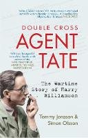
Paperback. The wartime career of British double-cross agent TATE, who makes agent ZIGZAG look like a bit of a wuss Num Pages: 272 pages, 56 illustrations. BIC Classification: 1DBK; 3JJH; BGH; HBWQ; JPSH. Category: (G) General (US: Trade). Dimension: 198 x 126 x 16. Weight in Grams: 252. The Wartime Story of Harry Williamson. 272 pages, 56 illustrations. The wartime career of British double-cross agent TATE, who makes agent ZIGZAG look like a bit of a wuss. Cateogry: (G) General (US: Trade). BIC Classification: 1DBK; 3JJH; BGH; HBWQ; JPSH. Dimension: 198 x 126 x 16. Weight: 252.
- Publisher
- Amberley Publishing
- Number of pages
- 272
- Format
- Paperback
- Publication date
- 2012
- Condition
- New
- SKU
- V9781445608648
- ISBN
- 9781445608648
Paperback
Condition: New
€ 20.45
€ 20.45
Paperback. The "Campaign" titles provide concise accounts of the great conflicts of history, assessing each commander's strategy, and recounting the progress of the fighting using 3-D battle maps to illustrate the critical stages. This covers the victory of Henry V's heavily-outnumbered army at Agincourt. Series: Osprey Campaign S. Num Pages: 96 pages, 10 colour plates, 3 3-D maps, 70 b&w illustrations. BIC Classification: 1DBKE; 3H; HBJD1; HBLC; JWL. Category: (G) General (US: Trade). Dimension: 248 x 186 x 7. Weight in Grams: 315.
- Format
- Paperback
- Publication date
- 1991
- Publisher
- Osprey Publishing
- Edition
- First Edition
- Number of pages
- 96
- Condition
- New
- SKU
- V9781855321328
- ISBN
- 9781855321328
Paperback
Condition: New
€ 23.99€ 20.75
€ 23.99
€ 20.75
Hardback. The story of Agincourt, one of the most iconic battles in English history - how it was fought, how it has been remembered, and what it has come to mean Series: Great Battles. Num Pages: 272 pages, 25 b&w halftones, 5 maps. BIC Classification: 1DBK; 1DDF; 3H; HBJD; HBLC; HBW; JWL. Category: (G) General (US: Trade). Dimension: 151 x 224 x 22. Weight in Grams: 458.
- Publisher
- Oxford University Press
- Format
- Hardback
- Publication date
- 2015
- Condition
- New
- SKU
- V9780199681013
- ISBN
- 9780199681013
Hardback
Condition: New
€ 36.99€ 36.73
€ 36.99
€ 36.73
Paperback. One of the most successful history books of recent years, Agincourt is reissued with a new introduction by Bernard Cornwell and a new preface by Juliet Barker to mark the 600th anniversary of the battle. Num Pages: 528 pages, Section: 16, b/w. BIC Classification: 1DBKE; 1DDF; 3H; HBJD; HBLC. Category: (G) General (US: Trade). Dimension: 196 x 128 x 32. Weight in Grams: 438.
- Format
- Paperback
- Publication date
- 2006
- Publisher
- Abacus
- Edition
- New Ed
- Condition
- New
- SKU
- V9780349119182
- ISBN
- 9780349119182
Paperback
Condition: New
€ 16.99€ 12.52
€ 16.99
€ 12.52
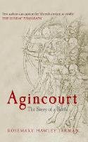
Paperback. The fascinating story of the Battle of Agincourt told by a distinguished historical novelist Num Pages: 192 pages. BIC Classification: 1DBKE; 1DDF; 3H; HBJD; HBLC; HBW; JWLF. Category: (G) General (US: Trade). Dimension: 126 x 198 x 25. Weight in Grams: 180.
- Publisher
- Amberley Publishing
- Format
- Paperback
- Publication date
- 2015
- Condition
- New
- SKU
- V9781445619750
- ISBN
- 9781445619750
Paperback
Condition: New
€ 18.76
€ 18.76
paperback. Presents a portrait of Julius Agricola - the most famous governor of Roman Britain and Tacitus' well-loved and respected father-in-law. This title offers fascinating descriptions of the geography, climate and people of the country, and an account of the early stages of the Roman occupation of Britain. Editor(s): Rives, James. Translator(s): Mattingly, H. Num Pages: 176 pages, maps. BIC Classification: 1DB; 1QDAR; DB; HBJD1; HBLA. Category: (G) General (US: Trade). Dimension: 197 x 130 x 12. Weight in Grams: 134.
- Publisher
- Penguin
- Number of pages
- 176
- Format
- Paperback
- Publication date
- 2010
- Edition
- Revised
- Condition
- New
- SKU
- V9780140455403
- ISBN
- 9780140455403
Paperback
Condition: New
€ 14.99€ 11.90
€ 14.99
€ 11.90
Paperback. The perfectly formed humour title of the year everyone already wants Num Pages: 192 pages, 50 b/w line illustrations. BIC Classification: 1DBKS; WHX. Category: (G) General (US: Trade). Dimension: 168 x 128 x 14. Weight in Grams: 158.
- Publisher
- Hachette Scotland
- Format
- Paperback
- Publication date
- 2009
- Condition
- New
- SKU
- KRS0029626
- ISBN
- 9780755319497
Paperback
Condition: New
€ 4.99
€ 4.99
Paperback. The perfectly formed humour title of the year everyone already wants Num Pages: 192 pages, 50 b/w line illustrations. BIC Classification: 1DBKS; WHX. Category: (G) General (US: Trade). Dimension: 168 x 128 x 14. Weight in Grams: 158. Good clean copy with some minor shelf wear
- Condition
- Used, Very Good
- Publisher
- Hachette Scotland
- Format
- Paperback
- Publication date
- 2009
- SKU
- KRS0029634
- ISBN
- 9780755319497
Paperback
Condition: Used, Very Good
€ 4.99
€ 4.99
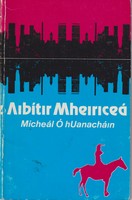
Paperback. Filíocht. an clúdach rud beag caite. maisithe. 48pp
- Condition
- Used, Good
- Edition
- An Chéad Chló
- Publisher
- "An Clóchomhar,"
- Format
- Paperback
- Publication date
- 1982
- SKU
- KTK0001781
- ISBN
- 9781906882273
Paperback
Condition: Used, Good
€ 20.99€ 12.00
€ 20.99
€ 12.00
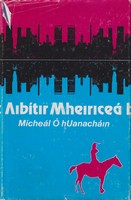
Paperback. Filíocht. an clúdach deannaaigh caite. maisithe. 48pp
- Condition
- Used, Good
- Edition
- An Chéad Chló
- Publisher
- "An Clóchomhar,"
- Format
- Paperback
- Publication date
- 1982
- SKU
- KTK0001780
- ISBN
- 9781906882273
Paperback
Condition: Used, Good
€ 20.99€ 15.00
€ 20.99
€ 15.00
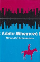
Paperback. Lé linn agus direach in ndiadh turas fada a rinne Micheal agus a bhean go dtí na Stait Aontaithe i 1979. During and after a trip to the U.S.A.
- Condition
- Used, Like New
- Edition
- An Chéad Chló
- Publisher
- "An Clóchomhar,"
- Format
- Paperback
- Publication date
- 1982
- SKU
- KMR0005250
- ISBN
- 9781906882273
Paperback
Condition: Used, Like New
€ 20.99€ 14.41
€ 20.99
€ 14.41
Paperback. This volume records the speed and nature of the public and official response to AIDS in the UK, describing how, in less than 15 years, a network of organizations developed, devoted to the study, containment and treatment of this new, critical disease. Num Pages: 404 pages, line figures, tables. BIC Classification: 1DBK; 3JJPN; 3JJPR; JFFH2; MBN; MBX; MJCJ2. Category: (P) Professional & Vocational. Dimension: 216 x 138 x 24. Weight in Grams: 550.
- Format
- Paperback
- Publication date
- 1996
- Publisher
- Oxford University Press United Kingdom
- Number of pages
- 404
- Condition
- New
- SKU
- V9780198204732
- ISBN
- 9780198204732
Paperback
Condition: New
€ 76.59
€ 76.59
Hardback. Gearrscéalta. stampaí leabharlainne. ainm scríofa ar an mbilleog ceangal. 221pp.
- Condition
- Used, Good
- Publisher
- Oifig an tSoláthair
- Format
- Hardback
- Publication date
- 1940
- SKU
- KTK0000333
Hardback
Condition: Used, Good
€ 18.00
€ 18.00
Hardback. Stampaí leabharlainne. 220pp
- Condition
- Used, Very Good
- Publisher
- Oifig an tSoláthair Baile Átha Cliath
- Format
- Hardback
- Publication date
- 1959
- SKU
- KTK0002122
Hardback
Condition: Used, Very Good
€ 20.00
€ 20.00
hardcover. A close look at the effects of air raids on school attendance. Detailed information about the three Zeppelin raids on Leyton with extracts from contemporary letters, diaries, newspapers and combat reports. Num Pages: 224 pages, 32 illustrations. BIC Classification: 1DBKEAX; 3JJF; HBJD; HBLW; HBWN; JWG. Category: (G) General (US: Trade). Dimension: 316 x 313 x 23. Weight in Grams: 644.
- Format
- Hardback
- Publication date
- 2015
- Publisher
- Pen & Sword Aviation
- Condition
- New
- SKU
- 9781473834125
- ISBN
- 9781473834125
Hardback
Condition: New
€ 19.99€ 6.49
€ 19.99
€ 6.49
Hardcover. The author enlists her readers in pursuit of the elusive concept of atmosphere in literary works. In this title, she shows how diverse conceptions of air in the eighteenth century converged in British fiction, producing the modern literary sense of atmosphere and moving novelists to explore the threshold between material and immaterial worlds. Num Pages: 336 pages, 8 halftones. BIC Classification: 1DBK; DSB; PDX. Category: (G) General (US: Trade). Dimension: 229 x 152 x 25. Weight in Grams: 544.
- Format
- Hardback
- Publication date
- 2012
- Publisher
- The University of Chicago Press United States
- Number of pages
- 336
- Condition
- New
- SKU
- V9780226476698
- ISBN
- 9780226476698
Hardback
Condition: New
€ 53.03€ 45.64
€ 53.03
€ 45.64
Paperback. .
- Publisher
- Pen & Sword Books Ltd
- Format
- Paperback
- Publication date
- 2014
- Condition
- New
- SKU
- V9781783030408
- ISBN
- 9781783030408
Paperback
Condition: New
€ 19.99€ 16.02
€ 19.99
€ 16.02


