Geographical information systems (GIS) & remote sensing
Results 81 - 96 of 96
Geographical information systems (GIS) & remote sensing
Hardcover. Satellites are able to gather a wide variety of data for earth scientists. This book presents both the theory and practical applications of remote sensing satellite data to geological problems. The applications include: mineral explorations, hydrocarbon exploration, stratigraphy, engineering geology, and environmental studies. Editor(s): Rencz, Andrew N.; Ryerson, Robert A. Series: Manual of Remote Sensing. Num Pages: 728 pages, Illustrationssome col.), maps. BIC Classification: RB; RGW. Category: (P) Professional & Vocational; (UP) Postgraduate, Research & Scholarly. Dimension: 263 x 180 x 47. Weight in Grams: 1614.
- Format
- Hardback
- Publication date
- 1999
- Publisher
- John Wiley and Sons Ltd United States
- Edition
- 3rd Edition
- Number of pages
- 728
- Condition
- New
- SKU
- V9780471294054
- ISBN
- 9780471294054
Hardback
Condition: New
€ 374.06
€ 374.06
Hardcover. The IUPAC Series on Analytical and Physical Chemistry of Environmental Systems provides the scientific community with a critical evaluation of the state of the art on physicochemical structures and reactions in environmental systems, as well as on the analytical techniques required to study and monitor these systems. Editor(s): Harrison, Roy M.; Grieken, Rene van. Series: Series on Analytical and Physical Chemistry of Environmental Systems. Num Pages: 622 pages, illustrations. BIC Classification: PHVJ; PNR; RGW; RNP. Category: (P) Professional & Vocational; (UP) Postgraduate, Research & Scholarly. Dimension: 240 x 165 x 38. Weight in Grams: 1040.
- Format
- Hardback
- Publication date
- 1998
- Publisher
- John Wiley and Sons Ltd United Kingdom
- Edition
- 1st Edition
- Number of pages
- 622
- Condition
- New
- SKU
- V9780471959359
- ISBN
- 9780471959359
Hardback
Condition: New
€ 751.12
€ 751.12
Hardcover. Covers the convergent use of GIS for Location Science analysis, written by two of the leading researchers in the field. Introduction to new field at juncture of two mature disciplines. Includes ArcGIS and LINGO application files and data sets which will accompany the end of chapter questions. Num Pages: 320 pages, Illustrations, maps. BIC Classification: KJMV4; RGW. Category: (P) Professional & Vocational. Dimension: 244 x 162 x 20. Weight in Grams: 578.
- Format
- Hardback
- Publication date
- 2008
- Publisher
- John Wiley and Sons Ltd United Kingdom
- Edition
- 1st Edition
- Number of pages
- 320
- Condition
- New
- SKU
- V9780470191064
- ISBN
- 9780470191064
Hardback
Condition: New
€ 191.08
€ 191.08
Paperback. Num Pages: 112 pages, illustrations, maps. BIC Classification: RGW. Category: (G) General (US: Trade); (P) Professional & Vocational; (UP) Postgraduate, Research & Scholarly. Dimension: 276 x 216 x 7. Weight in Grams: 290.
- Format
- Paperback
- Publication date
- 1999
- Publisher
- John Wiley and Sons Ltd United States
- Edition
- 1st Edition
- Number of pages
- 112
- Condition
- New
- SKU
- V9780471195986
- ISBN
- 9780471195986
Paperback
Condition: New
€ 89.28
€ 89.28
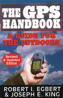
Paperback. Num Pages: 192 pages, 30 b/w photos. BIC Classification: RGW; UDH. Category: (G) General (US: Trade). Dimension: 209 x 140 x 13. Weight in Grams: 226.
- Format
- Paperback
- Publication date
- 2008
- Publisher
- Burford Books,U.S. United States
- Edition
- Revised, Updated
- Number of pages
- 192
- Condition
- New
- SKU
- V9781580801492
- ISBN
- 9781580801492
Paperback
Condition: New
€ 16.99€ 16.75
€ 16.99
€ 16.75
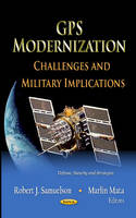
Hardback. Editor(s): Samuelson, Robert J.; Mata, Marlin. Num Pages: 148 pages, illustrations. BIC Classification: JWK; RGW. Category: (P) Professional & Vocational; (UP) Postgraduate, Research & Scholarly; (UU) Undergraduate. Dimension: 236 x 158 x 15. Weight in Grams: 366.
- Publisher
- Nova Science Publishers Inc United States
- Number of pages
- 148
- Format
- Hardback
- Publication date
- 2012
- Edition
- UK ed.
- Condition
- New
- SKU
- V9781619425897
- ISBN
- 9781619425897
Hardback
Condition: New
€ 162.91€ 111.07
€ 162.91
€ 111.07
Hardback. Num Pages: 250 pages. BIC Classification: PHVB; RGW; TTD. Category: (UP) Postgraduate, Research & Scholarly. Dimension: 260 x 180. .
- Publisher
- Nova Science Publishers Inc
- Format
- Hardback
- Publication date
- 2017
- Condition
- New
- SKU
- V9781633219182
- ISBN
- 9781633219182
Hardback
Condition: New
€ 244.37€ 182.73
€ 244.37
€ 182.73
Hardback. This book provides the reader a broad grounding in the science of Earth Observation (EO) of our changing planet. It contains a comprehensive sequenced discussion covering the significant themes of global change, their cause, and how they can be monitored through time. Num Pages: 384 pages, Illustrations, maps. BIC Classification: RBP; RGW; RNPG. Category: (P) Professional & Vocational. Dimension: 256 x 192 x 24. Weight in Grams: 1104.
- Format
- Hardback
- Publication date
- 2011
- Publisher
- John Wiley and Sons Ltd United Kingdom
- Edition
- 1st Edition
- Number of pages
- 384
- Condition
- New
- SKU
- V9781444339352
- ISBN
- 9781444339352
Hardback
Condition: New
€ 206.82
€ 206.82
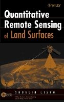
Hardcover. Processing the vast amounts of data on the Earth's land surface environment generated by NASA's and other international satellite programs is a significant challenge. Series: Wiley Series in Remote Sensing & Image Processing. Num Pages: 560 pages, references. BIC Classification: RGW; TNC. Category: (P) Professional & Vocational. Dimension: 245 x 167 x 34. Weight in Grams: 960.
- Format
- Hardback
- Publication date
- 2003
- Publisher
- John Wiley & Sons Inc United States
- Edition
- 1st Edition
- Number of pages
- 560
- Condition
- New
- SKU
- V9780471281665
- ISBN
- 9780471281665
Hardback
Condition: New
€ 320.84
€ 320.84
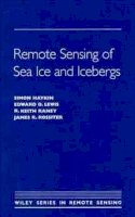
Hardcover. The most recent sensing technologies as they apply to the study of sea ice and its properties are presented in this text. The contributors describe technologies that include acoustic sensing, ice thickness and measurement, ground wave radar, and passive microwave remote sensing. Series: Wiley Series in Remote Sensing & Image Processing. Num Pages: 686 pages. BIC Classification: RBGD; RBKC; RGW. Category: (P) Professional & Vocational; (UP) Postgraduate, Research & Scholarly; (UU) Undergraduate. Dimension: 234 x 161 x 41. Weight in Grams: 1182.
- Format
- Hardback
- Publication date
- 1994
- Publisher
- John Wiley and Sons Ltd United States
- Edition
- 1st Edition
- Number of pages
- 686
- Condition
- New
- SKU
- V9780471554943
- ISBN
- 9780471554943
Hardback
Condition: New
€ 296.26
€ 296.26
Hardcover. This unique work introduces the basic principles of artificial intelligence with applications in geographical teaching and research, GIS, and planning. Written in an accessible, non-technical and witty style, this book marks the beginning of the Al revolution in geography with major implications for teaching and research. Num Pages: 348 pages, Illustrations, maps. BIC Classification: RGW; UYQ. Category: (P) Professional & Vocational; (UP) Postgraduate, Research & Scholarly; (UU) Undergraduate. Dimension: 239 x 161 x 25. Weight in Grams: 650.
- Format
- Hardback
- Publication date
- 1997
- Publisher
- John Wiley and Sons Ltd United Kingdom
- Edition
- 1st Edition
- Number of pages
- 348
- Condition
- New
- SKU
- V9780471969914
- ISBN
- 9780471969914
Hardback
Condition: New
€ 392.20
€ 392.20
Hardcover. "If we are to solve many of the problems facing us-in the cities, in the wild areas of the earth, in the atmosphere, and the oceans-we shall need the help of skilled users of GIS technology. If readers can master what is in this volume, they will be well started on this enterprise. Num Pages: 448 pages, maps. BIC Classification: RGW. Category: (P) Professional & Vocational; (U) Tertiary Education (US: College). Dimension: 240 x 163 x 30. Weight in Grams: 824.
- Format
- Hardback
- Publication date
- 2002
- Publisher
- John Wiley and Sons Ltd United States
- Edition
- 3rd Edition
- Number of pages
- 448
- Condition
- New
- SKU
- V9780471419686
- ISBN
- 9780471419686
Hardback
Condition: New
€ 171.71
€ 171.71
Paperback. A quantitative yet accessible introduction to remote sensing techniques, this new edition covers a broad spectrum of Earth science applications. Num Pages: 460 pages, 323 b/w illus. 40 colour illus. BIC Classification: RGW; TTB. Category: (P) Professional & Vocational; (U) Tertiary Education (US: College). Dimension: 244 x 190 x 23. Weight in Grams: 1066. 460 pages, 323 b/w illus. 40 colour illus. A quantitative yet accessible introduction to remote sensing techniques, this new edition covers a broad spectrum of Earth science applications. Cateogry: (P) Professional & Vocational; (U) Tertiary Education (US: College). BIC Classification: RGW; TTB. Dimension: 244 x 190 x 23. Weight: 1054.
- Publisher
- Cambridge University Press
- Number of pages
- 460
- Format
- Paperback
- Publication date
- 2012
- Edition
- 3rd Edition
- Condition
- New
- SKU
- V9780521181167
- ISBN
- 9780521181167
Paperback
Condition: New
€ 119.94
€ 119.94
Paperback. Includes almost one hundred maps, satellite and aerial photographs, and computer graphics to illustrate the products of remote sensing. An indispensable guidebook for ecologists, conservation biologists, and resource managers. Series: Issues, Cases, and Methods in Biodiversity Conservation. Num Pages: 295 pages, 1 photo, 94 figures. BIC Classification: RGW; RNF; TTB. Category: (P) Professional & Vocational. Dimension: 241 x 159 x 18. Weight in Grams: 454.
- Format
- Paperback
- Publication date
- 1996
- Publisher
- Columbia University Press United States
- Number of pages
- 295
- Condition
- New
- SKU
- V9780231079297
- ISBN
- 9780231079297
Paperback
Condition: New
€ 58.31
€ 58.31
Hardback. This title focuses on the evolution of the modeling process and on new research perspectives in theoretical and applied geography, as well as spatial planning. In the last 50 years, the achievements of spatial analysis models opened the way to a new understanding of the relationship between society and geographical space. Editor(s): Guermond, Yves. Series: ISTE. Num Pages: 376 pages, Illustrations. BIC Classification: RGW. Category: (P) Professional & Vocational. Dimension: 242 x 163 x 26. Weight in Grams: 688.
- Format
- Hardback
- Publication date
- 2009
- Publisher
- ISTE Ltd and John Wiley & Sons Inc United Kingdom
- Edition
- 1st Edition
- Number of pages
- 376
- Condition
- New
- SKU
- V9781848210875
- ISBN
- 9781848210875
Hardback
Condition: New
€ 189.71
€ 189.71
Hardback. This book presents Internet GIS in an applied and practical manner, including an introduction to basic network architecture and application development. Information is also provided on metadata, recent open standard initiatives, and ways of assuring a current system will be compatible with future designs. Num Pages: 720 pages, Illustrations, maps. BIC Classification: RGW; UDB. Category: (P) Professional & Vocational. Dimension: 242 x 161 x 37. Weight in Grams: 1140.
- Format
- Hardback
- Publication date
- 2003
- Publisher
- John Wiley and Sons Ltd United States
- Number of pages
- 720
- Condition
- New
- SKU
- V9780471359234
- ISBN
- 9780471359234
Hardback
Condition: New
€ 197.76
€ 197.76


