Active outdoor pursuits
Results 913 - 936 of 2144
Active outdoor pursuits
Num Pages: 64 pages, illustrated with colour photographs and sketch maps. BIC Classification: 1DBKEWS; WSZC; WTH. Category: (G) General (US: Trade). Dimension: 124 x 163 x 12. Weight in Grams: 166.
- Number of pages
- 64
- Publisher
- Pixz Books United Kingdom
- Format
- Hardback
- Publication date
- 2014
- Condition
- New
- SKU
- V9780857100870
- ISBN
- 9780857100870
Hardback
Condition: New
€ 8.32
€ 8.32
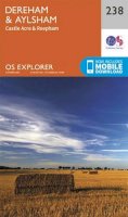
Sheet map, folded. .
- Publisher
- Ordnance Survey
- Publication date
- 2015
- Edition
- September 2015 ed
- Condition
- New
- SKU
- V9780319469880
- ISBN
- 9780319469880
Hardback
Condition: New
€ 23.99€ 17.77
€ 23.99
€ 17.77
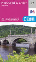
Sheet map, folded. Series: OS Landranger Map. BIC Classification: 1DBKSH; WSZC; WTRM. Category: (G) General (US: Trade). Dimension: 136 x 227 x 47. Weight in Grams: 98.
- Publisher
- Ordnance Survey
- Publication date
- 2016
- Edition
- February 2016 ed
- Condition
- New
- SKU
- V9780319261316
- ISBN
- 9780319261316
Hardback
Condition: New
€ 17.99€ 14.33
€ 17.99
€ 14.33
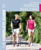
Paperback. Num Pages: 192 pages, More than 200 full-colour photos. BIC Classification: VFMG. Category: (G) General (US: Trade). Dimension: 228 x 191 x 11. Weight in Grams: 506.
- Publisher
- Bloomsbury Publishing PLC United Kingdom
- Number of pages
- 224
- Format
- Paperback
- Publication date
- 2014
- Condition
- New
- SKU
- V9781408186572
- ISBN
- 9781408186572
Paperback
Condition: New
€ 39.00
€ 39.00
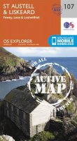
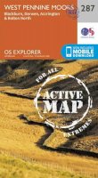
Sheet map, folded. Series: OS Explorer Map. BIC Classification: 1DBKESU; WSZC; WTRM. Category: (G) General (US: Trade). Dimension: 136 x 240 x 14. Weight in Grams: 130.
- Publisher
- Ordnance Survey
- Publication date
- 2015
- Edition
- September 2015 ed
- Condition
- New
- SKU
- V9780319243657
- ISBN
- 9780319243657
Paperback
Condition: New
€ 17.99€ 14.33
€ 17.99
€ 14.33
Sheet map, folded. .
- Publisher
- Ordnance Survey
- Publication date
- 2015
- Edition
- September 2015 ed
- Condition
- New
- SKU
- V9780319246092
- ISBN
- 9780319246092
Paperback
Condition: New
€ 17.99€ 14.33
€ 17.99
€ 14.33
Sheet map, folded. Series: OS Explorer Map. BIC Classification: 1DBKESB; WSZC; WTRM. Category: (G) General (US: Trade). Dimension: 137 x 240 x 32. Weight in Grams: 128.
- Publisher
- Ordnance Survey
- Publication date
- 2015
- Edition
- September 2015 ed
- Condition
- New
- SKU
- V9780319243534
- ISBN
- 9780319243534
Paperback
Condition: New
€ 17.99€ 14.33
€ 17.99
€ 14.33
Paperback. .
- Publisher
- Ordnance Survey/Crimson
- Format
- Paperback
- Publication date
- 2017
- Edition
- Revised edition
- Condition
- New
- SKU
- V9780319090718
- ISBN
- 9780319090718
Paperback
Condition: New
€ 10.99€ 10.03
€ 10.99
€ 10.03
Sheet map, folded. Series: OS Explorer Map. BIC Classification: 1DBKEWG; WSZC; WTRM. Category: (G) General (US: Trade). Dimension: 137 x 240 x 37. Weight in Grams: 128.
- Publisher
- Ordnance Survey
- Publication date
- 2015
- Edition
- September 2015 ed
- Condition
- New
- SKU
- V9780319243619
- ISBN
- 9780319243619
Paperback
Condition: New
€ 17.99€ 14.33
€ 17.99
€ 14.33
Sheet map, folded. .
- Publisher
- Ordnance Survey
- Publication date
- 2015
- Edition
- May 2015 ed
- Condition
- New
- SKU
- V9780319242810
- ISBN
- 9780319242810
Paperback
Condition: New
€ 17.99€ 14.33
€ 17.99
€ 14.33
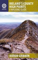
Paperback. This definitive guide explains everything you need to know as a walker before setting out on your County High Point quests. Each county-focused chapter contains a brief county profile and detailed walking route descriptions accompanied by easy-to-read maps. Num Pages: 192 pages, Maps and photographs. BIC Classification: 1DBR; WSZC; WTH. Category: (G) General (US: Trade). Dimension: 203 x 141 x 11. Weight in Grams: 304.
- Publisher
- Gill
- Number of pages
- 192
- Format
- Paperback
- Publication date
- 2012
- Condition
- New
- SKU
- V9781848891401
- ISBN
- 9781848891401
Paperback
Condition: New
€ 16.99€ 14.51
€ 16.99
€ 14.51
Sheet map, folded. .
- Publisher
- Ordnance Survey
- Publication date
- 2016
- Edition
- February 2016 ed
- Condition
- New
- SKU
- V9780319261507
- ISBN
- 9780319261507
Paperback
Condition: New
€ 17.99€ 14.33
€ 17.99
€ 14.33
Paperback. Num Pages: 320 pages, 150 colour illustrations, 100 maps. BIC Classification: 1DBK; WSZC. Category: (G) General (US: Trade). Dimension: 235 x 190. .
- Format
- Paperback
- Publisher
- Rowman & Littlefield
- Publication date
- 2016
- Condition
- New
- SKU
- V9781493019656
- ISBN
- 9781493019656
Paperback
Condition: New
€ 30.07
€ 30.07
Sheet map, folded. .
- Publisher
- Ordnance Survey
- Publication date
- 2015
- Edition
- September 2015 ed
- Condition
- New
- SKU
- V9780319244319
- ISBN
- 9780319244319
Paperback
Condition: New
€ 17.99€ 14.33
€ 17.99
€ 14.33
Paperback. Num Pages: 144 pages, 80 colour illustrations. BIC Classification: WSZG. Category: (G) General (US: Trade). Dimension: 178 x 108. .
- Publisher
- Rowman & Littlefield United States
- Number of pages
- 144
- Format
- Paperback
- Publication date
- 2019
- Condition
- New
- SKU
- V9781493027620
- ISBN
- 9781493027620
Paperback
Condition: New
€ 17.99€ 16.23
€ 17.99
€ 16.23
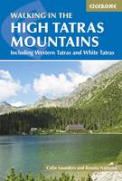
Paperback. Guidebook detailing walks and scrambles in the High Tatras mountains of Poland and Slovakia. Varied routes among the strikingly beautiful craggy peaks of the High, Western and White Tatras range from easy to strenuous. Includes useful lists of summits as well as practical advice on accommodation and facilities, travel, mapping and language. Num Pages: 336 pages, 68 colour photos. BIC Classification: 1DVKS; 1DVP; WSZC; WTH. Category: (G) General (US: Trade). Dimension: 172 x 116 x 18. .
- Publisher
- Cicerone Press
- Format
- Paperback
- Publication date
- 2017
- Edition
- 4th Revised edition
- Condition
- New
- SKU
- V9781852848873
- ISBN
- 9781852848873
Paperback
Condition: New
€ 25.99€ 19.45
€ 25.99
€ 19.45
.
- Publisher
- Pixz Books United Kingdom
- Number of pages
- 64
- Format
- Hardback
- Publication date
- 2011
- Condition
- New
- SKU
- V9780857100207
- ISBN
- 9780857100207
Hardback
Condition: New
€ 8.32
€ 8.32
.
- Publisher
- Ordnance Survey
- Publication date
- 2015
- Edition
- September 2015 ed
- Condition
- New
- SKU
- V9780319471593
- ISBN
- 9780319471593
Hardback
Condition: New
€ 23.99€ 17.77
€ 23.99
€ 17.77
Paperback. Whether you're taking the kids camping for a weekend, a week or even longer, this is the perfect addition to your gear - offering delicious, easy-to-make food the whole family will love Num Pages: 176 pages, col. Illustrations. BIC Classification: WBA; WSZR. Category: (G) General (US: Trade). Dimension: 195 x 150 x 15. Weight in Grams: 330. 176 pages, col. Illustrations. Whether you're taking the kids camping for a weekend, a week or even longer, this is the perfect addition to your gear - offering delicious, easy-to-make food the whole family will love. Cateogry: (G) General (US: Trade). BIC Classification: WBA; WSZR. Dimension: 196 x 219 x 14. Weight: 324.
- Publisher
- Watkins Media Limited
- Number of pages
- 176
- Format
- Paperback
- Publication date
- 2012
- Condition
- New
- SKU
- V9781848990081
- ISBN
- 9781848990081
Paperback
Condition: New
€ 17.99€ 14.33
€ 17.99
€ 14.33
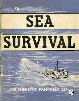
Paperback. Series: RAF Survival Guide. Num Pages: 48 pages. BIC Classification: WSZV. Category: (G) General (US: Trade). Dimension: 135 x 106. .
- Publisher
- Penguin Books Ltd
- Format
- Paperback
- Publication date
- 2017
- Condition
- New
- SKU
- V9781405931656
- ISBN
- 9781405931656
Paperback
Condition: New
€ 7.45
€ 7.45
Sheet map, folded. .
- Publisher
- Ordnance Survey
- Publication date
- 2015
- Edition
- September 2015 ed
- Condition
- New
- SKU
- V9780319244647
- ISBN
- 9780319244647
Paperback
Condition: New
€ 17.99€ 14.33
€ 17.99
€ 14.33
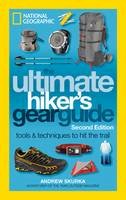
Paperback. Outdoors enthusiasts and buyers of the National Geographic Survival Manual snapped up 70,000 copies of The Ultimate Hiker's Gear Guide by Andrew Skurka, Outside magazine's Adventurer of the Year. This second edition will feature 16 new pages (including food on the trail and other essentials), and update all gear recommendations. Num Pages: 224 pages. BIC Classification: WSZC. Category: (G) General (US: Trade). Dimension: 133 x 212. Weight in Grams: 367.
- Publisher
- National Geographic Society
- Format
- Paperback
- Publication date
- 2017
- Edition
- 2nd Edition
- Condition
- New
- SKU
- V9781426217845
- ISBN
- 9781426217845
Paperback
Condition: New
€ 21.99€ 19.42
€ 21.99
€ 19.42
Paperback. Series: State Rock Climbing Series. Num Pages: 608 pages, colour illustrations, maps. BIC Classification: 1KBBW; WSZG; WTH. Category: (G) General (US: Trade). Dimension: 155 x 227 x 33. Weight in Grams: 1140.
- Publisher
- Rowman & Littlefield
- Format
- Paperback
- Publication date
- 2013
- Edition
- 2nd Edition
- Condition
- New
- SKU
- V9780762744510
- ISBN
- 9780762744510
Paperback
Condition: New
€ 53.99€ 52.42
€ 53.99
€ 52.42
Paperback. A collection of 20 tried and tested circular walks,varying in length for dogs and their owners to explore Norfolk. Series: Dog Walker's Guide. Num Pages: 96 pages. BIC Classification: 1DBKEAN; WSZC; WTH. Category: (G) General (US: Trade). Dimension: 150 x 210 x 5. Weight in Grams: 210.
- Publisher
- Countryside Books
- Format
- Paperback
- Publication date
- 2014
- Condition
- New
- SKU
- V9781846743191
- ISBN
- 9781846743191
Paperback
Condition: New
€ 13.99€ 13.51
€ 13.99
€ 13.51
.png)

