Active outdoor pursuits
Results 1341 - 1360 of 2118
Active outdoor pursuits
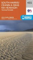
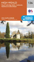
Sheet map, folded. Series: OS Explorer Map. BIC Classification: 1DBKSHL; WSZC; WTRM. Category: (G) General (US: Trade). Dimension: 135 x 240 x 44. Weight in Grams: 128.
- Publisher
- Ordnance Survey
- Publication date
- 2015
- Edition
- September 2015 ed
- Condition
- New
- SKU
- V9780319246986
- ISBN
- 9780319246986
Condition: New
€ 17.99€ 14.33
€ 17.99
€ 14.33
Paperback. The Beach Book presents a whole host of activities and adventures to be enjoyed on the water's edge by the sea, lakes and rivers. Num Pages: 128 pages, 100 images. BIC Classification: WSZ. Category: (G) General (US: Trade). Dimension: 203 x 141 x 11. Weight in Grams: 272.
- Publisher
- Quarto Publishing PLC
- Format
- Paperback
- Publication date
- 2015
- Condition
- New
- SKU
- V9780711235779
- ISBN
- 9780711235779
Paperback
Condition: New
€ 19.99€ 16.06
€ 19.99
€ 16.06
.
- Publisher
- Ordnance Survey
- Publication date
- 2015
- Edition
- September 2015 ed
- Condition
- New
- SKU
- V9780319244036
- ISBN
- 9780319244036
Paperback
Condition: New
€ 17.99€ 14.33
€ 17.99
€ 14.33
Sheet map, folded. .
- Publisher
- Ordnance Survey
- Publication date
- 2015
- Edition
- September 2015 ed
- Condition
- New
- SKU
- V9780319247204
- ISBN
- 9780319247204
Paperback
Condition: New
€ 17.99€ 14.33
€ 17.99
€ 14.33
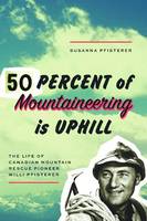
Paperback. Num Pages: 220 pages, illus. BIC Classification: 1KB; BGH; WSZG. Dimension: 230 x 155. .
- Publisher
- NeWest Press
- Format
- Paperback
- Publication date
- 2016
- Edition
- UK ed.
- Condition
- New
- SKU
- V9781926455600
- ISBN
- 9781926455600
Paperback
Condition: New
€ 26.99€ 19.08
€ 26.99
€ 19.08
Sheet map, folded. .
- Publisher
- Ordnance Survey
- Publication date
- 2015
- Edition
- September 2015 ed
- Condition
- New
- SKU
- V9780319244425
- ISBN
- 9780319244425
Paperback
Condition: New
€ 17.99€ 14.33
€ 17.99
€ 14.33
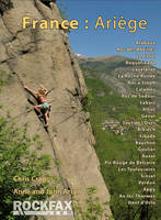
Paperback. The Ariege region of Southern France is the compact area where the Ariege River cuts through the Pyrenees on its way from Andorra to the coast. In this title, the areas covered are in and around the main Ariege river valley which runs down from Andorra through Tarascon-sur-Ariege and Foix. Series: Rockfax Climbing Guide Series. Num Pages: 312 pages, colour photo action shots, plus colour photo topos. BIC Classification: WSZG. Category: (G) General (US: Trade). Dimension: 152 x 210 x 17. Weight in Grams: 616. Rockfax Rock Climbing Guidebook. Series: Rockfax Climbing Guide S. 312 pages, colour photo action shots, plus colour photo topos. The Ariege region of Southern France is the compact area where the Ariege River cuts through the Pyrenees on its way from Andorra to the coast. In this title, the areas covered are in and around the main Ariege river valley which runs down from Andorra through Tarascon-sur-Ariege and Foix. Cateogry: (G) General (US: Trade). BIC Classification: WSZG. Dimension: 152 x 210 x 17. Weight: 614.
- Publisher
- Rockfax Ltd
- Number of pages
- 312
- Format
- Paperback
- Publication date
- 2012
- Condition
- New
- SKU
- V9781873341872
- ISBN
- 9781873341872
Paperback
Condition: New
€ 33.99€ 28.99
€ 33.99
€ 28.99
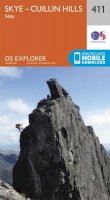
Series: OS Explorer Map. BIC Classification: 1DBKSHQ; WSZC; WTRM. Category: (G) General (US: Trade). Dimension: 242 x 135 x 51. Weight in Grams: 128.
- Publisher
- Ordnance Survey
- Publication date
- 2015
- Edition
- September 2015 ed
- Condition
- New
- SKU
- V9780319246467
- ISBN
- 9780319246467
Paperback
Condition: New
€ 17.99€ 14.33
€ 17.99
€ 14.33
Sheet map, folded. .
- Publisher
- Ordnance Survey
- Publication date
- 2015
- Edition
- May 2015 ed
- Condition
- New
- SKU
- V9780319469774
- ISBN
- 9780319469774
Paperback
Condition: New
€ 23.99€ 17.77
€ 23.99
€ 17.77
Hardcover. Num Pages: 96 pages, illustrations throughout. BIC Classification: 1DBKESX; WNW; WSZC; WTH. Category: (G) General (US: Trade). Dimension: 195 x 124 x 11. Weight in Grams: 182.
- Publisher
- Snake River Press Ltd United Kingdom
- Number of pages
- 96
- Format
- Hardback
- Publication date
- 2008
- Condition
- New
- SKU
- V9781906022174
- ISBN
- 9781906022174
Hardback
Condition: New
€ 11.99€ 10.89
€ 11.99
€ 10.89
Sheet map, folded. .
- Publisher
- Ordnance Survey
- Publication date
- 2015
- Edition
- September 2015 ed
- Condition
- New
- SKU
- V9780319472064
- ISBN
- 9780319472064
Hardback
Condition: New
€ 23.99€ 17.77
€ 23.99
€ 17.77
Sheet map, folded. .
- Publisher
- Ordnance Survey
- Publication date
- 2016
- Edition
- February 2016 ed
- Condition
- New
- SKU
- V9780319262672
- ISBN
- 9780319262672
Hardback
Condition: New
€ 17.99€ 14.33
€ 17.99
€ 14.33
Sheet map, folded. .
- Publisher
- Ordnance Survey
- Publication date
- 2016
- Edition
- February 2016 ed
- Condition
- New
- SKU
- V9780319262016
- ISBN
- 9780319262016
Hardback
Condition: New
€ 17.99€ 14.36
€ 17.99
€ 14.36
Paperback. 20 simple, circular routes covering the whole of the county and all between 2 and 5 miles in length. Most begin at a popular pub that serves good food. Series: Waterside Walks. Num Pages: 96 pages. BIC Classification: 1DBKESH; WSZC; WTH. Category: (G) General (US: Trade). Dimension: 150 x 210 x 7. Weight in Grams: 212.
- Publisher
- Countryside Books
- Format
- Paperback
- Publication date
- 2016
- Edition
- Illustrated edition
- Condition
- New
- SKU
- V9781846743399
- ISBN
- 9781846743399
Paperback
Condition: New
€ 13.99€ 13.51
€ 13.99
€ 13.51
Paperback. A handbook covering the finest walks, scrambles, climbs and ski tours in Scotland, with its variety of wild landscapes ranging from the Southern Uplands to the great granite plateaus of the Cairngorms and jagged aretes of the Cuillin hills on the Isle of Skye. All the information the independent mountain lover needs for any activity. Num Pages: 560 pages, 230 colour photos and 76 colour maps. BIC Classification: 1DBKS; WSZC; WSZG; WTHA. Category: (G) General (US: Trade). Dimension: 233 x 156 x 35. Weight in Grams: 1214. 560 pages, 230 colour photos and 76 colour maps. A handbook covering the finest walks, scrambles, climbs and ski tours in Scotland, with its variety of wild landscapes ranging from the Southern Uplands to the great granite plateaus of the Cairngorms and jagged aretes of the Cuillin hills on the Isle of Skye. All the information the independent mountain lover needs for any activity. Cateogry: (G) General (US: Trade). BIC Classification: 1DBKS; WSZC; WSZG; WTHA. Dimension: 233 x 156 x 35. Weight: 1194.
- Publisher
- Cicerone Press Limited
- Number of pages
- 560
- Format
- Paperback
- Publication date
- 2010
- Edition
- 1st Edition
- Condition
- New
- SKU
- V9781852844424
- ISBN
- 9781852844424
Paperback
Condition: New
€ 33.99€ 24.66
€ 33.99
€ 24.66
Sheet map, folded. .
- Publisher
- Ordnance Survey
- Publication date
- 2015
- Edition
- September 2015 ed
- Condition
- New
- SKU
- V9780319243299
- ISBN
- 9780319243299
Paperback
Condition: New
€ 17.99€ 14.33
€ 17.99
€ 14.33
Sheet map, folded. Series: OS Explorer Map. BIC Classification: 1DBKESX; WSZC; WTRM. Category: (G) General (US: Trade). Dimension: 136 x 241 x 37. Weight in Grams: 128.
- Publisher
- Ordnance Survey
- Publication date
- 2015
- Edition
- September 2015 ed
- Condition
- New
- SKU
- V9780319243282
- ISBN
- 9780319243282
Paperback
Condition: New
€ 17.99€ 14.33
€ 17.99
€ 14.33
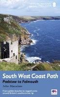
Paperback. The South West Coast Path is the longest of Britain's National Trails, following the spectacular coastline for 630 miles around the southernmost tip of England, from Somerset all the way to Dorset. Num Pages: 144 pages, 1 colour illustrations. BIC Classification: 1DBKEWC; WSZC; WTH. Category: (G) General (US: Trade). Dimension: 210 x 130. .
- Publisher
- Aurum Press
- Format
- Paperback
- Publication date
- 2018
- Edition
- Reissue
- Condition
- New
- SKU
- V9781781315804
- ISBN
- 9781781315804
Paperback
Condition: New
€ 19.99€ 15.34
€ 19.99
€ 15.34
Sheet map, folded. .
- Publisher
- Ordnance Survey
- Publication date
- 2015
- Edition
- September 2015 ed
- Condition
- New
- SKU
- V9780319243688
- ISBN
- 9780319243688
Paperback
Condition: New
€ 17.99€ 14.33
€ 17.99
€ 14.33
.
- Publisher
- Ordnance Survey
- Publication date
- 2015
- Edition
- September 2015 ed
- Condition
- New
- SKU
- V9780319470671
- ISBN
- 9780319470671
Paperback
Condition: New
€ 23.99€ 17.77
€ 23.99
€ 17.77
.png)
