Travel maps & atlases
Results 1 - 20 of 1250
Travel maps & atlases
map. A detailed touring map of Mayo and Sligo that highlights hundreds of interesting places and points of interest for the visitor. With over 40 different categories of tourist information, it gives an instant view of all the attractions including scenic drives, cycle routes and local walks that are just waiting to be discovered in the area. BIC Classification: 1DBR; WTRM. Category: (G) General (US: Trade). Dimension: 254 x 119 x 10. Weight in Grams: 106.
- Publication date
- 2013
- Publisher
- Fountain Software and Publications Ltd
- Condition
- New
- SKU
- 9780955265556
- ISBN
- 9780955265556
Condition: New
€ 19.99€ 17.58
€ 19.99
€ 17.58
With its mixture of rugged mountains, glorious seascapes, rolling hills and wooded valleys, Cork - The 'Rebel' County - provides a multitude of beautiful walking trails, cycle routes and scenic drives. This map can guide you to the numerous leisure spots and renowned destinations such as Blarney Castle, King Charles Fort, and Cape Clear Island. BIC Classification: 1DBR; WTRM. Category: (G) General (US: Trade). Dimension: 254 x 113 x 10. Weight in Grams: 102. Scale 1 : 100 000
- Publication date
- 2008
- Publisher
- Fountain Software & Publications Ltd Co. Clare
- Condition
- New
- SKU
- 9780955265525
- ISBN
- 9780955265525
Condition: New
€ 17.58
€ 17.58
Hardcover. Cartographers know that maps are more than just representations of the world; rather, every map reflects the agendas and intentions of its creators. Employing several nature maps, this book explores the different aspects of maps' self-presentation: from place names to titles and legends. Num Pages: 231 pages, 179 colour plates, 16 halftones. BIC Classification: WTRM. Category: (P) Professional & Vocational. Dimension: 279 x 279 x 23. Weight in Grams: 1606.
- Format
- Hardback
- Publication date
- 2009
- Publisher
- The University of Chicago Press United States
- Number of pages
- 231
- Condition
- New
- SKU
- V9780226906041
- ISBN
- 9780226906041
Hardback
Condition: New
€ 70.93
€ 70.93
Sheet map, folded. Series: Colin Baxter Maps. BIC Classification: 1DBKSHL; WTRM. Category: (G) General (US: Trade). Dimension: 225 x 129 x 3. Weight in Grams: 60.
- Publisher
- Colin Baxter Photography Ltd
- Publication date
- 2006
- Condition
- New
- SKU
- V9781841073279
- ISBN
- 9781841073279
Hardback
Condition: New
€ 9.03
€ 9.03
Paperback. Num Pages: 24 pages, 50. BIC Classification: 1DSE; WTHF; WTM; WTR. Category: (G) General (US: Trade). Dimension: 131 x 202 x 12. Weight in Grams: 164.
- Publisher
- Victionary
- Format
- Paperback
- Publication date
- 2016
- Condition
- New
- SKU
- V9789887714897
- ISBN
- 9789887714897
Paperback
Condition: New
€ 13.99€ 13.37
€ 13.99
€ 13.37
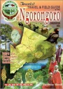
Paperback. Num Pages: 192 pages, 600 photos, illustrations. BIC Classification: 1HFGT; WTR. Category: (G) General (US: Trade). Dimension: 149 x 202 x 12. Weight in Grams: 364.
- Publisher
- Papyrus Publications
- Format
- Paperback
- Publication date
- 2006
- Edition
- 4Rev e.
- Condition
- New
- SKU
- V9780620341912
- ISBN
- 9780620341912
Paperback
Condition: New
€ 17.99€ 13.13
€ 17.99
€ 13.13
Paperback. Num Pages: 192 pages, 600 photos, illustrations. BIC Classification: 1HFGK; 1HFGT; WTR. Category: (G) General (US: Trade). Dimension: 210 x 149 x 12. Weight in Grams: 370.
- Publisher
- Papyrus Publications
- Format
- Paperback
- Publication date
- 2006
- Edition
- 4Rev e.
- Condition
- New
- SKU
- V9780620341905
- ISBN
- 9780620341905
Paperback
Condition: New
€ 17.99€ 13.16
€ 17.99
€ 13.16
Series: Cassini Old Series Historical Map. Num Pages: 1 pages. BIC Classification: 1DBKEML; WCU; WTRM; WTRS. Category: (G) General (US: Trade). Dimension: 217 x 134 x 10. Weight in Grams: 98. Series: Cassini Old Series Historical Map. 1 pages. Cateogry: (G) General (US: Trade). BIC Classification: 1DBKEML; WCU; WTRM; WTRS. Dimension: 217 x 134 x 10. Weight: 98.
- Publication date
- 2006
- Publisher
- Cassini Publishing Ltd
- Number of pages
- 1
- Condition
- New
- SKU
- V9781905568727
- ISBN
- 9781905568727
Paperback
Condition: New
€ 23.23
€ 23.23
Sheet map, folded. BIC Classification: 1DBKN; WTRS. Category: (G) General (US: Trade). Dimension: 274 x 128 x 39. Weight in Grams: 116.
- Publisher
- Ordnance Survey
- Publication date
- 2008
- Condition
- New
- SKU
- V9781905306367
- ISBN
- 9781905306367
Paperback
Condition: New
€ 15.99€ 15.26
€ 15.99
€ 15.26
Sheet map, folded. BIC Classification: 1DST; WTRM. Category: (G) General (US: Trade). Dimension: 255 x 119 x 8. Weight in Grams: 118.
- Publication date
- 2005
- Publisher
- Freytag-Berndt
- Condition
- New
- SKU
- V9783707901771
- ISBN
- 9783707901771
Paperback
Condition: New
€ 17.99€ 16.43
€ 17.99
€ 16.43
Sheet map, folded. BIC Classification: 1MTANC; WTRM. Category: (G) General (US: Trade). Dimension: 255 x 122 x 11. Weight in Grams: 184.
- Publisher
- Freytag-Berndt Austria
- Publication date
- 2009
- Condition
- New
- SKU
- V9783707910612
- ISBN
- 9783707910612
Paperback
Condition: New
€ 17.99€ 16.41
€ 17.99
€ 16.41
Hardcover. A fully revised new edition of this major world atlas in the 'Times' range. Num Pages: 240 pages, Illustrations, col. facsims., chiefly col. maps, port. BIC Classification: WTRM. Category: (G) General (US: Trade). Dimension: 360 x 270 x 45. Weight in Grams: 3250. Very good copy in good dustwrappers in slipcase. DW has light wear. Slipcase in good condition. Light nicks, remains very good
- Format
- Hardback
- Publication date
- 2004
- Publisher
- HarperCollins Publishers
- Condition
- Used, Very Good
- SKU
- KCW0018945
- ISBN
- 9780007157297
Hardback
Condition: Used, Very Good
€ 70.00
€ 70.00
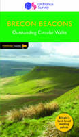
Paperback. 28 fabulous country walks in the Becon Beacons National Park, graded by length and ranging from 3 to 10 miles. All routes come with a clear, large-scale OS map, GPS waypoints and highlight where to park, good pubs and places of interest en route. Series: Pathfinder Guides. Num Pages: 95 pages. BIC Classification: 1DBKWS; WSZC; WTRM. Category: (G) General (US: Trade). Dimension: 135 x 228 x 15. Weight in Grams: 208.
- Publisher
- Ordnance Survey/Crimson
- Format
- Paperback
- Publication date
- 2016
- Edition
- 9th Revised edition
- Condition
- New
- SKU
- V9780319090015
- ISBN
- 9780319090015
Paperback
Condition: New
€ 17.99€ 14.19
€ 17.99
€ 14.19
Sheet map, folded. .
- Publisher
- Alan Godfrey Maps United Kingdom
- Publication date
- 2005
- Condition
- New
- SKU
- V9781841518374
- ISBN
- 9781841518374
Paperback
Condition: New
€ 7.00
€ 7.00
Paperback. Num Pages: 180 pages, colour illustrations. BIC Classification: HB; WTRM. Category: (G) General (US: Trade). Dimension: 348 x 276 x 14. Weight in Grams: 1230.
- Format
- Paperback
- Publication date
- 2003
- Publisher
- Square One Publishers United States
- Edition
- 2
- Number of pages
- 180
- Condition
- New
- SKU
- V9780757001611
- ISBN
- 9780757001611
Paperback
Condition: New
€ 32.17
€ 32.17
Paperback. .
- Publisher
- Ordnance Survey/Crimson
- Format
- Paperback
- Publication date
- 2016
- Edition
- UK ed.
- Condition
- New
- SKU
- V9780319090244
- ISBN
- 9780319090244
Paperback
Condition: New
€ 10.99€ 10.05
€ 10.99
€ 10.05
Paperback. .
- Publisher
- Ordnance Survey/Crimson
- Format
- Paperback
- Publication date
- 2016
- Condition
- New
- SKU
- V9780319090169
- ISBN
- 9780319090169
Paperback
Condition: New
€ 17.99€ 14.35
€ 17.99
€ 14.35
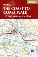
Paperback. Map of the 190 miles (300km) Coast to Coast Walk, between St Bees Head in Cumbria and Robin Hood's Bay in Yorkshire. This booklet is included with the Cicerone guidebook to the trail, and shows the full route on Ordnance Survey 1:25,000 maps. This popular long-distance route typically takes a fortnight to walk. Num Pages: 104 pages, 92 pages of OS 1:25,000 mapping. BIC Classification: 1DBKEY; WSZC; WTRM. Category: (G) General (US: Trade). Dimension: 122 x 225 x 7. Weight in Grams: 138.
- Publisher
- Cicerone Press
- Format
- Paperback
- Publication date
- 2017
- Condition
- New
- SKU
- V9781852849269
- ISBN
- 9781852849269
Paperback
Condition: New
€ 17.99€ 14.16
€ 17.99
€ 14.16
Paperback. .
- Publisher
- Ordnance Survey/Crimson
- Format
- Paperback
- Publication date
- 2016
- Edition
- UK ed.
- Condition
- New
- SKU
- V9780319090145
- ISBN
- 9780319090145
Paperback
Condition: New
€ 17.99€ 14.35
€ 17.99
€ 14.35
Sheet map, folded. Series: Old Ordnance Survey Maps - Inch to the Mile. BIC Classification: 1DBKEYK; 3JH; WQH; WTRM. Category: (G) General (US: Trade). Dimension: 210 x 123 x 3. Weight in Grams: 26. One Inch Sheet 54. Series: Old Ordnance Survey Maps - Inch to the Mile. Cateogry: (G) General (US: Trade). BIC Classification: 1DBKEYK; 3JH; WQH; WTRM. Dimension: 210 x 123 x 3. Weight: 24.
- Publisher
- Alan Godfrey Maps
- Publication date
- 2006
- Condition
- New
- SKU
- V9781841518756
- ISBN
- 9781841518756
Paperback
Condition: New
€ 7.07
€ 7.07


