Travel maps & atlases
Results 81 - 100 of 1250
Travel maps & atlases
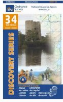
Sheet map, folded. Series: Irish Discovery Series. BIC Classification: 1DBR; WSZC; WTR. Category: (G) General (US: Trade). Dimension: 195 x 149 x 8. Weight in Grams: 74.
- Publication date
- 2011
- Publisher
- Ordnance Survey Ireland
- Condition
- New
- SKU
- 9781907122545
- ISBN
- 9781907122545
Condition: New
€ 4.99
€ 4.99
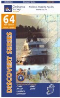
Paperback. Series: Irish Maps, Atlases and Guides. BIC Classification: 1DBR; WTRD. Category: (G) General (US: Trade). Dimension: 264 x 189 x 12. Weight in Grams: 92.
- Format
- Paperback
- Publication date
- 2011
- Publisher
- Ordnance Survey Ireland
- Condition
- New
- Edition
- 4th Edition
- SKU
- KSS0005537
- ISBN
- 9781907122385
Paperback
Condition: New
€ 4.99
€ 4.99
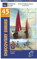
Sheet map, folded. Series: Irish Discovery Series. BIC Classification: 1DBR; WTRD. Category: (G) General (US: Trade). Dimension: 189 x 112 x 6. Weight in Grams: 74. Good clean copy with minor shelf wear
- Publication date
- 2012
- Publisher
- Ordnance Survey Ireland
- Condition
- Used, Very Good
- SKU
- KSS0005758
- ISBN
- 9781907122934
Paperback
Condition: Used, Very Good
€ 4.99
€ 4.99
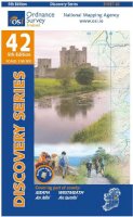
Sheet map, folded. Series: Irish Discovery Series. BIC Classification: 1DBR; WTRD. Category: (G) General (US: Trade). Dimension: 190 x 111 x 7. Weight in Grams: 74.
- Publication date
- 2012
- Publisher
- Ordnance Survey Ireland
- Condition
- New
- SKU
- KSS0005756
- ISBN
- 9781907122866
Paperback
Condition: New
€ 4.99
€ 4.99
Sheet map, folded. .
- Publisher
- Ordnance Survey Ireland
- Publication date
- 2016
- Edition
- 5th Revised edition
- Condition
- New
- SKU
- V9781908852656
- ISBN
- 9781908852656
Paperback
Condition: New
€ 15.99€ 15.26
€ 15.99
€ 15.26
Sheet map, folded. Series: Irish Discovery Series. BIC Classification: 1DBR; WSZC; WTRM. Category: (G) General (US: Trade). Dimension: 195 x 155 x 7. Weight in Grams: 80.
- Publisher
- Ordnance Survey Ireland
- Publication date
- 2011
- Condition
- New
- SKU
- V9781907122576
- ISBN
- 9781907122576
Paperback
Condition: New
€ 13.05
€ 13.05
Sheet map, folded. Series: Irish Discovery Series. BIC Classification: 1DBR; WSZC; WTRM. Category: (G) General (US: Trade). Dimension: 156 x 191 x 7. Weight in Grams: 74.
- Publisher
- Ordnance Survey
- Publication date
- 2011
- Edition
- 3rd Edition
- Condition
- New
- SKU
- V9781907122590
- ISBN
- 9781907122590
Paperback
Condition: New
€ 13.05
€ 13.05
Sheet map, folded. Series: Irish Discovery Series. BIC Classification: 1DBR; WTRD. Category: (G) General (US: Trade). Dimension: 199 x 114 x 7. Weight in Grams: 80.
- Publisher
- Ordnance Survey Ireland
- Publication date
- 2012
- Edition
- 4th Revised edition
- Condition
- New
- SKU
- V9781907122927
- ISBN
- 9781907122927
Paperback
Condition: New
€ 15.99€ 15.24
€ 15.99
€ 15.24
Sheet map, folded.
- Publisher
- Ordnance Survey Ireland
- Publication date
- 2003
- Edition
- 2nd Revised edition
- Condition
- New
- SKU
- 9781903974308
- ISBN
- 9781903974308
Paperback
Condition: New
€ 7.41
€ 7.41
Sheet map, folded. Series: OS Explorer Map. BIC Classification: 1DBKSC; WSZC; WTRM. Category: (G) General (US: Trade). Dimension: 136 x 227 x 41. Weight in Grams: 100.
- Publication date
- 2015
- Publisher
- Ordnance Survey
- Condition
- New
- SKU
- 9780319246139
- ISBN
- 9780319246139
Paperback
Condition: New
€ 10.99€ 9.92
€ 10.99
€ 9.92
Sheet map, folded. OS Explorer is the Ordnance Survey's most detailed map and is recommended for anyone enjoying outdoor activities such as walking, horse riding and off-road cycling. The series provides complete GB coverage and can now be used in all weathers thanks to OS Explorer - Active, a tough, versatile version of OS Explorer. Series: OS Explorer Map Active. BIC Classification: 1DBKEWT; WSZC; WTRM. Category: (G) General (US: Trade). Dimension: 245 x 137 x 25. Weight in Grams: 208.
- Publisher
- Ordnance Survey
- Publication date
- 2015
- Edition
- May 2015 ed
- Condition
- New
- SKU
- V9780319469330
- ISBN
- 9780319469330
Paperback
Condition: New
€ 23.99€ 17.80
€ 23.99
€ 17.80
Series: OS Explorer Map. BIC Classification: 1DBKEWT; WSZC; WTRM. Category: (G) General (US: Trade). Dimension: 137 x 253 x 50. Weight in Grams: 100.
- Publisher
- Ordnance Survey
- Publication date
- 2015
- Edition
- September 2015 ed
- Condition
- New
- SKU
- V9780319243190
- ISBN
- 9780319243190
Paperback
Condition: New
€ 17.99€ 14.16
€ 17.99
€ 14.16
Series: OS Explorer Map. BIC Classification: 1DBKEAS; WSZC; WTRM. Category: (G) General (US: Trade). Dimension: 136 x 240 x 14. Weight in Grams: 128.
- Publisher
- Ordnance Survey
- Publication date
- 2015
- Edition
- September 2015 ed
- Condition
- New
- SKU
- V9780319244241
- ISBN
- 9780319244241
Paperback
Condition: New
€ 17.99€ 14.15
€ 17.99
€ 14.15
Sheet map, folded. .
- Publisher
- Ordnance Survey
- Publication date
- 2015
- Edition
- September 2015 ed
- Condition
- New
- SKU
- V9780319244074
- ISBN
- 9780319244074
Paperback
Condition: New
€ 17.99€ 14.17
€ 17.99
€ 14.17
Series: OS Landranger Map. BIC Classification: 1DBKSHQ; WSZC; WTRM. Category: (G) General (US: Trade). Dimension: 137 x 228 x 46. Weight in Grams: 98.
- Publisher
- Ordnance Survey
- Publication date
- 2016
- Edition
- February 2016 ed
- Condition
- New
- SKU
- V9780319261217
- ISBN
- 9780319261217
Paperback
Condition: New
€ 17.99€ 14.16
€ 17.99
€ 14.16
Sheet map, folded. .
- Publisher
- Ordnance Survey
- Publication date
- 2016
- Edition
- February 2016 ed
- Condition
- New
- SKU
- V9780319262429
- ISBN
- 9780319262429
Paperback
Condition: New
€ 17.99€ 14.20
€ 17.99
€ 14.20
Sheet map, folded. .
- Publisher
- Ordnance Survey
- Publication date
- 2017
- Edition
- February 2017 ed
- Condition
- New
- SKU
- V9780319263396
- ISBN
- 9780319263396
Paperback
Condition: New
€ 17.99€ 14.35
€ 17.99
€ 14.35
Sheet map, folded. .
- Publisher
- Ordnance Survey
- Publication date
- 2016
- Edition
- February 2016 ed
- Condition
- New
- SKU
- V9780319473269
- ISBN
- 9780319473269
Paperback
Condition: New
€ 23.99€ 17.57
€ 23.99
€ 17.57
Sheet map, folded. .
- Publisher
- Ordnance Survey
- Publication date
- 2015
- Edition
- September 2015 ed
- Condition
- New
- SKU
- V9780319243824
- ISBN
- 9780319243824
Paperback
Condition: New
€ 17.99€ 14.20
€ 17.99
€ 14.20
Sheet map, folded. .
- Publisher
- Ordnance Survey
- Publication date
- 2016
- Edition
- February 2016 ed
- Condition
- New
- SKU
- V9780319473276
- ISBN
- 9780319473276
Paperback
Condition: New
€ 23.99€ 17.59
€ 23.99
€ 17.59

