Travel maps & atlases
Results 181 - 200 of 1250
Travel maps & atlases
Sheet map, folded. Series: Michelin Regional Maps. Num Pages: Colour Mapping. BIC Classification: 1DST; WTRM. Category: (G) General (US: Trade). Dimension: 249 x 115 x 9. Weight in Grams: 94.
- Publisher
- Michelin Travel Publications United Kingdom
- Publication date
- 2016
- Edition
- Fol Map
- Condition
- New
- SKU
- V9782067126701
- ISBN
- 9782067126701
Condition: New
€ 8.99€ 8.04
€ 8.99
€ 8.04
Sheet map, folded. Series: Old O.S. Maps of Gloucestershire. BIC Classification: 1DBKEWS; 3JJC; WQH; WTRM. Category: (G) General (US: Trade). Dimension: 210 x 120 x 2. Weight in Grams: 26. Gloucestershire Sheet 72.14. Series: Old O.S. Maps of Gloucestershire. Cateogry: (G) General (US: Trade). BIC Classification: 1DBKEWS; 3JJC; WQH; WTRM. Dimension: 210 x 120 x 2. Weight: 26.
- Publisher
- Alan Godfrey Maps
- Publication date
- 2002
- Edition
- Facsimile
- Condition
- New
- SKU
- V9781841514246
- ISBN
- 9781841514246
Condition: New
€ 7.04
€ 7.04
Paperback. Map of the 177-mile (283km) Offa's Dyke Path National Trail, between Sedbury (nr Chepstow) and Prestatyn. The trail takes a fortnight to walk, and is suitable for walkers at all levels of experience. This compact booklet of Ordnance Survey 1:25,000 maps shows the full route, providing all of the mapping you need to complete the trail. Num Pages: 96 pages. BIC Classification: 1DBKW; WSZC; WTR. Category: (G) General (US: Trade). Dimension: 172 x 116 x 10. .
- Publisher
- Cicerone Press
- Format
- Paperback
- Publication date
- 2016
- Condition
- New
- SKU
- V9781852848941
- ISBN
- 9781852848941
Paperback
Condition: New
€ 17.99€ 14.16
€ 17.99
€ 14.16
Sheet map, folded. Series: Old O.S. Maps of Lancashire. BIC Classification: 1DBKENL; WQH; WTRM. Category: (G) General (US: Trade). Dimension: 201 x 114 x 4. Weight in Grams: 24.
- Publisher
- Alan Godfrey Maps
- Publication date
- 2000
- Edition
- facsim of 1906 ed
- Condition
- New
- SKU
- V9781841511696
- ISBN
- 9781841511696
Paperback
Condition: New
€ 7.01
€ 7.01
Sheet map, folded. .
- Publisher
- Harvey Map Services Ltd
- Publication date
- 2016
- Condition
- New
- SKU
- V9781851375882
- ISBN
- 9781851375882
Paperback
Condition: New
€ 16.69
€ 16.69
Series: Old O.S. Maps of Lancashire. BIC Classification: 1DBKENL; 3JJC; WQH; WTRM. Category: (G) General (US: Trade). Dimension: 204 x 120 x 2. Weight in Grams: 26. Lancashire Sheet 113.02. Series: Old O.S. Maps of Lancashire. Cateogry: (G) General (US: Trade). BIC Classification: 1DBKENL; 3JJC; WQH; WTR. Dimension: 204 x 120 x 2. Weight: 26.
- Publisher
- Alan Godfrey Maps
- Publication date
- 1989
- Edition
- Facsimile of 1906 ed
- Condition
- New
- SKU
- V9780850542349
- ISBN
- 9780850542349
Paperback
Condition: New
€ 7.01
€ 7.01
Sheet map, folded. Num Pages: 1 pages. BIC Classification: 1KBBEH; WTR. Category: (G) General (US: Trade). Dimension: 129 x 272 x 18. Weight in Grams: 192.
- Publisher
- National Geographic Maps United States
- Number of pages
- 1
- Publication date
- 2012
- Edition
- 2008th Edition
- Condition
- New
- SKU
- V9781597752244
- ISBN
- 9781597752244
Paperback
Condition: New
€ 33.99€ 28.62
€ 33.99
€ 28.62
Sheet map, folded. Num Pages: 1 pages, , colour illustrations, maps. BIC Classification: 1KLSC; WTR. Category: (G) General (US: Trade). Dimension: 232 x 112 x 5. Weight in Grams: 94.
- Publisher
- National Geographic Maps United States
- Number of pages
- 1
- Publication date
- 2012
- Edition
- 2012th Edition
- Condition
- New
- SKU
- V9781566956246
- ISBN
- 9781566956246
Paperback
Condition: New
€ 19.99€ 18.45
€ 19.99
€ 18.45
Paperback. 28 fabulous country walks in this fine English county from the Wirral to the fringes of the Peak District, graded by length and ranging from 3 to 11 miles. All routes come with a clear, large-scale OS map, GPS waypoints and highlight where to park, good pubs and places of interest en route. Series: Pathfinder Guide. BIC Classification: 1DBKENC; WSZC; WTRM. Category: (G) General (US: Trade). Dimension: 135 x 228 x 7. Weight in Grams: 208.
- Publisher
- Ordnance Survey/Crimson
- Format
- Paperback
- Publication date
- 2016
- Edition
- Revised edition
- Condition
- New
- SKU
- V9780319090312
- ISBN
- 9780319090312
Paperback
Condition: New
€ 17.99€ 14.35
€ 17.99
€ 14.35
Paperback. A brand new title with 28 fabulous country walks in the southern Pennines, ranging from 3 to 10 miles with accompanying GPS references for all waypoints and clear, large scale Ordnance Survey route maps. Series: Pathfinder Guides. BIC Classification: 1DBKEY; WSZC; WTH; WTRM. Category: (G) General (US: Trade). Dimension: 230 x 157 x 8. Weight in Grams: 214.
- Publisher
- Ordnance Survey/Crimson
- Format
- Paperback
- Publication date
- 2016
- Condition
- New
- SKU
- V9780319090046
- ISBN
- 9780319090046
Paperback
Condition: New
€ 17.99€ 14.35
€ 17.99
€ 14.35
Paperback. .
- Publisher
- Imray,Laurie,Norie & Wilson Ltd United Kingdom
- Number of pages
- 107
- Format
- Paperback
- Publication date
- 2006
- Edition
- First Edition
- Condition
- New
- SKU
- V9780852889107
- ISBN
- 9780852889107
Paperback
Condition: New
€ 26.99€ 23.85
€ 26.99
€ 23.85
Sheet map, folded. .
- Publisher
- Alan Godfrey Maps
- Publication date
- 1994
- Edition
- Facsim.of 1848 Ed
- Condition
- New
- SKU
- V9780850546828
- ISBN
- 9780850546828
Paperback
Condition: New
€ 7.07
€ 7.07
Sheet map, folded. Series: Old Ordnance Survey Maps of Manchester. BIC Classification: 1DBKENL; 3JH; WQH; WTRM. Category: (G) General (US: Trade). Dimension: 211 x 121 x 2. Weight in Grams: 26. Manchester Sheet 33. Series: Old Ordnance Survey Maps of Manchester. Cateogry: (G) General (US: Trade). BIC Classification: 1DBKENL; 3JH; WQH; WTR. Dimension: 196 x 108 x 4. Weight: 24.
- Publisher
- Alan Godfrey Maps
- Publication date
- 1988
- Edition
- Facsimile
- Condition
- New
- SKU
- V9780850541618
- ISBN
- 9780850541618
Paperback
Condition: New
€ 7.07
€ 7.07
Paperback. .
- Publisher
- Ordnance Survey/Crimson
- Format
- Paperback
- Publication date
- 2016
- Edition
- Revised edition
- Condition
- New
- SKU
- V9780319090053
- ISBN
- 9780319090053
Paperback
Condition: New
€ 17.99€ 14.35
€ 17.99
€ 14.35
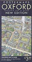
.
- Publisher
- Postermaps United Kingdom
- Publication date
- 2001
- Edition
- 2r.e.
- Condition
- New
- SKU
- V9780952165811
- ISBN
- 9780952165811
Paperback
Condition: New
€ 10.33
€ 10.33
Sheet map, folded. Series: Chiltern Society Footpath Maps S. Num Pages: folded colour map. BIC Classification: 1DBKESU; WSZC; WTRM. Category: (G) General (US: Trade). Dimension: 203 x 116 x 1. Weight in Grams: 22. Series: Chiltern Society Footpath Maps S. folded colour map. Cateogry: (G) General (US: Trade). BIC Classification: 1DBKESU; WSZC; WTRM. Dimension: 203 x 116 x 1. Weight: 22.
- Publisher
- The Book Castle
- Publication date
- 2009
- Edition
- 7th Revised edition
- Condition
- New
- SKU
- V9781906632038
- ISBN
- 9781906632038
Paperback
Condition: New
€ 6.03
€ 6.03
Sheet map, folded. Series: Chiltern Society Footpath Maps S. Num Pages: folded colour map. BIC Classification: 1DBKESF; WSZC; WTRM. Category: (G) General (US: Trade). Dimension: 197 x 135 x 1. Weight in Grams: 22. Series: Chiltern Society Footpath Maps S. folded colour map. Cateogry: (G) General (US: Trade). BIC Classification: 1DBKESF; WSZC; WTRM. Dimension: 197 x 135 x 1. Weight: 22.
- Publisher
- Book Castle
- Publication date
- 2009
- Edition
- 8th Revised edition
- Condition
- New
- SKU
- V9781906632045
- ISBN
- 9781906632045
Paperback
Condition: New
€ 5.99
€ 5.99
Sheet map, folded. Series: Chiltern Society Footpath Maps Series. BIC Classification: 1DBKES; WSZC; WTRM. Category: (G) General (US: Trade). Dimension: 203 x 109 x 1. Weight in Grams: 20. Series: Chiltern Society Footpath Maps Series. Cateogry: (G) General (US: Trade). BIC Classification: 1DBKES; WSZC; WTRM. Dimension: 203 x 109 x 1. Weight: 20.
- Publisher
- The Book Castle
- Publication date
- 2010
- Edition
- 9th edition
- Condition
- New
- SKU
- V9781906632076
- ISBN
- 9781906632076
Paperback
Condition: New
€ 5.97
€ 5.97
Sheet map, folded. Covers the Arctic archipelago (named Spitsbergen when discovered by the Dutch in 1596, but now commonly referred to as Svalbard). This title features a map of the archipelago, with annotations. It includes biographical summaries of 27 explorers as well as descriptions and colour photographs of the common plants, invertebrates, birds and mammals. Editor(s): Sitwell, Nigel; Riffenburgh, Beau; Cruwys, Liz; Carlsson, Olle. Series: Ocean Explorer Maps. Num Pages: Col & B/w photos. BIC Classification: 1MTN; WTRM. Category: (G) General (US: Trade). Dimension: 222 x 102 x 2. Weight in Grams: 40.
- Publisher
- Ocean Explorer Maps United Kingdom
- Publication date
- 2010
- Condition
- New
- SKU
- V9780953861811
- ISBN
- 9780953861811
Paperback
Condition: New
€ 12.61
€ 12.61
Sheet map, folded. .
- Publisher
- Ocean Explorer Maps United Kingdom
- Publication date
- 2007
- Condition
- New
- SKU
- V9780954371746
- ISBN
- 9780954371746
Paperback
Condition: New
€ 12.57
€ 12.57


