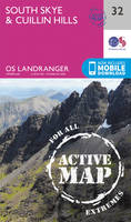
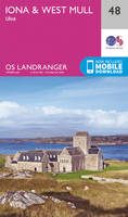
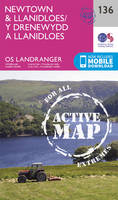
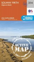
Travel maps & atlases
Results 221 - 240 of 1196
Travel maps & atlases
Sheet map, folded. .
- Publisher
- Ordnance Survey
- Publication date
- 2015
- Edition
- May 2015 ed
- Condition
- New
- SKU
- V9780319469620
- ISBN
- 9780319469620
Condition: New
€ 21.99€ 17.59
€ 21.99
€ 17.59
Series: OS Explorer Map. BIC Classification: 1DBKSH; WSZC; WTRM. Category: (G) General (US: Trade). Dimension: 135 x 240 x 49. Weight in Grams: 126.
- Publisher
- Ordnance Survey
- Publication date
- 2015
- Edition
- September 2015 ed
- Condition
- New
- SKU
- V9780319246443
- ISBN
- 9780319246443
Condition: New
€ 17.99€ 14.08
€ 17.99
€ 14.08
Sheet map, folded. .
- Publisher
- Ordnance Survey
- Publication date
- 2016
- Edition
- February 2016 ed
- Condition
- New
- SKU
- V9780319473559
- ISBN
- 9780319473559
Condition: New
€ 21.99€ 17.62
€ 21.99
€ 17.62
Sheet map, folded. .
- Publisher
- Ordnance Survey
- Publication date
- 2016
- Edition
- February 2016 ed
- Condition
- New
- SKU
- V9780319261460
- ISBN
- 9780319261460
Condition: New
€ 17.99€ 14.21
€ 17.99
€ 14.21
Sheet map, folded. Series: OS Explorer Active Map. BIC Classification: 1DBKEWC; WSZC; WTRM. Category: (G) General (US: Trade). Dimension: 139 x 245 x 23. Weight in Grams: 212.
- Publisher
- Ordnance Survey
- Publication date
- 2015
- Edition
- September 2015 ed
- Condition
- New
- SKU
- V9780319469866
- ISBN
- 9780319469866
Condition: New
€ 21.99€ 17.57
€ 21.99
€ 17.57
Sheet map, folded. .
- Publisher
- Ordnance Survey
- Publication date
- 2015
- Edition
- September 2015 ed
- Condition
- New
- SKU
- V9780319470565
- ISBN
- 9780319470565
Condition: New
€ 21.99€ 17.53
€ 21.99
€ 17.53
.
- Publisher
- Ordnance Survey
- Publication date
- 2015
- Edition
- September 2015 ed
- Condition
- New
- SKU
- V9780319245873
- ISBN
- 9780319245873
Condition: New
€ 17.99€ 14.28
€ 17.99
€ 14.28
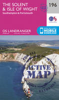
Sheet map, folded. Series: OS Landranger Map. BIC Classification: 1DBKSH; WSZC; WTRM. Category: (G) General (US: Trade). Dimension: 137 x 229 x 14. Weight in Grams: 100.
- Publisher
- Ordnance Survey
- Publication date
- 2016
- Edition
- February 2016 ed
- Condition
- New
- SKU
- V9780319261569
- ISBN
- 9780319261569
Condition: New
€ 17.99€ 14.20
€ 17.99
€ 14.20
Sheet map, folded. Series: OS Landranger Map. BIC Classification: 1DBKEWS; WSZC; WTRM. Category: (G) General (US: Trade). Dimension: 135 x 229 x 32. Weight in Grams: 98.
- Publisher
- Ordnance Survey
- Publication date
- 2016
- Edition
- February 2016 ed
- Condition
- New
- SKU
- V9780319262795
- ISBN
- 9780319262795
Condition: New
€ 17.99€ 14.25
€ 17.99
€ 14.25
.
- Publisher
- Ordnance Survey
- Publication date
- 2015
- Edition
- September 2015 ed
- Condition
- New
- SKU
- V9780319472804
- ISBN
- 9780319472804
Condition: New
€ 21.99€ 17.67
€ 21.99
€ 17.67
Sheet map, folded. .
- Publisher
- Ordnance Survey
- Publication date
- 2015
- Edition
- September 2015 ed
- Condition
- New
- SKU
- V9780319245965
- ISBN
- 9780319245965
Condition: New
€ 17.99€ 14.19
€ 17.99
€ 14.19
Sheet map, folded. .
- Publisher
- Ordnance Survey
- Publication date
- 2016
- Edition
- February 2016 ed
- Condition
- New
- SKU
- V9780319262191
- ISBN
- 9780319262191
Condition: New
€ 17.99€ 14.17
€ 17.99
€ 14.17
.
- Publisher
- Ordnance Survey
- Publication date
- 2016
- Edition
- February 2016 ed
- Condition
- New
- SKU
- V9780319474877
- ISBN
- 9780319474877
Condition: New
€ 21.99€ 17.59
€ 21.99
€ 17.59
Sheet map, folded. .
- Publisher
- Ordnance Survey
- Publication date
- 2016
- Edition
- February 2016 ed
- Condition
- New
- SKU
- V9780319474594
- ISBN
- 9780319474594
Condition: New
€ 20.99€ 20.77
€ 20.99
€ 20.77
.
- Publisher
- Ordnance Survey
- Publication date
- 2015
- Edition
- September 2015 ed
- Condition
- New
- SKU
- V9780319471869
- ISBN
- 9780319471869
Condition: New
€ 21.99€ 17.53
€ 21.99
€ 17.53
Sheet map, folded. .
- Publisher
- Ordnance Survey
- Publication date
- 2016
- Edition
- February 2016 ed
- Condition
- New
- SKU
- V9780319475195
- ISBN
- 9780319475195
Condition: New
€ 21.99€ 17.59
€ 21.99
€ 17.59
Sheet map, folded. .
- Publisher
- Ordnance Survey
- Publication date
- 2015
- Edition
- September 2015 ed
- Condition
- New
- SKU
- V9780319470862
- ISBN
- 9780319470862
Condition: New
€ 21.99€ 17.59
€ 21.99
€ 17.59
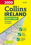
Sheet map, folded. Full colour map of Ireland at 9 miles to 1 inch (1:570,240), with clear, detailed road network and counties and administrative areas shown in colour. Num Pages: With index. BIC Classification: 1DBR; WTR. Category: (G) General (US: Trade). Dimension: 245 x 140. Weight in Grams: 79.
- Condition
- Used, Like New
- Publisher
- HarperCollins Publishers Cheltenham
- Publication date
- 2008
- Edition
- New edition
- SKU
- KRS0003573
- ISBN
- 9780007272518
Condition: Used, Like New
€ 4.99
€ 4.99
Series: OS Explorer Map. BIC Classification: 1DBKESR; WSZC; WTRM. Category: (G) General (US: Trade). Dimension: 139 x 241 x 35. Weight in Grams: 130.
- Publisher
- Ordnance Survey
- Publication date
- 2015
- Edition
- September 2015 ed
- Condition
- New
- SKU
- V9780319243398
- ISBN
- 9780319243398
Condition: New
€ 17.99€ 14.25
€ 17.99
€ 14.25
Sheet map, folded. .
- Publisher
- Ordnance Survey
- Publication date
- 2015
- Edition
- September 2015 ed
- Condition
- New
- SKU
- V9780319472064
- ISBN
- 9780319472064
Condition: New
€ 21.99€ 17.59
€ 21.99
€ 17.59


