Travel maps & atlases
Results 49 - 72 of 1250
Travel maps & atlases
Sheet map, folded. .
- Publisher
- Ordnance Survey
- Publication date
- 2015
- Edition
- September 2015 ed
- Condition
- New
- SKU
- V9780319243305
- ISBN
- 9780319243305
Condition: New
€ 17.99€ 14.15
€ 17.99
€ 14.15
Sheet map, folded. .
- Publisher
- Ordnance Survey
- Publication date
- 2015
- Edition
- September 2015 ed
- Condition
- New
- SKU
- V9780319472941
- ISBN
- 9780319472941
Condition: New
€ 23.99€ 17.69
€ 23.99
€ 17.69
Sheet map, folded. Series: OS Explorer Map. BIC Classification: 1DBKSH; WSZC; WTRM. Category: (G) General (US: Trade). Dimension: 135 x 226 x 42. Weight in Grams: 100.
- Publisher
- Ordnance Survey
- Publication date
- 2015
- Edition
- September 2015 ed
- Condition
- New
- SKU
- V9780319246856
- ISBN
- 9780319246856
Condition: New
€ 17.99€ 14.15
€ 17.99
€ 14.15
Sheet map, folded. .
- Publisher
- Ordnance Survey
- Publication date
- 2015
- Edition
- May 2015 ed
- Condition
- New
- SKU
- V9780319469699
- ISBN
- 9780319469699
Condition: New
€ 23.99€ 17.59
€ 23.99
€ 17.59
Sheet map, folded. .
- Publisher
- Ordnance Survey
- Publication date
- 2015
- Edition
- May 2015 ed
- Condition
- New
- SKU
- V9780319242902
- ISBN
- 9780319242902
Condition: New
€ 17.99€ 14.20
€ 17.99
€ 14.20
hardcover. Traced through a wide-ranging series of texts, and through a tapestry of images, this book includes photographs, archival material, satellite images and artworks. Num Pages: 464 pages, col. Illustrations, col. maps, ports. (some col.). BIC Classification: 1DBR; WTRS. Category: (G) General (US: Trade). Dimension: 299 x 237 x 39. Weight in Grams: 2572.
- Edition
- Illustrated
- Publisher
- Cork University Press
- Number of pages
- 464
- Format
- Hardback
- Publication date
- 2005
- Condition
- New
- SKU
- V9781859183809
- ISBN
- 9781859183809
Hardback
Condition: New
€ 59.00€ 45.48
€ 59.00
€ 45.48
Sheet map, folded. BIC Classification: RGS; WTR. Category: (G) General (US: Trade). Dimension: 260 x 130. .
- Publisher
- Freytag Berndt
- Publication date
- 2015
- Edition
- 1st
- Condition
- New
- SKU
- V9783707914153
- ISBN
- 9783707914153
Hardback
Condition: New
€ 17.99€ 16.35
€ 17.99
€ 16.35
Sheet map, folded. Num Pages: 5 city plans; 8 area maps. BIC Classification: 1MBF; WTRM. Category: (G) General (US: Trade). Dimension: 112 x 262 x 9. Weight in Grams: 70.
- Publisher
- Periplus Editions (HK) ltd.
- Publication date
- 2015
- Edition
- 6th Edition
- Condition
- New
- SKU
- V9780794607685
- ISBN
- 9780794607685
Hardback
Condition: New
€ 9.99€ 9.54
€ 9.99
€ 9.54
.
- Publisher
- Ordnance Survey
- Publication date
- 2015
- Edition
- September 2015 ed
- Condition
- New
- SKU
- V9780319471982
- ISBN
- 9780319471982
Hardback
Condition: New
€ 23.99€ 17.59
€ 23.99
€ 17.59
Sheet map, folded. .
- Publisher
- Ordnance Survey
- Publication date
- 2016
- Edition
- February 2016 ed
- Condition
- New
- SKU
- V9780319261682
- ISBN
- 9780319261682
Hardback
Condition: New
€ 17.99€ 14.20
€ 17.99
€ 14.20
Sheet map, folded. Series: OS Landranger Map. BIC Classification: 1DBKWN; WSZC; WTRM. Category: (G) General (US: Trade). Dimension: 135 x 229 x 63. Weight in Grams: 110.
- Publisher
- Ordnance Survey
- Publication date
- 2016
- Edition
- February 2016 ed
- Condition
- New
- SKU
- V9780319262238
- ISBN
- 9780319262238
Hardback
Condition: New
€ 17.99€ 14.16
€ 17.99
€ 14.16
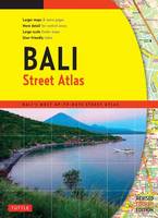
Paperback. Num Pages: 144 pages. BIC Classification: 1FMNB; WTRS. Category: (G) General (US: Trade). Dimension: 272 x 199 x 8. Weight in Grams: 384.
- Publisher
- Tuttle Publishing
- Format
- Paperback
- Publication date
- 2015
- Edition
- 4th Edition
- Condition
- New
- SKU
- V9780804845298
- ISBN
- 9780804845298
Paperback
Condition: New
€ 19.99€ 14.71
€ 19.99
€ 14.71
Sheet map, folded. .
- Publisher
- Ordnance Survey
- Publication date
- 2015
- Edition
- September 2015 ed
- Condition
- New
- SKU
- V9780319471890
- ISBN
- 9780319471890
Paperback
Condition: New
€ 23.99€ 17.59
€ 23.99
€ 17.59
Sheet map, folded. .
- Publisher
- Ordnance Survey
- Publication date
- 2015
- Edition
- September 2015 ed
- Condition
- New
- SKU
- V9780319245699
- ISBN
- 9780319245699
Paperback
Condition: New
€ 17.99€ 14.20
€ 17.99
€ 14.20
Sheet map, folded. .
- Publisher
- Ordnance Survey
- Publication date
- 2016
- Edition
- February 2016 ed
- Condition
- New
- SKU
- V9780319473672
- ISBN
- 9780319473672
Paperback
Condition: New
€ 23.99€ 17.57
€ 23.99
€ 17.57
Sheet map, folded. Series: OS Landranger Map. BIC Classification: 1DBKSH; WSZC; WTRM. Category: (G) General (US: Trade). Dimension: 137 x 227 x 42. Weight in Grams: 100.
- Publisher
- Ordnance Survey
- Publication date
- 2016
- Edition
- February 2016 ed
- Condition
- New
- SKU
- V9780319261422
- ISBN
- 9780319261422
Paperback
Condition: New
€ 17.99€ 14.19
€ 17.99
€ 14.19
Sheet map. Series: Michelin National Maps. Num Pages: Colour Mapping. BIC Classification: 1DVUC; 1DVUE; 1DVUF; WTRM. Category: (G) General (US: Trade). Dimension: 252 x 114 x 4. Weight in Grams: 130.
- Publisher
- Michelin Editions des Voyages France
- Publication date
- 2001
- Edition
- 2016th Edition
- Condition
- New
- SKU
- V9782067173828
- ISBN
- 9782067173828
Paperback
Condition: New
€ 9.31
€ 9.31
.
- Publisher
- Ordnance Survey
- Publication date
- 2015
- Edition
- September 2015 ed
- Condition
- New
- SKU
- V9780319470633
- ISBN
- 9780319470633
Paperback
Condition: New
€ 23.99€ 17.53
€ 23.99
€ 17.53
.
- Publisher
- Ordnance Survey
- Publication date
- 2015
- Edition
- September 2015 ed
- Condition
- New
- SKU
- V9780319243848
- ISBN
- 9780319243848
Paperback
Condition: New
€ 17.99€ 14.16
€ 17.99
€ 14.16
.
- Publisher
- Ordnance Survey
- Publication date
- 2016
- Edition
- February 2016 ed
- Condition
- New
- SKU
- V9780319473528
- ISBN
- 9780319473528
Paperback
Condition: New
€ 23.99€ 17.53
€ 23.99
€ 17.53
.
- Publisher
- Ordnance Survey
- Publication date
- 2015
- Edition
- September 2015 ed
- Condition
- New
- SKU
- V9780319472781
- ISBN
- 9780319472781
Paperback
Condition: New
€ 23.99€ 17.59
€ 23.99
€ 17.59
.
- Publisher
- Ordnance Survey
- Publication date
- 2015
- Edition
- September 2015 ed
- Condition
- New
- SKU
- V9780319246580
- ISBN
- 9780319246580
Paperback
Condition: New
€ 17.99€ 14.16
€ 17.99
€ 14.16
Sheet map, folded. .
- Publisher
- Ordnance Survey
- Publication date
- 2017
- Edition
- February 2017 ed
- Condition
- New
- SKU
- V9780319475416
- ISBN
- 9780319475416
Paperback
Condition: New
€ 23.99€ 17.59
€ 23.99
€ 17.59
Sheet map, folded. .
- Publisher
- Ordnance Survey
- Publication date
- 2017
- Edition
- February 2017 ed
- Condition
- New
- SKU
- V9780319263396
- ISBN
- 9780319263396
Paperback
Condition: New
€ 17.99€ 14.35
€ 17.99
€ 14.35

